Category:Lantau Island
Zur Navigation springen
Zur Suche springen
English: Lantau Island
中文(繁體):大嶼山
中文(简体):大屿山
粵語: 大嶼山
größte Insel Hongkongs   | |||||
| Medium hochladen | |||||
| Ist ein(e) | |||||
|---|---|---|---|---|---|
| Ort | Islands District, Hongkong, China | ||||
| Liegt am oder im Gewässer | |||||
| Breite |
| ||||
| Länge |
| ||||
| Höchster Punkt | |||||
| Einwohnerzahl |
| ||||
| Fläche |
| ||||
| Höhe über dem Meeresspiegel |
| ||||
| Verschieden von | |||||
| Eventuell gleichwertig | Tai Yue Shan | ||||
 | |||||
Unterkategorien
Es werden 75 von insgesamt 75 Unterkategorien in dieser Kategorie angezeigt:
In Klammern die Anzahl der enthaltenen Kategorien (K), Seiten (S), Dateien (D)
#
*
2
A
B
C
D
E
H
- Hau Hok Wan (4 D)
L
M
- Man Kok Tsui (5 D)
N
P
- Panoramics in Lantau Island (27 D)
S
T
- Tai Ho (2 D)
- Tai Shui Hang Pier (1 D)
- Lantau taxis (60 D)
- To Kau Wan (2 D)
- Tung Wan, Lantau Island (2 D)
U
V
Y
Medien in der Kategorie „Lantau Island“
Folgende 46 Dateien sind in dieser Kategorie, von 46 insgesamt.
-

-
 Admiralty Chart No 3280 Hongkong Waters West, Published 1903, Corrections to 1932.jpg 24.215 × 16.204; 62,99 MB
-
 Airport Express view - Lantau Island.jpg 1.600 × 1.200; 664 KB
-
 Beautiful Hillside (2796599652).jpg 600 × 800; 78 KB
-
 Compagnie des indes orientales 1006515.jpg 2.320 × 2.212; 2,73 MB
-
 Du Halde - Description de la Chine - Carte de l entree de Canton.jpg 1.755 × 2.764; 952 KB
-
 Fountains at Night Lantau Island (Hong Kong) No. 2 (9449798862).jpg 2.400 × 3.000; 3,13 MB
-
 Hikers (Unsplash).jpg 4.705 × 3.137; 22,23 MB
-
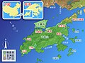 HK-lantau-map-zh.jpg 600 × 446; 89 KB
-
 Hong Kong (16347923914).jpg 3.582 × 2.372; 1,43 MB
-
 Hong Kong Railway for Lantau Island Map.svg 960 × 220; 11 KB
-
 Kausantei.JPG 2.048 × 1.536; 512 KB
-
 KF1488(Hong Kong Lantau Taxi) 01-08-2021.jpg 4.032 × 3.024; 2,32 MB
-
 Lantau Harbour (2796599894).jpg 600 × 800; 82 KB
-
 Lantau Island (2043283216).jpg 3.008 × 2.000; 3,46 MB
-
 Lantau Island - panoramio (4).jpg 3.648 × 2.432; 3,66 MB
-
 Lantau Island - panoramio (5).jpg 4.142 × 1.286; 3,31 MB
-
 Lantau Island from Cheung Chau Island.jpg 4.032 × 3.024; 1,19 MB
-
 Lantau Island Pano.jpg 2.099 × 298; 170 KB
-
 Lantau Island reclamation.png 800 × 560; 34 KB
-
 Lantau Link Toll Plaza bus stop 10-05-2021.jpg 3.024 × 4.032; 2,69 MB
-
 Lantau montane grassland.jpg 8.422 × 4.271; 23,68 MB
-
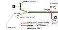
 Lantau MR route map 2010.png 900 × 644; 38 KB
-
 Lantau MTR Map.JPG 763 × 402; 35 KB
-
 Lantauisland.png 1.024 × 768; 203 KB
-
 LantauMap.png 1.155 × 870; 287 KB
-
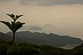
 Lantaustree.JPG 2.048 × 1.536; 526 KB
-
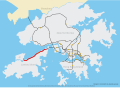 North Lantau Highway map.svg 1.607 × 1.170; 156 KB
-
 Offerings for Chinese new year - 大嶼山.jpg 1.600 × 1.081; 1,98 MB
-
 Rain Be Gone (22437963).jpeg 1.280 × 720; 152 KB
-
 Skypier outside 16-04-2017.jpg 3.264 × 2.448; 2,47 MB
-
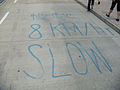 Speed limit spraypaint.jpg 3.648 × 2.736; 3,27 MB
-
 Tall sail (6405537049).jpg 3.648 × 2.736; 1,37 MB
-
 The tree near the top (8061048270).jpg 1.024 × 769; 436 KB
-
Time-lapse video of Tuen Mun Road, Route 9, Hong Kong I filmed from the front window of a double-decker bus.webm 9,7 s, 1.920 × 1.080; 2,53 MB
-
 To Kau Wan.jpg 6.000 × 4.000; 10,17 MB
-
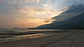
 Tung Chung sunset colors - panoramio.jpg 3.906 × 2.430; 3,82 MB
-
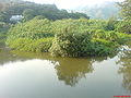 Wangtongriver2.JPG 1.632 × 1.224; 448 KB
-
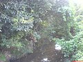 Wangtongriver3.JPG 1.632 × 1.224; 425 KB
-
 Wreck of Fatshan.jpg 778 × 542; 367 KB
-
 Остров Лантау, Гонконг - panoramio.jpg 2.048 × 2.048; 1,27 MB
-
 大屿山(1).jpg 3.264 × 2.448; 1,47 MB
-
 大屿山.jpg 3.264 × 2.448; 1,56 MB
-
 大屿山泉 Hong Kong - panoramio.jpg 3.072 × 2.304; 3,12 MB
-
 彌散石澗, Hong Kong - panoramio.jpg 2.048 × 2.048; 1 MB
-
 盧亨魚人.jpg 670 × 1.206; 205 KB


.jpg)


_No._2_(9449798862).jpg)
.jpg)

.jpg)

_01-08-2021.jpg)
.jpg)
.jpg)
.jpg)


.jpeg)


.jpg)
.jpg)


.jpg)


.jpg)