Category:Latitudes
Vai alla navigazione
Vai alla ricerca
coordinata geografica  | |||||
| Carica un file multimediale | |||||
| Audio della pronuncia | |||||
|---|---|---|---|---|---|
| Istanza di | |||||
| Sottoclasse di | |||||
| Parte di |
| ||||
| |||||
Sottocategorie
Questa categoria contiene le 35 sottocategorie indicate di seguito, su un totale di 35.
+
1
A
- Antarctic Circle (14 F)
- Axial tilt (or Obliquity) (19 F)
M
N
- 26th parallel north (3 F)
- 41st parallel north (2 F)
- 44th parallel north (1 F)
- 51st parallel north (2 F)
P
S
- 45th parallel south (3 F)
T
↕
Pagine nella categoria "Latitudes"
Questa categoria contiene un'unica pagina, indicata di seguito.
File nella categoria "Latitudes"
Questa categoria contiene 90 file, indicati di seguito, su un totale di 90.
-
De-Breitenkreis.ogg 2,3 s; 22 KB
-
En-GB-latitude.ogg 1,4 s; 24 KB
-
En-us-latitude.ogg 1,6 s; 17 KB
-
Nl-breedtegraad.ogg 1,3 s; 15 KB
-

-
 368 of 'Physiography ... New edition' (11091787823).jpg 1 198 × 603; 125 KB
-
 Angle dunkerque barcelone.svg 257 × 146; 9 KB
-
 Axial tilt vs tropical and polar circles ru.svg 512 × 186; 47 KB
-
 Axial tilt vs tropical and polar circles-ml.svg 1 890 × 720; 70 KB
-
 Axial tilt vs tropical and polar circles.svg 512 × 186; 115 KB
-
 BesselianElementsCalc4.svg 463 × 331; 46 KB
-
 Calc-lat.JPG 1 319 × 1 406; 407 KB
-
 Cercles tropicaux et polaires.svg 2 189 × 981; 51 KB
-
 Circle of latitude elevation mono.svg 800 × 800; 86 KB
-
 Circle of latitude elevation.svg 1 000 × 880; 97 KB
-
 Circles of latitude.jpg 551 × 284; 43 KB
-
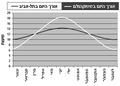 DayLength TelAviv vs Stockholm.png 491 × 351; 9 KB
-
De-Breite.ogg 2,0 s; 18 KB
-
De-Breitengrad.ogg 1,5 s; 14 KB
-
 December solstice geometry ur.png 390 × 267; 35 KB
-
 December solstice geometry.svg 367 × 251; 98 KB
-
 Dijagram Zemljopisne Sirine.PNG 717 × 306; 107 KB
-
 Diurnal motion by latitude.svg 940 × 224; 639 KB
-
 EB1911 Latitude.jpg 492 × 497; 28 KB
-
 Ellipsoidal coordinates cartography a mono.gif 348 × 348; 289 KB
-
 Ellipsoidal coordinates cartography b mono.gif 351 × 351; 418 KB
-
 Ellipsoidal coordinates.svg 299 × 288; 24 KB
-
 FedStats Lat long sw.png 1 156 × 898; 130 KB
-
 FedStats Lat long.png 435 × 340; 5 KB
-
 FedStats Lat long.svg 435 × 340; 31 KB
-
 Fotothek df tg 0001221 Astronomie ^ Sonne ^ Mond ^ Jahreszeit.jpg 697 × 820; 252 KB
-
 Geocentric coordinates.svg 286 × 273; 46 KB
-
 Geocentric coords 02.svg 330 × 321; 43 KB
-
 Geocentric coords 03.svg 316 × 262; 34 KB
-
 Geocentric vs geodetic latitude with elevation.svg 300 × 275; 70 KB
-
 Geocentric vs geodetic latitude.svg 792 × 792; 52 KB
-
 Geodetic coordinates.svg 300 × 268; 39 KB
-

-
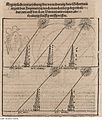
 Illustration Leupold Conversationslexikon 1796.jpg 640 × 1 065; 149 KB
-
 Inclination of earth's axis.jpg 2 560 × 1 920; 583 KB
-
 Lat long.png 1 522 × 1 190; 375 KB
-
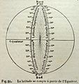
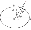
 Latitud Geográfica y Geocéntrica. Cálculo.jpg 892 × 520; 45 KB
-
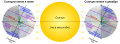
 Latitud templada comparativa.jpg 2 408 × 574; 107 KB
-
 Latitud.png 409 × 443; 6 KB
-
 Latitude (AR).png 800 × 830; 224 KB
-
 Latitude (PSF).png 1 104 × 1 146; 404 KB
-
 Latitude 62 Motel.jpg 1 936 × 1 296; 1,22 MB
-
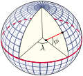
 Latitude and longitude graticule on a sphere.svg 825 × 825; 69 KB
-
 Latitude and longitude graticule on an ellipsoid.svg 825 × 750; 102 KB
-
 Latitude and Longitude of the Earth fr.svg 652 × 340; 45 KB
-
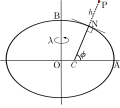
 Latitude geodésica.png 403 × 358; 10 KB
-
 Latitude lines color.svg 1 224 × 1 224; 197 KB
-
 Latitude lines fr.svg 1 224 × 1 224; 185 KB
-
 Latitude lines-es.png 1 306 × 1 306; 366 KB
-
 Latitude lines.svg 1 224 × 1 224; 195 KB
-
 Latitude of the Earth fr.svg 353 × 310; 22 KB
-
 Latitudes and Latitudinal Lines.gif 800 × 473; 99 KB
-
 Lines of equal latitude and longitude FROM (World borders parallel).png 2 000 × 1 999; 509 KB
-

-
 Lorangeitude.png 2 400 × 2 400; 526 KB
-
 MercNormSph enhanced.png 800 × 797; 660 KB
-
 Meyer‘s Zeitungsatlas 088 – Karte der magnetischen Meridiane und Parallel-Kreise.jpg 7 393 × 6 265; 11,9 MB
-
 Obliquity berger -5000000 to 0.png 1 175 × 819; 23 KB
-
 Parabola-alt.gif 470 × 153; 5 KB
-
 Parallels construction.png 629 × 712; 334 KB
-
 Parallèles.JPG 1 251 × 768; 257 KB
-
 Parralèles-ellipsoide.svg 363 × 300; 14 KB
-
 Parralèles-longueurs égales.svg 354 × 409; 16 KB
-
 Planisferio Latitud templada comparada.png 2 358 × 343; 868 KB
-
 Robinson projection with major circles of latitude and prime meridian labeled.png 1 920 × 1 028; 671 KB
-
 Solterrestriale Vocabulum (Solar-Earth Terms) 01.png 1 598 × 5 999; 965 KB
-
 Solterrestriale Vocabulum (Solar-Earth Terms) 02.png 3 199 × 3 290; 1 003 KB
-
 Surface of latitude ellipsoid cone.gif 512 × 512; 1,38 MB
-
 Surface of latitude sphere cone.gif 512 × 512; 1,5 MB
-
 Surface of latitude sphere plane.gif 512 × 512; 1,41 MB
-
 Temperate zone (PSF).png 3 506 × 1 697; 595 KB
-
 Temperate zone (PSF).svg 526 × 255; 428 KB
-
 Temperature zone of earth.jpg 2 560 × 1 920; 912 KB
-

-
 Two types of latitude-ru.svg 528 × 443; 2 KB
-
 Two types of latitude.svg 600 × 450; 103 KB
-
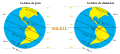
 Two-types-of-latitude.png 787 × 508; 49 KB
-
 Wendekreise.png 1 061 × 462; 102 KB
-
 WGS84 angle to distance conversion.svg 512 × 410; 115 KB
-
 World map latitude001.svg 1 200 × 684; 1,57 MB
-
 World map with major latitude circles.jpg 3 630 × 1 870; 1,29 MB
-
 World map with major latitude circles.svg 1 300 × 651; 1,49 MB
-
 York MMB 49 York Observatory.jpg 4 383 × 2 931; 5,36 MB
-
 দিগংশ-দিগন্ত.svg 436 × 420; 205 KB
-
 দিগংশদিগন্ত.png 436 × 427; 32 KB
_-_Geographicus_-_Tableau-monin-1838.jpg)
.jpg)


.png)
.png)


.png)
.png)


_02.png)


.png)
.svg)


_01.png)