Category:Laughton en le Morthen
Aller à la navigation
Aller à la recherche
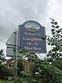
English: Laughton en le Morthen is a small dormitory village and civil parish in the Metropolitan Borough of Rotherham lying to the south of Rotherham, South Yorkshire, England, and its main attraction is the All Saints Church with its huge spire. It has a population of 1,185.
Nederlands: Laughton en le Morthen is een dorp (village) en civil parish in het bestuurlijke gebied Rotherham, in het Engelse graafschap South Yorkshire. De civil parish telt
village britannique  | |||||
| Téléverser des médias | |||||
| Nature de l’élément | |||||
|---|---|---|---|---|---|
| Lieu | district métropolitain de Rotherham, Yorkshire du Sud, Yorkshire-et-Humber, Angleterre | ||||
 | |||||
Sous-catégories
Cette catégorie comprend 6 sous-catégories, dont les 6 ci-dessous.
Média dans la catégorie « Laughton en le Morthen »
Cette catégorie comprend 181 fichiers, dont les 181 ci-dessous.
-
 "The Cartwheel" pub-restaurant in Brookhouse - geograph.org.uk - 3226380.jpg 4 304 × 2 870 ; 2,54 Mio
-
 21 High Street, Laughton en le Morthen - geograph.org.uk - 1898233.jpg 640 × 480 ; 46 kio
-
 23, High Street, Laughton en le Morthen - geograph.org.uk - 1898230.jpg 640 × 480 ; 65 kio
-
 A road junction to the north of Slade Hooton - geograph.org.uk - 2301664.jpg 800 × 600 ; 151 kio
-
 Abbey Close, Laughton en le Morthen - geograph.org.uk - 1898222.jpg 640 × 480 ; 60 kio
-
 Abbey Lane towards the A634 - geograph.org.uk - 2573375.jpg 1 600 × 1 200 ; 436 kio
-
 Abbey Mill House - geograph.org.uk - 3871548.jpg 800 × 533 ; 156 kio
-
 Angel on a tombstone - geograph.org.uk - 1898154.jpg 480 × 640 ; 137 kio
-
 Approaching Roche Abbey - geograph.org.uk - 4082974.jpg 2 592 × 1 944 ; 2,83 Mio
-
 Beacon Hill - geograph.org.uk - 4357132.jpg 3 264 × 2 448 ; 4,13 Mio
-
 Bee on ripe hawthorn berries, Tunwell Road, Carr - geograph.org.uk - 3226369.jpg 3 967 × 2 834 ; 2,38 Mio
-
 Bench and Viewpoint Above Hooton Dike - geograph.org.uk - 2575975.jpg 3 296 × 2 472 ; 1,01 Mio
-
-
 Bib Lane towards Carr - geograph.org.uk - 2553302.jpg 1 600 × 1 200 ; 842 kio
-
 Bridleway to Hangsman Lane - geograph.org.uk - 3023593.jpg 4 000 × 3 000 ; 2,27 Mio
-
 Brookhouse - geograph.org.uk - 4898356.jpg 665 × 1 024 ; 185 kio
-
 Brookhouse viaduct - geograph.org.uk - 2220996.jpg 640 × 427 ; 83 kio
-
 C of E Primary School, Laughton en le Morthen - geograph.org.uk - 4720507.jpg 2 001 × 1 485 ; 724 kio
-
 Carr Lane's junction with Bib Lane - geograph.org.uk - 3226372.jpg 4 608 × 3 072 ; 3,45 Mio
-
 Cartwheel public house. - geograph.org.uk - 1830385.jpg 640 × 480 ; 92 kio
-
 Carved head on All Saints Church, Laughton en le Morthen - geograph.org.uk - 4720497.jpg 1 536 × 2 048 ; 809 kio
-
 Cascade, Laughton Pool.jpg 2 048 × 1 536 ; 1,11 Mio
-
 Castle Hill, Laughton-en-le-Morthen - geograph.org.uk - 6000938.jpg 1 024 × 768 ; 339 kio
-
 Castle Hill, Laughton-en-le-Morthen - geograph.org.uk - 6000942.jpg 1 024 × 768 ; 279 kio
-
 Church Corner, Laughton en le Morthen - geograph.org.uk - 1898201.jpg 640 × 480 ; 120 kio
-
 Colonel's Holt - geograph.org.uk - 5997151.jpg 1 024 × 768 ; 365 kio
-
 Cottage on the edge of Brookhouse - geograph.org.uk - 3226376.jpg 4 198 × 2 999 ; 3,03 Mio
-
 Country scene from the path to Slade Hooton - geograph.org.uk - 4767891.jpg 4 840 × 3 434 ; 2,28 Mio
-
 Crop Field Adjoining Kirk Croft Road - geograph.org.uk - 5065291.jpg 4 608 × 3 456 ; 4,22 Mio
-
 Cross field path to Slade Hooten. - geograph.org.uk - 4932568.jpg 640 × 480 ; 45 kio
-
 Crossroads east of Thurcroft - geograph.org.uk - 2301653.jpg 800 × 600 ; 210 kio
-
 Crossroads in the autumn sun - geograph.org.uk - 2684444.jpg 640 × 409 ; 64 kio
-

-
 Earthworks at Laughton en le Morthen - geograph.org.uk - 4720493.jpg 2 048 × 1 536 ; 813 kio
-
 East Field - geograph.org.uk - 3140883.jpg 1 024 × 691 ; 232 kio
-
 East Field Lane heading east - geograph.org.uk - 2553313.jpg 1 600 × 1 200 ; 351 kio
-
 East field lane looking towards Kings Wood - geograph.org.uk - 3229591.jpg 640 × 434 ; 70 kio
-
 EB1911 p477 fig1.png 641 × 741 ; 258 kio
-
 Emblem on a gateway at Old Hall Farm - geograph.org.uk - 4720513.jpg 1 496 × 1 996 ; 608 kio
-
 Entering King's Wood - geograph.org.uk - 4083044.jpg 2 590 × 1 850 ; 2,69 Mio
-

-
 Entering the Village - geograph.org.uk - 3023578.jpg 3 000 × 4 000 ; 2,1 Mio
-
 Entrance to Manor farm - geograph.org.uk - 1268079.jpg 640 × 480 ; 64 kio
-
 Farm buildings beside Ramper Road, Carr - geograph.org.uk - 3735438.jpg 1 600 × 1 200 ; 548 kio
-
 Farmland near Carr - geograph.org.uk - 2573359.jpg 1 600 × 1 200 ; 445 kio
-
 Farmland near Firbeck - geograph.org.uk - 4837354.jpg 640 × 480 ; 126 kio
-
 Farmland off Abbey Lane - geograph.org.uk - 2573377.jpg 1 600 × 1 200 ; 515 kio
-
 Farmland off East Field Lane - geograph.org.uk - 2553312.jpg 1 600 × 1 200 ; 347 kio
-
 Farmland off Newhall Lane - geograph.org.uk - 2573357.jpg 1 600 × 1 200 ; 640 kio
-
 Farmland south off King's Wood - geograph.org.uk - 2553314.jpg 1 600 × 1 200 ; 304 kio
-
 Farmland west of the hamlet of Carr - geograph.org.uk - 3226357.jpg 4 608 × 3 072 ; 3,43 Mio
-
 Field of Maize near King's Wood - geograph.org.uk - 2575987.jpg 3 296 × 2 472 ; 1,01 Mio
-
 Field off School Road, Laughton en le Morthen - geograph.org.uk - 4720477.jpg 2 048 × 1 536 ; 962 kio
-
 Field to King's Wood - geograph.org.uk - 3019707.jpg 4 000 × 3 000 ; 2,67 Mio
-
 Field, Slade Hills - geograph.org.uk - 3140873.jpg 1 024 × 745 ; 251 kio
-
 Fields Adjoining High Hooton Road - geograph.org.uk - 5528202.jpg 3 264 × 2 448 ; 2,67 Mio
-
 Fields Below Laughton en le Morthen - geograph.org.uk - 5037800.jpg 4 316 × 3 131 ; 4,02 Mio
-
 Firbeck Dike at Mill House - geograph.org.uk - 3876446.jpg 4 000 × 2 248 ; 6,61 Mio
-
 Firbeck Lane, Laughton en le Morthen - geograph.org.uk - 4720556.jpg 2 048 × 1 536 ; 785 kio
-
 Fishing pond east of Carr - geograph.org.uk - 3226363.jpg 4 375 × 2 917 ; 3,02 Mio
-
 Footpath and Ploughed Field near Slade Hooton - geograph.org.uk - 5528195.jpg 3 264 × 2 448 ; 3,23 Mio
-
 Footpath at East Field - geograph.org.uk - 3754805.jpg 1 600 × 1 200 ; 662 kio
-
 Footpath gate at Church Corner, Laughton en le Morthen - geograph.org.uk - 4720491.jpg 2 008 × 1 480 ; 1,08 Mio
-
 Footpath junction in King's Wood - geograph.org.uk - 3754803.jpg 1 600 × 1 200 ; 1,02 Mio
-
 Footpath Junction near Laughton en le Morthen - geograph.org.uk - 2575953.jpg 3 296 × 2 472 ; 1,03 Mio
-
 Footpath on Slade Hills - geograph.org.uk - 3871031.jpg 800 × 533 ; 168 kio
-
 Footpath to Laughton en le Morthen - geograph.org.uk - 3023130.jpg 4 000 × 3 000 ; 3,07 Mio
-
 Footpath towards Carr - geograph.org.uk - 3139352.jpg 1 024 × 744 ; 261 kio
-
 Footpath towards Hooton Lane, Laughton - geograph.org.uk - 3754807.jpg 1 600 × 1 200 ; 467 kio
-
 Footpath, Hooton Bridge - geograph.org.uk - 2553308.jpg 1 600 × 1 200 ; 790 kio
-
 Former bridge abutments on Newhall Lane - geograph.org.uk - 1268072.jpg 640 × 461 ; 94 kio
-
 Former shop front at the crossroads, Laughten en le Morthen - geograph.org.uk - 4720532.jpg 2 048 × 1 536 ; 832 kio
-
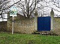
 Gateway to Old Hall - geograph.org.uk - 1898112.jpg 640 × 480 ; 95 kio
-
 Gateway, Old Hall Farm, Laughton en le Morthen.jpg 1 536 × 2 048 ; 953 kio
-
 Grazing land, Slade Hooton - geograph.org.uk - 2553306.jpg 1 600 × 1 200 ; 425 kio
-
 Hatfeild Arms - geograph.org.uk - 3735474.jpg 1 600 × 1 200 ; 426 kio
-
 Hatfeild Arms, Laughton en le Morthen - geograph.org.uk - 1898238.jpg 640 × 480 ; 50 kio
-
 Hatfeild Arms, Laughton en le Morthen - geograph.org.uk - 1898245.jpg 480 × 640 ; 47 kio
-
 Hatfeild Arms, Laughton en le Morthen - geograph.org.uk - 1898249.jpg 480 × 640 ; 50 kio
-
 Hatfeild Arms, Laughton-en-le-Morthen - geograph.org.uk - 3870734.jpg 4 000 × 2 248 ; 4,5 Mio
-
 High Street, Laughton en le Morthen - geograph.org.uk - 1898104.jpg 640 × 480 ; 43 kio
-
 High Street, Laughton en le Morthen - geograph.org.uk - 1898138.jpg 640 × 480 ; 96 kio
-
 High Street, Laughton en le Morthen - geograph.org.uk - 1898240.jpg 640 × 480 ; 50 kio
-
 House in Church Corner, from the churchyard - geograph.org.uk - 1898126.jpg 640 × 480 ; 131 kio
-
 House in Church Corner, Laughton en le Morthen - geograph.org.uk - 1898194.jpg 640 × 480 ; 130 kio
-
 House in Laughton en le Morthen - geograph.org.uk - 1898099.jpg 640 × 480 ; 85 kio
-
 House in Laughton en le Morthen - geograph.org.uk - 4083460.jpg 2 428 × 1 942 ; 1,72 Mio
-
 House on the High Street - geograph.org.uk - 1898115.jpg 640 × 480 ; 78 kio
-
 Houses on St Johns Road - geograph.org.uk - 2553310.jpg 1 600 × 1 200 ; 434 kio
-

-
 Housing off Eastfield Lane - geograph.org.uk - 3871026.jpg 800 × 533 ; 83 kio
-
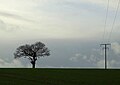
 Isolated power - geograph.org.uk - 1160963.jpg 640 × 460 ; 75 kio
-
 Junction at the southern corner of King's Wood - geograph.org.uk - 4795517.jpg 1 600 × 1 200 ; 559 kio
-

-
 Junction of lanes near Laughton-en-le-Morthen - geograph.org.uk - 4083038.jpg 2 592 × 1 944 ; 1,94 Mio
-
 King's Wood Lane near Stone - geograph.org.uk - 4837425.jpg 640 × 480 ; 148 kio
-
 King's Wood Lane to Laughton-en-le- Morthen - geograph.org.uk - 2301614.jpg 800 × 600 ; 219 kio
-
 King's Wood Lane, at King's Wood, Stone - geograph.org.uk - 2301560.jpg 800 × 600 ; 332 kio
-
 King's Wood Lane, Stone - geograph.org.uk - 2301551.jpg 800 × 600 ; 281 kio
-
 Kings Wood ahead - geograph.org.uk - 3229593.jpg 640 × 430 ; 92 kio
-
 Kirk Croft Road ( Track ) - geograph.org.uk - 3023603.jpg 4 000 × 3 000 ; 2,69 Mio
-
 Laughton Church from Common Lane - geograph.org.uk - 5997105.jpg 1 024 × 604 ; 100 kio
-
 Laughton en le Morthen - geograph.org.uk - 4898352.jpg 1 024 × 494 ; 56 kio
-
 Laughton en le Morthen from East Field Lane - geograph.org.uk - 3737162.jpg 2 013 × 1 334 ; 877 kio
-
 Laughton en le Morthen School - geograph.org.uk - 1363003.jpg 640 × 480 ; 57 kio
-
 Laughton en le morthen. - geograph.org.uk - 4932571.jpg 640 × 480 ; 36 kio
-
 Laughton Pond, Laughton - geograph.org.uk - 4721722.jpg 2 048 × 1 536 ; 856 kio
-

-
 Laughton-en-le-Morthen Church - geograph.org.uk - 3722816.jpg 4 641 × 3 481 ; 3,4 Mio
-
 Looking down the Slade Hills - geograph.org.uk - 3023112.jpg 4 000 × 3 000 ; 2,72 Mio
-
 Looking East from Kingsforth Lane - geograph.org.uk - 5430834.jpg 3 205 × 2 299 ; 2,22 Mio
-
 Low Lane towards Hooton Levitt - geograph.org.uk - 2573361.jpg 1 600 × 1 200 ; 751 kio
-
 Manor Farmhouse, Laughton en le Morthen.jpg 2 019 × 1 494 ; 647 kio
-
 Mast on Beacon hill. - geograph.org.uk - 1830375.jpg 640 × 480 ; 48 kio
-
 Mellow Fields Road - geograph.org.uk - 1898219.jpg 640 × 480 ; 45 kio
-
 Minor road towards Firbeck - geograph.org.uk - 2553315.jpg 1 600 × 1 200 ; 456 kio
-
 Muddy track towards Laughton-en-le-Morthen - geograph.org.uk - 3870738.jpg 3 906 × 2 064 ; 5,76 Mio
-
 Newhall lane is a single track - geograph.org.uk - 1268064.jpg 640 × 480 ; 40 kio
-
 Newhall Lane looking to Newhall Grange - geograph.org.uk - 3226355.jpg 4 608 × 3 072 ; 3,71 Mio
-
 Newhall Lane towards Carr - geograph.org.uk - 2573355.jpg 1 600 × 1 200 ; 564 kio
-
 Old Hall Farm - geograph.org.uk - 1898106.jpg 640 × 480 ; 62 kio
-
 Old Hall Farm, Laughton en le Morthen - geograph.org.uk - 1898206.jpg 640 × 480 ; 49 kio
-
 Old Hall Farm, Laughton en le Morthen - geograph.org.uk - 1898215.jpg 640 × 480 ; 51 kio
-
 Old Hall Farmhouse, Laughton en le Morthen.jpg 4 000 × 3 000 ; 2,12 Mio
-
 On the footpath from King's Wood to Laughton - geograph.org.uk - 4083023.jpg 1 944 × 2 592 ; 2,49 Mio
-
 Ordnance Survey Cut Mark - geograph.org.uk - 4963296.jpg 640 × 607 ; 149 kio
-
 Outbuilding by Ramper Road in Carr - geograph.org.uk - 3369469.jpg 4 000 × 3 000 ; 2,07 Mio
-
 Outbuilding, Old Hall Farmhouse, Laughton en le Morthen.jpg 2 019 × 1 491 ; 728 kio
-
 Over fields to Laughton en le Morthen - geograph.org.uk - 3023579.jpg 4 000 × 3 000 ; 2,92 Mio
-
 Path by East Field, Laughton-en-le-Morthen - geograph.org.uk - 4083032.jpg 1 944 × 2 592 ; 2,64 Mio
-
 Path on Slade Hills - geograph.org.uk - 3870749.jpg 1 280 × 719 ; 1,39 Mio
-
 Path to Hooton Levitt leaves Tunwell Road - geograph.org.uk - 3735069.jpg 1 600 × 1 200 ; 832 kio
-
 Peak Lane near Slade Hooton - geograph.org.uk - 822884.jpg 640 × 367 ; 45 kio
-
 Ploughed Field next to Bib Lane - geograph.org.uk - 3369332.jpg 4 000 × 3 000 ; 2,79 Mio
-
 Power lines crossing St. John's Road - geograph.org.uk - 1268097.jpg 640 × 449 ; 69 kio
-
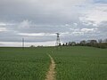
 Power lines near Slade Hooton - geograph.org.uk - 1161005.jpg 640 × 387 ; 52 kio
-
 Railway bridge near Slade Hooton - geograph.org.uk - 822887.jpg 640 × 512 ; 120 kio
-
 Rectory Court, Laughton en le Morthen - geograph.org.uk - 4720526.jpg 2 048 × 1 536 ; 954 kio
-
 Roche Abbey stepping stones - geograph.org.uk - 5997154.jpg 1 024 × 768 ; 337 kio
-

-
 Scamming Lane - geograph.org.uk - 3228362.jpg 640 × 472 ; 93 kio
-
 School Road, Laughton en le Morthen - geograph.org.uk - 1898283.jpg 640 × 480 ; 44 kio
-
 Signpost and old farm building in Carr - geograph.org.uk - 3226361.jpg 4 041 × 2 887 ; 3,01 Mio
-
 Signposts and Lane Junction in Slade Hooton - geograph.org.uk - 5528200.jpg 3 214 × 2 385 ; 2,74 Mio
-
 Site of the motte and bailey fort in Laughton - geograph.org.uk - 3226390.jpg 4 606 × 2 764 ; 2,72 Mio
-
 Slade Hills - geograph.org.uk - 6298163.jpg 1 024 × 768 ; 254 kio
-
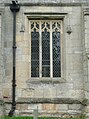 South nave window, All Saints Church, Laughton en le Morthen - geograph.org.uk - 4720500.jpg 1 484 × 1 988 ; 812 kio
-
 St Johns Road, Laughton en le Morthen - geograph.org.uk - 2553311.jpg 1 600 × 1 200 ; 354 kio
-
 Stepping stones across outflow from Laughton Pond - geograph.org.uk - 3876394.jpg 3 551 × 2 247 ; 7,68 Mio
-
 Stepping stones across the outlet channel from Laughton Pond - geograph.org.uk - 4721748.jpg 2 048 × 1 536 ; 1,08 Mio
-
 Stepping stones over Hooton Dike - geograph.org.uk - 3737220.jpg 2 048 × 1 501 ; 1,27 Mio
-
 Stile in Laughton - geograph.org.uk - 3871618.jpg 800 × 533 ; 177 kio
-
 Strolling on Abbey lane - geograph.org.uk - 1362996.jpg 640 × 375 ; 51 kio
-
 The Cartwheel Public House in Brookhouse - geograph.org.uk - 3368673.jpg 3 888 × 2 846 ; 1,93 Mio
-
 The former St Leger Arms public house, Laughton en le Morthen - geograph.org.uk - 4720541.jpg 1 958 × 1 359 ; 679 kio
-
 The old hedge - geograph.org.uk - 1172610.jpg 640 × 453 ; 141 kio
-
 The Old School, Laughton en le Morthen - geograph.org.uk - 1898132.jpg 640 × 480 ; 68 kio
-
 The spire of All Saints Church, Laughton en le Morthen - geograph.org.uk - 4720504.jpg 1 488 × 2 004 ; 520 kio
-
 The St Leger, Laughton en le Morthen - geograph.org.uk - 2553309.jpg 1 600 × 1 200 ; 350 kio
-
 The Vicarage, Laughton en le Morthen.jpg 3 620 × 2 896 ; 2,39 Mio
-
 Three men in a field - geograph.org.uk - 3870744.jpg 4 000 × 2 248 ; 5,98 Mio
-
 Towards Old Hall farm - geograph.org.uk - 1898117.jpg 640 × 480 ; 87 kio
-
 Towards Rotheram Lane - geograph.org.uk - 1898141.jpg 640 × 480 ; 84 kio
-
 Track and Byway near Carr - geograph.org.uk - 3369349.jpg 4 000 × 3 000 ; 3,02 Mio
-
 Triangulation Pillar next to Bib Lane - geograph.org.uk - 3369338.jpg 4 000 × 3 000 ; 3,64 Mio
-
 Up the hill to Laughton en le Morthen - geograph.org.uk - 1268091.jpg 640 × 480 ; 121 kio
-
 View along Back Lane - geograph.org.uk - 3139346.jpg 1 024 × 768 ; 228 kio
-
 View from Slade Hills - geograph.org.uk - 1637606.jpg 640 × 480 ; 106 kio
-
 View through a hedge - geograph.org.uk - 3871029.jpg 800 × 533 ; 153 kio
-
 Village scene, Laughton en le Morthen - geograph.org.uk - 3140894.jpg 1 024 × 668 ; 189 kio
-
 Village sign and west entrance to Slade Hooton Hall - geograph.org.uk - 4767896.jpg 5 083 × 3 725 ; 5,78 Mio
-
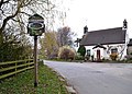
 Village sign. - geograph.org.uk - 1830390.jpg 640 × 480 ; 97 kio
-
 Waiting for the Bride and Groom - geograph.org.uk - 1898256.jpg 640 × 480 ; 129 kio
-
 Walkway over Hooton Dike - geograph.org.uk - 4767889.jpg 5 184 × 3 888 ; 6,82 Mio
-
 Waterfall from Laughton Pond near Roche Abbey - geograph.org.uk - 4083017.jpg 2 592 × 1 944 ; 2,59 Mio
-
 Weir at Laughton Pond - geograph.org.uk - 3737209.jpg 1 366 × 1 024 ; 632 kio
-
 Yew-lined Path to Roche Abbey - geograph.org.uk - 2576006.jpg 3 296 × 2 472 ; 952 kio
-
 Abbey Valley - geograph.org.uk - 208008.jpg 640 × 480 ; 99 kio
-
 Dry Valley - geograph.org.uk - 148173.jpg 640 × 480 ; 76 kio
-
 Footpath to Brampton - geograph.org.uk - 183804.jpg 640 × 480 ; 111 kio
-
 Lane to Laughton - geograph.org.uk - 148176.jpg 640 × 480 ; 74 kio


_-_geograph.org.uk_-_3023603.jpg)


