Category:Lawkland
Aller à la navigation
Aller à la recherche
localité britannique du comté anglais de North Yorkshire  | |||||
| Téléverser des médias | |||||
| Nature de l’élément | |||||
|---|---|---|---|---|---|
| Lieu | Craven, Yorkshire du Nord, Yorkshire-et-Humber, Angleterre | ||||
 | |||||
Sous-catégories
Cette catégorie comprend 5 sous-catégories, dont les 5 ci-dessous.
Média dans la catégorie « Lawkland »
Cette catégorie comprend 347 fichiers, dont les 200 ci-dessous.
(page précédente) (page suivante)-
 'Linethwaite', with repositioned benchmark - geograph.org.uk - 5650195.jpg 683 × 1 024 ; 228 kio
-
 A fingerpost and Lane Side (Railway) Bridge - geograph.org.uk - 5834766.jpg 1 600 × 1 202 ; 508 kio
-
 A fingerpost in Eldroth - geograph.org.uk - 5834757.jpg 1 200 × 1 600 ; 465 kio
-
 A three way junction near Eldroth, North Yorkshire. - geograph.org.uk - 2039084.jpg 1 024 × 768 ; 253 kio
-
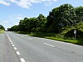
 A65 - approaching the Clapham turning - geograph.org.uk - 4646831.jpg 640 × 426 ; 41 kio
-
 A65 - geograph.org.uk - 4654230.jpg 640 × 426 ; 39 kio
-
 A65 at Feizor Lane junction - geograph.org.uk - 3338787.jpg 640 × 480 ; 73 kio
-
 A65 at Rawlingshaw - geograph.org.uk - 4646813.jpg 640 × 426 ; 62 kio
-
 A65 bends at Owlet Hall - geograph.org.uk - 5187975.jpg 1 600 × 1 066 ; 263 kio
-
 A65 looking north near Crow Nest - geograph.org.uk - 3338777.jpg 640 × 480 ; 45 kio
-
 A65 near Owlet Hall - geograph.org.uk - 5927898.jpg 640 × 480 ; 83 kio
-
 A65 near Sandaber - geograph.org.uk - 3338809.jpg 640 × 480 ; 56 kio
-
 A65 near The Dalesbridge Centre - geograph.org.uk - 3338799.jpg 640 × 480 ; 55 kio
-
 A65 Settle Bypass - geograph.org.uk - 5927929.jpg 640 × 480 ; 91 kio
-
 A65 south east of Clapham - geograph.org.uk - 4562470.jpg 1 024 × 767 ; 773 kio
-
 A65 towards Skipton - geograph.org.uk - 5927752.jpg 640 × 480 ; 106 kio
-
 A65 towards Skipton - geograph.org.uk - 5927892.jpg 640 × 480 ; 103 kio
-
 A65 towards Skipton - geograph.org.uk - 5927903.jpg 640 × 480 ; 82 kio
-
 A65 towards Skipton - geograph.org.uk - 5927920.jpg 640 × 480 ; 96 kio
-
 A65, eastbound - geograph.org.uk - 4654233.jpg 640 × 392 ; 88 kio
-
 A65, Field House - geograph.org.uk - 4646819.jpg 640 × 426 ; 78 kio
-
 A65, Harden Bridge - geograph.org.uk - 2738130.jpg 640 × 480 ; 66 kio
-
 A65, Harden Bridge - geograph.org.uk - 2738131.jpg 640 × 431 ; 64 kio
-
 A65, northbound - geograph.org.uk - 4646811.jpg 640 × 396 ; 38 kio
-
 A65, Owlet Hall - geograph.org.uk - 4646824.jpg 640 × 395 ; 52 kio
-
 A65, the north end of the bypass of Settle - geograph.org.uk - 5187964.jpg 1 600 × 1 200 ; 713 kio
-
 A65, westbound - geograph.org.uk - 4646818.jpg 640 × 426 ; 43 kio
-
 A65, westbound - geograph.org.uk - 4646827.jpg 640 × 426 ; 79 kio
-
 A65-Graystonber Lane junction - geograph.org.uk - 3338792.jpg 640 × 481 ; 48 kio
-
 Access to Lawsings - geograph.org.uk - 4318624.jpg 5 179 × 3 451 ; 6,4 Mio
-
 At the end of Cragg Lane, Austwick - geograph.org.uk - 4613710.jpg 2 048 × 1 536 ; 903 kio
-
 Austwick Beck and Harden Bridge - geograph.org.uk - 5552328.jpg 640 × 480 ; 116 kio
-
 Austwick Beck from Waters Bridge - geograph.org.uk - 4115923.jpg 2 000 × 1 500 ; 1,21 Mio
-
 Austwick Common - geograph.org.uk - 5851849.jpg 720 × 540 ; 131 kio
-
 Austwick sewage pumping station - geograph.org.uk - 4118149.jpg 2 000 × 1 500 ; 1,03 Mio
-
 Austwick turn, A65 - geograph.org.uk - 4654234.jpg 640 × 386 ; 66 kio
-
 Austwick, aerial 2018 - geograph.org.uk - 5896124.jpg 800 × 533 ; 98 kio
-
 Austwick-Lawkland boundary stone - geograph.org.uk - 5649399.jpg 1 024 × 683 ; 362 kio
-
 Austwick-Lawkland boundary stone - geograph.org.uk - 5833470.jpg 1 200 × 1 600 ; 637 kio
-
 B6480 approaching the A65 - geograph.org.uk - 4654227.jpg 640 × 394 ; 27 kio
-
 Bark Head, Lawkland.jpg 640 × 480 ; 75 kio
-
 Barn and shed, Low Kettlesbeck - geograph.org.uk - 3285891.jpg 800 × 453 ; 128 kio
-
 Barn at Stalpes - geograph.org.uk - 5719859.jpg 1 024 × 683 ; 255 kio
-
 Barn beside Craven Ridge Lane - geograph.org.uk - 4654236.jpg 1 024 × 683 ; 257 kio
-
 Barn Conversion - geograph.org.uk - 172705.jpg 640 × 480 ; 67 kio
-
 Barn conversion on the A65 - geograph.org.uk - 5927905.jpg 640 × 480 ; 69 kio
-
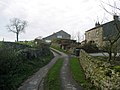
 Barn north of Lawkland - geograph.org.uk - 5553147.jpg 640 × 480 ; 58 kio
-
 Benchmark on back of underpass parapet beside B6480 - geograph.org.uk - 5654197.jpg 1 024 × 683 ; 272 kio
-
 Benchmark on building at Bank End Farm - geograph.org.uk - 5650303.jpg 638 × 1 024 ; 258 kio
-
 Benchmark on building at Lawkland Green Farm - geograph.org.uk - 5719475.jpg 1 024 × 683 ; 321 kio
-
 Benchmark on Craven Ridge Lane barn - geograph.org.uk - 4654221.jpg 1 024 × 683 ; 327 kio
-
 Benchmark on gatepost at field entrance - geograph.org.uk - 5650214.jpg 663 × 1 024 ; 237 kio
-
 Benchmark on gatepost at field entrance - geograph.org.uk - 5650540.jpg 683 × 1 024 ; 271 kio
-
 Benchmark on Loughton Croft - geograph.org.uk - 5650331.jpg 683 × 1 024 ; 331 kio
-
 Benchmark on railway bridge parapet near Blaithwaite - geograph.org.uk - 5719894.jpg 683 × 1 024 ; 332 kio
-

-
 Benchmark on the former Cross Streets Hotel - geograph.org.uk - 5719457.jpg 683 × 1 024 ; 216 kio
-
 Bend in the A65 towards Skipton - geograph.org.uk - 5927910.jpg 640 × 480 ; 78 kio
-
 Bend, A65 - geograph.org.uk - 4646816.jpg 640 × 426 ; 42 kio
-
 Black Bank Road near Black Bank - geograph.org.uk - 2226069.jpg 612 × 460 ; 110 kio
-
 Boundary Stone and Ingleborough - geograph.org.uk - 5833370.jpg 1 200 × 1 600 ; 461 kio
-
 Boundary stone beside minor road south of Austwick - geograph.org.uk - 5649400.jpg 1 024 × 683 ; 223 kio
-
 Boundary stone on Eldroth Road - geograph.org.uk - 4613731.jpg 2 048 × 1 536 ; 887 kio
-
 Boundary stone, Austwick - Lawkland - geograph.org.uk - 4114596.jpg 2 000 × 1 500 ; 1,48 Mio
-
 Boundary stone, Lawsings Brow road - geograph.org.uk - 1977758.jpg 480 × 640 ; 182 kio
-
 Boundary stone, White Swan - geograph.org.uk - 5851804.jpg 960 × 720 ; 245 kio
-
 Bridge on Austwick Moss - geograph.org.uk - 5552358.jpg 640 × 480 ; 104 kio
-
 Bridge over Kellot Beck - geograph.org.uk - 3291554.jpg 640 × 480 ; 138 kio
-
 Bridge over railway for farm track towards Stalpes - geograph.org.uk - 5719900.jpg 1 024 × 683 ; 286 kio
-
 Building at Bank End Farm - geograph.org.uk - 5650327.jpg 1 024 × 683 ; 134 kio
-
 Camping at Dalesbridge - geograph.org.uk - 1650239.jpg 640 × 428 ; 47 kio
-
 Cattle grid and road to Ravenshaw - geograph.org.uk - 2226113.jpg 640 × 480 ; 183 kio
-
 Cattle grid at the west end of Black Bank Road - geograph.org.uk - 2226080.jpg 640 × 480 ; 139 kio
-
 Cave Hole Wood - geograph.org.uk - 1765032.jpg 480 × 640 ; 136 kio
-
 Cave Hole, Common Scars - geograph.org.uk - 1765027.jpg 480 × 640 ; 129 kio
-

-
 Clapham Woods, aerial 2018 - geograph.org.uk - 5895872.jpg 800 × 533 ; 91 kio
-
 Clapham, aerial 2018 (2) - geograph.org.uk - 5895879.jpg 800 × 533 ; 96 kio
-
 Clapham, aerial 2018 - geograph.org.uk - 5895874.jpg 661 × 1 024 ; 112 kio
-
 Cobbled footbridge over Kettles Beck - geograph.org.uk - 3285911.jpg 640 × 480 ; 161 kio
-
 Common Scar - geograph.org.uk - 4646807.jpg 640 × 426 ; 55 kio
-
 Cows heading towards Lawkland Hall - geograph.org.uk - 5553136.jpg 800 × 600 ; 94 kio
-
 Cragg Lane - geograph.org.uk - 4329006.jpg 5 179 × 3 451 ; 5,52 Mio
-
 Cragg Lane at Stoops, Austwick - geograph.org.uk - 5871691.jpg 2 000 × 1 500 ; 1,12 Mio
-
 Cragg Lane, Austwick - geograph.org.uk - 4613702.jpg 2 048 × 1 536 ; 872 kio
-
 Cragg Lane, Austwick - geograph.org.uk - 5871675.jpg 2 000 × 1 500 ; 995 kio
-
 Cragg Lane, Austwick - geograph.org.uk - 5871683.jpg 2 000 × 1 466 ; 948 kio
-
 Dales out-barn in the mist - geograph.org.uk - 3959786.jpg 1 600 × 1 202 ; 232 kio
-
 Descending Lawsings Brow - geograph.org.uk - 4318633.jpg 5 184 × 3 456 ; 5,93 Mio
-
 Disused quarry, Knott Coppy - geograph.org.uk - 3286149.jpg 800 × 451 ; 126 kio
-
 Dry Stone Wall on Water Garth - geograph.org.uk - 3490145.jpg 4 320 × 3 240 ; 6,11 Mio
-
 Eldroth church - geograph.org.uk - 4964638.jpg 1 280 × 960 ; 1,04 Mio
-
 Eldroth House Farm, Eldroth Road - geograph.org.uk - 4113803.jpg 2 000 × 1 430 ; 911 kio
-
 Eldroth Road - geograph.org.uk - 2226231.jpg 640 × 475 ; 138 kio
-
 Eldroth Road - geograph.org.uk - 2226236.jpg 640 × 480 ; 131 kio
-
 Eldroth Road passing Eldroth Church - geograph.org.uk - 4114712.jpg 2 000 × 1 500 ; 969 kio
-
 Eldroth Village Hall - geograph.org.uk - 2226225.jpg 640 × 480 ; 109 kio
-
 Emergency phone in layby on A65 - geograph.org.uk - 4403880.jpg 1 024 × 669 ; 129 kio
-
 Entrance to 'Linethwaite' from minor road - geograph.org.uk - 5650199.jpg 1 024 × 666 ; 216 kio
-
 Entrance to Field House - geograph.org.uk - 5610205.jpg 640 × 427 ; 158 kio
-
 Entrance to Lanshaw Farm - geograph.org.uk - 5837360.jpg 1 600 × 1 200 ; 390 kio
-
 Entrance to Lawkland Hall - geograph.org.uk - 5610204.jpg 640 × 427 ; 147 kio
-
 Fallen tree over Shepherd Gate, Lawkland - geograph.org.uk - 4111818.jpg 2 000 × 1 500 ; 1,63 Mio
-
 Farm buildings at Waters - geograph.org.uk - 4115929.jpg 2 000 × 1 332 ; 830 kio
-
 Farm road with cattle grid - geograph.org.uk - 3501664.jpg 1 500 × 949 ; 1,1 Mio
-
 Fen Beck - geograph.org.uk - 4313069.jpg 5 179 × 3 451 ; 5,14 Mio
-
 Field entrance at Lawkland Green Farm - geograph.org.uk - 5650231.jpg 1 024 × 683 ; 228 kio
-
 Field entrance over stream at Lawkland Green Farm - geograph.org.uk - 5650285.jpg 1 024 × 683 ; 280 kio
-
 Field gate on the footpath from Black Bank to School Lane - geograph.org.uk - 4114646.jpg 2 000 × 1 488 ; 1,06 Mio
-
 Field near Dalesbridge Centre - geograph.org.uk - 4685608.jpg 640 × 480 ; 112 kio
-
 Fields near Austwick - geograph.org.uk - 5967934.jpg 1 024 × 683 ; 1 010 kio
-
 Fingerpost near Lane Side (Railway) Bridge, Keasden - geograph.org.uk - 5833422.jpg 1 203 × 1 600 ; 538 kio
-
 Follow the wall to Rock Cat Knott - geograph.org.uk - 3537404.jpg 1 600 × 1 200 ; 645 kio
-
 Footbridge at Staipes - geograph.org.uk - 3079111.jpg 2 000 × 1 500 ; 1,12 Mio
-
 Footbridge near Black Bank - geograph.org.uk - 4112592.jpg 1 500 × 2 000 ; 1,7 Mio
-
 Footbridge near Middlesber - geograph.org.uk - 4118120.jpg 2 000 × 1 529 ; 1,44 Mio
-
 Footbridge over a little stream - geograph.org.uk - 4114630.jpg 2 000 × 1 500 ; 1,24 Mio
-
 Footbridge over a little stream - geograph.org.uk - 4118245.jpg 2 000 × 1 500 ; 1,3 Mio
-
 Footpath at Lawkland Moss - geograph.org.uk - 4111767.jpg 2 000 × 1 500 ; 1,53 Mio
-
 Footpath by Silver Hills Plantation - geograph.org.uk - 3285898.jpg 640 × 480 ; 90 kio
-
 Footpath from Black Bank towards School Lane - geograph.org.uk - 4112609.jpg 2 000 × 1 500 ; 1,36 Mio
-
 Footpath gate near Black Bank - geograph.org.uk - 4112564.jpg 2 000 × 1 458 ; 1,27 Mio
-
 Footpath gate on the path from School Lane to Black Bank - geograph.org.uk - 4114603.jpg 2 000 × 1 466 ; 1,14 Mio
-
 Footpath near Rigghead - geograph.org.uk - 4112939.jpg 2 000 × 1 500 ; 1,26 Mio
-
 Footpath off Black Bank Road - geograph.org.uk - 2226075.jpg 640 × 480 ; 149 kio
-
 Footpath on track from Waters Farm to Old Road - geograph.org.uk - 4115894.jpg 2 000 × 1 500 ; 1,01 Mio
-
 Footpath on track to Waters - geograph.org.uk - 4115875.jpg 2 000 × 1 500 ; 927 kio
-
 Ford at Staipes - geograph.org.uk - 3079107.jpg 2 000 × 1 464 ; 987 kio
-
 Ford at Staipes - geograph.org.uk - 4606753.jpg 1 084 × 725 ; 384 kio
-
 Forest of Bowland sign on Orcaber Lane - geograph.org.uk - 5552331.jpg 480 × 640 ; 120 kio
-
 Former Cross Streets Hotel beside the A65 - geograph.org.uk - 5719466.jpg 1 024 × 683 ; 160 kio
-

-
 Four Lane Ends - geograph.org.uk - 2226058.jpg 640 × 480 ; 113 kio
-
 Fummerber Lane, Austwick - geograph.org.uk - 4613723.jpg 2 025 × 1 479 ; 748 kio
-
 Gate into Cragg Lane, Austwick - geograph.org.uk - 5871659.jpg 2 000 × 1 500 ; 1,02 Mio
-
 Gate into the Lawkland Moss common - geograph.org.uk - 4111803.jpg 2 000 × 1 436 ; 1,31 Mio
-
 Gate on footpath near Lawkland - geograph.org.uk - 5553143.jpg 640 × 480 ; 112 kio
-
 Gate to Sheep Pasture off School Lane - geograph.org.uk - 4329001.jpg 5 179 × 3 451 ; 6,27 Mio
-
 Gateway from minor road from A65 to Lawkland - geograph.org.uk - 5650546.jpg 1 024 × 683 ; 228 kio
-
 Gayclops - geograph.org.uk - 5552353.jpg 640 × 518 ; 111 kio
-
 Giggleswick to Clapham Railway - geograph.org.uk - 2226159.jpg 640 × 480 ; 122 kio
-
 Giggleswick to Clapham Railway - geograph.org.uk - 2226164.jpg 640 × 480 ; 153 kio
-
 Giggleswick to Clapham Railway - geograph.org.uk - 2226233.jpg 640 × 480 ; 147 kio
-
 Giggleswick to Clapham Railway - geograph.org.uk - 2226235.jpg 640 × 480 ; 150 kio
-
 Going nowhere, disused quarry on Knott Coppy - geograph.org.uk - 3286426.jpg 480 × 640 ; 153 kio
-
 Grassland towards Common Scars - geograph.org.uk - 5927916.jpg 640 × 480 ; 118 kio
-
 Grassy bank beside the A65 Settle Bypass - geograph.org.uk - 5927925.jpg 640 × 480 ; 111 kio
-
 Grazing and stone wall near Eldroth Church - geograph.org.uk - 5926507.jpg 640 × 386 ; 37 kio
-
 Grazing and woodland near the Kettles Beck - geograph.org.uk - 5926503.jpg 640 × 427 ; 52 kio
-
 Grazing land near Austwick - geograph.org.uk - 3959794.jpg 1 600 × 1 200 ; 296 kio
-
 Grazing near Armitstead - geograph.org.uk - 5926526.jpg 640 × 495 ; 54 kio
-
 Grazing near Lower Waters - geograph.org.uk - 5926492.jpg 640 × 481 ; 65 kio
-
 Grazing towards Lawkland Hall Wood - geograph.org.uk - 5926515.jpg 640 × 402 ; 46 kio
-
 Grazing towards Lawkland Hall Wood - geograph.org.uk - 5926520.jpg 640 × 398 ; 47 kio
-
 Grazing towards Rawlinshaw - geograph.org.uk - 5927907.jpg 640 × 480 ; 72 kio
-
 Grazing, Eldroth Bridge - geograph.org.uk - 5926513.jpg 640 × 437 ; 66 kio
-
 Great Hill - geograph.org.uk - 5052321.jpg 1 600 × 1 067 ; 625 kio
-
 Gritstone boulder, Knotteranum - geograph.org.uk - 5851855.jpg 960 × 720 ; 148 kio
-
 Gritstone boulders and outcrops, Knott Coppy - geograph.org.uk - 3291535.jpg 800 × 423 ; 100 kio
-
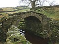
 Harden Bridge - geograph.org.uk - 4685616.jpg 640 × 480 ; 145 kio
-
 Harden Bridge crosses Austwick Beck - geograph.org.uk - 5819038.jpg 640 × 480 ; 37 kio
-
 Harden Bridge spanning Austwick Beck - geograph.org.uk - 4313058.jpg 5 179 × 3 451 ; 6,1 Mio
-
 Haw Hill - geograph.org.uk - 5052397.jpg 1 600 × 1 067 ; 648 kio
-
 Hedge by the A65 - geograph.org.uk - 4646806.jpg 640 × 426 ; 34 kio
-
 High Birks Farm - geograph.org.uk - 4329010.jpg 5 179 × 3 451 ; 6,43 Mio
-
 High Lanshaw - geograph.org.uk - 4313172.jpg 5 179 × 3 451 ; 5,19 Mio
-
 Horses in field between B6480 and Brunton Road - geograph.org.uk - 5652738.jpg 1 024 × 683 ; 282 kio
-
 House by the A65 - geograph.org.uk - 4646823.jpg 640 × 426 ; 58 kio
-
 House on Shepherd Gate at Bark Head - geograph.org.uk - 4111834.jpg 2 000 × 1 500 ; 1,23 Mio
-
 Howith Farm - geograph.org.uk - 3286131.jpg 640 × 480 ; 74 kio
-
 Israel Farm - geograph.org.uk - 3285940.jpg 640 × 420 ; 76 kio
-
 Jack Beck Gate, Keasden, Clapham - geograph.org.uk - 5082240.jpg 2 000 × 1 500 ; 1,07 Mio
-
 Junction of A65 with Crow Nest Road - geograph.org.uk - 5187968.jpg 1 600 × 1 200 ; 831 kio
-

-
 Junction of dry stone walls on south side of B6480 - geograph.org.uk - 5654185.jpg 1 024 × 683 ; 274 kio
-
 Junction of Eldroth Road and Cragg Lane - geograph.org.uk - 4964623.jpg 640 × 479 ; 278 kio
-
 Junction of Holm Lane and the A65 - geograph.org.uk - 2343166.jpg 640 × 480 ; 103 kio
-
 Junction of School Lane and Eldroth Road - geograph.org.uk - 2226224.jpg 640 × 480 ; 102 kio
-
 Junction of the A65 and B6480 - geograph.org.uk - 4051437.jpg 2 667 × 1 998 ; 2,08 Mio
-
 Junction with the A65 trunk road near Clapham - geograph.org.uk - 2488576.jpg 1 024 × 643 ; 141 kio
-
 Kettles Beck alongside the footpath to Lanshaw Farm - geograph.org.uk - 4613699.jpg 1 992 × 1 461 ; 816 kio
-
 Kettles Beck Bridge, Lawkland - geograph.org.uk - 4613743.jpg 2 048 × 1 536 ; 780 kio
-
 Kettlesbeck Bridge and Ingleborough - geograph.org.uk - 5835172.jpg 1 600 × 1 200 ; 799 kio
-
 Kettlesbeck Bridge and Pen y Ghent - geograph.org.uk - 5837384.jpg 1 600 × 1 200 ; 627 kio
-
 Kettlesbeck Brow and a boundary stone - geograph.org.uk - 5833488.jpg 1 600 × 1 202 ; 525 kio
-
 Kettlesbeck Brow over Kettlesbeck Bridge - geograph.org.uk - 5837368.jpg 1 600 × 1 200 ; 664 kio
-
 Knotteranum in the rain - geograph.org.uk - 3537420.jpg 1 600 × 1 200 ; 362 kio
-
 Lane alongside the railway, Eldroth - geograph.org.uk - 4112957.jpg 2 000 × 1 466 ; 1,55 Mio
-
 Lane on railway bridge - geograph.org.uk - 3079095.jpg 2 000 × 1 500 ; 1 Mio
-
 Lane Side Bridge, Austwick - geograph.org.uk - 4613716.jpg 2 048 × 1 536 ; 806 kio
-
 Lane Side Bridge, Keasden - geograph.org.uk - 5833435.jpg 1 600 × 1 200 ; 635 kio
-
 Lane to Lawkland Green - geograph.org.uk - 3078990.jpg 2 000 × 1 500 ; 780 kio
-
 Lane, looking towards railway bridge - geograph.org.uk - 3078981.jpg 2 000 × 1 500 ; 833 kio
-
 Lanshaw Farm - geograph.org.uk - 4313166.jpg 5 179 × 3 451 ; 6,57 Mio
-
 Large benchmark on barn at Stalpes - geograph.org.uk - 5719854.jpg 1 024 × 683 ; 342 kio
-
 Laughton Grange - geograph.org.uk - 5650340.jpg 1 024 × 683 ; 168 kio
-
 Lawkland-Giggleswick boundary stone - geograph.org.uk - 5649404.jpg 1 024 × 683 ; 219 kio
-
 Lawsings Brow - geograph.org.uk - 4318595.jpg 5 179 × 3 451 ; 5,38 Mio
-
 Lawsings Brow - geograph.org.uk - 5818958.jpg 640 × 480 ; 21 kio
-
 Lay-by by B6480 - geograph.org.uk - 5224521.jpg 1 600 × 1 200 ; 723 kio

_Bridge_-_geograph.org.uk_-_5834766.jpg)


_-_geograph.org.uk_-_5895879.jpg)


_Bridge,_Keasden_-_geograph.org.uk_-_5833422.jpg)


,_A65_near_Austwick_-_geograph.org.uk_-_2520639.jpg)


