Category:Layer Marney
Vai alla navigazione
Vai alla ricerca
parrocchia civile dell'Essex | |||||
| Carica un file multimediale | |||||
| Istanza di | |||||
|---|---|---|---|---|---|
| Luogo | Colchester, Essex, Est dell'Inghilterra, Inghilterra | ||||
| Popolazione |
| ||||
 | |||||
Sottocategorie
Questa categoria contiene le 3 sottocategorie indicate di seguito, su un totale di 3.
File nella categoria "Layer Marney"
Questa categoria contiene 98 file, indicati di seguito, su un totale di 98.
-
 14th Century iron bound chest (geograph 1897805).jpg 2 816 × 2 112; 1,44 MB
-
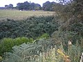 A very overgrown rampart - geograph.org.uk - 2801512.jpg 640 × 480; 99 KB
-
 Abberton Reservoir - geograph.org.uk - 2145185.jpg 1 024 × 640; 121 KB
-
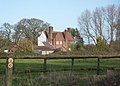
 Almonds, Layer Marney (Listed building) (geograph 3945598).jpg 3 648 × 2 736; 2,31 MB
-
 Arable land near Rockingham's Farm, Layer Marney - geograph.org.uk - 3945608.jpg 3 648 × 2 736; 2,6 MB
-
 B1022 Maldon Road ^ Layer Marney Village sign - geograph.org.uk - 5178900.jpg 3 072 × 2 304; 1,84 MB
-
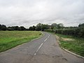
 B1022 Maldon Road, Smythe's Green - geograph.org.uk - 5178811.jpg 3 072 × 2 304; 1,81 MB
-
 Black sheep, Layer Marney (geograph 2490765).jpg 1 600 × 1 200; 496 KB
-
 Blind Lane to Copford from B1022 - geograph.org.uk - 2074480.jpg 640 × 480; 50 KB
-
 Entrance road to Hall Farm, Layer Marney - geograph.org.uk - 1897847.jpg 2 816 × 2 112; 1,61 MB
-
 Farm machinery in a field - geograph.org.uk - 1609883.jpg 578 × 640; 73 KB
-
 Field south of Winter's Road - geograph.org.uk - 5613152.jpg 640 × 480; 119 KB
-
 Footpath 142 5 in Layer Wood - geograph.org.uk - 6449352.jpg 683 × 1 024; 250 KB
-
 Footpath near Layer Marney - geograph.org.uk - 4917051.jpg 1 064 × 1 600; 266 KB
-
 Footpath PROW 142 8 - geograph.org.uk - 6449381.jpg 1 024 × 683; 207 KB
-

-
 Gulf Service Station - geograph.org.uk - 3329895.jpg 2 894 × 1 924; 1,38 MB
-
 Haynes Green - geograph.org.uk - 1609843.jpg 640 × 458; 93 KB
-
 Haynes Green Road - geograph.org.uk - 6449367.jpg 1 024 × 683; 239 KB
-
 Haynes Green Road, Layer Marney - geograph.org.uk - 4396019.jpg 3 648 × 2 432; 3,87 MB
-
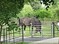 Horse and cattle grid, Layer Marney (geograph 2490757).jpg 1 600 × 1 200; 601 KB
-
 House by the edge of Layer Wood - geograph.org.uk - 1609892.jpg 640 × 426; 97 KB
-
 In Layer Wood - geograph.org.uk - 4614091.jpg 640 × 480; 195 KB
-
 In the ditch at The Rampart - geograph.org.uk - 1609854.jpg 640 × 463; 156 KB
-
 Keeper's Cottages - geograph.org.uk - 4952914.jpg 1 600 × 1 064; 470 KB
-
 Layer Breton sign, Winter's Hill - geograph.org.uk - 5617429.jpg 640 × 480; 99 KB
-
 Layer Marney Tower near Tiptree - geograph.org.uk - 6488683.jpg 1 199 × 1 799; 572 KB
-

-
 Layer Marney Tower, Essex - geograph.org.uk - 3086056.jpg 1 024 × 756; 200 KB
-
 Layer Marney Tower, Gatehouse - geograph.org.uk - 6235794.jpg 3 492 × 5 238; 4,63 MB
-
 Layer Marney Tower, Gatehouse and private west wing - geograph.org.uk - 6235788.jpg 6 398 × 4 265; 6,45 MB
-
 Layer Marney Tower, Gatehouse and private west wing - geograph.org.uk - 6235791.jpg 6 900 × 4 600; 7,2 MB
-

-
-

-

-
 Layer Marney Tower, St. Mary the Virgin Church, Roof angel 2 - geograph.org.uk - 6235865.jpg 6 977 × 4 651; 6,79 MB
-

-

-
 Layer Marney Tower, St. Mary the Virgin Church, The font - geograph.org.uk - 6235833.jpg 7 352 × 4 901; 6,44 MB
-
 Layer Marney Tower, St. Mary the Virgin Church, The nave - geograph.org.uk - 6235835.jpg 7 155 × 4 769; 6,36 MB
-
-
 Layer Marney Tower, St. Mary the Virgin Church, The pulpit - geograph.org.uk - 6235843.jpg 4 735 × 7 103; 5,82 MB
-
 Layer Marney Tower, The Long Gallery - geograph.org.uk - 6235813.jpg 6 260 × 4 174; 4,86 MB
-
 Layer Marney Tower, The Long Gallery fireplace - geograph.org.uk - 6235817.jpg 4 586 × 6 878; 6,09 MB
-
 Layer Marney Tower, The Lower Garden from the Gallery Walk - geograph.org.uk - 6235821.jpg 6 576 × 4 383; 5,47 MB
-
 Layer Marney Tower, The Upper Garden from the Gatehouse - geograph.org.uk - 6235797.jpg 7 570 × 5 046; 5,15 MB
-
 Layer Marney Tower, The Upper Garden from the Gatehouse - geograph.org.uk - 6235801.jpg 7 057 × 4 704; 5,36 MB
-
 Layer Marney village sign - geograph.org.uk - 1143019.jpg 427 × 640; 54 KB
-
 Layer Marney Village sign - geograph.org.uk - 5178913.jpg 2 291 × 3 046; 4,21 MB
-
 Layer Marney Village sign - geograph.org.uk - 5178914.jpg 2 265 × 3 011; 2,97 MB
-
 Layer Wood, Layer Marney - geograph.org.uk - 4396006.jpg 3 648 × 2 736; 5,73 MB
-
 Layer Wood, Layer Marney - geograph.org.uk - 4396011.jpg 2 736 × 2 736; 4,51 MB
-

-
 Looking across The Rampart - geograph.org.uk - 1609845.jpg 640 × 461; 156 KB
-
 Looking along the ramparts - geograph.org.uk - 3199634.jpg 4 608 × 3 072; 3,5 MB
-
 Minor Earthwork in Layer Wood - geograph.org.uk - 6449328.jpg 683 × 1 024; 321 KB
-
 Paddock Near The Rampart - geograph.org.uk - 6449419.jpg 1 024 × 683; 214 KB
-
 Part of Layerwood Farm - geograph.org.uk - 772028.jpg 640 × 480; 78 KB
-
 Pasture, Layer Marney - geograph.org.uk - 3945600.jpg 3 648 × 2 736; 2,79 MB
-
 Path in Layer Wood - geograph.org.uk - 4614095.jpg 640 × 480; 187 KB
-
 Path in Pods Wood - geograph.org.uk - 4952935.jpg 1 600 × 1 064; 787 KB
-
 Path Through Rockingham's Farm - geograph.org.uk - 425381.jpg 426 × 640; 129 KB
-
 Pathway looking towards the Rampart - geograph.org.uk - 2801537.jpg 480 × 640; 62 KB
-
 Pods Wood in spring - geograph.org.uk - 3188353.jpg 4 608 × 3 072; 3,49 MB
-
 Pond by Pods Wood - geograph.org.uk - 6449426.jpg 1 024 × 683; 231 KB
-
 Postbox and signpost, Layer Marney - geograph.org.uk - 2490768.jpg 1 600 × 1 148; 453 KB
-
 Primrose ^ Selfheal in Layer Wood - geograph.org.uk - 6449334.jpg 1 024 × 683; 285 KB
-
 Rich arable land - geograph.org.uk - 789972.jpg 640 × 480; 77 KB
-
 Rockingham's Farm - geograph.org.uk - 1608564.jpg 640 × 424; 74 KB
-
 Rockingham's Farm - geograph.org.uk - 2182700.jpg 1 024 × 515; 107 KB
-
 Roundbush Corner - geograph.org.uk - 4913450.jpg 1 600 × 1 063; 342 KB
-
 Roundbush Lane - geograph.org.uk - 4913446.jpg 1 600 × 1 064; 223 KB
-
 Roundbush Road - geograph.org.uk - 4596629.jpg 1 064 × 1 600; 209 KB
-
 Roundbush Road sign ^ roadsign - geograph.org.uk - 5178803.jpg 3 044 × 2 283; 5,26 MB
-
 Selfheal ^ Path Junction - geograph.org.uk - 6449346.jpg 683 × 1 024; 290 KB
-
 Shooting tower - geograph.org.uk - 2801701.jpg 480 × 640; 62 KB
-

-

-
 The eastern edge of Pods Wood - geograph.org.uk - 1609836.jpg 488 × 640; 138 KB
-
 The Gate to Layer Wood - geograph.org.uk - 6449502.jpg 1 024 × 683; 279 KB
-
 The Rampart - geograph.org.uk - 4952929.jpg 1 600 × 1 064; 815 KB
-
 The Rampart - geograph.org.uk - 6449415.jpg 1 024 × 418; 193 KB
-
 Track by The Rampart - geograph.org.uk - 1609841.jpg 640 × 413; 102 KB
-
 Track to Hall Farm, Layer Marney - geograph.org.uk - 3945602.jpg 3 648 × 2 736; 4,27 MB
-
 Trees on the bank of The Rampart - geograph.org.uk - 1609859.jpg 640 × 509; 169 KB
-
 View towards Layer Marney Tower - geograph.org.uk - 4596616.jpg 1 064 × 1 600; 505 KB
-
 Wheat field by Roundbush Road - geograph.org.uk - 4614071.jpg 640 × 480; 143 KB
-
 Wheat field near Layer Lakes - geograph.org.uk - 2801526.jpg 640 × 480; 62 KB
-
 Wick Farm - geograph.org.uk - 4917057.jpg 1 600 × 1 064; 293 KB
-
 Winter's Road - geograph.org.uk - 5617419.jpg 640 × 480; 107 KB
-
 Woodland Track Through Layer Wood - geograph.org.uk - 6449319.jpg 683 × 1 024; 292 KB
-
 Abberton Drying Out 1 - geograph.org.uk - 45766.jpg 640 × 482; 81 KB
-
 An old barn at Shemmings Farm - geograph.org.uk - 797858.jpg 640 × 421; 78 KB
-
 One track road to Rockingham's Farm - geograph.org.uk - 427167.jpg 640 × 480; 81 KB
-
 Path to Layer Marney - geograph.org.uk - 425368.jpg 640 × 426; 125 KB
-
 Stockhouse Farmhouse - geograph.org.uk - 264395.jpg 640 × 480; 61 KB
-
 View up disused wartime runway - geograph.org.uk - 427208.jpg 640 × 480; 68 KB
.jpg)


_(geograph_3945598).jpg)


.jpg)


.jpg)


