Category:Lea, Lincolnshire
Aller à la navigation
Aller à la recherche
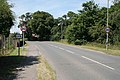
English: Lea is a small village and parish on the outskirts of Gainsborough. It is at the junction of the A156 and B1241, approximately 2 miles south of Gainsborough town centre and 14 miles north-west of Lincoln.
localité britannique du comté anglais de Lincolnshire  | |||||
| Téléverser des médias | |||||
| Nature de l’élément | |||||
|---|---|---|---|---|---|
| Lieu | West Lindsey, Lincolnshire, Midlands de l'Est, Angleterre | ||||
 | |||||
Sous-catégories
Cette catégorie comprend seulement la sous-catégorie ci-dessous.
H
Média dans la catégorie « Lea, Lincolnshire »
Cette catégorie comprend 101 fichiers, dont les 101 ci-dessous.
-
 CS p1.078 - Lea Hall, Lincolnshire - Morris's County Seats, 1866.jpg 2 832 × 1 845 ; 1,26 Mio
-
 1GL Bolt, Lea, St. Helen's Church - geograph.org.uk - 5245737.jpg 1 280 × 960 ; 453 kio
-
 A156 Gainsborough Road entering Lea - geograph.org.uk - 3493925.jpg 1 891 × 1 151 ; 2,01 Mio
-
 Abandoned Farm Implement - geograph.org.uk - 1413690.jpg 640 × 480 ; 126 kio
-
 Bend ahead - geograph.org.uk - 1737159.jpg 640 × 427 ; 78 kio
-
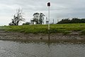
 Beside the River Trent - geograph.org.uk - 5087438.jpg 800 × 508 ; 84 kio
-
 Causeway Lane - geograph.org.uk - 5157046.jpg 1 024 × 768 ; 291 kio
-
 Causeway Lane - geograph.org.uk - 5157833.jpg 1 024 × 768 ; 315 kio
-
 Cavendish Drive Gainsborough - geograph.org.uk - 4655245.jpg 1 024 × 768 ; 130 kio
-
 Cavendish Drive Leigh - geograph.org.uk - 1336833.jpg 640 × 480 ; 54 kio
-
 Continuing up the Trent - geograph.org.uk - 3158611.jpg 640 × 427 ; 136 kio
-
 East Midlands Railway train crossing Lea Road bridge, Gainsborough (geograph 6625057).jpg 1 600 × 1 200 ; 482 kio
-
 Farmhouse at Lea - geograph.org.uk - 2700967.jpg 1 024 × 768 ; 175 kio
-
 Farmland towards Norbury Hills - geograph.org.uk - 3533280.jpg 640 × 480 ; 78 kio
-
 Farmland towards Top Fox Covert - geograph.org.uk - 2985747.jpg 640 × 480 ; 69 kio
-
 Field alongside Upton Road - geograph.org.uk - 5157349.jpg 1 024 × 768 ; 221 kio
-
 Field of oilseed rape, Lea Marshes - geograph.org.uk - 5157846.jpg 1 024 × 728 ; 153 kio
-
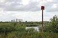
 Field on Lea Marshes and West Burton Power Station - geograph.org.uk - 5157256.jpg 1 024 × 713 ; 142 kio
-
 Forever chasing - geograph.org.uk - 3158608.jpg 640 × 426 ; 154 kio
-
 Gainsborough Road (A156) - geograph.org.uk - 3533282.jpg 640 × 480 ; 73 kio
-
 Gainsborough Road towards Lea - geograph.org.uk - 5781935.jpg 1 600 × 1 118 ; 746 kio
-
 Gainsborough Road, Lea, heading south - geograph.org.uk - 2985725.jpg 640 × 480 ; 72 kio
-
 Gap in the hedge - geograph.org.uk - 1737166.jpg 640 × 457 ; 97 kio
-
 Grazing along the bank - geograph.org.uk - 3158593.jpg 640 × 467 ; 169 kio
-
 Houses on Gainsborough Road, Lea - geograph.org.uk - 2985723.jpg 640 × 480 ; 73 kio
-
 Houses on Willingham Road, Lea - geograph.org.uk - 5893292.jpg 1 600 × 1 065 ; 681 kio
-
 Landfill site near Gainsborough - geograph.org.uk - 5157035.jpg 1 024 × 768 ; 194 kio
-
 Lane on Lea Marsh - geograph.org.uk - 5156981.jpg 1 024 × 768 ; 245 kio
-
 Lea Marsh - geograph.org.uk - 5156995.jpg 1 024 × 768 ; 194 kio
-
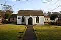
 Lea Methodist Church - geograph.org.uk - 1413756.jpg 640 × 480 ; 87 kio
-
 Lea railway station (site), Lincolnshire (geograph 3215497).jpg 800 × 600 ; 177 kio
-
 Lea village pump - geograph.org.uk - 273979.jpg 640 × 427 ; 132 kio
-
 Lea, St. Helen's Church - geograph.org.uk - 5245734.jpg 1 280 × 960 ; 351 kio
-
 Looking towards Moor House from Station Road - geograph.org.uk - 1838992.jpg 1 600 × 1 200 ; 227 kio
-
 Memorial plaque to Francis Foljambe Anderson - geograph.org.uk - 5893173.jpg 1 225 × 1 600 ; 487 kio
-
 Moorhouse Farm - geograph.org.uk - 3358486.jpg 640 × 427 ; 48 kio
-
 Moorhouse Farm, Lea - geograph.org.uk - 2004883.jpg 640 × 480 ; 61 kio
-
 Navigation marker on Lea Marsh - geograph.org.uk - 3158629.jpg 640 × 428 ; 192 kio
-
-
 Next stop Gainsborough Lea Road - geograph.org.uk - 1737629.jpg 640 × 477 ; 106 kio
-
 Norbury Hills - geograph.org.uk - 5157285.jpg 1 024 × 768 ; 165 kio
-
 North aisle, St Helen's church, Lea - geograph.org.uk - 5392186.jpg 3 211 × 4 648 ; 6,92 Mio
-
 Old Moat , Near Priory Farm - geograph.org.uk - 1413719.jpg 640 × 480 ; 100 kio
-
 Organ, St Helen's church, Lea - geograph.org.uk - 5392647.jpg 2 867 × 4 140 ; 6,76 Mio
-
 Pipeline protection^ - geograph.org.uk - 3158589.jpg 640 × 431 ; 224 kio
-
 Poppyhead, St Helen's church, Lea - geograph.org.uk - 5392648.jpg 2 856 × 4 364 ; 7,11 Mio
-
 Port marker - geograph.org.uk - 3158621.jpg 640 × 427 ; 185 kio
-
 Private road to Thurlby Wood - geograph.org.uk - 2985749.jpg 640 × 480 ; 109 kio
-
 Private Track to Thurlby Wood - geograph.org.uk - 3283754.jpg 2 256 × 1 504 ; 1,62 Mio
-
 Pumping station beside the River Trent - geograph.org.uk - 5090717.jpg 3 072 × 1 728 ; 3,22 Mio
-

-

-
 River Trent near the West Burton power station - geograph.org.uk - 5366546.jpg 800 × 538 ; 123 kio
-
 River Trent with West Burton Power Station A and B behind - geograph.org.uk - 5090721.jpg 2 047 × 1 152 ; 1,8 Mio
-
 Sheep grazing on Lea Marsh - geograph.org.uk - 5156985.jpg 1 024 × 768 ; 165 kio
-
 Sheep grazing on Lea Marsh - geograph.org.uk - 5157020.jpg 1 024 × 768 ; 201 kio
-
 Sheep grazing on Lea Marsh - geograph.org.uk - 5157146.jpg 1 024 × 768 ; 233 kio
-
 Sheep next to the River Trent - geograph.org.uk - 5366555.jpg 800 × 461 ; 94 kio
-
 St Helen's Church, Lea - geograph.org.uk - 5781944.jpg 1 600 × 1 065 ; 728 kio
-
 St Helen's Church, Lea - geograph.org.uk - 5893141.jpg 1 144 × 1 600 ; 486 kio
-
 St Helen's Church, Lea - geograph.org.uk - 5893144.jpg 1 282 × 1 600 ; 999 kio
-
 St Helen's Church, Lea - geograph.org.uk - 5893147.jpg 1 065 × 1 600 ; 392 kio
-
 St Helen's Church, Lea - geograph.org.uk - 5893182.jpg 831 × 1 600 ; 634 kio
-
 St Helen's Church, Lea - geograph.org.uk - 5893187.jpg 1 065 × 1 600 ; 491 kio
-
 St Helen's Church, Lea - geograph.org.uk - 5893193.jpg 848 × 1 600 ; 567 kio
-
 St Helen's Church, Lea - geograph.org.uk - 5893198.jpg 1 600 × 1 065 ; 420 kio
-
 St Helen's Church, Lea - geograph.org.uk - 5893205.jpg 1 600 × 1 288 ; 680 kio
-
 St Helen's Church, Lea - geograph.org.uk - 5893278.jpg 713 × 1 600 ; 583 kio
-
 St Helen's Church, Lea - geograph.org.uk - 5893283.jpg 714 × 1 600 ; 613 kio
-
 St Helen's Church, Lea - geograph.org.uk - 5893285.jpg 1 600 × 1 065 ; 425 kio
-
 St Helen's Road, Lea - geograph.org.uk - 2985733.jpg 640 × 480 ; 61 kio
-
 St Helens Church, Willingham Road, Lea - geograph.org.uk - 5652775.jpg 5 196 × 4 562 ; 6,14 Mio
-
 Stained glass window detail, St Helen's church, Lea - geograph.org.uk - 5392679.jpg 2 709 × 4 410 ; 6,66 Mio
-
 Station Road towards Knaith - geograph.org.uk - 5781908.jpg 1 600 × 1 097 ; 816 kio
-
 Steps to St. Helen's church - geograph.org.uk - 2701075.jpg 1 024 × 768 ; 316 kio
-

-
 The approach to Lea - geograph.org.uk - 1372027.jpg 640 × 427 ; 85 kio
-
 The beginning of a footpath to Kexby - geograph.org.uk - 5157320.jpg 1 024 × 768 ; 199 kio
-
 The entrance to Priory Farm - geograph.org.uk - 1413730.jpg 640 × 480 ; 97 kio
-
 The Joint Line near Gainsborough Lea Road - geograph.org.uk - 1372378.jpg 640 × 427 ; 104 kio
-
 The River Trent near Lea - geograph.org.uk - 5157024.jpg 1 024 × 768 ; 207 kio
-
 The Village Green, Lea - geograph.org.uk - 2701067.jpg 1 024 × 768 ; 268 kio
-
 Timber stack on Causeway Lane - geograph.org.uk - 5157053.jpg 1 024 × 768 ; 302 kio
-
 Track by Upton Grove Farm - geograph.org.uk - 6133123.jpg 5 376 × 3 024 ; 6,52 Mio
-
 Track from Warren Wood - geograph.org.uk - 1737136.jpg 640 × 427 ; 76 kio
-
 Track Leading towards Priory Farm - geograph.org.uk - 1413706.jpg 640 × 480 ; 100 kio
-
 Track on Lea Marsh - geograph.org.uk - 5157016.jpg 1 024 × 768 ; 228 kio
-
 Up the Trent - geograph.org.uk - 3158575.jpg 640 × 427 ; 144 kio
-
 Up the Trent - geograph.org.uk - 3158578.jpg 640 × 456 ; 165 kio
-
 View to Thurlby Wood - geograph.org.uk - 274728.jpg 640 × 427 ; 62 kio
-
 View towards Lea from Lea Marshes - geograph.org.uk - 5157842.jpg 1 024 × 768 ; 197 kio
-
 Willingham Road (B1241) - geograph.org.uk - 2985734.jpg 640 × 480 ; 65 kio
-
 Willingham Road (B1241) towards Kexby - geograph.org.uk - 2985740.jpg 640 × 480 ; 67 kio
-

-
 Willingham Road, Lea - geograph.org.uk - 2004879.jpg 640 × 480 ; 101 kio
-
 Woodland, Lea Marsh - geograph.org.uk - 2985716.jpg 640 × 480 ; 59 kio
-
 Cart Track Along the edge of Woodland - geograph.org.uk - 1413683.jpg 640 × 480 ; 72 kio
-
 Lea Methodist church - geograph.org.uk - 113697.jpg 640 × 427 ; 108 kio
-
 Norbury Hills - geograph.org.uk - 274722.jpg 640 × 427 ; 123 kio
-
 Padmoor Lane - geograph.org.uk - 274747.jpg 640 × 427 ; 89 kio
-
 The Stag's Head - geograph.org.uk - 113708.jpg 640 × 427 ; 88 kio


.jpg)


_-_geograph.org.uk_-_3533282.jpg)


,_Lincolnshire_(geograph_3215497).jpg)


_-_geograph.org.uk_-_2985734.jpg)
_towards_Kexby_-_geograph.org.uk_-_2985740.jpg)


