Category:Leigh, Gloucestershire
Aller à la navigation
Aller à la recherche
établissement humain du Tewkesbury, Angleterre, Royaume-Uni  | |||||
| Téléverser des médias | |||||
| Nature de l’élément | |||||
|---|---|---|---|---|---|
| Lieu | Tewkesbury, Gloucestershire, Angleterre du Sud-Ouest, Angleterre | ||||
 | |||||
Leigh is a village on Gloucestershire about 11km NE of Gloucester.
Sous-catégories
Cette catégorie comprend 2 sous-catégories, dont les 2 ci-dessous.
C
L
Média dans la catégorie « Leigh, Gloucestershire »
Cette catégorie comprend 90 fichiers, dont les 90 ci-dessous.
-
 A38 approaching The Leigh - geograph.org.uk - 2001301.jpg 3 008 × 2 000 ; 1,48 Mio
-
 A38 at Pancake Corner - geograph.org.uk - 2133155.jpg 640 × 480 ; 259 kio
-
 A38 at Pancake Corner - geograph.org.uk - 6414142.jpg 800 × 601 ; 108 kio
-
 A38 at The Leigh - geograph.org.uk - 2030897.jpg 640 × 480 ; 232 kio
-
 A38 at The Leigh turn - geograph.org.uk - 6414139.jpg 800 × 601 ; 125 kio
-
 A38 at The Leigh, a small collection of signs - geograph.org.uk - 2030902.jpg 640 × 480 ; 237 kio
-
 A38 from Blacksmith Lane, The Leigh - geograph.org.uk - 4975652.jpg 1 600 × 998 ; 618 kio
-
 A38 north of Coombe Hill - geograph.org.uk - 6414147.jpg 800 × 600 ; 111 kio
-
 Arable land, The Leigh - geograph.org.uk - 2001379.jpg 640 × 426 ; 77 kio
-
 Autumnal hedgerow, 1 - geograph.org.uk - 5169117.jpg 1 600 × 1 200 ; 740 kio
-
 Autumnal hedgerow, 2 - geograph.org.uk - 5169118.jpg 1 600 × 1 200 ; 776 kio
-
 Beef in an old orchard - geograph.org.uk - 4744600.jpg 1 600 × 901 ; 689 kio
-
 Benchmark on Leigh Church - geograph.org.uk - 4112990.jpg 2 560 × 1 920 ; 1,01 Mio
-
 Blacksmith Lane, The Leigh - geograph.org.uk - 4975608.jpg 1 600 × 1 128 ; 522 kio
-
 Blacksmith Lane, The Leigh - geograph.org.uk - 4975611.jpg 1 600 × 1 070 ; 808 kio
-
 Blacksmith Lane, The Leigh - geograph.org.uk - 4975622.jpg 1 600 × 1 065 ; 494 kio
-
 Blacksmith Lane, The Leigh - geograph.org.uk - 4975631.jpg 1 600 × 1 080 ; 672 kio
-
 Blacksmith Lane, The Leigh towards the A38 - geograph.org.uk - 4975638.jpg 1 600 × 1 054 ; 634 kio
-
 Blacksmith's Lane junction - geograph.org.uk - 2043571.jpg 640 × 480 ; 207 kio
-
 Blacksmith's Lane to The Leigh - geograph.org.uk - 2043540.jpg 640 × 480 ; 239 kio
-
 Bridleway across the marshes - geograph.org.uk - 2043468.jpg 640 × 480 ; 228 kio
-
 Canalside path and bridleway - geograph.org.uk - 2190442.jpg 1 024 × 768 ; 706 kio
-
 Coombe Hill Canal (disused) - geograph.org.uk - 4975679.jpg 1 600 × 1 065 ; 768 kio
-
 Coombe Hill Canal (disused) - geograph.org.uk - 4975680.jpg 1 600 × 1 065 ; 731 kio
-
 Coombe Hill Canal basin - geograph.org.uk - 2748357.jpg 1 024 × 768 ; 188 kio
-
 Coombe Hill Canal path - geograph.org.uk - 5169116.jpg 1 600 × 1 200 ; 982 kio
-
 Coombe Hill Canal, 1 - geograph.org.uk - 5169109.jpg 1 600 × 899 ; 945 kio
-
 Coombe Hill Canal, 2 - geograph.org.uk - 5169110.jpg 1 600 × 1 200 ; 1,18 Mio
-
 Coombe Hill Canal, 3 - geograph.org.uk - 5169111.jpg 1 600 × 1 200 ; 1,14 Mio
-
 Coombe Hill Canal, 4 - geograph.org.uk - 5169112.jpg 1 600 × 899 ; 911 kio
-
 Coombe Hill Canal, 5 - geograph.org.uk - 5169113.jpg 1 600 × 899 ; 980 kio
-
 Coombe Hill Canal, 6 - geograph.org.uk - 5169115.jpg 1 600 × 901 ; 710 kio
-
 Coombe Hill crossroads - geograph.org.uk - 2190448.jpg 1 024 × 768 ; 492 kio
-
 Coombe Hill Nature Reserve - geograph.org.uk - 1898958.jpg 640 × 426 ; 120 kio
-
 Coombe Hill Nature Reserve - geograph.org.uk - 4702878.jpg 1 024 × 680 ; 294 kio
-
 Coombe Hill Nature Reserve and Canal - geograph.org.uk - 1902632.jpg 3 008 × 2 000 ; 1,51 Mio
-
 Cottage at The Leigh - geograph.org.uk - 2043479.jpg 640 × 480 ; 252 kio
-
 Deans Road off Church Lane - geograph.org.uk - 4975489.jpg 1 600 × 1 065 ; 589 kio
-
 Farm buildings, The Leigh - geograph.org.uk - 61778.jpg 640 × 426 ; 123 kio
-
 Farm Track at Leigh Court Farm, The Leigh - geograph.org.uk - 4975587.jpg 1 600 × 1 065 ; 711 kio
-
 Farmyard in The Leigh - geograph.org.uk - 61776.jpg 640 × 426 ; 193 kio
-
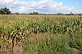 Field of Maize at The Leigh - geograph.org.uk - 59089.jpg 640 × 426 ; 171 kio
-
 Field of maize, The Leigh - geograph.org.uk - 2001381.jpg 640 × 426 ; 94 kio
-
 Flat pasture land - geograph.org.uk - 2030868.jpg 640 × 480 ; 222 kio
-

-
 Flooded Leigh Brook, 1 - geograph.org.uk - 3276655.jpg 1 200 × 900 ; 571 kio
-
 Flooded Leigh Brook, 2 - geograph.org.uk - 3276656.jpg 1 200 × 898 ; 535 kio
-
 Flooded Leigh Brook, 2014 - geograph.org.uk - 3862841.jpg 800 × 600 ; 355 kio
-
 Flooded meadows near The Leigh - geograph.org.uk - 3852300.jpg 800 × 600 ; 331 kio
-
 Floodwater at The Wharf - geograph.org.uk - 3862825.jpg 800 × 600 ; 367 kio
-
 Font in Saint Catherine's, The Leigh - geograph.org.uk - 4975509.jpg 1 065 × 1 600 ; 416 kio
-
 Footpath off Blacksmith Lane, The Leigh - geograph.org.uk - 4975646.jpg 1 600 × 1 065 ; 815 kio
-
 Former Chapel at Coombe Hill - geograph.org.uk - 4975698.jpg 1 600 × 1 065 ; 762 kio
-
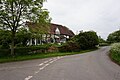
 Georgian house on the A4019, Coombe Hill - geograph.org.uk - 6241146.jpg 1 862 × 1 186 ; 1 Mio
-
 Hawthorn, Cretaegus sp. - geograph.org.uk - 2043560.jpg 640 × 481 ; 284 kio
-
 House on Blacksmith Lane, The Leigh - geograph.org.uk - 4975602.jpg 1 600 × 1 065 ; 687 kio
-
 Houses at The Leigh - geograph.org.uk - 2001376.jpg 640 × 426 ; 73 kio
-
 Junction of Church Lane and Gloucester Road - geograph.org.uk - 4975485.jpg 1 600 × 1 063 ; 804 kio
-
 Late summer view - geograph.org.uk - 2030883.jpg 640 × 481 ; 256 kio
-
 Leigh Court Farm, The Leigh - geograph.org.uk - 4975580.jpg 1 600 × 1 065 ; 522 kio
-
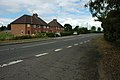
 Leigh, lay-by - geograph.org.uk - 2140711.jpg 1 024 × 768 ; 193 kio
-
 Modern Housing - geograph.org.uk - 2660937.jpg 640 × 480 ; 69 kio
-
 Oxenton Hill viewed from Coombe Hill Canal - geograph.org.uk - 61783.jpg 640 × 426 ; 122 kio
-
 Pancake Lane - geograph.org.uk - 2133151.jpg 640 × 480 ; 258 kio
-
 Pastoral scene - geograph.org.uk - 2043528.jpg 640 × 480 ; 203 kio
-
 Pond at The Leigh - geograph.org.uk - 2043493.jpg 640 × 481 ; 209 kio
-
 Pond on Blacksmith Lane, The Leigh - geograph.org.uk - 4975617.jpg 1 600 × 1 065 ; 855 kio
-
 Prospect House, The Leigh - geograph.org.uk - 4975594.jpg 1 600 × 1 065 ; 629 kio
-
 Pylons crossing meadows near The Leigh - geograph.org.uk - 59153.jpg 426 × 640 ; 88 kio
-
 Roll of Honour in Saint Catherine's, The Leigh - geograph.org.uk - 4975534.jpg 1 272 × 1 600 ; 553 kio
-
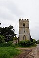
 Saint Catherine's, The Leigh - geograph.org.uk - 4975502.jpg 1 600 × 1 065 ; 623 kio
-
 Saint Catherine's, The Leigh - geograph.org.uk - 4975539.jpg 1 600 × 1 065 ; 356 kio
-
 Saint Catherine's, The Leigh - geograph.org.uk - 4975572.jpg 817 × 1 600 ; 503 kio
-
 Saint Catherine's, The Leigh - geograph.org.uk - 4975575.jpg 1 078 × 1 600 ; 767 kio
-
 Saint Catherine's, The Leigh - geograph.org.uk - 4975588.jpg 1 065 × 1 600 ; 431 kio
-
 Series of gateways - geograph.org.uk - 2043513.jpg 640 × 480 ; 250 kio
-
 Small Graveyard at Coombe Hill - geograph.org.uk - 4975692.jpg 1 600 × 1 065 ; 896 kio
-
 The Leigh - geograph.org.uk - 2030893.jpg 640 × 480 ; 248 kio
-
 The Swan at Coombe Hill - geograph.org.uk - 4975685.jpg 1 600 × 1 065 ; 431 kio
-
 The Swan at Coombe Hill - geograph.org.uk - 4975687.jpg 1 600 × 1 065 ; 534 kio
-
 The Swan at Coombe Hill - geograph.org.uk - 4975688.jpg 1 065 × 1 600 ; 341 kio
-
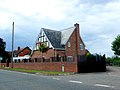
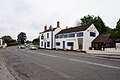
 The Swan Inn, Coombe Hill - geograph.org.uk - 5713542.jpg 640 × 454 ; 47 kio
-
 Track and footpath - geograph.org.uk - 4744601.jpg 1 600 × 901 ; 643 kio
-
 Track and footpath at Coombe Hill - geograph.org.uk - 2005594.jpg 3 008 × 2 000 ; 1,57 Mio
-
 Victorian Postbox at The Coach House - geograph.org.uk - 4975658.jpg 1 600 × 1 065 ; 802 kio
-
 Victorian Postbox at The Coach House - geograph.org.uk - 4975659.jpg 1 065 × 1 600 ; 726 kio
-
 View from tower of St Mary's Church - geograph.org.uk - 393604.jpg 640 × 480 ; 42 kio
-
 War Memorial in Saint Catherine's, The Leigh - geograph.org.uk - 4975514.jpg 1 600 × 1 065 ; 340 kio
-
 War Memorial in Saint Catherine's, The Leigh - geograph.org.uk - 4975537.jpg 1 600 × 1 065 ; 377 kio
-
 Willow Hill Farm - geograph.org.uk - 83887.jpg 640 × 479 ; 106 kio


_-_geograph.org.uk_-_4975679.jpg)
_-_geograph.org.uk_-_4975680.jpg)


