Category:Leribe
Vai alla navigazione
Vai alla ricerca
city  Центр города | |||||
| Carica un file multimediale | |||||
| Istanza di | |||||
|---|---|---|---|---|---|
| Luogo | distretto di Leribe, Lesotho | ||||
| Distinto da | |||||
 | |||||
English: Leribe or Hlotse. Hlotse is a market town in the district of Leribe in Lesotho (southern Africa).
Sottocategorie
Questa categoria contiene un'unica sottocategoria, indicata di seguito.
File nella categoria "Leribe"
Questa categoria contiene 106 file, indicati di seguito, su un totale di 106.
-
 'Matalane View of Sephokong sa Leribe - panoramio.jpg 1 024 × 680; 423 KB
-
 'Mate Court.jpg 1 600 × 1 200; 890 KB
-
 IY188 pg394 MOLAPPO'S HOUSE NEAR LERIBE, BASUTOLAND, INTERVIEW WITH LOYAL BASUTOS.jpg 1 343 × 1 126; 917 KB
-
 A Flock of Sheep - panoramio.jpg 4 912 × 3 264; 6,1 MB
-
 Ancient rock pantings at Maoana-masooana - panoramio.jpg 1 024 × 576; 286 KB
-
 Beautiful Outcrop at Sephokong sa Leribe - panoramio.jpg 1 024 × 651; 373 KB
-
 Boitelo, Leribe, seen from Qoqolosaneng - panoramio.jpg 4 912 × 3 264; 4,55 MB
-
 Bridge over Katse Dam - panoramio.jpg 1 600 × 1 200; 346 KB
-
 Buzzard on patrol hovers over cliffs - panoramio.jpg 1 024 × 622; 260 KB
-
 Chafo, Qoqolosing, Leribe, Lesotho - panoramio.jpg 1 864 × 968; 885 KB
-
 Child's play, Kids at Ha Malesaoana village from fetching water - panoramio.jpg 1 024 × 567; 398 KB
-
 Clanrens Rock Formations near Leribe LEC Mission - panoramio.jpg 3 498 × 2 256; 3,69 MB
-
 Cliffs of Matalane, Leribe - panoramio.jpg 3 568 × 2 368; 1,68 MB
-
 Cloud over Qoqolosing - panoramio.jpg 4 912 × 3 264; 6,09 MB
-
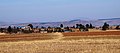
 Corn crop ready for harvest at Ha Poso - panoramio.jpg 1 024 × 680; 321 KB
-
 Eagle vs Rabbit, Leribe Plateau - panoramio.jpg 3 568 × 2 368; 3,25 MB
-
 Fish Eagle at Matalane - panoramio.jpg 3 568 × 2 368; 4,41 MB
-
 Free State in the Background over Ha Malesaoana - panoramio.jpg 1 024 × 680; 348 KB
-
 Goat boy - at Maphakheng Leribe - panoramio.jpg 4 608 × 3 072; 3,57 MB
-
 Ha 'Malesaoana Makotoko - panoramio.jpg 3 568 × 2 368; 3,63 MB
-
 Ha Khabo in the Background, Leribe, Lesotho - panoramio.jpg 4 912 × 3 264; 3,12 MB
-
 Ha Lehlaha - panoramio.jpg 3 526 × 1 568; 1,58 MB
-
 Ha Lehlaha, Qoqolosing, Leribe, Lesotho - panoramio.jpg 4 912 × 1 983; 3,41 MB
-
 Ha Lehlaha, Qoqoqolosing, Leribe - From Qoqolosaneng - panoramio.jpg 4 912 × 2 719; 3,5 MB
-
 Ha Malesaoana - panoramio.jpg 1 024 × 680; 317 KB
-
 Ha Mohapi on top of the Hill - panoramio.jpg 1 024 × 629; 290 KB
-
 Ha Mohapi Village - panoramio.jpg 1 024 × 474; 274 KB
-
 Ha Mohapi Village - Showing Primary School - panoramio.jpg 2 304 × 1 536; 1,56 MB
-
 Ha Mohapi Village, showing Qoqolosaneng in the Background - panoramio.jpg 3 568 × 2 368; 3,03 MB
-
 Ha Mohapi with Qoqolosing in the Background - panoramio.jpg 3 568 × 2 368; 3,47 MB
-
 Ha Monki Makotoko Lesaoana, Leribe - panoramio.jpg 3 568 × 2 368; 2,72 MB
-
 Ha Moshepe, Qoqolosaneng, Leribe, Lesotho - panoramio.jpg 4 279 × 2 675; 4,18 MB
-
 Ha Phohlonyane - panoramio.jpg 1 024 × 614; 371 KB
-
 Ha Sabata, Phahameng, Leribe - panoramio.jpg 4 912 × 3 264; 5,59 MB
-
 Ha Simone Phamotse, Leribe - panoramio.jpg 4 912 × 2 248; 4,37 MB
-
 Ha Simone with Free State in the background - panoramio.jpg 3 568 × 2 368; 3,94 MB
-
 Hill Sides - panoramio.jpg 4 792 × 2 471; 4,05 MB
-
 Hill Walking at Leribe - panoramio.jpg 4 912 × 2 758; 6,7 MB
-
 Hlotse central part.jpg 1 800 × 1 200; 1,51 MB
-
 Hlotse from Qoqolosing - panoramio.jpg 3 568 × 2 368; 2,94 MB
-
 Hlotse viewed from Leribe Plateau (Sehlabaneng, Ha Mohapi) - panoramio.jpg 3 568 × 2 368; 4,31 MB
-
 Hlotse, Leribe - panoramio.jpg 3 568 × 2 368; 4,34 MB
-
 Hlotse, Leribe in the Background - panoramio.jpg 1 024 × 563; 264 KB
-
 Katse Bridge before the water - panoramio.jpg 736 × 530; 223 KB
-
 Katse Bridge from the Basin - panoramio.jpg 741 × 495; 161 KB
-
 Katse Bridge under construction - panoramio.jpg 741 × 528; 183 KB
-
 Katse Hotel - panoramio.jpg 3 072 × 2 304; 1,13 MB
-
 Khanyane mountain viewed from Qoqolosaneng over Ha Sekota, Leribe, Lesotho - panoramio.jpg 4 912 × 3 264; 3,57 MB
-
 Khohlong Ha Poso - panoramio (1).jpg 3 568 × 2 368; 4,41 MB
-
 Khohlong Ha Poso - panoramio.jpg 1 024 × 680; 332 KB
-
 Khohlong Ha Poso, Qoqolosing - panoramio.jpg 3 568 × 2 368; 4,88 MB
-
 Le temple de Léribé.png 1 105 × 656; 1,79 MB
-
 Le village et le temple de Léribé.png 704 × 474; 720 KB
-
 Lehaha la 'Masello Poso - panoramio.jpg 1 024 × 617; 297 KB
-
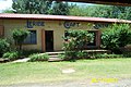 Leribe Craft Center.jpg 1 800 × 1 200; 597 KB
-
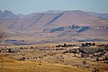
 Leribe district.jpg 1 000 × 750; 909 KB
-
 Leribe High School from the Hill - panoramio.jpg 4 870 × 3 200; 6 MB
-
 Leribe High School from the Hilltop - panoramio.jpg 1 024 × 680; 318 KB
-
 Leribe High School just before sunset - panoramio.jpg 1 024 × 680; 364 KB
-
 Leribe Moreneng - Ha Bolokoe - panoramio.jpg 4 912 × 3 264; 5,53 MB
-
 Leribe Plateau from Ha Simone, Leribe - panoramio.jpg 3 568 × 2 368; 3,81 MB
-
 Leribe, Lesotho - panoramio (1).jpg 4 912 × 2 896; 2,77 MB
-
 Leribe, Lesotho - panoramio.jpg 4 912 × 2 936; 4,49 MB
-
 Lessouto-Le Khotla de Jonathan Molapo.jpg 1 635 × 1 032; 460 KB
-
 Lipetu - panoramio.jpg 4 908 × 1 671; 3,46 MB
-
 Léribé 2.png 1 388 × 750; 2,27 MB
-
 Mabuleng, Leribe, Lesotho - panoramio.jpg 4 912 × 2 620; 3,37 MB
-
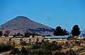
 Maloti - panoramio.jpg 3 568 × 2 368; 2,85 MB
-
 Maloti a Leribe - panoramio.jpg 4 049 × 1 421; 1,32 MB
-
 Maloti a Leribe over Qoqolosing - panoramio.jpg 4 912 × 3 264; 3,86 MB
-
 Maloti Mountains from Qoqolosing Plateau - panoramio.jpg 4 908 × 2 118; 4,06 MB
-
 Maloti Range near Mphosong, viewed from Qoqolosing - panoramio.jpg 3 568 × 2 368; 2,85 MB
-
 Maoana-masooana - panoramio.jpg 1 024 × 680; 352 KB
-
 Matalane Afforestation - Leribe - panoramio.jpg 1 024 × 680; 386 KB
-
 Matalane Valley with Lithabaneng in the Background - panoramio.jpg 3 568 × 2 368; 4,53 MB
-
 Matalane with Qoqolosing in the background - panoramio.jpg 3 568 × 2 368; 4,44 MB
-
 Mohapi Primary School, Qoqolosing, Leribe, Lesotho - panoramio.jpg 4 528 × 2 948; 4,48 MB
-
 Mushroom rock outcrop near Leribe High School - panoramio.jpg 3 568 × 2 368; 1,04 MB
-
 Overhanging Cliffs at Matalane Leribe - 80 metres free-fall drop - panoramio.jpg 3 568 × 2 368; 3,34 MB
-
 Panoramic view of Ha lehlaha, Leribe, Lesotho - panoramio.jpg 8 176 × 1 784; 5,98 MB
-
 Phahameng, Qoqolosing, Leribe, Lesotho - panoramio.jpg 4 912 × 2 162; 3,3 MB
-
 Phats'oe Leribe - panoramio.jpg 3 526 × 2 302; 3 MB
-
 Power Sub-station - Phelandaba - panoramio.jpg 3 568 × 2 368; 3,66 MB
-
 Qoqolosaneng, Leribe, Lesotho - panoramio (1).jpg 4 608 × 3 072; 3,68 MB
-
 Qoqolosaneng, Leribe, Lesotho - panoramio.jpg 4 912 × 2 454; 4,08 MB
-
 Qoqolosing Moreneng - panoramio (1).jpg 3 568 × 2 368; 2,31 MB
-
 Qoqolosing Moreneng - panoramio.jpg 3 568 × 2 368; 2,75 MB
-
 Qoqolosing Village - panoramio.jpg 3 568 × 2 368; 3,24 MB
-
 Rampai Pass - panoramio (1).jpg 2 592 × 1 936; 1,99 MB
-
 Rampai Pass - panoramio (2).jpg 2 592 × 1 936; 1,89 MB
-
 Rampai Pass - panoramio (3).jpg 2 592 × 1 936; 1,82 MB
-
 Rampai Pass - panoramio (4).jpg 2 592 × 1 936; 1,75 MB
-
 Ruins of Old Huts at Molapo's Old Village - Leribe - panoramio.jpg 1 024 × 680; 291 KB
-
 Rural Village in Lesotho Foothills, Ha Mohapi - panoramio.jpg 2 463 × 1 605; 1,67 MB
-
 Sehlabeng ACL High School in the forefront, Qoqolosing, Leribe - panoramio.jpg 4 912 × 3 264; 4,92 MB
-
 Sephokong from Sehlabeng - panoramio.jpg 2 048 × 1 361; 1 007 KB
-
 Seubeng River dry in July - panoramio.jpg 1 024 × 680; 337 KB
-
 Snow bound road - near Qoqolosing, Leribe - panoramio.jpg 1 600 × 745; 403 KB
-
 Subeng Old Bridge - Ha Simone - panoramio.jpg 1 024 × 535; 292 KB
-
 The National Archives UK - CO 1069-209-60.jpg 831 × 844; 282 KB
-
 Thoteng Ha Mokhoabane - panoramio.jpg 1 024 × 383; 263 KB
-
 Ts'ehlanyane Nature Reserve - panoramio (1).jpg 1 280 × 960; 577 KB
-
 Ts'ehlanyane Nature Reserve - panoramio.jpg 1 536 × 2 048; 1,36 MB
-
 Tsikoane Plateau from Qoqolosaneng, Leribe, Lesotho - panoramio.jpg 4 902 × 2 324; 3,82 MB
-
 Unnamed Road, Jonathans, Lesotho - panoramio (15).jpg 4 912 × 3 264; 3,66 MB
-
 Unnamed Road, Lesotho - panoramio (10).jpg 2 304 × 1 536; 1,3 MB


_-_panoramio.jpg)


.jpg)


.jpg)


.jpg)

.jpg)


.jpg)
.jpg)
.jpg)
.jpg)


.jpg)


.jpg)
.jpg)