Category:Letcombe Bassett
Aller à la navigation
Aller à la recherche
localité britannique du comté anglais d'Oxfordshire  | |||||
| Téléverser des médias | |||||
| Nature de l’élément | |||||
|---|---|---|---|---|---|
| Lieu | Vale of White Horse, Oxfordshire, Angleterre du Sud-Est, Angleterre | ||||
| Réputé identique à | Letcombe Bassett (page en doublon, paroisse civile) | ||||
| site officiel | |||||
 | |||||
Sous-catégories
Cette catégorie comprend 2 sous-catégories, dont les 2 ci-dessous.
Média dans la catégorie « Letcombe Bassett »
Cette catégorie comprend 181 fichiers, dont les 181 ci-dessous.
-
 A338 on Furzewick Down - geograph.org.uk - 1006592.jpg 640 × 480 ; 57 kio
-
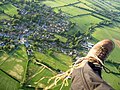 Aerial view from Paramotor of Letcombe Basset - geograph.org.uk - 305614.jpg 640 × 480 ; 128 kio
-
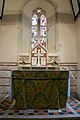 Altar ^ cross - geograph.org.uk - 6127869.jpg 509 × 764 ; 112 kio
-
 Ancient field system, Mere End Down - geograph.org.uk - 2747633.jpg 4 592 × 3 056 ; 4,88 Mio
-
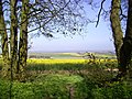 Another Ridgeway View - geograph.org.uk - 3953571.jpg 1 600 × 1 200 ; 625 kio
-
 Arch decoration - geograph.org.uk - 6127892.jpg 1 024 × 683 ; 71 kio
-
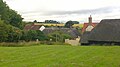
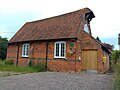
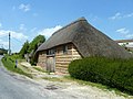 Barn conversion, Letcombe Bassett - geograph.org.uk - 3984126.jpg 640 × 480 ; 102 kio
-
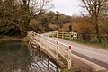 Bassett Road crosses Letcombe Brook - geograph.org.uk - 3402740.jpg 1 500 × 1 000 ; 245 kio
-
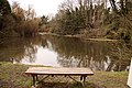 Bench overlooking the old watercress beds - geograph.org.uk - 3402747.jpg 1 500 × 1 000 ; 290 kio
-
 Birds on the headstone - geograph.org.uk - 6145438.jpg 533 × 800 ; 116 kio
-
 Blackthorn on the Byway - geograph.org.uk - 3950570.jpg 1 024 × 689 ; 224 kio
-
 Blocked north door - geograph.org.uk - 6123465.jpg 533 × 800 ; 92 kio
-
 Blocks in the brook - geograph.org.uk - 6150492.jpg 1 024 × 768 ; 259 kio
-
 Bridge over the brook - geograph.org.uk - 6150516.jpg 1 024 × 768 ; 250 kio
-
 Bridleway, Letcombe Bassett - geograph.org.uk - 1571033.jpg 640 × 480 ; 161 kio
-
 Broken wall - geograph.org.uk - 6150494.jpg 1 024 × 768 ; 241 kio
-
 Byway at Stancombe Farm - geograph.org.uk - 695281.jpg 640 × 480 ; 104 kio
-
 Chancel Arch - geograph.org.uk - 6127856.jpg 533 × 800 ; 70 kio
-
 Chancel in St Michael ^ All Angels - geograph.org.uk - 6127861.jpg 533 × 800 ; 85 kio
-
 Channel in the brook - geograph.org.uk - 6150503.jpg 1 024 × 768 ; 253 kio
-
 Childrey Warren - geograph.org.uk - 511370.jpg 640 × 480 ; 162 kio
-
 Church End, Letcombe Bassett (geograph 7524737).jpg 4 080 × 3 060 ; 5,74 Mio
-
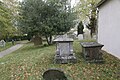
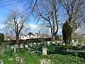
 Churchyard at St Michael's - geograph.org.uk - 6122033.jpg 1 024 × 683 ; 236 kio
-
 Cotswold style tomb - geograph.org.uk - 6136372.jpg 1 024 × 683 ; 177 kio
-
 Couple of Tombs - geograph.org.uk - 6145437.jpg 1 024 × 683 ; 211 kio
-
 Cress Beds, Letcombe Bassett - geograph.org.uk - 2950936.jpg 3 708 × 2 232 ; 2,48 Mio
-
 Cross on the porch - geograph.org.uk - 6146173.jpg 533 × 800 ; 86 kio
-
 Devils Punchbowl - geograph.org.uk - 1167388.jpg 640 × 480 ; 56 kio
-
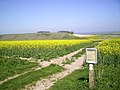
 Downland above Letcombe Bassett - geograph.org.uk - 228624.jpg 640 × 478 ; 169 kio
-
 Downland view near Letcombe Bassett - geograph.org.uk - 1365218.jpg 640 × 427 ; 187 kio
-
 Downland, Letcombe Bassett - geograph.org.uk - 510952.jpg 640 × 480 ; 128 kio
-
 Downland, Letcombe Bassett - geograph.org.uk - 510970.jpg 640 × 480 ; 156 kio
-
 Downland, Letcombe Bassett - geograph.org.uk - 511355.jpg 640 × 480 ; 133 kio
-
 Downland, Letcombe Bassett - geograph.org.uk - 511363.jpg 640 × 480 ; 129 kio
-
 Downland, Letcombe Bassett - geograph.org.uk - 695423.jpg 640 × 480 ; 133 kio
-
 EA Benchmark - geograph.org.uk - 6150509.jpg 1 024 × 768 ; 285 kio
-
 East end churchyard of St Michael ^ All Angels - geograph.org.uk - 6146180.jpg 1 024 × 683 ; 216 kio
-
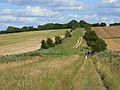
 Eastmanton Down - geograph.org.uk - 1548717.jpg 640 × 426 ; 198 kio
-
 End of the tomb - geograph.org.uk - 6136366.jpg 533 × 800 ; 135 kio
-
 Farmland, Letcombe Bassett - geograph.org.uk - 1571032.jpg 640 × 480 ; 164 kio
-
 Farmland, Letcombe Bassett - geograph.org.uk - 4373364.jpg 640 × 480 ; 226 kio
-
 Farmland, Letcombe Bassett - geograph.org.uk - 6190630.jpg 1 024 × 683 ; 238 kio
-
 Farmland, Letcombe Bassett - geograph.org.uk - 695438.jpg 640 × 480 ; 136 kio
-
 Farmland, Letcombe Regis - geograph.org.uk - 6190340.jpg 1 024 × 683 ; 247 kio
-
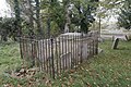 Fenced vault - geograph.org.uk - 6145458.jpg 1 024 × 683 ; 257 kio
-
 Field Barn, and surrounding downland - geograph.org.uk - 1237113.jpg 640 × 427 ; 41 kio
-
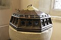 Font cover - geograph.org.uk - 6123480.jpg 1 024 × 683 ; 107 kio
-
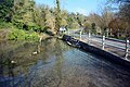 Ford at Letcombe Bassett - geograph.org.uk - 4872298.jpg 1 600 × 1 067 ; 1,99 Mio
-
 Foresters lane - geograph.org.uk - 6146188.jpg 1 024 × 683 ; 109 kio
-
 Frieze on the arch - geograph.org.uk - 6127899.jpg 878 × 574 ; 118 kio
-
 From the north west - geograph.org.uk - 6146170.jpg 1 024 × 683 ; 215 kio
-
 From the south west - geograph.org.uk - 6145449.jpg 1 024 × 683 ; 231 kio
-
 Garland Memorial - geograph.org.uk - 6127858.jpg 1 024 × 683 ; 144 kio
-
 Going around the south - geograph.org.uk - 6145443.jpg 1 024 × 683 ; 184 kio
-
 Graves under the trees - geograph.org.uk - 6146175.jpg 1 024 × 683 ; 235 kio
-
 Horse in the Letcombe Brook - geograph.org.uk - 2950891.jpg 3 156 × 2 064 ; 1,81 Mio
-
 House at Letcombe Bassett - geograph.org.uk - 1236982.jpg 640 × 427 ; 107 kio
-
 Into Oxfordshire - geograph.org.uk - 1548722.jpg 640 × 426 ; 187 kio
-
 Lane nearing Flint Farm - geograph.org.uk - 2206222.jpg 640 × 480 ; 74 kio
-
 Forsters Lane, Letcombe Bassett - geograph.org.uk - 1236947.jpg 640 × 427 ; 80 kio
-
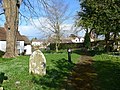
 View from the church path - geograph.org.uk - 1237003.jpg 640 × 427 ; 76 kio
-
 Letcombe Bassett - geograph.org.uk - 1236910.jpg 640 × 427 ; 67 kio
-
 Letcombe Bassett - geograph.org.uk - 2918896.jpg 900 × 596 ; 466 kio
-
 Letcombe Bassett - geograph.org.uk - 2918900.jpg 900 × 596 ; 543 kio
-
 Letcombe Bassett - geograph.org.uk - 4603006.jpg 1 632 × 918 ; 380 kio
-
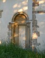 Letcombe Bassett church, blocked Norman doorway - geograph.org.uk - 6192345.jpg 792 × 1 024 ; 152 kio
-

-
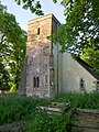 Letcombe Bassett church, the tower from the south-west - geograph.org.uk - 6192390.jpg 768 × 1 024 ; 276 kio
-
 Letcombe Bassett Cress Bed - geograph.org.uk - 6146207.jpg 1 024 × 768 ; 224 kio
-
 Letcombe Bassett Gauging Station - geograph.org.uk - 3127722.jpg 3 968 × 2 232 ; 2,02 Mio
-
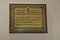 Letcombe Bassett roll of honour - geograph.org.uk - 6123472.jpg 1 024 × 683 ; 127 kio
-
 Letcombe Bassett village hall (geograph 7524756).jpg 4 080 × 3 060 ; 4,67 Mio
-
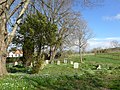
 Letcombe Bassett, church and churchyard - geograph.org.uk - 6189504.jpg 1 024 × 774 ; 233 kio
-
 Letcombe Bassett, church and churchyard, light and shade - geograph.org.uk - 6192221.jpg 1 024 × 784 ; 245 kio
-
 Letcombe Bassett, old watercress beds - geograph.org.uk - 6192408.jpg 1 024 × 768 ; 187 kio
-
 Letcombe Bassett, the church tower from the west - geograph.org.uk - 6190160.jpg 765 × 1 024 ; 184 kio
-
 Letcombe Bassett, views from the churchyard (1) - geograph.org.uk - 6189897.jpg 1 024 × 775 ; 135 kio
-
 Letcombe Bassett, views from the churchyard (2) - geograph.org.uk - 6189818.jpg 1 024 × 768 ; 338 kio
-
 Letcombe Bassett, views from the churchyard (3) - geograph.org.uk - 6189915.jpg 1 024 × 768 ; 122 kio
-
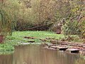
 Letcombe Brook - geograph.org.uk - 6146210.jpg 1 024 × 768 ; 296 kio
-
 Letcombe Brook Cress Bed - geograph.org.uk - 6150484.jpg 1 024 × 768 ; 221 kio
-
 Letcombe Brook source.JPG 4 608 × 2 592 ; 5,07 Mio
-
 LetcombeBassett ThatchedHouse.JPG 2 790 × 1 860 ; 626 kio
-
 Looking down Letcombe Brook - geograph.org.uk - 3402742.jpg 1 500 × 1 000 ; 375 kio
-
 Nave in St Michael ^ All Angels - geograph.org.uk - 6123468.jpg 1 024 × 683 ; 111 kio
-
 Now that's Style - geograph.org.uk - 2053808.jpg 1 978 × 1 536 ; 907 kio
-
 Old watercress beds at Letcombe Bassett - geograph.org.uk - 58594.jpg 640 × 480 ; 129 kio
-
 Older headstones - geograph.org.uk - 6136382.jpg 1 024 × 683 ; 232 kio
-
 On The Ridgeway, Smith's Hill - geograph.org.uk - 3951143.jpg 1 600 × 1 167 ; 531 kio
-
 Organ in the aisle - geograph.org.uk - 6123470.jpg 533 × 800 ; 89 kio
-
 Ornamental Garden, Warren Farm - geograph.org.uk - 5033665.jpg 1 600 × 1 200 ; 693 kio
-
 Parsonagehill Barn - geograph.org.uk - 3950552.jpg 1 600 × 1 158 ; 572 kio
-
 Path to the porch - geograph.org.uk - 6123466.jpg 1 024 × 683 ; 164 kio
-
 Pearl Part 3 (7012126887).jpg 2 448 × 3 264 ; 2,42 Mio
-
 Private A.G.Walters - geograph.org.uk - 6146176.jpg 533 × 800 ; 125 kio
-
 Pulpit view - geograph.org.uk - 6127901.jpg 1 024 × 683 ; 123 kio
-
 Rectory Cottage, Letcombe Bassett (geograph 7524749).jpg 4 080 × 3 060 ; 4,26 Mio
-
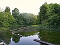
 Reservoir near Letcombe Bassett - geograph.org.uk - 58590.jpg 640 × 480 ; 136 kio
-
 Restricted Byway - geograph.org.uk - 2205551.jpg 640 × 480 ; 96 kio
-
 Restricted Byway - geograph.org.uk - 2206231.jpg 640 × 480 ; 103 kio
-
 Restricted Byway by Nut Wood - geograph.org.uk - 2205536.jpg 640 × 480 ; 93 kio
-
 Ridgeway Barley - geograph.org.uk - 4835137.jpg 800 × 509 ; 206 kio
-
 Ridgeway crossing Gramp's Hill - geograph.org.uk - 1008251.jpg 640 × 480 ; 119 kio
-
 Ridgeway near Round Hill - geograph.org.uk - 1009553.jpg 640 × 480 ; 85 kio
-
 Ridgeway Signpost - geograph.org.uk - 3950546.jpg 1 600 × 1 178 ; 488 kio
-
 Road near Letcombe Bassett - geograph.org.uk - 1571029.jpg 640 × 480 ; 144 kio
-
 Road through Letcombe Bassett - geograph.org.uk - 1237089.jpg 640 × 427 ; 72 kio
-
 Road to Letcombe Bassett - geograph.org.uk - 1237135.jpg 640 × 427 ; 58 kio
-
 Roof view - geograph.org.uk - 6136340.jpg 533 × 800 ; 97 kio
-
 Rush hour in Letcombe Bassett - geograph.org.uk - 4108144.jpg 640 × 480 ; 63 kio
-
 Segsbury Camp - geograph.org.uk - 1111977.jpg 640 × 480 ; 57 kio
-
 Segsbury Camp, from the Ridgeway, Oxfrodshire.jpg 2 592 × 1 944 ; 1,41 Mio
-
 Short tower - geograph.org.uk - 6145454.jpg 533 × 800 ; 98 kio
-
 South aisle - geograph.org.uk - 6136350.jpg 1 024 × 683 ; 116 kio
-
 South of the church - geograph.org.uk - 6145453.jpg 1 024 × 683 ; 234 kio
-
 South side - geograph.org.uk - 6145446.jpg 1 024 × 683 ; 216 kio
-
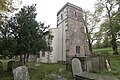
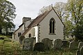
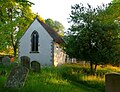
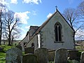
 St Michael ^ All Angels, Letcombe Bassett - geograph.org.uk - 6122039.jpg 1 024 × 683 ; 184 kio
-
-

-

-

-

-

-
-
-
-

-
-
-

-

-
-

-

-

-

-

-

-

-
-
-

-
-

-

-

-

-

-
 St Michael, Letcombe Bassett, March 2014 - geograph.org.uk - 3895647.jpg 640 × 480 ; 128 kio
-
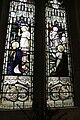
 Stained glass window - geograph.org.uk - 6123483.jpg 533 × 800 ; 76 kio
-
 Stained glass window - geograph.org.uk - 6136356.jpg 533 × 800 ; 134 kio
-
 Stained glass window 2 - geograph.org.uk - 6123485.jpg 533 × 800 ; 99 kio
-
 Stained glass window 2 - geograph.org.uk - 6136359.jpg 533 × 800 ; 131 kio
-
 Stalls in the chancel - geograph.org.uk - 6136361.jpg 533 × 800 ; 74 kio
-
 Steep Footpath - geograph.org.uk - 4602895.jpg 1 632 × 918 ; 482 kio
-
 Steps to the path - geograph.org.uk - 6122038.jpg 533 × 800 ; 140 kio
-
 Stubble, Lambourn Downs - geograph.org.uk - 938194.jpg 640 × 480 ; 108 kio
-
 Terms and Conditions - geograph.org.uk - 3949617.jpg 1 600 × 1 200 ; 523 kio
-
 The altar cross - geograph.org.uk - 6127875.jpg 1 024 × 683 ; 103 kio
-
 The Devil's Punchbowl from the bottom of the Ridge.jpg 2 592 × 1 944 ; 1,38 Mio
-
 The east end of St Michael ^ All Angels - geograph.org.uk - 6145440.jpg 1 024 × 683 ; 172 kio
-
 The east window - geograph.org.uk - 6127879.jpg 533 × 800 ; 91 kio
-
 The old watercress beds - geograph.org.uk - 3402744.jpg 1 500 × 1 000 ; 211 kio
-
 The Ridgeway - geograph.org.uk - 2205573.jpg 640 × 480 ; 86 kio
-
 The Ridgeway - geograph.org.uk - 2206213.jpg 640 × 480 ; 77 kio
-
 The Ridgeway - geograph.org.uk - 510958.jpg 640 × 480 ; 144 kio
-
 The same hedge 6 years later - geograph.org.uk - 3951196.jpg 1 600 × 1 296 ; 546 kio
-
 Through the nave - geograph.org.uk - 6136348.jpg 1 024 × 683 ; 122 kio
-
 Tomb near the door - geograph.org.uk - 6123461.jpg 1 024 × 683 ; 139 kio
-
 Towards Flint Farm - geograph.org.uk - 3950667.jpg 1 024 × 721 ; 189 kio
-
 Towards the Ridgeway - geograph.org.uk - 6146203.jpg 1 024 × 683 ; 112 kio
-
 Track and Dead Tree - geograph.org.uk - 3953595.jpg 1 024 × 783 ; 260 kio
-
 Track and farmland, Letcombe Bassett - geograph.org.uk - 6190624.jpg 1 024 × 683 ; 229 kio
-
 Unusual font - geograph.org.uk - 6123476.jpg 533 × 800 ; 73 kio
-
 View from Foresters lane - geograph.org.uk - 6146194.jpg 1 024 × 683 ; 89 kio
-

-
 Warborough Farm - geograph.org.uk - 67215.jpg 640 × 480 ; 136 kio
-
 Weathered headstone - geograph.org.uk - 6145463.jpg 533 × 800 ; 146 kio
-

-
 Window by the door - geograph.org.uk - 6127889.jpg 486 × 731 ; 71 kio
-
 Window in the tower - geograph.org.uk - 6145468.jpg 533 × 800 ; 141 kio


.jpg)


_-_geograph.org.uk_-_6192287.jpg)


.jpg)


_-_geograph.org.uk_-_6189897.jpg)
_-_geograph.org.uk_-_6189818.jpg)
_-_geograph.org.uk_-_6189915.jpg)


.jpg)


.jpg)


_-_geograph.org.uk_-_4108128.jpg)
_-_geograph.org.uk_-_4108129.jpg)
_-_geograph.org.uk_-_4108130.jpg)
_-_geograph.org.uk_-_4108132.jpg)
_-_geograph.org.uk_-_4108133.jpg)
_-_geograph.org.uk_-_4108134.jpg)
_-_geograph.org.uk_-_4108136.jpg)
_-_geograph.org.uk_-_4108137.jpg)
_-_geograph.org.uk_-_4108139.jpg)
_-_geograph.org.uk_-_4108140.jpg)
_-_geograph.org.uk_-_4108142.jpg)


_-_geograph.org.uk_-_4108146.jpg)
_-_geograph.org.uk_-_4108149.jpg)
_-_geograph.org.uk_-_4108150.jpg)
_-_geograph.org.uk_-_4108168.jpg)


_-_geograph.org.uk_-_4108175.jpg)
_-_geograph.org.uk_-_4108176.jpg)
_-_geograph.org.uk_-_4108178.jpg)
_-_geograph.org.uk_-_4108179.jpg)


