Category:Letwell
Aller à la navigation
Aller à la recherche
English: Letwell is a rural village and civil parish in the Metropolitan Borough of Rotherham in South Yorkshire, England, on the border with Nottinghamshire. It lies between Dinnington and Langold, off the B6463 road. It is located at 53° 22' 40" North, 1° 9' West, at an elevation of around 75 metres above sea level. It has a population of 111.
village britannique | |||||
| Téléverser des médias | |||||
| Nature de l’élément | |||||
|---|---|---|---|---|---|
| Lieu | district métropolitain de Rotherham, Yorkshire du Sud, Yorkshire-et-Humber, Angleterre | ||||
 | |||||
Sous-catégories
Cette catégorie comprend seulement la sous-catégorie ci-dessous.
P
- St Peter's Church, Letwell (9 F)
Média dans la catégorie « Letwell »
Cette catégorie comprend 102 fichiers, dont les 102 ci-dessous.
-
 Across a field of rapeseed to Letwell church - geograph.org.uk - 4082924.jpg 1 944 × 2 592 ; 2,8 Mio
-
 Alongside Dyscarr Wood - geograph.org.uk - 5961277.jpg 1 024 × 768 ; 127 kio
-
 Approaching Buckwood farm from the north - geograph.org.uk - 3836587.jpg 1 600 × 1 200 ; 545 kio
-
 Approaching Letwell - geograph.org.uk - 3871568.jpg 800 × 533 ; 180 kio
-
 B6463 Lamb Lane, south of Thwaite Wood - geograph.org.uk - 6082189.jpg 1 024 × 738 ; 111 kio
-
 Barker Hades Lane - geograph.org.uk - 4683194.jpg 1 024 × 768 ; 191 kio
-
 Barker Hades Road (Track) - geograph.org.uk - 3025408.jpg 4 000 × 3 000 ; 2,59 Mio
-
 Barker Hades Road - geograph.org.uk - 4683186.jpg 1 024 × 768 ; 407 kio
-
 Barker Hades Road in Letwell - geograph.org.uk - 5044008.jpg 4 608 × 3 456 ; 4,3 Mio
-
 Barker Hades Road, leading east from Letwell - geograph.org.uk - 3876788.jpg 3 723 × 1 784 ; 4,74 Mio
-
 Bench on Gildingwells Road Letwell - geograph.org.uk - 1363027.jpg 640 × 480 ; 109 kio
-
 Bridge over Lamb Lane Dike - geograph.org.uk - 3025399.jpg 4 000 × 3 000 ; 5,05 Mio
-
 Bridleway - geograph.org.uk - 3871596.jpg 800 × 533 ; 112 kio
-
 Bridleway south of Lamb Lane - geograph.org.uk - 4082901.jpg 1 944 × 2 592 ; 2,08 Mio
-
 Bridleway through the fields to Letwell - geograph.org.uk - 3025016.jpg 4 000 × 3 000 ; 2,61 Mio
-
 Bridleway to Firbeck - geograph.org.uk - 145400.jpg 640 × 480 ; 89 kio
-
 Bridleway to Langold - geograph.org.uk - 4683154.jpg 1 024 × 768 ; 334 kio
-
 Bridleway, extending Church Lane, Letwell towards Dinnington - geograph.org.uk - 3876820.jpg 4 000 × 2 248 ; 6,49 Mio
-
 Buckwood Farm - geograph.org.uk - 1078425.jpg 640 × 427 ; 71 kio
-
 Buckwood Farm - geograph.org.uk - 3890616.jpg 640 × 480 ; 69 kio
-
 Buckwood Farm at Rotherham Baulk - geograph.org.uk - 5486194.jpg 3 158 × 2 262 ; 2,54 Mio
-
 Burrs Lane Between Gildingwells and Letwell - geograph.org.uk - 5043897.jpg 4 608 × 3 456 ; 4,24 Mio
-
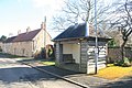 Bus Shelter, Letwell.jpg 800 × 533 ; 141 kio
-
 Church Lane (track) heading west - geograph.org.uk - 2552802.jpg 1 600 × 1 200 ; 712 kio
-
 Church Lane - geograph.org.uk - 4683254.jpg 1 024 × 768 ; 263 kio
-
 Church Lane - geograph.org.uk - 4683654.jpg 1 024 × 768 ; 223 kio
-
 Church Lane - geograph.org.uk - 4683660.jpg 1 024 × 768 ; 246 kio
-
 Church Lane at Lamb Lane Dike - geograph.org.uk - 3836511.jpg 1 600 × 1 200 ; 663 kio
-
 Church Lane toward Letwell - geograph.org.uk - 3020137.jpg 4 000 × 3 000 ; 3,57 Mio
-
 Church Rooms, Letwell.jpg 1 024 × 768 ; 211 kio
-
 Dog Kennels Plantation seen from Salt Hill Road - geograph.org.uk - 5065351.jpg 4 608 × 3 456 ; 4,46 Mio
-
 Dovecote, Letwell.jpg 4 205 × 3 171 ; 3,53 Mio
-
 Driveway to Langold Farm - geograph.org.uk - 4683184.jpg 1 024 × 768 ; 378 kio
-
 Entrance to the Gally Knight Estate - geograph.org.uk - 5065346.jpg 4 608 × 3 456 ; 3,65 Mio
-
 Extension of Church Lane towards Leys Lane - geograph.org.uk - 3836502.jpg 1 600 × 1 200 ; 403 kio
-
 Farming near Letwell - geograph.org.uk - 4082908.jpg 2 501 × 1 787 ; 1,38 Mio
-
 Farmland Adjoining Langold Holt - geograph.org.uk - 5486186.jpg 3 264 × 2 448 ; 2,92 Mio
-
 Farmland off Gildingwells Road - geograph.org.uk - 2552781.jpg 1 600 × 1 200 ; 414 kio
-
 Farmland towards Little Thwaite Wood - geograph.org.uk - 2553269.jpg 1 600 × 1 200 ; 532 kio
-
 Footpath alongside Dyscarr Wood - geograph.org.uk - 3019516.jpg 4 000 × 3 000 ; 2,84 Mio
-
 Footpath junction east of Letwell - geograph.org.uk - 3836522.jpg 1 600 × 1 200 ; 744 kio
-
 Footpath towards Buckwood Farm - geograph.org.uk - 2552762.jpg 1 600 × 1 200 ; 374 kio
-
 Footpath towards Gildingwells Road, Letwell - geograph.org.uk - 3836533.jpg 1 600 × 1 200 ; 536 kio
-
 Footpaths crossing Barker Hades Lane - geograph.org.uk - 4683198.jpg 1 024 × 768 ; 220 kio
-
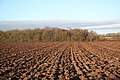 Freshly ploughed - geograph.org.uk - 1078440.jpg 640 × 427 ; 87 kio
-
 Gally Knight Estate, strictly private - geograph.org.uk - 4795477.jpg 1 600 × 1 200 ; 762 kio
-
 Gate on Church Lane - geograph.org.uk - 4683234.jpg 1 024 × 768 ; 421 kio
-
 Gildingwells Road heading south - geograph.org.uk - 2552790.jpg 1 600 × 1 200 ; 381 kio
-
 Gildingwells Road towards Letwell - geograph.org.uk - 2552774.jpg 640 × 480 ; 74 kio
-
 Harrowed field and electricity line - geograph.org.uk - 4683943.jpg 1 024 × 768 ; 218 kio
-
 Harrowing near Letwell - geograph.org.uk - 4082906.jpg 1 854 × 2 472 ; 1,25 Mio
-
 Heart of Letwell Village - geograph.org.uk - 5043939.jpg 4 608 × 3 456 ; 3,7 Mio
-
 Hedge and fields of oilseed rape - geograph.org.uk - 4683188.jpg 1 024 × 768 ; 232 kio
-
 Ivy Lodge Lane and Ivy Lodge Plantation - geograph.org.uk - 4683193.jpg 1 024 × 768 ; 162 kio
-
 Ivy Lodge Lane, Letwell - geograph.org.uk - 1363031.jpg 640 × 480 ; 81 kio
-
 Lamb Lane (B6463) towards Dinnington - geograph.org.uk - 2553270.jpg 1 600 × 1 200 ; 427 kio
-
 Lamb Lane Dike - geograph.org.uk - 4683650.jpg 1 024 × 768 ; 197 kio
-
 Lamb Lane Dike from Church Lane, Letwell - geograph.org.uk - 3876816.jpg 3 909 × 2 064 ; 7,29 Mio
-
 Letwell all the main bits - geograph.org.uk - 3025426.jpg 4 000 × 3 000 ; 3,27 Mio
-
 Letwell Village Scene - geograph.org.uk - 5043920.jpg 4 608 × 3 456 ; 4,37 Mio
-
 Looking east along Lamb Lane towards Oldcotes - geograph.org.uk - 2301472.jpg 800 × 600 ; 222 kio
-
 Looking over Lamb Lane - geograph.org.uk - 3871601.jpg 800 × 533 ; 69 kio
-
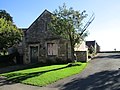
 North Farm House, Letwell.jpg 2 557 × 1 827 ; 1,6 Mio
-
 Octagonal restored 18th Century Dovecote - geograph.org.uk - 3025438.jpg 3 000 × 4 000 ; 2,02 Mio
-
 Old Post Office, Letwell.jpg 1 024 × 768 ; 173 kio
-
 Over field towards Dog Kennels Plantation - geograph.org.uk - 3019522.jpg 4 000 × 3 000 ; 2,4 Mio
-
 Overgrown track - geograph.org.uk - 5063187.jpg 1 024 × 768 ; 212 kio
-
 Penny Hill towards Firbeck - geograph.org.uk - 2301481.jpg 800 × 600 ; 266 kio
-
 Power Lines cross Church Lane (Track) - geograph.org.uk - 3025021.jpg 3 000 × 4 000 ; 2,61 Mio
-
 Rubble and Church Lane - geograph.org.uk - 4683655.jpg 1 024 × 768 ; 310 kio
-
 Salt Hill Road (Bridleway) - geograph.org.uk - 5065353.jpg 4 608 × 3 456 ; 4,03 Mio
-
 Salt Hill Road (Track) looking south. - geograph.org.uk - 3019528.jpg 4 000 × 3 000 ; 2,49 Mio
-
 Salt Hill Road - geograph.org.uk - 4683144.jpg 1 024 × 768 ; 228 kio
-
 Snowy scene - geograph.org.uk - 1637571.jpg 640 × 480 ; 43 kio
-
 Soggy footpath at Miller Lands - geograph.org.uk - 3836537.jpg 1 600 × 1 200 ; 540 kio
-
 St Peter's Church in Letwell - geograph.org.uk - 5044028.jpg 4 469 × 3 383 ; 3,45 Mio
-
 Telephone box, bus shelter and War Memorial, Letwell - geograph.org.uk - 3876795.jpg 3 931 × 1 933 ; 5,53 Mio
-
 The B6463 near Letwell - geograph.org.uk - 4241598.jpg 1 024 × 768 ; 90 kio
-
 The Old Dovecote in Letwell - geograph.org.uk - 4082917.jpg 2 428 × 1 942 ; 1,36 Mio
-
 View over cornfields to Harworth Colliery - geograph.org.uk - 4083467.jpg 2 483 × 1 774 ; 1,17 Mio
-
 View towards Dog Kennels Plantation - geograph.org.uk - 4683191.jpg 1 024 × 768 ; 235 kio
-
 View towards the former colliery tip at Langold - geograph.org.uk - 4683662.jpg 1 024 × 768 ; 203 kio
-

-
 Village sign and farm in Letwell - geograph.org.uk - 4082921.jpg 1 942 × 2 428 ; 2,15 Mio
-
 War Memorial, Gildingwells Road, Letwell - geograph.org.uk - 3876789.jpg 4 000 × 2 248 ; 6,9 Mio
-
 Wheat Field and Langold Holt - geograph.org.uk - 5486180.jpg 3 264 × 2 448 ; 3,14 Mio
-
 Wheat Field Between Letwell and Dinnington - geograph.org.uk - 5044037.jpg 4 608 × 3 456 ; 4,37 Mio
-
 Woodland at Langold Holt over Oil Seed Rape - geograph.org.uk - 3025457.jpg 4 000 × 3 000 ; 3,68 Mio
-
 Bridle way to Long Thwaite Wood - geograph.org.uk - 308637.jpg 640 × 480 ; 115 kio
-
 Countryside and fields - geograph.org.uk - 309110.jpg 640 × 480 ; 115 kio
-
 Edge of the wood - geograph.org.uk - 308657.jpg 640 × 480 ; 115 kio
-
 Farmland View - geograph.org.uk - 308676.jpg 640 × 480 ; 116 kio
-
 Field and hedge - geograph.org.uk - 309088.jpg 640 × 480 ; 114 kio
-
 Field and Road - geograph.org.uk - 141048.jpg 640 × 480 ; 85 kio
-
 Footpath to Letwell - geograph.org.uk - 145401.jpg 480 × 640 ; 84 kio
-
 Large Field near Letwell - geograph.org.uk - 309067.jpg 640 × 480 ; 117 kio
-
 Long Thwaite Wood - geograph.org.uk - 308648.jpg 640 × 480 ; 115 kio
-
 Moorland Farm and hedge - geograph.org.uk - 309072.jpg 640 × 480 ; 118 kio
-
 Oldcotes Road - geograph.org.uk - 308667.jpg 640 × 480 ; 119 kio
-
 Oldcotes Road Junction - geograph.org.uk - 308628.jpg 640 × 480 ; 115 kio
-
 Towards Dinnington - geograph.org.uk - 309104.jpg 640 × 480 ; 115 kio
-
 Up the field - geograph.org.uk - 309099.jpg 640 × 480 ; 114 kio


_-_geograph.org.uk_-_3025408.jpg)


_heading_west_-_geograph.org.uk_-_2552802.jpg)


_towards_Dinnington_-_geograph.org.uk_-_2553270.jpg)


_-_geograph.org.uk_-_3025021.jpg)

_-_geograph.org.uk_-_5065353.jpg)
_looking_south._-_geograph.org.uk_-_3019528.jpg)


