Category:Lewis and Clark National Forest
Zur Navigation springen
Zur Suche springen
Wald in den Vereinigten Staaten  | |||||
| Medium hochladen | |||||
| Ist ein(e) | |||||
|---|---|---|---|---|---|
| Ort | |||||
| Betreiber | |||||
| Schutzgebietkategorie der IUCN | |||||
| offizielle Website | |||||
 | |||||
Unterkategorien
Es werden 8 von insgesamt 8 Unterkategorien in dieser Kategorie angezeigt:
In Klammern die Anzahl der enthaltenen Kategorien (K), Seiten (S), Dateien (D)
B
- Beartop Lookout (1 D)
- Bob Marshall Wilderness (131 D)
C
- Crazy Mountains (23 D)
J
- Judith River Ranger Station (12 D)
M
- Monument Peak Lookout (1 D)
S
T
- The Chinese Wall (Montana) (6 D)
Medien in der Kategorie „Lewis and Clark National Forest“
Folgende 60 Dateien sind in dieser Kategorie, von 60 insgesamt.
-

-

-
 BadgerCreek (14744024935).jpg 3.072 × 2.304; 2,86 MB
-
 Big Baldy Sign (14038705528).jpg 2.288 × 1.712; 549 KB
-
 Boundary Marker (14038712067).jpg 2.032 × 1.524; 1,4 MB
-
 CastleReef (14743733052).jpg 2.272 × 1.704; 904 KB
-
 Forest atlas of the national forests of the United States. Lewis & Clark folio (IA CAT31292363).pdf 143 × 197, 40 Seiten; 646,55 MB
-
 CrownMtnPassLooking2HaystackMtn (14721024506).jpg 2.048 × 1.536; 656 KB
-
 DepuyerRngrStation ca1911clipped (14038713167).jpg 300 × 225; 30 KB
-
 Dogsledding trail sign L&C NF (33928278930).jpg 4.416 × 3.312; 2,59 MB
-
 Dry Wolf Station (14043937558).jpg 1.753 × 1.032; 836 KB
-
 Dscn0376 (14557341278).jpg 1.200 × 900; 1,13 MB
-
 Ellis Creek part of the Elbow Pass Fire 9-18-2012 (8003426971).jpg 1.024 × 576; 81 KB
-

-
-

-

-
 Granite Butte Lookout (28764183244).jpg 1.600 × 1.200; 333 KB
-
 Granite Butte Lookout (28764183524).jpg 540 × 720; 49 KB
-
 Granite Butte Lookout (28764183844).jpg 540 × 720; 45 KB
-
 Granite Butte Lookout (29388083655).jpg 540 × 720; 38 KB
-
 Granite Butte Lookout (29388083745).jpg 540 × 720; 44 KB
-
 HarlequinSurveys (33470491044).jpg 1.000 × 884; 183 KB
-
 Indian Point 2005 (14245480103).jpg 900 × 600; 456 KB
-
 June Snow Storm - panoramio.jpg 2.816 × 2.112; 1,29 MB
-
 Kenck Cabin (26764823522).jpg 3.648 × 2.736; 1,76 MB
-
 Kings Hill Cabin (14201885036).jpg 1.945 × 1.088; 649 KB
-
 L&C entrance sign (14038633228).jpg 256 × 192; 11 KB
-
 Lewis and Clark National Forest buildings 99-2022 (5866962856).jpg 1.621 × 924; 477 KB
-
 Lewis and Clark National Forest Western Unit Sign.jpg 2.160 × 1.952; 2,25 MB
-
 Lewis and Clark National Forest.JPG 572 × 142; 15 KB
-
 Little Belt Mountains, Lewis and Clark National Forest, Meagher County, MT 1a35030u original.jpg 7.819 × 6.122; 18,76 MB
-
 MariasPassHistoricSiteCropped (14557542087).jpg 1.452 × 1.089; 734 KB
-
 Moonlight over the Scapegoat (14741641404).jpg 576 × 382; 34 KB
-
 Outtotheprairie (14743710772).jpg 2.032 × 1.524; 1,83 MB
-
 Packstring fire RMRD-2 (14721004746).jpg 2.592 × 1.944; 758 KB
-
 PackstringGoatsAtHeadquartersPass (14741666364).jpg 1.536 × 2.048; 1,28 MB
-
 Pictographs, Sun Canyon (14222965842).jpg 640 × 480; 194 KB
-
 Prairie Reef 03 (14557357628).jpg 891 × 602; 249 KB
-
 Prairie Reef Lookout (14741646114).jpg 3.264 × 2.448; 2,04 MB
-
 Pulp and Paper Woods - Montana - DPLA - 93558526ba8694f9cd4f309e837ab939.jpg 5.056 × 3.924; 2,61 MB
-
 Reforestation- Camera Point - Montana - DPLA - 16c4c957d92c3e7d4d9b1aa447630ddd.jpg 4.732 × 3.798; 1,58 MB
-
 Riding in Lewis and Clark National Forest.jpg 800 × 623; 144 KB
-
 Route Creek Pass - Lewis & Clark National Forest (9970649623).jpg 4.608 × 3.456; 7,22 MB
-
 Scenery and Landscapes - Montana - DPLA - 3a31ca81e84c41269194e8feae91e394.jpg 4.764 × 3.787; 2,23 MB
-
 Sheep (34181784051).jpg 1.280 × 960; 255 KB
-
 Sign for Lang Creek Trail (14038718617).jpg 681 × 1.007; 69 KB
-
 South Fork Judith River (14202115336).jpg 4.416 × 3.312; 2,38 MB
-
 SunRiver (14743732302).jpg 5.152 × 3.864; 4,28 MB
-
 SunRiverCountry (14557564477).jpg 2.576 × 1.932; 1,86 MB
-
 Tenderfoot Creek on the Lewis & Clark National Forest (18905047223).jpg 4.288 × 3.216; 6,58 MB
-

-
 Tenderfoot Creek on the Lewis & Clark National Forest (19499801066).jpg 1.500 × 1.000; 1,24 MB
-
 Tenderfoot Creek on the Lewis & Clark National Forest (19519235382).jpg 3.072 × 2.304; 1,53 MB
-

-
 Tenderfoot Creek on the Lewis & Clark National Forest (19530131531).jpg 1.500 × 1.000; 445 KB
-
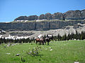 Wallandhorses (14743707352).jpg 4.000 × 3.000; 6,27 MB
-
 Wallcliffmtn (14557348738).jpg 4.000 × 3.000; 4,19 MB
-
 Walllookingsouth (14743705202).jpg 4.000 × 3.000; 4,46 MB
-
 West Fork Guard Station (14225199185).jpg 4.416 × 3.312; 1,97 MB


.jpg)
.jpg)
.jpg)
.jpg)
.jpg)
.jpg)
.jpg)
.jpg)
.jpg)
.jpg)


.jpg)
.jpg)
.jpg)
.jpg)
.jpg)
.jpg)
.jpg)

.jpg)
.jpg)
.jpg)
.jpg)


.jpg)
.jpg)
.jpg)
.jpg)
.jpg)
.jpg)
.jpg)
.jpg)


.jpg)

.jpg)
.jpg)
.jpg)
.jpg)
.jpg)
.jpg)
.jpg)
.jpg)
.jpg)
.jpg)
.jpg)
.jpg)
.jpg)
.jpg)
.jpg)