Category:Lewtrenchard
Aller à la navigation
Aller à la recherche
English: Lewtrenchard is a village and civil parish in west Devon, England. Most of the larger village of Lewdown is in the parish. In Domesday Book a manor of Lew is recorded in this area and two rivers have the same name: see River Lew. Trenchard comes from the lords of the manor in the 13th century. The A30 runs through Lewdown towards Launceston.
village britannique  | |||||
| Téléverser des médias | |||||
| Nature de l’élément | |||||
|---|---|---|---|---|---|
| Lieu | West Devon, Devon, Angleterre du Sud-Ouest, Angleterre | ||||
| Altitude |
| ||||
 | |||||
Sous-catégories
Cette catégorie comprend 3 sous-catégories, dont les 3 ci-dessous.
L
- Lewdown (2 F)
- Lewtrenchard Manor (3 F)
S
Média dans la catégorie « Lewtrenchard »
Cette catégorie comprend 73 fichiers, dont les 73 ci-dessous.
-
 Beechcombe - geograph.org.uk - 247975.jpg 640 × 480 ; 99 kio
-
 Beechcombe Cross - geograph.org.uk - 246826.jpg 640 × 480 ; 129 kio
-
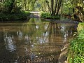
 Beside the River Lew - geograph.org.uk - 430547.jpg 640 × 480 ; 168 kio
-
 Blossom near Lew Quarry - geograph.org.uk - 430446.jpg 480 × 640 ; 168 kio
-
 Bridge over River Lew north-west of Lew Wood - geograph.org.uk - 3394881.jpg 1 024 × 768 ; 212 kio
-
 Bridleway near River Lew - geograph.org.uk - 430462.jpg 640 × 480 ; 135 kio
-
 Bridleway to Lewtrenchard and Ardoch Lodge restaurant - geograph.org.uk - 3394861.jpg 1 024 × 768 ; 145 kio
-
 Burleydown Woods - geograph.org.uk - 246352.jpg 480 × 640 ; 127 kio
-
 Cattle beside River Lew - geograph.org.uk - 430544.jpg 640 × 480 ; 141 kio
-
 Coombe Trenchard viewed from the Croquet Lawn - geograph.org.uk - 3964585.jpg 640 × 480 ; 106 kio
-
 Cottage near Lewtrenchard - geograph.org.uk - 421147.jpg 640 × 480 ; 81 kio
-
 Cross Roads - geograph.org.uk - 3394864.jpg 1 024 × 768 ; 110 kio
-
 Crosses at Lewtrenchard - geograph.org.uk - 430563.jpg 640 × 480 ; 180 kio
-
 Distant view - Warston Barton Farm - geograph.org.uk - 4126720.jpg 1 600 × 1 063 ; 517 kio
-
 Entrance to Jethro's - geograph.org.uk - 5512040.jpg 640 × 480 ; 53 kio
-
 Farmland north of Lydford Forest - geograph.org.uk - 4349640.jpg 1 600 × 1 063 ; 486 kio
-
 Field at Lewtrenchard - geograph.org.uk - 430606.jpg 640 × 480 ; 113 kio
-
 Field boundary on Burley Down - geograph.org.uk - 250231.jpg 640 × 480 ; 122 kio
-
 Field near Lew Quarry Farm - geograph.org.uk - 430452.jpg 640 × 480 ; 88 kio
-
 Fields and the road up Galford Down - geograph.org.uk - 3783464.jpg 1 536 × 1 152 ; 830 kio
-
 Fields near Lewtrenchard - geograph.org.uk - 430236.jpg 640 × 480 ; 93 kio
-
 Fields, hills and woods south-west of Lewtrenchard - geograph.org.uk - 3394867.jpg 1 024 × 767 ; 149 kio
-
 Footbridge over River Lew - geograph.org.uk - 421342.jpg 640 × 480 ; 170 kio
-
 Footbridge over River Lew - geograph.org.uk - 426846.jpg 480 × 640 ; 131 kio
-
 Footbridge over River Lew - geograph.org.uk - 430468.jpg 640 × 480 ; 168 kio
-
 Ford across River Lew - geograph.org.uk - 426854.jpg 640 × 480 ; 141 kio
-
 Ford at Lewtrenchard - geograph.org.uk - 4188197.jpg 3 872 × 2 592 ; 4,74 Mio
-
 Hartswell - geograph.org.uk - 419083.jpg 640 × 474 ; 110 kio
-
 Hedge and trees near Lewtrenchard - geograph.org.uk - 430231.jpg 640 × 480 ; 97 kio
-
 Hedge Cross - geograph.org.uk - 246353.jpg 640 × 480 ; 114 kio
-
 Lane between Hedge Cross and Hartswell - geograph.org.uk - 429921.jpg 480 × 640 ; 155 kio
-
 Lane through Barton Wood - geograph.org.uk - 369347.jpg 640 × 480 ; 142 kio
-
 Lane to Foxcombe - geograph.org.uk - 247984.jpg 640 × 480 ; 132 kio
-
 Lane to Lewquarry Farm - geograph.org.uk - 430222.jpg 640 × 480 ; 138 kio
-
 Lane towards Hedge Cross ^ River Lew - geograph.org.uk - 4126581.jpg 1 600 × 982 ; 503 kio
-
 Lew Cottage - geograph.org.uk - 430443.jpg 640 × 480 ; 125 kio
-
 Lew Trenchard woods (6400707919).png 1 920 × 1 080 ; 4,52 Mio
-
 Lewtrenchard Manor - geograph.org.uk - 4992322.jpg 640 × 480 ; 122 kio
-
 Lewtrenchard, Dower House at Lew Mill - geograph.org.uk - 5723279.jpg 1 600 × 1 066 ; 612 kio
-
 Lewtrenchard, Lew Mill - geograph.org.uk - 5723298.jpg 1 600 × 1 066 ; 753 kio
-
 Lime kiln near Lew Quarry - geograph.org.uk - 430438.jpg 640 × 480 ; 158 kio
-
 Lime kiln, Broadridge Wood - geograph.org.uk - 435487.jpg 480 × 640 ; 129 kio
-
 Meadow by River Lew - geograph.org.uk - 430471.jpg 640 × 480 ; 133 kio
-
 No through road to Holdstrong and other farms - geograph.org.uk - 3935052.jpg 1 536 × 1 152 ; 1,4 Mio
-

-

-
 On Galford Down, looking along the edge of the woods - geograph.org.uk - 3783477.jpg 1 536 × 1 152 ; 1,05 Mio
-
 Pasture north of Lydford Forest - geograph.org.uk - 4126613.jpg 1 600 × 1 063 ; 611 kio
-
 River Lew - geograph.org.uk - 422451.jpg 640 × 480 ; 158 kio
-
 River Lew - geograph.org.uk - 430536.jpg 480 × 640 ; 143 kio
-
 Road just east of Hedge Cross - geograph.org.uk - 3935044.jpg 1 536 × 1 152 ; 1,37 Mio
-
 Road south of Lewtrenchard - geograph.org.uk - 422424.jpg 480 × 640 ; 125 kio
-
 Shed at Lew Quarry - geograph.org.uk - 430550.jpg 640 × 462 ; 110 kio
-
 The edge of the woods on Galford Down - geograph.org.uk - 3783465.jpg 1 536 × 1 152 ; 919 kio
-
 The entrance drive at Coombe Trenchard - geograph.org.uk - 3964625.jpg 640 × 480 ; 139 kio
-
 The Gas House at Coombe Trenchard - geograph.org.uk - 3964612.jpg 640 × 480 ; 133 kio
-

-
 The road to Beechcombe Farm - geograph.org.uk - 3783461.jpg 1 536 × 1 152 ; 923 kio
-
 The road to Galford Down - geograph.org.uk - 3935036.jpg 1 536 × 1 152 ; 1,54 Mio
-

-
 The western corner of Lew Wood - geograph.org.uk - 3394885.jpg 1 024 × 1 023 ; 277 kio
-
 The wood on Galford Down - geograph.org.uk - 3935059.jpg 1 536 × 1 153 ; 1,31 Mio
-
 The Yew Walk at Coombe Trenchard - geograph.org.uk - 3964594.jpg 480 × 640 ; 124 kio
-
 Track into Lydford Forest - geograph.org.uk - 3935071.jpg 1 536 × 1 152 ; 1,42 Mio
-
 Tree-lined road south of Lewtrenchard - geograph.org.uk - 3394875.jpg 1 024 × 768 ; 235 kio
-
 Trees near the River Lew - geograph.org.uk - 430456.jpg 480 × 640 ; 138 kio
-
 Two bare trees by the road at Beechcombe - geograph.org.uk - 3783456.jpg 1 536 × 1 152 ; 1,26 Mio
-
 View at Waddlestone - geograph.org.uk - 426826.jpg 640 × 480 ; 141 kio
-
 View of Waddlestone Down - geograph.org.uk - 4126722.jpg 1 600 × 1 031 ; 521 kio
-
 View towards Waddlestone - geograph.org.uk - 4126727.jpg 1 600 × 941 ; 646 kio
-
 Warson Barton - geograph.org.uk - 429943.jpg 640 × 480 ; 102 kio
-
 Wood (OfOrchard Lew Trenchard Devon) Arms.png 812 × 936 ; 100 kio
-
 Woods and fields south-west of Lewtrenchard - geograph.org.uk - 3394872.jpg 1 024 × 767 ; 155 kio


.png)


_Arms.png)
