Category:Lias (Gers)
Vai alla navigazione
Vai alla ricerca
comune francese  .svg) _OSM_01.png) | |||||
| Carica un file multimediale | |||||
| Istanza di | |||||
|---|---|---|---|---|---|
| Luogo |
| ||||
| Indirizzo stradale |
| ||||
| Popolazione |
| ||||
| Superficie |
| ||||
| Altezza sul mare |
| ||||
| Distinto da | |||||
| sito web ufficiale | |||||
 | |||||
Sottocategorie
Questa categoria contiene le 2 sottocategorie indicate di seguito, su un totale di 2.
M
- Maps of Lias (Gers) (5 F)
File nella categoria "Lias (Gers)"
Questa categoria contiene 19 file, indicati di seguito, su un totale di 19.
-
 32210-Lias-Routes-Hydro.png 3 507 × 2 480; 1,47 MB
-
 32210-Lias-Sols.png 3 507 × 2 480; 1,65 MB
-
 Blason ville fr Lias (Gers).svg 600 × 660; 16 KB
-
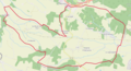 Lias (Gers) OSM 01.png 904 × 492; 163 KB
-
 Lias (Gers) OSM 02.png 904 × 492; 360 KB
-
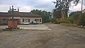
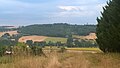 Lias - Vue vers le nord.jpg 3 264 × 1 840; 1,18 MB
-
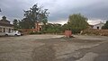
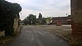 Lias 1.jpg 3 264 × 1 840; 1,6 MB
-
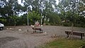
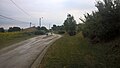 Lias 10.jpg 3 264 × 1 840; 1,47 MB
-
 Lias 2.jpg 3 264 × 1 840; 1,81 MB
-
 Lias 3.jpg 3 264 × 1 840; 1,71 MB
-
 Lias 4.jpg 3 264 × 1 840; 1,76 MB
-
 Lias 5.jpg 3 264 × 1 840; 1,67 MB
-
 Lias 6.jpg 3 264 × 1 840; 1,71 MB
-
 Lias 7.jpg 3 264 × 1 840; 1,79 MB
-
 Lias 8.jpg 3 264 × 1 840; 2,21 MB
-
 Lias 9.jpg 3 264 × 1 840; 2,38 MB
-
 Map commune FR insee code 32210.png 756 × 605; 41 KB
-
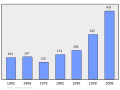 Population - Municipality code 32210.svg 475 × 355; 13 KB
-
 Vallée de la Save.jpg 3 264 × 1 840; 1,79 MB


_OSM_02.png)


