Category:Lichfield
Salti al navigilo
Salti al serĉilo

cathedral city in Staffordshire, England   Wyneb gorllewinol cadeirlan Caerlwytgoed | |||||
| Alŝuti plurmedion | |||||
| Estas | |||||
|---|---|---|---|---|---|
| Loko | Lichfield, Staffordshire, West Midlands, Anglio | ||||
| Signifa okazaĵo |
| ||||
| Loĝantaro |
| ||||
| Areo |
| ||||
| Supermara alteco |
| ||||
| Alia ol | |||||
| oficiala retejo | |||||
 | |||||
English: Lichfield is a cathedral city and civil parish in Staffordshire, England, situated roughly 25 km (16 miles) north of Birmingham, and 200 km (124 miles) northwest of London
Français : Lichfield est une petite ville du Staffordshire (Angleterre).
日本語: リッチフィールドは、イギリスのスタッフォードシャーにある市。
Subkategorioj
Ĉi tiu kategorio havas la 24 jenajn subkategoriojn, el 24 entute.
2
- 2011 in Lichfield (18 D)
B
C
- Coats of arms of Lichfield (1 D)
D
H
L
- Leomansley (2 D)
- Lichfield Bus Station (6 D)
- Lichfield Guildhall (17 D)
M
O
- Old Picture House (5 D)
P
R
S
- Sandfields Pumping Station (7 D)
- Streets in Lichfield (2 D)
Dosieroj en kategorio “Lichfield”
La jenaj 200 dosieroj estas en ĉi tiu kategorio, el 796 entute.
(antaŭa paĝo) (sekva paĝo)-
 10, 10a and 10b Dam Street, Lichfield - Truly Scrumptious! and Kizon (3679091281).jpg 3 648 × 2 736; 2,45 MB
-
 16 Dam Street, Lichfield - geograph.org.uk - 2963565.jpg 427 × 640; 120 KB
-

-
 A glimpse of the Cathedral - geograph.org.uk - 1830845.jpg 480 × 640; 183 KB
-

-
 A tour of the tower of Lichfield Cathedral - geograph.org.uk - 5893055.jpg 768 × 1 024; 168 KB
-

-
 A38 northbound near Freeford Farm - geograph.org.uk - 3694519.jpg 640 × 482; 50 KB
-

-
 A38 southbound near Lichfield - geograph.org.uk - 2403115.jpg 640 × 422; 55 KB
-
 A38, Lichfield Bypass - geograph.org.uk - 4369693.jpg 640 × 430; 49 KB
-
 A461 and A5127 Island Lichfield - geograph.org.uk - 3482577.jpg 640 × 480; 55 KB
-
 A461, Walsall Road, Lichfield - geograph.org.uk - 2515665.jpg 640 × 428; 68 KB
-
 A5127, A461 Island Lichfield - geograph.org.uk - 3950656.jpg 640 × 480; 55 KB
-
 A5192 Cappers Lane Lichfield - geograph.org.uk - 5566828.jpg 640 × 480; 50 KB
-
 Abnalls Lane - geograph.org.uk - 3553726.jpg 640 × 480; 99 KB
-
 ACF and ATC nameboards, Lichfield - geograph.org.uk - 5695282.jpg 800 × 377; 83 KB
-

-
 Air Training Corps hall, Lichfield - geograph.org.uk - 5695267.jpg 800 × 718; 171 KB
-
 Aldershawe Lodge - geograph.org.uk - 2273924.jpg 800 × 600; 187 KB
-
 Aldershawe View - geograph.org.uk - 2273931.jpg 800 × 600; 131 KB
-
 Alexandra House - geograph.org.uk - 5602724.jpg 1 600 × 1 064; 466 KB
-

-
 An old quarry, Curborough - geograph.org.uk - 2829986.jpg 640 × 355; 37 KB
-
 Antique Shop Lichfield - geograph.org.uk - 5750026.jpg 4 896 × 3 672; 6,34 MB
-
 Approaching The Close, Lichfield - geograph.org.uk - 4355691.jpg 640 × 480; 102 KB
-
-
 Art Gallery, Registery Office and former Library - geograph.org.uk - 5891829.jpg 768 × 1 024; 246 KB
-
 Auchinleck Drive - geograph.org.uk - 1671048.jpg 3 072 × 2 048; 2,99 MB
-
 Backcester Lane (4) - geograph.org.uk - 2450215.jpg 2 048 × 3 072; 1,87 MB
-
 Backcester Lane, Car Park (1) - geograph.org.uk - 2450168.jpg 3 072 × 2 048; 2,53 MB
-
 Backcester Lane, Car Park (2) - geograph.org.uk - 2450187.jpg 640 × 427; 49 KB
-
 Backcester Lane, Car park (3) - geograph.org.uk - 2450195.jpg 640 × 427; 59 KB
-
 Baker's Lane - Tamworth Street - geograph.org.uk - 3137242.jpg 640 × 480; 91 KB
-
-
 Baker's Lane, Lichfield - geograph.org.uk - 3792090.jpg 1 200 × 900; 366 KB
-
 Baker's Lane, Lichfield - geograph.org.uk - 3792138.jpg 1 200 × 900; 322 KB
-
 Baker's Lane, Lichfield - geograph.org.uk - 3792140.jpg 1 200 × 900; 366 KB
-
 Bakers Lane, Lichfield - geograph.org.uk - 4980879.jpg 1 024 × 768; 184 KB
-
 Bales ready for collection - geograph.org.uk - 6278438.jpg 5 746 × 3 835; 4,42 MB
-
 Band outside Lichfield Guild Hall - geograph.org.uk - 4980915.jpg 1 024 × 768; 251 KB
-
 Barnfield Close, Lichfield - geograph.org.uk - 5682729.jpg 800 × 461; 56 KB
-
 Beacon Park - geograph.org.uk - 3453256.jpg 640 × 480; 99 KB
-
 Beacon Park - geograph.org.uk - 3453260.jpg 640 × 480; 122 KB
-
 Beacon Park Fountain - geograph.org.uk - 3172777.jpg 4 320 × 3 240; 5,05 MB
-
 Beacon Park in Lichfield - geograph.org.uk - 5053565.jpg 640 × 480; 89 KB
-
 Beacon Park, Lichfield - geograph.org.uk - 2418635.jpg 3 648 × 2 736; 4,22 MB
-
 Beacon Street - geograph.org.uk - 1638641.jpg 640 × 480; 84 KB
-

-
 Beggars Oak Clog Dancers - geograph.org.uk - 3444942.jpg 600 × 800; 111 KB
-
 Beside Stowe Pool - geograph.org.uk - 5917457.jpg 1 600 × 900; 336 KB
-
 Bird Street - viewed from the Friary - geograph.org.uk - 3137104.jpg 640 × 480; 77 KB
-
-
-
 Birmingham Road, Lichfield - bus 820 - Midland Classic (26193057820).jpg 4 608 × 3 456; 2,28 MB
-
 Bishop's House - The Close - geograph.org.uk - 3137236.jpg 640 × 474; 79 KB
-
 Bishop's Palace, Lichfield - geograph.org.uk - 3443771.jpg 640 × 428; 173 KB
-
 Bishops Fish Pool.jpg 8 615 × 6 767; 19,35 MB
-
 Bitter-Suite Micropub, Lichfield - geograph.org.uk - 5682611.jpg 800 × 624; 127 KB
-
 Blackberry Avenue Lichfield - geograph.org.uk - 5566814.jpg 640 × 480; 68 KB
-

-
 Bloodlines (14599432666).jpg 4 638 × 3 006; 3,2 MB
-
 Blue lifting vehicle on The Close in Lichfield.jpg 3 648 × 2 736; 2,39 MB
-
 Bojangles in Lichfield - geograph.org.uk - 5697033.jpg 549 × 800; 113 KB
-
 Booze King in Lichfield - geograph.org.uk - 5682706.jpg 800 × 680; 120 KB
-
 Bore Street - viewed from the Friary - geograph.org.uk - 3137100.jpg 640 × 458; 89 KB
-
 Bore Street, Lichfield - geograph.org.uk - 3727528.jpg 1 600 × 1 181; 398 KB
-
 Bore Street, Lichfield - geograph.org.uk - 3792092.jpg 1 200 × 900; 389 KB
-
 Bore Street, Lichfield - geograph.org.uk - 3792095.jpg 1 200 × 900; 322 KB
-
 Borrowcop Lane, Lichfield - geograph.org.uk - 5793551.jpg 800 × 654; 154 KB
-
 Borrowcop Locks Canal Park.JPG 4 608 × 2 592; 4,95 MB
-
 Borrowcop Locks on the Lichfield Canal - geograph.org.uk - 5655648.jpg 6 000 × 4 000; 6,17 MB
-
 Boswell - Market Place - geograph.org.uk - 3137129.jpg 452 × 640; 64 KB
-
 Bowling Green PH - geograph.org.uk - 5602658.jpg 1 600 × 1 200; 313 KB
-
 Bowling Green, Beacon Park - geograph.org.uk - 3453255.jpg 640 × 480; 116 KB
-
 Breadmarket Street, Lichfield - geograph.org.uk - 3792105.jpg 1 200 × 900; 391 KB
-

-
 Buildings in The Close - geograph.org.uk - 4355774.jpg 640 × 480; 52 KB
-
 Bus shelter on Roman Way in Boley Park - geograph.org.uk - 4701597.jpg 800 × 539; 139 KB
-
 Business parking on the edge of Lichfield - geograph.org.uk - 5644205.jpg 6 000 × 4 000; 6,52 MB
-
 Buttons in Lichfield Cathedral - geograph.org.uk - 5894173.jpg 768 × 1 024; 335 KB
-
 C18 house in The Close, Lichfield - geograph.org.uk - 2963638.jpg 640 × 427; 94 KB
-
-
 Cafe-Restaurant, Swan Road - geograph.org.uk - 2413750.jpg 3 648 × 2 048; 2,1 MB
-
 Caravan Park Entrance - geograph.org.uk - 3123729.jpg 1 024 × 768; 181 KB
-
 Caravan ^ Camping Site - geograph.org.uk - 3174098.jpg 1 024 × 768; 133 KB
-
 CarsInPark.jpg 3 888 × 2 645; 2,98 MB
-
 Cathedral Close, Lichfield (1) - geograph.org.uk - 4355731.jpg 640 × 480; 66 KB
-
 Cathedral Close, Lichfield (2) - geograph.org.uk - 4355734.jpg 640 × 480; 62 KB
-
 Cathedral Close, Lichfield (3) - geograph.org.uk - 4355735.jpg 640 × 480; 56 KB
-
 Cathedral Close, Lichfield - geograph.org.uk - 1830747.jpg 640 × 482; 184 KB
-
 Cathedral Lodge - geograph.org.uk - 3173654.jpg 1 024 × 768; 137 KB
-
 Cathedral School - geograph.org.uk - 1863646.jpg 600 × 800; 137 KB
-
 Cathedral Stone - geograph.org.uk - 1862633.jpg 600 × 800; 114 KB
-
 Central England Co-operative, Lichfield (37504291910).jpg 2 304 × 3 072; 1,29 MB
-
 Chapel Lane Lichfield - geograph.org.uk - 5691576.jpg 640 × 623; 78 KB
-

-
 Cherry Orchard, Lichfield - geograph.org.uk - 5697087.jpg 800 × 639; 108 KB
-
 Choir Screen - geograph.org.uk - 3128540.jpg 640 × 427; 136 KB
-
 Christ Church Lane, Lichfield - geograph.org.uk - 2515674.jpg 640 × 428; 78 KB
-
 Christ Church Primary School - geograph.org.uk - 1991167.jpg 4 000 × 3 000; 4,28 MB
-
 Christ Church, Lichfield - geograph.org.uk - 6278434.jpg 6 000 × 4 000; 5,08 MB
-
 Christchurch Allotments - geograph.org.uk - 6278436.jpg 5 561 × 3 707; 4,82 MB
-
 Christchurch Lane - geograph.org.uk - 6278432.jpg 6 000 × 4 000; 4,25 MB
-
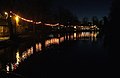 Christmas lights, Minster Pool - geograph.org.uk - 1073620.jpg 640 × 415; 171 KB
-
 Christmas tree festival in Lichfield Cathedral - geograph.org.uk - 5637909.jpg 6 000 × 4 000; 7,34 MB
-
 Church View - geograph.org.uk - 4645880.jpg 800 × 600; 141 KB
-
 Churchyard of St Chad's, Stowe - geograph.org.uk - 5637860.jpg 6 000 × 4 000; 5,91 MB
-

-
 City Council Offices - Wade Street - geograph.org.uk - 3137317.jpg 640 × 480; 71 KB
-
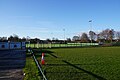 City Ground, Lichfield - geograph.org.uk - 5642392.jpg 6 000 × 4 000; 5,07 MB
-

-
 Classical Portico (Alongside the A51, The Friary) - geograph.org.uk - 2428014.jpg 2 048 × 3 072; 2,52 MB
-
 Clay pit Lane (1) - geograph.org.uk - 2479993.jpg 3 072 × 2 048; 2,92 MB
-
 Close Trees - geograph.org.uk - 3444966.jpg 600 × 800; 182 KB
-
 Co-operative Funeralcare, Lichfield - geograph.org.uk - 5682619.jpg 800 × 619; 106 KB
-
 Colour Me Wednesday - Lichfield 2018-07-14.jpg 3 000 × 1 800; 1,56 MB
-

-
 Conduit Street - Tamworth Street - geograph.org.uk - 3137069.jpg 640 × 480; 90 KB
-
 Crazy golf course in Beacon Park - geograph.org.uk - 1639881.jpg 640 × 480; 114 KB
-
 Crop field off Abnalls Lane - geograph.org.uk - 3553721.jpg 640 × 480; 51 KB
-
 Cross City Line, Lichfield - geograph.org.uk - 5691666.jpg 800 × 798; 139 KB
-
-
 Crucifix conduit, Lichfield (2).JPG 3 440 × 4 608; 4,49 MB
-
 Curve on the Stafford Road - geograph.org.uk - 2725943.jpg 640 × 480; 56 KB
-

-
 Cycle Path - geograph.org.uk - 3177599.jpg 1 024 × 768; 162 KB
-
 Cycleway and footpath at Stowe - geograph.org.uk - 2210300.jpg 1 024 × 768; 249 KB
-
 Dains Accountants in Lichfield - geograph.org.uk - 5697020.jpg 800 × 567; 100 KB
-
 Dam St., Lichfield - geograph.org.uk - 3060882.jpg 2 560 × 1 920; 1,56 MB
-
 Dam Street - geograph.org.uk - 3173605.jpg 1 024 × 768; 219 KB
-
 Dam Street - geograph.org.uk - 5603232.jpg 1 600 × 1 200; 461 KB
-
 Dam Street - geograph.org.uk - 852220.jpg 640 × 480; 100 KB
-

-
 Dam Street in Lichfield - geograph.org.uk - 4701614.jpg 800 × 586; 119 KB
-

-
 Dam Street, Lichfield - geograph.org.uk - 2963521.jpg 640 × 427; 121 KB
-
 Dam Street, Lichfield - geograph.org.uk - 4980948.jpg 1 024 × 768; 225 KB
-
 Dam Street, Lichfield - geograph.org.uk - 519254.jpg 640 × 428; 89 KB
-
 Darnford Lane in Lichfield - geograph.org.uk - 4701580.jpg 800 × 515; 112 KB
-
-
-

-
 Disused Farm and Farm House - geograph.org.uk - 2457239.jpg 3 072 × 2 048; 3,41 MB
-
 Donegal House, Bore St - geograph.org.uk - 2963394.jpg 427 × 640; 89 KB
-
 Donegal House, Lichfield - geograph.org.uk - 3443791.jpg 640 × 479; 242 KB
-
 Dr Johnson - geograph.org.uk - 5631811.jpg 6 000 × 4 000; 3,22 MB
-
 Dr Johnson is not amused - geograph.org.uk - 4980936.jpg 1 024 × 768; 207 KB
-
 Dr Samuel Johnson - Market Place - geograph.org.uk - 3137126.jpg 414 × 640; 72 KB
-
 Dr Samuel Johnson Mural - Bird Street - geograph.org.uk - 5602775.jpg 3 998 × 5 330; 6,29 MB
-
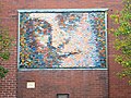 Dr Samuel Johnson Mural - geograph.org.uk - 5602760.jpg 5 021 × 3 766; 5,45 MB
-
 Dr. Johnson Birthplace.jpg 4 320 × 3 240; 5,42 MB
-
 East along Borrowcop Lane, Lichfield - geograph.org.uk - 5682485.jpg 766 × 800; 155 KB
-
 Eastern Avenue - geograph.org.uk - 6279730.jpg 6 000 × 4 000; 3,94 MB
-
 Eastern end of Two Saints Way, St Chad's Well, Lichfield - geograph.org.uk - 5231134.jpg 5 184 × 2 920; 5,71 MB
-

-
 Electrical Sub-station - geograph.org.uk - 4369705.jpg 640 × 430; 58 KB
-

-

-

-
 End of Frog Lane - geograph.org.uk - 2172006.jpg 3 448 × 2 672; 2,36 MB
-
 Entrance to Erasmus Darwin House ^ Herb Garden - geograph.org.uk - 5289408.jpg 4 608 × 3 456; 5,02 MB
-
 Entrance to Gaia Lane - geograph.org.uk - 2210370.jpg 1 024 × 768; 211 KB
-

-

-
 Entrance to The Close - geograph.org.uk - 3173619.jpg 4 320 × 3 240; 3,26 MB
-

-
-
-
 Erasmus Darwin House - geograph.org.uk - 1830833.jpg 640 × 480; 179 KB
-
 Erasmus Darwin House - geograph.org.uk - 3173630.jpg 4 320 × 3 240; 3,39 MB
-
 Erasmus Darwin House - Museum and Herb Garden - Beacon Street, Lichfield (26211866490).jpg 4 608 × 3 456; 6,51 MB
-

-
 Erasmus Darwin memorial - geograph.org.uk - 3128529.jpg 427 × 640; 73 KB
-
 Farmland on the edge of Lichfield - geograph.org.uk - 3657905.jpg 640 × 327; 31 KB
-
 Farmland, Curborough - geograph.org.uk - 3845318.jpg 640 × 430; 43 KB
-
 Festival View - geograph.org.uk - 4645966.jpg 800 × 600; 169 KB
-
 Field - panoramio (30).jpg 1 936 × 1 936; 931 KB
-
 Field entrance off the A461 - geograph.org.uk - 3553693.jpg 640 × 480; 79 KB
-
 Field near Lichfield Junction - geograph.org.uk - 2829996.jpg 640 × 432; 31 KB
-
 Field of Sweetcorn, Walsall Road - geograph.org.uk - 2515686.jpg 640 × 428; 90 KB
-
 Figures on the west front of Lichfield Cathedral - geograph.org.uk - 5894168.jpg 768 × 1 024; 327 KB
-
 Fire Station - Birmingham Road - geograph.org.uk - 3137324.jpg 640 × 480; 67 KB
-
 Fishing lake, Curborough - geograph.org.uk - 2221521.jpg 640 × 580; 92 KB
-
 Five Gables - geograph.org.uk - 1863656.jpg 800 × 600; 117 KB
-
 Flag of Lichfield.png 4 125 × 2 475; 1 023 KB
-
 Flooded quarry, Curborough - geograph.org.uk - 3662171.jpg 640 × 430; 40 KB
-
 Flooded quarry, Curborough - geograph.org.uk - 3733969.jpg 640 × 430; 37 KB
-
 Flooded quarry, Curborough - geograph.org.uk - 3845320.jpg 640 × 430; 45 KB
-
 Footbridge in Festival Gardens - geograph.org.uk - 5602665.jpg 1 600 × 1 200; 731 KB
-
 Footpath and cycle path bridge - geograph.org.uk - 3177609.jpg 1 024 × 768; 313 KB
-

-
 Footpath on the edge of Lichfield - geograph.org.uk - 5644214.jpg 5 760 × 3 840; 6,75 MB
-
 Footpath to Wentworth Drive - geograph.org.uk - 5655628.jpg 6 000 × 4 000; 5,05 MB
-
 Footpath-cycleway on Friary Road - geograph.org.uk - 5603420.jpg 1 600 × 1 200; 673 KB
-
 Former episcopal palace, Lichfield - geograph.org.uk - 5895218.jpg 1 024 × 768; 328 KB
-
 Former footpath across the railway - geograph.org.uk - 5642388.jpg 6 000 × 4 000; 7,73 MB
-

-
 Fosseway Lane - geograph.org.uk - 2480013.jpg 2 048 × 3 072; 2,9 MB
-
 Fossway Crossing, Lichfield. - geograph.org.uk - 2618270.jpg 3 916 × 2 893; 1,68 MB
.jpg)


_-_geograph.org.uk_-_2450215.jpg)
_-_geograph.org.uk_-_2450168.jpg)
_-_geograph.org.uk_-_2450187.jpg)
_-_geograph.org.uk_-_2450195.jpg)


.jpg)


.jpg)


_-_geograph.org.uk_-_4355731.jpg)
_-_geograph.org.uk_-_4355734.jpg)
_-_geograph.org.uk_-_4355735.jpg)


.jpg)


_-_geograph.org.uk_-_2428014.jpg)
_-_geograph.org.uk_-_2479993.jpg)


.JPG)


.jpg)


.jpg)


.jpg)