Category:Lichfield
Vai alla navigazione
Vai alla ricerca

cathedral city in Staffordshire, England   Wyneb gorllewinol cadeirlan Caerlwytgoed | |||||
| Carica un file multimediale | |||||
| Istanza di | |||||
|---|---|---|---|---|---|
| Luogo | Lichfield, Staffordshire, Midlands Occidentali, Inghilterra | ||||
| Evento significativo |
| ||||
| Popolazione |
| ||||
| Superficie |
| ||||
| Altezza sul mare |
| ||||
| Distinto da | |||||
| sito web ufficiale | |||||
 | |||||
English: Lichfield is a cathedral city and civil parish in Staffordshire, England, situated roughly 25 km (16 miles) north of Birmingham, and 200 km (124 miles) northwest of London
Français : Lichfield est une petite ville du Staffordshire (Angleterre).
日本語: リッチフィールドは、イギリスのスタッフォードシャーにある市。
Sottocategorie
Questa categoria contiene le 23 sottocategorie indicate di seguito, su un totale di 23.
2
- 2011 in Lichfield (18 F)
B
C
- Coats of arms of Lichfield (1 F)
H
L
- Leomansley (2 F)
- Lichfield Bus Station (6 F)
- Lichfield Guildhall (17 F)
M
O
- Old Picture House (5 F)
P
R
S
- Sandfields Pumping Station (7 F)
- Streets in Lichfield (2 F)
Pagine nella categoria "Lichfield"
Questa categoria contiene un'unica pagina, indicata di seguito.
File nella categoria "Lichfield"
Questa categoria contiene 200 file, indicati di seguito, su un totale di 888.
(pagina precedente) (pagina successiva)-
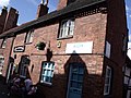 10, 10a and 10b Dam Street, Lichfield - Truly Scrumptious! and Kizon (3679091281).jpg 3 648 × 2 736; 2,45 MB
-
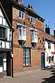 16 Dam Street, Lichfield - geograph.org.uk - 2963565.jpg 427 × 640; 120 KB
-
 A cat in the passage - geograph.org.uk - 6387299.jpg 768 × 1 024; 237 KB
-
 A curious architectural feature - geograph.org.uk - 6389380.jpg 1 024 × 768; 253 KB
-

-
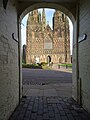 A glimpse of Lichfield Cathedral - geograph.org.uk - 6388421.jpg 768 × 1 024; 217 KB
-
 A glimpse of the Cathedral - geograph.org.uk - 1830845.jpg 480 × 640; 183 KB
-

-
 A tour of the tower of Lichfield Cathedral - geograph.org.uk - 5893055.jpg 768 × 1 024; 168 KB
-

-
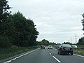 A38 northbound near Freeford Farm - geograph.org.uk - 3694519.jpg 640 × 482; 50 KB
-

-
 A38 southbound near Lichfield - geograph.org.uk - 2403115.jpg 640 × 422; 55 KB
-
 A38, Lichfield Bypass - geograph.org.uk - 4369693.jpg 640 × 430; 49 KB
-
 A461 and A5127 Island Lichfield - geograph.org.uk - 3482577.jpg 640 × 480; 55 KB
-
 A461, Walsall Road, Lichfield - geograph.org.uk - 2515665.jpg 640 × 428; 68 KB
-
 A5127, A461 Island Lichfield - geograph.org.uk - 3950656.jpg 640 × 480; 55 KB
-
 A5192 Cappers Lane Lichfield - geograph.org.uk - 5566828.jpg 640 × 480; 50 KB
-
 Abnalls Lane - geograph.org.uk - 3553726.jpg 640 × 480; 99 KB
-
 ACF and ATC nameboards, Lichfield - geograph.org.uk - 5695282.jpg 800 × 377; 83 KB
-

-
 Air Training Corps hall, Lichfield - geograph.org.uk - 5695267.jpg 800 × 718; 171 KB
-
 Aldershawe Lodge - geograph.org.uk - 2273924.jpg 800 × 600; 187 KB
-
 Aldershawe View - geograph.org.uk - 2273931.jpg 800 × 600; 131 KB
-
 Alexandra House - geograph.org.uk - 5602724.jpg 1 600 × 1 064; 466 KB
-

-
 An old quarry, Curborough - geograph.org.uk - 2829986.jpg 640 × 355; 37 KB
-
 Antique Shop Lichfield - geograph.org.uk - 5750026.jpg 4 896 × 3 672; 6,34 MB
-
 Approaching The Close, Lichfield - geograph.org.uk - 4355691.jpg 640 × 480; 102 KB
-
 Arable land, Curborough - geograph.org.uk - 6483769.jpg 1 024 × 591; 62 KB
-
-
 Art Gallery, Registery Office and former Library - geograph.org.uk - 5891829.jpg 768 × 1 024; 246 KB
-
 Ask Italian - geograph.org.uk - 6388553.jpg 1 024 × 768; 248 KB
-
 Auchinleck Drive - geograph.org.uk - 1671048.jpg 3 072 × 2 048; 2,99 MB
-
 Backcester Lane (4) - geograph.org.uk - 2450215.jpg 2 048 × 3 072; 1,87 MB
-
 Backcester Lane, Car Park (1) - geograph.org.uk - 2450168.jpg 3 072 × 2 048; 2,53 MB
-
 Backcester Lane, Car Park (2) - geograph.org.uk - 2450187.jpg 640 × 427; 49 KB
-
 Backcester Lane, Car park (3) - geograph.org.uk - 2450195.jpg 640 × 427; 59 KB
-
 Baker's Lane - Tamworth Street - geograph.org.uk - 3137242.jpg 640 × 480; 91 KB
-
-
 Baker's Lane, Lichfield - geograph.org.uk - 3792090.jpg 1 200 × 900; 366 KB
-
 Baker's Lane, Lichfield - geograph.org.uk - 3792138.jpg 1 200 × 900; 322 KB
-
 Baker's Lane, Lichfield - geograph.org.uk - 3792140.jpg 1 200 × 900; 366 KB
-
 Bakers Lane, Lichfield - geograph.org.uk - 4980879.jpg 1 024 × 768; 184 KB
-
 Bales ready for collection - geograph.org.uk - 6278438.jpg 5 746 × 3 835; 4,42 MB
-
 Band outside Lichfield Guild Hall - geograph.org.uk - 4980915.jpg 1 024 × 768; 251 KB
-
 Barnfield Close, Lichfield - geograph.org.uk - 5682729.jpg 800 × 461; 56 KB
-
 Beacon Park - geograph.org.uk - 3453256.jpg 640 × 480; 99 KB
-
 Beacon Park - geograph.org.uk - 3453260.jpg 640 × 480; 122 KB
-
 Beacon Park Fountain - geograph.org.uk - 3172777.jpg 4 320 × 3 240; 5,05 MB
-
 Beacon Park in Lichfield - geograph.org.uk - 5053565.jpg 640 × 480; 89 KB
-
 Beacon Park, Lichfield - geograph.org.uk - 2418635.jpg 3 648 × 2 736; 4,22 MB
-
 Beacon Street - geograph.org.uk - 1638641.jpg 640 × 480; 84 KB
-

-
 Beggars Oak Clog Dancers - geograph.org.uk - 3444942.jpg 600 × 800; 111 KB
-
 Beside Stowe Pool - geograph.org.uk - 5917457.jpg 1 600 × 900; 336 KB
-
 Bird Street - viewed from the Friary - geograph.org.uk - 3137104.jpg 640 × 480; 77 KB
-
-
-
 Birmingham Road, Lichfield - bus 820 - Midland Classic (26193057820).jpg 4 608 × 3 456; 2,28 MB
-
 Bishop's House - The Close - geograph.org.uk - 3137236.jpg 640 × 474; 79 KB
-
 Bishops Fish Pool.jpg 8 615 × 6 767; 19,35 MB
-
 Bitter-Suite Micropub, Lichfield - geograph.org.uk - 5682611.jpg 800 × 624; 127 KB
-
 Blackberry Avenue Lichfield - geograph.org.uk - 5566814.jpg 640 × 480; 68 KB
-

-
 Bloodlines (14599432666).jpg 4 638 × 3 006; 3,2 MB
-
 Blue lifting vehicle on The Close in Lichfield.jpg 3 648 × 2 736; 2,39 MB
-
 Bojangles in Lichfield - geograph.org.uk - 5697033.jpg 549 × 800; 113 KB
-
 Booze King in Lichfield - geograph.org.uk - 5682706.jpg 800 × 680; 120 KB
-
 Bore Street - viewed from the Friary - geograph.org.uk - 3137100.jpg 640 × 458; 89 KB
-
 Bore Street, Lichfield - geograph.org.uk - 3727528.jpg 1 600 × 1 181; 398 KB
-
 Bore Street, Lichfield - geograph.org.uk - 3792092.jpg 1 200 × 900; 389 KB
-
 Bore Street, Lichfield - geograph.org.uk - 3792095.jpg 1 200 × 900; 322 KB
-
 Borrowcop Lane, Lichfield - geograph.org.uk - 5793551.jpg 800 × 654; 154 KB
-
 Borrowcop Locks Canal Park.JPG 4 608 × 2 592; 4,95 MB
-
 Borrowcop Locks on the Lichfield Canal - geograph.org.uk - 5655648.jpg 6 000 × 4 000; 6,17 MB
-
 Boswell - Market Place - geograph.org.uk - 3137129.jpg 452 × 640; 64 KB
-
 Bowling Green PH - geograph.org.uk - 5602658.jpg 1 600 × 1 200; 313 KB
-
 Bowling Green, Beacon Park - geograph.org.uk - 3453255.jpg 640 × 480; 116 KB
-
 Breadmarket Street, Lichfield - geograph.org.uk - 3792105.jpg 1 200 × 900; 391 KB
-

-
 Buildings in The Close - geograph.org.uk - 4355774.jpg 640 × 480; 52 KB
-
 Bus shelter on Roman Way in Boley Park - geograph.org.uk - 4701597.jpg 800 × 539; 139 KB
-
 Business parking on the edge of Lichfield - geograph.org.uk - 5644205.jpg 6 000 × 4 000; 6,52 MB
-
 Buttercups on Pipe green - geograph.org.uk - 6455949.jpg 1 024 × 775; 306 KB
-
 Buttons in Lichfield Cathedral - geograph.org.uk - 5894173.jpg 768 × 1 024; 335 KB
-
 C18 house in The Close, Lichfield - geograph.org.uk - 2963638.jpg 640 × 427; 94 KB
-
-
 Cafe-Restaurant, Swan Road - geograph.org.uk - 2413750.jpg 3 648 × 2 048; 2,1 MB
-
 Caravan Park Entrance - geograph.org.uk - 3123729.jpg 1 024 × 768; 181 KB
-
 Caravan ^ Camping Site - geograph.org.uk - 3174098.jpg 1 024 × 768; 133 KB
-
 CarsInPark.jpg 3 888 × 2 645; 2,98 MB
-
 Cathedral Close, Lichfield (1) - geograph.org.uk - 4355731.jpg 640 × 480; 66 KB
-
 Cathedral Close, Lichfield (2) - geograph.org.uk - 4355734.jpg 640 × 480; 62 KB
-
 Cathedral Close, Lichfield (3) - geograph.org.uk - 4355735.jpg 640 × 480; 56 KB
-
 Cathedral Close, Lichfield - geograph.org.uk - 1830747.jpg 640 × 482; 184 KB
-
 Cathedral Lodge - geograph.org.uk - 3173654.jpg 1 024 × 768; 137 KB
-
 Cathedral Stone - geograph.org.uk - 1862633.jpg 600 × 800; 114 KB
-
 Central England Co-operative, Lichfield (37504291910).jpg 2 304 × 3 072; 1,29 MB
-
 Chapel Lane Lichfield - geograph.org.uk - 5691576.jpg 640 × 623; 78 KB
-

-
 Cherry Blossoms, Lichfield City, England - Flickr - cattan2011.jpg 4 000 × 3 000; 8,87 MB
-
 Cherry Orchard, Lichfield - geograph.org.uk - 5697087.jpg 800 × 639; 108 KB
-
 Choir Screen - geograph.org.uk - 3128540.jpg 640 × 427; 136 KB
-
 Christ Church Lane, Lichfield - geograph.org.uk - 2515674.jpg 640 × 428; 78 KB
-
 Christ Church Primary School - geograph.org.uk - 1991167.jpg 4 000 × 3 000; 4,28 MB
-
 Christ Church, Lichfield - geograph.org.uk - 6278434.jpg 6 000 × 4 000; 5,08 MB
-
 Christchurch Allotments - geograph.org.uk - 6278436.jpg 5 561 × 3 707; 4,82 MB
-
 Christchurch Lane - geograph.org.uk - 6278432.jpg 6 000 × 4 000; 4,25 MB
-
 Christmas lights, Minster Pool - geograph.org.uk - 1073620.jpg 640 × 415; 171 KB
-
 Christmas tree festival in Lichfield Cathedral - geograph.org.uk - 5637909.jpg 6 000 × 4 000; 7,34 MB
-
 Church View - geograph.org.uk - 4645880.jpg 800 × 600; 141 KB
-
 Churchyard of St Chad's, Stowe - geograph.org.uk - 5637860.jpg 6 000 × 4 000; 5,91 MB
-

-
 City Council Offices - Wade Street - geograph.org.uk - 3137317.jpg 640 × 480; 71 KB
-
 City Ground, Lichfield - geograph.org.uk - 5642392.jpg 6 000 × 4 000; 5,07 MB
-

-
 Classical Portico (Alongside the A51, The Friary) - geograph.org.uk - 2428014.jpg 2 048 × 3 072; 2,52 MB
-
 Clay pit Lane (1) - geograph.org.uk - 2479993.jpg 3 072 × 2 048; 2,92 MB
-
 Close Trees - geograph.org.uk - 3444966.jpg 600 × 800; 182 KB
-
 Co-operative Funeralcare, Lichfield - geograph.org.uk - 5682619.jpg 800 × 619; 106 KB
-
 Colour Me Wednesday - Lichfield 2018-07-14.jpg 3 000 × 1 800; 1,56 MB
-

-
 Conduit Street - Tamworth Street - geograph.org.uk - 3137069.jpg 640 × 480; 90 KB
-
 Crazy golf course in Beacon Park - geograph.org.uk - 1639881.jpg 640 × 480; 114 KB
-
 Crop field off Abnalls Lane - geograph.org.uk - 3553721.jpg 640 × 480; 51 KB
-
 Cross City Line, Lichfield - geograph.org.uk - 5691666.jpg 800 × 798; 139 KB
-
-
 Crucifix conduit, Lichfield (2).JPG 3 440 × 4 608; 4,49 MB
-
 Curve on the Stafford Road - geograph.org.uk - 2725943.jpg 640 × 480; 56 KB
-

-
 Cycle Path - geograph.org.uk - 3177599.jpg 1 024 × 768; 162 KB
-
 Cycleway and footpath at Stowe - geograph.org.uk - 2210300.jpg 1 024 × 768; 249 KB
-
 Dains Accountants in Lichfield - geograph.org.uk - 5697020.jpg 800 × 567; 100 KB
-
 Dam St., Lichfield - geograph.org.uk - 3060882.jpg 2 560 × 1 920; 1,56 MB
-
 Dam Street - geograph.org.uk - 3173605.jpg 1 024 × 768; 219 KB
-
 Dam Street - geograph.org.uk - 5603232.jpg 1 600 × 1 200; 461 KB
-
 Dam Street - geograph.org.uk - 852220.jpg 640 × 480; 100 KB
-

-
 Dam Street in Lichfield - geograph.org.uk - 4701614.jpg 800 × 586; 119 KB
-
 Dam Street northwards - Lichfield, Staffordshire - geograph.org.uk - 6382882.jpg 1 024 × 683; 172 KB
-

-
 Dam Street, Lichfield - geograph.org.uk - 2963521.jpg 640 × 427; 121 KB
-
 Dam Street, Lichfield - geograph.org.uk - 4980948.jpg 1 024 × 768; 225 KB
-
 Dam Street, Lichfield - geograph.org.uk - 519254.jpg 640 × 428; 89 KB
-
 Darnford Lane in Lichfield - geograph.org.uk - 4701580.jpg 800 × 515; 112 KB
-
-
-
 Detail on the front of The Guildhall - geograph.org.uk - 6386796.jpg 1 024 × 576; 144 KB
-

-
 Disused Farm and Farm House - geograph.org.uk - 2457239.jpg 3 072 × 2 048; 3,41 MB
-
 Donegal House, Bore St - geograph.org.uk - 2963394.jpg 427 × 640; 89 KB
-
 Donegal House, Lichfield - geograph.org.uk - 3443791.jpg 640 × 479; 242 KB
-
 Dr Johnson - geograph.org.uk - 5631811.jpg 6 000 × 4 000; 3,22 MB
-
 Dr Johnson is not amused - geograph.org.uk - 4980936.jpg 1 024 × 768; 207 KB
-
 Dr Johnson public house, Nether Stowe - geograph.org.uk - 6306652.jpg 1 600 × 1 200; 230 KB
-
 Dr Samuel Johnson - geograph.org.uk - 6386803.jpg 768 × 1 024; 138 KB
-
 Dr Samuel Johnson - Market Place - geograph.org.uk - 3137126.jpg 414 × 640; 72 KB
-
 Dr Samuel Johnson Mural - Bird Street - geograph.org.uk - 5602775.jpg 3 998 × 5 330; 6,29 MB
-
 Dr Samuel Johnson Mural - geograph.org.uk - 5602760.jpg 5 021 × 3 766; 5,45 MB
-
 Dr. Johnson Birthplace.jpg 4 320 × 3 240; 5,42 MB
-
 East along Borrowcop Lane, Lichfield - geograph.org.uk - 5682485.jpg 766 × 800; 155 KB
-
 East end of The Close, Lichfield - geograph.org.uk - 6341247.jpg 1 600 × 1 201; 537 KB
-
 Eastern Avenue - geograph.org.uk - 6279730.jpg 6 000 × 4 000; 3,94 MB
-
 Eastern end of Two Saints Way, St Chad's Well, Lichfield - geograph.org.uk - 5231134.jpg 5 184 × 2 920; 5,71 MB
-

-
 Electrical Sub-station - geograph.org.uk - 4369705.jpg 640 × 430; 58 KB
-

-

-

-
 End of Frog Lane - geograph.org.uk - 2172006.jpg 3 448 × 2 672; 2,36 MB
-
 Entrance to Erasmus Darwin House ^ Herb Garden - geograph.org.uk - 5289408.jpg 4 608 × 3 456; 5,02 MB
-
 Entrance to Gaia Lane - geograph.org.uk - 2210370.jpg 1 024 × 768; 211 KB
-

-

-
 Entrance to The Close - geograph.org.uk - 3173619.jpg 4 320 × 3 240; 3,26 MB
-

-
-
-
 Erasmus Darwin House - geograph.org.uk - 1830833.jpg 640 × 480; 179 KB
-
 Erasmus Darwin House - geograph.org.uk - 3173630.jpg 4 320 × 3 240; 3,39 MB
-
 Erasmus Darwin House - geograph.org.uk - 6385996.jpg 1 024 × 768; 249 KB
-
 Erasmus Darwin House - Museum and Herb Garden - Beacon Street, Lichfield (26211866490).jpg 4 608 × 3 456; 6,51 MB
-

-
 Erasmus Darwin memorial - geograph.org.uk - 3128529.jpg 427 × 640; 73 KB
-
 Farmland on the edge of Lichfield - geograph.org.uk - 3657905.jpg 640 × 327; 31 KB
-
 Farmland, Curborough - geograph.org.uk - 3845318.jpg 640 × 430; 43 KB
-
 Festival View - geograph.org.uk - 4645966.jpg 800 × 600; 169 KB
-
 Field - panoramio (30).jpg 1 936 × 1 936; 931 KB
-
 Field entrance off the A461 - geograph.org.uk - 3553693.jpg 640 × 480; 79 KB
-
 Field near Lichfield Junction - geograph.org.uk - 2829996.jpg 640 × 432; 31 KB
-
 Field of Sweetcorn, Walsall Road - geograph.org.uk - 2515686.jpg 640 × 428; 90 KB
-
 Figures on the west front of Lichfield Cathedral - geograph.org.uk - 5894168.jpg 768 × 1 024; 327 KB
-
 Fire Station - Birmingham Road - geograph.org.uk - 3137324.jpg 640 × 480; 67 KB
-

-
 Fishing lake, Curborough - geograph.org.uk - 2221521.jpg 640 × 580; 92 KB
-
 Five Gables - geograph.org.uk - 1863656.jpg 800 × 600; 117 KB
-
 Flag of Lichfield.png 4 125 × 2 475; 1 023 KB
-
 Flooded pit - geograph.org.uk - 6483770.jpg 1 024 × 605; 79 KB
-
 Flooded quarry, Curborough - geograph.org.uk - 3662171.jpg 640 × 430; 40 KB
.jpg)


_-_geograph.org.uk_-_2450215.jpg)
_-_geograph.org.uk_-_2450168.jpg)
_-_geograph.org.uk_-_2450187.jpg)
_-_geograph.org.uk_-_2450195.jpg)


.jpg)


.jpg)


_-_geograph.org.uk_-_4355731.jpg)
_-_geograph.org.uk_-_4355734.jpg)
_-_geograph.org.uk_-_4355735.jpg)


.jpg)


_-_geograph.org.uk_-_2428014.jpg)
_-_geograph.org.uk_-_2479993.jpg)


.JPG)


.jpg)


.jpg)


.jpg)