Category:Lichfield
Jump to navigation
Jump to search

cathedral city in Staffordshire, England   Wyneb gorllewinol cadeirlan Caerlwytgoed | |||||
| Upload media | |||||
| Instance of | |||||
|---|---|---|---|---|---|
| Location | Lichfield, Staffordshire, West Midlands, Inglaterra | ||||
| Significant event |
| ||||
| Population |
| ||||
| Area |
| ||||
| Elevation above sea level |
| ||||
| Different from | |||||
| official website | |||||
 | |||||
English: Lichfield is a cathedral city and civil parish in Staffordshire, England, situated roughly 25 km (16 miles) north of Birmingham, and 200 km (124 miles) northwest of London
Français : Lichfield est une petite ville du Staffordshire (Angleterre).
日本語: リッチフィールドは、イギリスのスタッフォードシャーにある市。
Mga ubos-nga-kaarangay
Ini nga kaarangay mayda han mga nasunod nga 24 nga mga ubos-nga-kaarangay, tikang hin 24 nga kabug-osan.
2
- 2011 in Lichfield (18 F)
B
C
- Coats of arms of Lichfield (1 F)
D
H
L
- Leomansley (2 F)
- Lichfield Bus Station (6 F)
- Lichfield Guildhall (17 F)
M
O
- Old Picture House (5 F)
P
R
S
- Sandfields Pumping Station (7 F)
- Streets in Lichfield (2 F)
Mga pakli ha kaarangay nga "Lichfield"
Ini nga kaarangay mayda han amo la nga nasunod nga pakli.
Media ha kaarangay nga "Lichfield"
An mga nasunod nga 200 ka mga fayl aada han hini nga kaarangay, tikang hin 888 nga kabug-osan.
(nahiuna nga pakli) (masunod nga pakli)-
 10, 10a and 10b Dam Street, Lichfield - Truly Scrumptious! and Kizon (3679091281).jpg 3,648 × 2,736; 2.45 nga MB
-
 16 Dam Street, Lichfield - geograph.org.uk - 2963565.jpg 427 × 640; 120 nga KB
-
 A cat in the passage - geograph.org.uk - 6387299.jpg 768 × 1,024; 237 nga KB
-
 A curious architectural feature - geograph.org.uk - 6389380.jpg 1,024 × 768; 253 nga KB
-
 A Field Of Wheat, Walsall Rd, Pipehill - geograph.org.uk - 2515680.jpg 640 × 428; 74 nga KB
-
 A glimpse of Lichfield Cathedral - geograph.org.uk - 6388421.jpg 768 × 1,024; 217 nga KB
-
 A glimpse of the Cathedral - geograph.org.uk - 1830845.jpg 480 × 640; 183 nga KB
-
 A guided tour in Lichfield near the cathedral - geograph.org.uk - 6107942.jpg 640 × 480; 69 nga KB
-
 A tour of the tower of Lichfield Cathedral - geograph.org.uk - 5893055.jpg 768 × 1,024; 168 nga KB
-
 A38 north towards Hilliard's Corner junction - geograph.org.uk - 3002548.jpg 640 × 505; 69 nga KB
-
 A38 northbound near Freeford Farm - geograph.org.uk - 3694519.jpg 640 × 482; 50 nga KB
-
 A38 northbound passing under Darnford Lane - geograph.org.uk - 3694520.jpg 640 × 481; 51 nga KB
-
 A38 southbound near Lichfield - geograph.org.uk - 2403115.jpg 640 × 422; 55 nga KB
-
 A38, Lichfield Bypass - geograph.org.uk - 4369693.jpg 640 × 430; 49 nga KB
-
 A461 and A5127 Island Lichfield - geograph.org.uk - 3482577.jpg 640 × 480; 55 nga KB
-
 A461, Walsall Road, Lichfield - geograph.org.uk - 2515665.jpg 640 × 428; 68 nga KB
-
 A5127, A461 Island Lichfield - geograph.org.uk - 3950656.jpg 640 × 480; 55 nga KB
-
 A5192 Cappers Lane Lichfield - geograph.org.uk - 5566828.jpg 640 × 480; 50 nga KB
-
 Abnalls Lane - geograph.org.uk - 3553726.jpg 640 × 480; 99 nga KB
-
 ACF and ATC nameboards, Lichfield - geograph.org.uk - 5695282.jpg 800 × 377; 83 nga KB
-
 Aiden Court Road leading to Deans Croft, Lichfield - geograph.org.uk - 2514537.jpg 640 × 428; 71 nga KB
-
 Air Training Corps hall, Lichfield - geograph.org.uk - 5695267.jpg 800 × 718; 171 nga KB
-
 Aldershawe Lodge - geograph.org.uk - 2273924.jpg 800 × 600; 187 nga KB
-
 Aldershawe View - geograph.org.uk - 2273931.jpg 800 × 600; 131 nga KB
-
 Alexandra House - geograph.org.uk - 5602724.jpg 1,600 × 1,064; 466 nga KB
-

-
 An old quarry, Curborough - geograph.org.uk - 2829986.jpg 640 × 355; 37 nga KB
-
 Antique Shop Lichfield - geograph.org.uk - 5750026.jpg 4,896 × 3,672; 6.34 nga MB
-
 Approaching The Close, Lichfield - geograph.org.uk - 4355691.jpg 640 × 480; 102 nga KB
-
 Arable land, Curborough - geograph.org.uk - 6483769.jpg 1,024 × 591; 62 nga KB
-
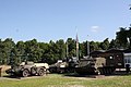 Armoured vehicle display at The Staffordshire Regiment Museum, Lichfield, Staffordshire.jpeg 1,280 × 853; 307 nga KB
-
 Art Gallery, Registery Office and former Library - geograph.org.uk - 5891829.jpg 768 × 1,024; 246 nga KB
-
 Ask Italian - geograph.org.uk - 6388553.jpg 1,024 × 768; 248 nga KB
-
 Auchinleck Drive - geograph.org.uk - 1671048.jpg 3,072 × 2,048; 2.99 nga MB
-
 Backcester Lane (4) - geograph.org.uk - 2450215.jpg 2,048 × 3,072; 1.87 nga MB
-
 Backcester Lane, Car Park (1) - geograph.org.uk - 2450168.jpg 3,072 × 2,048; 2.53 nga MB
-
 Backcester Lane, Car Park (2) - geograph.org.uk - 2450187.jpg 640 × 427; 49 nga KB
-
 Backcester Lane, Car park (3) - geograph.org.uk - 2450195.jpg 640 × 427; 59 nga KB
-
 Baker's Lane - Tamworth Street - geograph.org.uk - 3137242.jpg 640 × 480; 91 nga KB
-
 Baker's Lane - viewed from Gresley Row - geograph.org.uk - 3137321.jpg 640 × 480; 94 nga KB
-
 Baker's Lane, Lichfield - geograph.org.uk - 3792090.jpg 1,200 × 900; 366 nga KB
-
 Baker's Lane, Lichfield - geograph.org.uk - 3792138.jpg 1,200 × 900; 322 nga KB
-
 Baker's Lane, Lichfield - geograph.org.uk - 3792140.jpg 1,200 × 900; 366 nga KB
-
 Bakers Lane, Lichfield - geograph.org.uk - 4980879.jpg 1,024 × 768; 184 nga KB
-
 Bales ready for collection - geograph.org.uk - 6278438.jpg 5,746 × 3,835; 4.42 nga MB
-
 Band outside Lichfield Guild Hall - geograph.org.uk - 4980915.jpg 1,024 × 768; 251 nga KB
-
 Barnfield Close, Lichfield - geograph.org.uk - 5682729.jpg 800 × 461; 56 nga KB
-
 Beacon Park - geograph.org.uk - 3453256.jpg 640 × 480; 99 nga KB
-
 Beacon Park - geograph.org.uk - 3453260.jpg 640 × 480; 122 nga KB
-
 Beacon Park Fountain - geograph.org.uk - 3172777.jpg 4,320 × 3,240; 5.05 nga MB
-
 Beacon Park in Lichfield - geograph.org.uk - 5053565.jpg 640 × 480; 89 nga KB
-
 Beacon Park, Lichfield - geograph.org.uk - 2418635.jpg 3,648 × 2,736; 4.22 nga MB
-
 Beacon Street - geograph.org.uk - 1638641.jpg 640 × 480; 84 nga KB
-
 Beacon Street - viewed from The Close - geograph.org.uk - 3137233.jpg 640 × 480; 85 nga KB
-
 Beggars Oak Clog Dancers - geograph.org.uk - 3444942.jpg 600 × 800; 111 nga KB
-
 Beside Stowe Pool - geograph.org.uk - 5917457.jpg 1,600 × 900; 336 nga KB
-
 Bird Street - viewed from the Friary - geograph.org.uk - 3137104.jpg 640 × 480; 77 nga KB
-
 Birmingham Road - viewed from Levetts Field - geograph.org.uk - 3137327.jpg 640 × 480; 70 nga KB
-
 Birmingham Road - viewed from Levetts Field - geograph.org.uk - 3137330.jpg 640 × 480; 78 nga KB
-
 Birmingham Road, Lichfield - bus 820 - Midland Classic (26193057820).jpg 4,608 × 3,456; 2.28 nga MB
-
 Bishop's House - The Close - geograph.org.uk - 3137236.jpg 640 × 474; 79 nga KB
-
 Bishops Fish Pool.jpg 8,615 × 6,767; 19.35 nga MB
-
 Bitter-Suite Micropub, Lichfield - geograph.org.uk - 5682611.jpg 800 × 624; 127 nga KB
-
 Blackberry Avenue Lichfield - geograph.org.uk - 5566814.jpg 640 × 480; 68 nga KB
-

-
 Bloodlines (14599432666).jpg 4,638 × 3,006; 3.2 nga MB
-
 Blue lifting vehicle on The Close in Lichfield.jpg 3,648 × 2,736; 2.39 nga MB
-
 Bojangles in Lichfield - geograph.org.uk - 5697033.jpg 549 × 800; 113 nga KB
-
 Booze King in Lichfield - geograph.org.uk - 5682706.jpg 800 × 680; 120 nga KB
-
 Bore Street - viewed from the Friary - geograph.org.uk - 3137100.jpg 640 × 458; 89 nga KB
-
 Bore Street, Lichfield - geograph.org.uk - 3727528.jpg 1,600 × 1,181; 398 nga KB
-
 Bore Street, Lichfield - geograph.org.uk - 3792092.jpg 1,200 × 900; 389 nga KB
-
 Bore Street, Lichfield - geograph.org.uk - 3792095.jpg 1,200 × 900; 322 nga KB
-
 Borrowcop Lane, Lichfield - geograph.org.uk - 5793551.jpg 800 × 654; 154 nga KB
-
 Borrowcop Locks Canal Park.JPG 4,608 × 2,592; 4.95 nga MB
-
 Borrowcop Locks on the Lichfield Canal - geograph.org.uk - 5655648.jpg 6,000 × 4,000; 6.17 nga MB
-
 Boswell - Market Place - geograph.org.uk - 3137129.jpg 452 × 640; 64 nga KB
-
 Bowling Green PH - geograph.org.uk - 5602658.jpg 1,600 × 1,200; 313 nga KB
-
 Bowling Green, Beacon Park - geograph.org.uk - 3453255.jpg 640 × 480; 116 nga KB
-
 Breadmarket Street, Lichfield - geograph.org.uk - 3792105.jpg 1,200 × 900; 391 nga KB
-
 Brick houses, Upper St John Street, Lichfield - geograph.org.uk - 5695352.jpg 800 × 420; 73 nga KB
-
 Buildings in The Close - geograph.org.uk - 4355774.jpg 640 × 480; 52 nga KB
-
 Bus shelter on Roman Way in Boley Park - geograph.org.uk - 4701597.jpg 800 × 539; 139 nga KB
-
 Business parking on the edge of Lichfield - geograph.org.uk - 5644205.jpg 6,000 × 4,000; 6.52 nga MB
-
 Buttercups on Pipe green - geograph.org.uk - 6455949.jpg 1,024 × 775; 306 nga KB
-
 Buttons in Lichfield Cathedral - geograph.org.uk - 5894173.jpg 768 × 1,024; 335 nga KB
-
 C18 house in The Close, Lichfield - geograph.org.uk - 2963638.jpg 640 × 427; 94 nga KB
-
 Cabbage Field alongside the Knowle Lane - geograph.org.uk - 2486941.jpg 640 × 428; 88 nga KB
-
 Cafe-Restaurant, Swan Road - geograph.org.uk - 2413750.jpg 3,648 × 2,048; 2.1 nga MB
-
 Caravan Park Entrance - geograph.org.uk - 3123729.jpg 1,024 × 768; 181 nga KB
-
 Caravan ^ Camping Site - geograph.org.uk - 3174098.jpg 1,024 × 768; 133 nga KB
-
 CarsInPark.jpg 3,888 × 2,645; 2.98 nga MB
-
 Cathedral Close, Lichfield (1) - geograph.org.uk - 4355731.jpg 640 × 480; 66 nga KB
-
 Cathedral Close, Lichfield (2) - geograph.org.uk - 4355734.jpg 640 × 480; 62 nga KB
-
 Cathedral Close, Lichfield (3) - geograph.org.uk - 4355735.jpg 640 × 480; 56 nga KB
-
 Cathedral Close, Lichfield - geograph.org.uk - 1830747.jpg 640 × 482; 184 nga KB
-
 Cathedral Lodge - geograph.org.uk - 3173654.jpg 1,024 × 768; 137 nga KB
-
 Cathedral Stone - geograph.org.uk - 1862633.jpg 600 × 800; 114 nga KB
-
 Central England Co-operative, Lichfield (37504291910).jpg 2,304 × 3,072; 1.29 nga MB
-
 Chapel Lane Lichfield - geograph.org.uk - 5691576.jpg 640 × 623; 78 nga KB
-

-
 Cherry Blossoms, Lichfield City, England - Flickr - cattan2011.jpg 4,000 × 3,000; 8.87 nga MB
-
 Cherry Orchard, Lichfield - geograph.org.uk - 5697087.jpg 800 × 639; 108 nga KB
-
 Choir Screen - geograph.org.uk - 3128540.jpg 640 × 427; 136 nga KB
-
 Christ Church Lane, Lichfield - geograph.org.uk - 2515674.jpg 640 × 428; 78 nga KB
-
 Christ Church Primary School - geograph.org.uk - 1991167.jpg 4,000 × 3,000; 4.28 nga MB
-
 Christ Church, Lichfield - geograph.org.uk - 6278434.jpg 6,000 × 4,000; 5.08 nga MB
-
 Christchurch Allotments - geograph.org.uk - 6278436.jpg 5,561 × 3,707; 4.82 nga MB
-
 Christchurch Lane - geograph.org.uk - 6278432.jpg 6,000 × 4,000; 4.25 nga MB
-
 Christmas lights, Minster Pool - geograph.org.uk - 1073620.jpg 640 × 415; 171 nga KB
-
 Christmas tree festival in Lichfield Cathedral - geograph.org.uk - 5637909.jpg 6,000 × 4,000; 7.34 nga MB
-
 Church View - geograph.org.uk - 4645880.jpg 800 × 600; 141 nga KB
-
 Churchyard of St Chad's, Stowe - geograph.org.uk - 5637860.jpg 6,000 × 4,000; 5.91 nga MB
-
 City Cars taxi office, Davidson Road, Lichfield - geograph.org.uk - 5691639.jpg 800 × 600; 90 nga KB
-
 City Council Offices - Wade Street - geograph.org.uk - 3137317.jpg 640 × 480; 71 nga KB
-
 City Ground, Lichfield - geograph.org.uk - 5642392.jpg 6,000 × 4,000; 5.07 nga MB
-
 Class 350 Near Lichfield Trent Valley Station - geograph.org.uk - 2827261.jpg 640 × 421; 174 nga KB
-
 Classical Portico (Alongside the A51, The Friary) - geograph.org.uk - 2428014.jpg 2,048 × 3,072; 2.52 nga MB
-
 Clay pit Lane (1) - geograph.org.uk - 2479993.jpg 3,072 × 2,048; 2.92 nga MB
-
 Close Trees - geograph.org.uk - 3444966.jpg 600 × 800; 182 nga KB
-
 Co-operative Funeralcare, Lichfield - geograph.org.uk - 5682619.jpg 800 × 619; 106 nga KB
-
 Colour Me Wednesday - Lichfield 2018-07-14.jpg 3,000 × 1,800; 1.56 nga MB
-
 Colourful crests on a railway bridge, Lichfield - geograph.org.uk - 6098734.jpg 640 × 481; 91 nga KB
-
 Conduit Street - Tamworth Street - geograph.org.uk - 3137069.jpg 640 × 480; 90 nga KB
-
 Crazy golf course in Beacon Park - geograph.org.uk - 1639881.jpg 640 × 480; 114 nga KB
-
 Crop field off Abnalls Lane - geograph.org.uk - 3553721.jpg 640 × 480; 51 nga KB
-
 Cross City Line, Lichfield - geograph.org.uk - 5691666.jpg 800 × 798; 139 nga KB
-
 Crossfield Industrial Estate, Lichfield - geograph.org.uk - 2984167.jpg 640 × 434; 51 nga KB
-
 Crucifix conduit, Lichfield (2).JPG 3,440 × 4,608; 4.49 nga MB
-
 Curve on the Stafford Road - geograph.org.uk - 2725943.jpg 640 × 480; 56 nga KB
-
 Cut through from The Close to Stowe Pool - geograph.org.uk - 4355702.jpg 640 × 480; 78 nga KB
-
 Cycle Path - geograph.org.uk - 3177599.jpg 1,024 × 768; 162 nga KB
-
 Cycleway and footpath at Stowe - geograph.org.uk - 2210300.jpg 1,024 × 768; 249 nga KB
-
 Dains Accountants in Lichfield - geograph.org.uk - 5697020.jpg 800 × 567; 100 nga KB
-
 Dam St., Lichfield - geograph.org.uk - 3060882.jpg 2,560 × 1,920; 1.56 nga MB
-
 Dam Street - geograph.org.uk - 3173605.jpg 1,024 × 768; 219 nga KB
-
 Dam Street - geograph.org.uk - 5603232.jpg 1,600 × 1,200; 461 nga KB
-
 Dam Street - geograph.org.uk - 852220.jpg 640 × 480; 100 nga KB
-
 Dam Street - viewed from near Conduit Street - geograph.org.uk - 3137130.jpg 640 × 490; 79 nga KB
-
 Dam Street in Lichfield - geograph.org.uk - 4701614.jpg 800 × 586; 119 nga KB
-
 Dam Street northwards - Lichfield, Staffordshire - geograph.org.uk - 6382882.jpg 1,024 × 683; 172 nga KB
-
 Dam Street, Lichfield - Cathedral Visitors' Study Centre and Attached Wall and Gate (3679581968).jpg 3,648 × 2,736; 1.56 nga MB
-
 Dam Street, Lichfield - geograph.org.uk - 2963521.jpg 640 × 427; 121 nga KB
-
 Dam Street, Lichfield - geograph.org.uk - 4980948.jpg 1,024 × 768; 225 nga KB
-
 Dam Street, Lichfield - geograph.org.uk - 519254.jpg 640 × 428; 89 nga KB
-
 Darnford Lane in Lichfield - geograph.org.uk - 4701580.jpg 800 × 515; 112 nga KB
-
 Deans Lade Farm, Claypit Lane, Lichfield - geograph.org.uk - 2514514.jpg 640 × 428; 63 nga KB
-
 Derelict Grade II listed Davidson House, Lichfield - geograph.org.uk - 5691700.jpg 800 × 607; 97 nga KB
-
 Detail on the front of The Guildhall - geograph.org.uk - 6386796.jpg 1,024 × 576; 144 nga KB
-
 Directions sign on the approach to Lichfield city centre - geograph.org.uk - 5697081.jpg 579 × 640; 103 nga KB
-
 Disused Farm and Farm House - geograph.org.uk - 2457239.jpg 3,072 × 2,048; 3.41 nga MB
-
 Donegal House, Bore St - geograph.org.uk - 2963394.jpg 427 × 640; 89 nga KB
-
 Donegal House, Lichfield - geograph.org.uk - 3443791.jpg 640 × 479; 242 nga KB
-
 Dr Johnson - geograph.org.uk - 5631811.jpg 6,000 × 4,000; 3.22 nga MB
-
 Dr Johnson is not amused - geograph.org.uk - 4980936.jpg 1,024 × 768; 207 nga KB
-
 Dr Johnson public house, Nether Stowe - geograph.org.uk - 6306652.jpg 1,600 × 1,200; 230 nga KB
-
 Dr Samuel Johnson - geograph.org.uk - 6386803.jpg 768 × 1,024; 138 nga KB
-
 Dr Samuel Johnson - Market Place - geograph.org.uk - 3137126.jpg 414 × 640; 72 nga KB
-
 Dr Samuel Johnson Mural - Bird Street - geograph.org.uk - 5602775.jpg 3,998 × 5,330; 6.29 nga MB
-
 Dr Samuel Johnson Mural - geograph.org.uk - 5602760.jpg 5,021 × 3,766; 5.45 nga MB
-
 Dr. Johnson Birthplace.jpg 4,320 × 3,240; 5.42 nga MB
-
 East along Borrowcop Lane, Lichfield - geograph.org.uk - 5682485.jpg 766 × 800; 155 nga KB
-
 East end of The Close, Lichfield - geograph.org.uk - 6341247.jpg 1,600 × 1,201; 537 nga KB
-
 Eastern Avenue - geograph.org.uk - 6279730.jpg 6,000 × 4,000; 3.94 nga MB
-
 Eastern end of Two Saints Way, St Chad's Well, Lichfield - geograph.org.uk - 5231134.jpg 5,184 × 2,920; 5.71 nga MB
-
 Edwardian pillarbox, Upper St John Street, Lichfield - geograph.org.uk - 5695336.jpg 513 × 640; 65 nga KB
-
 Electrical Sub-station - geograph.org.uk - 4369705.jpg 640 × 430; 58 nga KB
-
 Electricity Substation No 9002 - Wade Street - geograph.org.uk - 3137247.jpg 640 × 544; 76 nga KB
-
 Electricity Substation No 9153 - Dam Street - geograph.org.uk - 3137214.jpg 640 × 480; 54 nga KB
-
 Electrovape Ltd, Davidson Road, Lichfield - geograph.org.uk - 5691626.jpg 800 × 632; 80 nga KB
-
 End of Frog Lane - geograph.org.uk - 2172006.jpg 3,448 × 2,672; 2.36 nga MB
-
 Entrance to Erasmus Darwin House ^ Herb Garden - geograph.org.uk - 5289408.jpg 4,608 × 3,456; 5.02 nga MB
-
 Entrance to Gaia Lane - geograph.org.uk - 2210370.jpg 1,024 × 768; 211 nga KB
-
 Entrance to Lichfield City railway station - geograph.org.uk - 5682565.jpg 800 × 600; 151 nga KB
-
 Entrance to the ATC and ACF site, Lichfield - geograph.org.uk - 5695273.jpg 800 × 642; 127 nga KB
-
 Entrance to The Close - geograph.org.uk - 3173619.jpg 4,320 × 3,240; 3.26 nga MB
-
 Entrance to the courtyard of the Kings Head inn, Bird Street, Lichfield - geograph.org.uk - 3728235.jpg 1,600 × 1,200; 317 nga KB
-
 Entrance to the former Lichfield Brewery site, Lichfield - geograph.org.uk - 6098732.jpg 992 × 1,024; 218 nga KB
-
-
 Erasmus Darwin House - geograph.org.uk - 1830833.jpg 640 × 480; 179 nga KB
-
 Erasmus Darwin House - geograph.org.uk - 3173630.jpg 4,320 × 3,240; 3.39 nga MB
-
 Erasmus Darwin House - geograph.org.uk - 6385996.jpg 1,024 × 768; 249 nga KB
-
 Erasmus Darwin House - Museum and Herb Garden - Beacon Street, Lichfield (26211866490).jpg 4,608 × 3,456; 6.51 nga MB
-
 Erasmus Darwin House, Beacon Street, Lichfield - geograph.org.uk - 4141335.jpg 640 × 427; 84 nga KB
-
 Erasmus Darwin memorial - geograph.org.uk - 3128529.jpg 427 × 640; 73 nga KB
-
 Farmland on the edge of Lichfield - geograph.org.uk - 3657905.jpg 640 × 327; 31 nga KB
-
 Farmland, Curborough - geograph.org.uk - 3845318.jpg 640 × 430; 43 nga KB
-
 Festival View - geograph.org.uk - 4645966.jpg 800 × 600; 169 nga KB
-
 Field - panoramio (30).jpg 1,936 × 1,936; 931 nga KB
-
 Field entrance off the A461 - geograph.org.uk - 3553693.jpg 640 × 480; 79 nga KB
-
 Field near Lichfield Junction - geograph.org.uk - 2829996.jpg 640 × 432; 31 nga KB
-
 Field of Sweetcorn, Walsall Road - geograph.org.uk - 2515686.jpg 640 × 428; 90 nga KB
-
 Figures on the west front of Lichfield Cathedral - geograph.org.uk - 5894168.jpg 768 × 1,024; 327 nga KB
-
 Fire Station - Birmingham Road - geograph.org.uk - 3137324.jpg 640 × 480; 67 nga KB
-
 Fires and Three Spires - Lichfield, Staffordshire - geograph.org.uk - 6510942.jpg 1,024 × 683; 146 nga KB
-
 Fishing lake, Curborough - geograph.org.uk - 2221521.jpg 640 × 580; 92 nga KB
-
 Five Gables - geograph.org.uk - 1863656.jpg 800 × 600; 117 nga KB
-
 Flag of Lichfield.png 4,125 × 2,475; 1,023 nga KB
-
 Flooded pit - geograph.org.uk - 6483770.jpg 1,024 × 605; 79 nga KB
-
 Flooded quarry, Curborough - geograph.org.uk - 3662171.jpg 640 × 430; 40 nga KB
.jpg)


_-_geograph.org.uk_-_2450215.jpg)
_-_geograph.org.uk_-_2450168.jpg)
_-_geograph.org.uk_-_2450187.jpg)
_-_geograph.org.uk_-_2450195.jpg)


.jpg)


.jpg)


_-_geograph.org.uk_-_4355731.jpg)
_-_geograph.org.uk_-_4355734.jpg)
_-_geograph.org.uk_-_4355735.jpg)


.jpg)


_-_geograph.org.uk_-_2428014.jpg)
_-_geograph.org.uk_-_2479993.jpg)


.JPG)


.jpg)


.jpg)


.jpg)