Category:Lighthouses in New York (state)
둘러보기로 이동
검색으로 이동
States of the United States: 노스캐롤라이나주 · 뉴욕주 · 뉴저지주 · 뉴햄프셔주 · 델라웨어주 · 로드아일랜드주 · 루이지애나주 · 매사추세츠주 · 메릴랜드주 · 메인주 · 미네소타주 · 미시간주 · 미시시피주 · 미주리주 · 버몬트주 · 버지니아주 · 사우스캐롤라이나주 · 알래스카주 · 애리조나주 · 앨라배마주 · 오리건주 · 오클라호마주 · 오하이오주 · 워싱턴주 · 위스콘신주 · 유타주 · 인디애나주 · 일리노이주 · 조지아주 · 캘리포니아주 · 코네티컷주 · 콜로라도주 · 텍사스주 · 펜실베이니아주 · 플로리다주 · 하와이주
미국령 버진아일랜드 · 푸에르토리코
미국령 버진아일랜드 · 푸에르토리코
위키미디어 분류 | |||||
| 미디어 올리기 | |||||
| 다음 종류에 속함 | |||||
|---|---|---|---|---|---|
| 다음 주제들의 교집합 분류임 | |||||
| 뉴욕주 | |||||
미국 북동부에 자리한 주  The New York State Capitol in Albany   .svg)   | |||||
| 발음 (음성 파일) | |||||
| 다음 종류에 속함 |
| ||||
| 다음의 한 부분임 | |||||
| 명칭의 유래 | |||||
| 위치 | 미국 | ||||
| 다음 유역을 끼고 있음 | |||||
| 정부 소재지 | |||||
| 입법부 | |||||
| 행정부 | |||||
| 최고 사법 기관 | |||||
| 행정부 수반 |
| ||||
| 만들어진 날 |
| ||||
| 가장 높은 곳 | |||||
| 인구수 |
| ||||
| 면적 |
| ||||
| 해발고도 |
| ||||
| 다음에서 이어받음 |
| ||||
| 다음과 다름 | |||||
| 최고 온도 |
| ||||
| 최저 온도 |
| ||||
| 공식 웹사이트 | |||||
 | |||||
하위 분류
다음은 이 분류에 속하는 하위 분류 28개 가운데 28개입니다.
#
*
A
- Ambrose Light (2 F)
B
- Bradock Point light station (1 F)
C
- Cape Vincent lighthouse (1 F)
- Cold Springs Harbor Light (2 F)
- Coney Island Light (8 F)
- Crown Point lighthouse (16 F)
E
- Elm Tree Beacon Light (2 F)
F
- Fort Tompkins Light (3 F)
G
- Gardiner's Island Lighthouse (23 F)
L
- Little Gull Island Light (3 F)
N
- North Dumpling Island (8 F)
O
- Olcott Light (7 F)
- Orient Long Beach Bar Light (5 F)
- Orient Point Light (26 F)
P
R
- Race Rock Light (9 F)
S
- Sodus Outer Light (30 F)
- Sodus Point Light (65 F)
- Staten Island range lights (5 F)
- Sunken Rock Light (6 F)
T
- Throgs Neck Lighthouse (3 F)
- Titanic Memorial (New York City) (27 F)
W
- Whitestone Point Light (1 F)
"Lighthouses in New York (state)" 분류에 속하는 미디어
다음은 이 분류에 속하는 파일 39개 가운데 39개입니다.
-
 Chautauqua Lake (Jamestown, NY).jpg 1,024 × 768; 164 KB
-
 Como Lake Park, Lancaster, New York - 20210627 - 03 (Lancaster Lighthouse).jpg 2,932 × 1,759; 2.08 MB
-
 Cooperstown, NY 13326, USA - panoramio.jpg 1,600 × 1,080; 293 KB
-
 CoxsackieLight.jpg 442 × 329; 36 KB
-
 Cumberlandhead.JPG 340 × 403; 30 KB
-
 Entering Harbor at St Johnsville.jpg 2,154 × 1,587; 2.59 MB
-
 Fire Island Lighthouse After Dark.jpg 6,000 × 4,000; 14.79 MB
-
 Fort Niagara Light House.jpg 2,755 × 2,755; 2.78 MB
-
 Fortwadsworth.JPG 465 × 339; 40 KB
-
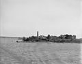
 Frenchman Island Lighthouse 1917.jpg 413 × 637; 169 KB
-

-
 Harper's weekly (1867) (14596315438).jpg 1,864 × 1,204; 614 KB
-
 Hudson River, Mills State Park, Staatsburg NY.jpg 3,264 × 2,448; 2.77 MB
-
 Isaias storm damage in New York City.jpg 2,594 × 2,777; 2.21 MB
-
 Island Street Boatyard Lighthouse - panoramio.jpg 1,828 × 2,573; 2 MB
-
 Lake Champlain, N.Y., Crown Point Light.jpg 4,577 × 3,601; 4.65 MB
-
 Lake Ontario from Rochester, New York.jpg 2,160 × 1,440; 1.85 MB
-
 Light house, Prince's Bay, Staten Island.jpg 704 × 438; 92 KB
-
 Lighthouse in sepia - Flickr - eva101.jpg 3,008 × 2,000; 1.11 MB
-
 Line3967 - Flickr - NOAA Photo Library.jpg 2,112 × 2,816; 1.24 MB
-
 Line4055 - Flickr - NOAA Photo Library.jpg 3,786 × 2,610; 4.64 MB
-
 Long Beach Town of Smithtown Sign & Lighthouse; Nissequogue.jpg 3,648 × 2,736; 2.1 MB
-
 Mayville Lighthouse.jpg 3,904 × 3,456; 696 KB
-
 Model of a lighthouse in New York (Antonio Sciortino), MUŻA, Valletta 001.jpg 2,268 × 3,670; 4.19 MB
-
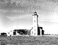
 New York - Shinnecock Bay - NARA - 68145595.jpg 6,998 × 5,452; 16.36 MB
-
 North Elevation-Section - NARA - 86454218.jpg 8,976 × 7,133; 3.46 MB
-
 Northbrother.JPG 438 × 386; 64 KB
-
 NY - Princess Bay - DPLA - 13377820236b053578c6c5613f01e923.jpg 8,977 × 6,644; 29 MB
-
 Light house near Caldwell's Landing (NYPL b12349137-421611).jpg 3,653 × 2,880; 3.38 MB
-

-
 Vanderbilt Tower, New Dorp, Staten Island, N.Y (NYPL b15279351-104867).tiff 1,673 × 2,488; 11.91 MB
-

-
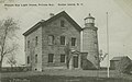
 Princes(sic) Bay Light House, Princes(sic) Bay, Staten Island, N.Y (NYPL b15279351-104875).tiff 2,448 × 1,682; 11.79 MB
-
 Oakorchard.JPG 465 × 308; 34 KB
-
 Pointauroche.JPG 344 × 425; 58 KB
-
 Sackettsharbor.JPG 370 × 322; 53 KB
-
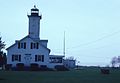
 Shinnecock Light, NY.JPG 282 × 384; 51 KB
-
 StonypointHenderson.JPG 452 × 345; 43 KB
-

.jpg)
.jpg)


_(14596315438).jpg)


,_MU%C5%BBA,_Valletta_001.jpg)


.jpg)


_(14757699811).jpg)