Category:Lilley, Hertfordshire
Aller à la navigation
Aller à la recherche
village britannique  | |||||
| Téléverser des médias | |||||
| Nature de l’élément | |||||
|---|---|---|---|---|---|
| Lieu | North Hertfordshire, Hertfordshire, Angleterre de l'Est, Angleterre | ||||
 | |||||
Sous-catégories
Cette catégorie comprend 2 sous-catégories, dont les 2 ci-dessous.
S
T
Média dans la catégorie « Lilley, Hertfordshire »
Cette catégorie comprend 73 fichiers, dont les 73 ci-dessous.
-
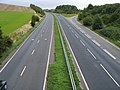 A505 passing Hollybush Hill - geograph.org.uk - 946165.jpg 640 × 480 ; 77 kio
-
 Access to Putteridge from A505 - geograph.org.uk - 393582.jpg 640 × 480 ; 154 kio
-
 Bridleway looking east, Offley - geograph.org.uk - 5320395.jpg 2 000 × 1 500 ; 1,28 Mio
-
 Bridleway looking west, Offley - geograph.org.uk - 5320398.jpg 2 000 × 1 500 ; 1,23 Mio
-
 Bridleway passing an elder tree, Lilley - geograph.org.uk - 6155254.jpg 2 000 × 1 500 ; 970 kio
-
 Bridleway through woodland, Lilley - geograph.org.uk - 5320339.jpg 2 000 × 1 500 ; 1,23 Mio
-
 Bridleway, Offley - geograph.org.uk - 5320401.jpg 2 000 × 1 500 ; 1,2 Mio
-
 Bridleway, Offley - geograph.org.uk - 5320415.jpg 2 000 × 1 500 ; 1,03 Mio
-
 Burnwell Spinneys - geograph.org.uk - 204506.jpg 640 × 397 ; 119 kio
-
 Bus lane, Lilley - geograph.org.uk - 5001358.jpg 2 000 × 1 478 ; 1,01 Mio
-
 Byway on the boundary between Offley and Lilley - geograph.org.uk - 6207514.jpg 2 000 × 1 500 ; 1,12 Mio
-
 Chiltern Way - geograph.org.uk - 2168218.jpg 640 × 480 ; 95 kio
-
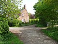
 Cottages near to the church in Lilley - geograph.org.uk - 3368472.jpg 2 560 × 1 920 ; 1,1 Mio
-
 Entrance to Putteridgebury - geograph.org.uk - 393591.jpg 640 × 480 ; 187 kio
-
 Entrance to the Woods at Putteridge Bury - geograph.org.uk - 287207.jpg 640 × 480 ; 98 kio
-
 Farmland and power cables - geograph.org.uk - 3458785.jpg 4 320 × 3 240 ; 5,19 Mio
-
 Farmland, Lilley - geograph.org.uk - 2230286.jpg 640 × 480 ; 168 kio
-
 Field entrance and start of track off Hexton Road, Lilley - geograph.org.uk - 6155273.jpg 2 000 × 1 500 ; 1,09 Mio
-
 Footpath ahead - geograph.org.uk - 1235167.jpg 640 × 480 ; 110 kio
-
 Footpath over the hill, Lilley - geograph.org.uk - 5001367.jpg 2 000 × 1 500 ; 1,42 Mio
-
 Footpath to Lilley - geograph.org.uk - 946107.jpg 640 × 480 ; 66 kio
-
 GOC Wild Beds and Edgy Herts 001 Arriving in Lilley (5618249505).jpg 2 354 × 1 770 ; 1,01 Mio
-
 GOC Wild Beds and Edgy Herts 002 Meeting place (5618837066).jpg 2 640 × 1 980 ; 776 kio
-
 Grazing cattle near Lilley - geograph.org.uk - 4543127.jpg 4 308 × 3 222 ; 5,8 Mio
-
 Hexton Road entering Lilley village - geograph.org.uk - 6155421.jpg 2 000 × 1 500 ; 1,18 Mio
-
 Hexton Road, Lilley - geograph.org.uk - 6155463.jpg 2 000 × 1 500 ; 1,08 Mio
-
 Holly Bush Hill seen from the road bridge over the A505 - geograph.org.uk - 3457397.jpg 4 320 × 3 240 ; 5,35 Mio
-
 Horse Training - geograph.org.uk - 361134.jpg 640 × 387 ; 105 kio
-
 Houses on East Street, Lilley - geograph.org.uk - 5299352.jpg 2 200 × 1 582 ; 1,31 Mio
-
 Houses on Hexton Road, Lilley - geograph.org.uk - 5298330.jpg 1 946 × 1 420 ; 834 kio
-
 Icknield Way north of Lilley, Hertfordshire.jpg 1 843 × 1 382 ; 816 kio
-
 Kingshill Lane, Lilley - geograph.org.uk - 6155472.jpg 2 000 × 1 500 ; 887 kio
-
 Lilley (5580626600).jpg 2 640 × 1 980 ; 668 kio
-
 Lilley - geograph.org.uk - 455767.jpg 640 × 480 ; 92 kio
-
 Lilley Bottom - geograph.org.uk - 5299322.jpg 2 304 × 1 728 ; 1 006 kio
-
 Lilley, East Street and West Street - geograph.org.uk - 202366.jpg 640 × 480 ; 88 kio
-
 Lilleypark Plantation, Lilley - geograph.org.uk - 80946.jpg 640 × 480 ; 92 kio
-
 Looking south from Wards Wood, Lilley - geograph.org.uk - 80950.jpg 640 × 480 ; 72 kio
-
 Lychgate and war memorial, West Street, Lilley - geograph.org.uk - 5001340.jpg 2 000 × 1 500 ; 1,17 Mio
-
 Open Gate - geograph.org.uk - 192594.jpg 640 × 468 ; 161 kio
-

-
 Pond Farm Lilley - geograph.org.uk - 204496.jpg 640 × 477 ; 98 kio
-

-
 Road sign Humps for 1 mile Lilley Hertfordshire 2011-06-17.jpg 3 168 × 3 651 ; 6,92 Mio
-
 St Peter's church, Lilley, from Lilley Bottom - geograph.org.uk - 3532953.jpg 4 320 × 3 240 ; 5,3 Mio
-
 The end of West Street, Lilley - geograph.org.uk - 6155412.jpg 2 000 × 1 500 ; 1,29 Mio
-
 The entrance to Lilley Church Hall - geograph.org.uk - 5298317.jpg 2 304 × 1 728 ; 837 kio
-
 The Icknield Way, Hexton - geograph.org.uk - 6154321.jpg 2 000 × 1 500 ; 982 kio
-
 The Icknield Way, Hexton - Lilley - geograph.org.uk - 6154349.jpg 2 000 × 1 500 ; 1,01 Mio
-
 The Lilley Arms - geograph.org.uk - 3599429.jpg 640 × 478 ; 89 kio
-
 The southern end of West Street, Lilley - geograph.org.uk - 5001349.jpg 2 000 × 1 441 ; 669 kio
-
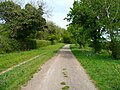
 Track Leading to Lilley Hoo - geograph.org.uk - 455633.jpg 640 × 446 ; 108 kio
-
 Track near Ward's Spring - geograph.org.uk - 3458777.jpg 4 320 × 3 240 ; 2,91 Mio
-
 Track on Lilley Hoo - geograph.org.uk - 5320331.jpg 2 000 × 1 500 ; 972 kio
-
 Wardswood lane approaching Ward's Wood, Lilley - geograph.org.uk - 6154388.jpg 2 000 × 1 500 ; 1,31 Mio
-
 Wardswood Lane passing Ward's Wood, Lilley - geograph.org.uk - 6154405.jpg 2 000 × 1 500 ; 1 024 kio
-
 Wardswood Lane, Lilley - geograph.org.uk - 6154384.jpg 2 000 × 1 500 ; 1,05 Mio
-
 Wardswood Lane, Lilley - geograph.org.uk - 6155403.jpg 2 000 × 1 500 ; 1,43 Mio
-
 Wardswood Lane, Lilley - geograph.org.uk - 80957.jpg 640 × 480 ; 99 kio
-
 West Street Lilley - geograph.org.uk - 946154.jpg 640 × 480 ; 77 kio
-
 An example of land slip - geograph.org.uk - 393726.jpg 640 × 415 ; 182 kio
-
 Downslope looking North on Galley Hill - geograph.org.uk - 390827.jpg 640 × 480 ; 74 kio
-
 Fly tipping near Whitehill Wood - geograph.org.uk - 81067.jpg 480 × 640 ; 177 kio
-
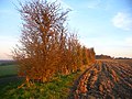 Hedgerow near Warden Hill - geograph.org.uk - 81054.jpg 640 × 480 ; 125 kio
-
 Lilly Bottom Farm - geograph.org.uk - 189754.jpg 640 × 413 ; 149 kio
-

-
 Looking WSW towards Drays Ditches - geograph.org.uk - 390631.jpg 480 × 640 ; 87 kio
-
 Path on top of Warden Hill looking N - geograph.org.uk - 393829.jpg 480 × 640 ; 184 kio
-
 Path to Galley Hill - geograph.org.uk - 390556.jpg 640 × 480 ; 122 kio
-
 South Beds golf course from Galley Hill - geograph.org.uk - 390806.jpg 640 × 480 ; 125 kio
-
 Stopsley, Butterfield Green Road - geograph.org.uk - 295930.jpg 640 × 480 ; 80 kio
-
 The Flints - geograph.org.uk - 189745.jpg 640 × 514 ; 208 kio
-
 Warden Hill from Turnpike Drive - geograph.org.uk - 387784.jpg 640 × 480 ; 76 kio


.jpg)
.jpg)


.jpg)


