Category:Little Barningham
Aller à la navigation
Aller à la recherche
English: Little Barningham is a village and civil parish in the North Norfolk district of Norfolk, England
localité britannique du comté anglais de Norfolk .JPG) | |||||
| Téléverser des médias | |||||
| Nature de l’élément | |||||
|---|---|---|---|---|---|
| Lieu | North Norfolk, Norfolk, Angleterre de l'Est, Angleterre | ||||
| Superficie |
| ||||
| Réputé identique à | Little Barningham (page en doublon, paroisse civile) | ||||
 | |||||
Sous-catégories
Cette catégorie comprend 4 sous-catégories, dont les 4 ci-dessous.
B
L
M
S
Média dans la catégorie « Little Barningham »
Cette catégorie comprend 82 fichiers, dont les 82 ci-dessous.
-
 A line of poplars - geograph.org.uk - 4191801.jpg 640 × 480 ; 163 kio
-
 A line of poplars - geograph.org.uk - 4191836.jpg 640 × 480 ; 173 kio
-
 Acres of peas destined for winter silage - geograph.org.uk - 4600236.jpg 640 × 480 ; 163 kio
-
 Acres of peas destined for winter silage - geograph.org.uk - 4600237.jpg 640 × 480 ; 159 kio
-
 Ancient beech trees - geograph.org.uk - 3663944.jpg 640 × 531 ; 261 kio
-
 Another piece of history gone - geograph.org.uk - 4191820.jpg 640 × 480 ; 184 kio
-
 Barningham Green Farm (farmhouse) - geograph.org.uk - 3663972.jpg 640 × 512 ; 186 kio
-
 Barningham Green Farm (farmhouse) - geograph.org.uk - 3663974.jpg 640 × 480 ; 154 kio
-
 Barningham Green Plantation - geograph.org.uk - 3663941.jpg 640 × 480 ; 279 kio
-
 Barningham Green Plantation - geograph.org.uk - 3663955.jpg 640 × 480 ; 272 kio
-
 Bracken and conifers - geograph.org.uk - 3663940.jpg 480 × 640 ; 283 kio
-
 Bridleway through Barningham Green Plantation - geograph.org.uk - 3663935.jpg 640 × 439 ; 271 kio
-
 Bridleway through Barningham Green Plantation - geograph.org.uk - 3663939.jpg 640 × 428 ; 251 kio
-
 Bus shelter, Little Barningham - geograph.org.uk - 3663993.jpg 640 × 480 ; 168 kio
-
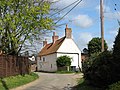 Cottage in Little Barningham - geograph.org.uk - 3938158.jpg 640 × 480 ; 193 kio
-
 Cottages in Little Barningham - geograph.org.uk - 3663989.jpg 640 × 480 ; 160 kio
-
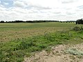
 Crop fields by Little Barningham village - geograph.org.uk - 4191806.jpg 640 × 480 ; 235 kio
-
 Cross roads, Little Barningham - geograph.org.uk - 3663995.jpg 640 × 480 ; 151 kio
-
 Cultivated field by Little Barningham - geograph.org.uk - 3938181.jpg 640 × 358 ; 117 kio
-

-
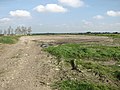
 Farm track skirting Barningham Green Plantation - geograph.org.uk - 3663928.jpg 640 × 480 ; 241 kio
-
 Fields by Richmond Cottage, Barningham Green - geograph.org.uk - 3663966.jpg 640 × 422 ; 130 kio
-
 Fields by Squallham - geograph.org.uk - 3937639.jpg 640 × 480 ; 185 kio
-
 Flowering oilseed rape crop by Little Barningham - geograph.org.uk - 3938176.jpg 640 × 480 ; 162 kio
-
 Footpath past WW2 remains - geograph.org.uk - 4191814.jpg 640 × 480 ; 155 kio
-
 Footpath south of Barningham Green Plantation - geograph.org.uk - 3663947.jpg 640 × 480 ; 187 kio
-
 Footpath through fields - geograph.org.uk - 4191800.jpg 640 × 480 ; 191 kio
-
 Footpath to Underwoods - geograph.org.uk - 3663926.jpg 640 × 445 ; 201 kio
-
 Free range pigs by Barningham Green Plantation - geograph.org.uk - 3663933.jpg 640 × 480 ; 167 kio
-
 Lane past Barningham Green Plantation - geograph.org.uk - 3663929.jpg 640 × 480 ; 245 kio
-
 Lane to Little Barningham - geograph.org.uk - 5610834.jpg 1 600 × 1 200 ; 317 kio
-
 Laurel Farm - farmhouse - geograph.org.uk - 3938163.jpg 640 × 470 ; 174 kio
-
 Little Barningham - geograph.org.uk - 3938156.jpg 640 × 610 ; 231 kio
-
 Little Barningham St Andrew's church - geograph.org.uk - 2261802.jpg 640 × 480 ; 99 kio
-
 Little Barningham village hall - geograph.org.uk - 4600167.jpg 640 × 480 ; 136 kio
-
 Little Barningham village hall beside The Street - geograph.org.uk - 4600170.jpg 640 × 480 ; 175 kio
-
 Little Barningham War Memorial - geograph.org.uk - 4600968.jpg 3 456 × 2 592 ; 3,86 Mio
-
 Little Wood, Barningham Green - geograph.org.uk - 3663912.jpg 640 × 480 ; 290 kio
-
 Minor road past Little Wood - geograph.org.uk - 3663920.jpg 640 × 430 ; 221 kio
-
 Oilseed rape crop by Little Barningham - geograph.org.uk - 3938179.jpg 640 × 480 ; 177 kio
-
 Open fields opposite Broom Covert - geograph.org.uk - 3938187.jpg 640 × 480 ; 55 kio
-
 Ordnance Survey Cut Mark - geograph.org.uk - 4561363.jpg 4 000 × 3 000 ; 4,61 Mio
-
 Pond by Barningham Green Farm - geograph.org.uk - 3663979.jpg 640 × 480 ; 193 kio
-
 Private road into Birch Hole Plantation - geograph.org.uk - 543458.jpg 480 × 640 ; 103 kio
-
 Remains of a WW2 fighter pen - geograph.org.uk - 4191826.jpg 640 × 530 ; 197 kio
-

-
 Seat at Dog Corner, Little Barningham - geograph.org.uk - 3663991.jpg 640 × 419 ; 177 kio
-
 Sheds at Barningham Green Farm - geograph.org.uk - 3663976.jpg 640 × 480 ; 140 kio
-
 Sheds at Barningham Green Farm - geograph.org.uk - 3663978.jpg 640 × 446 ; 131 kio
-
 Stubble by Richmond Cottage - geograph.org.uk - 3663964.jpg 640 × 480 ; 178 kio
-
 Stubble field east of Birch Hole Plantation - geograph.org.uk - 3663961.jpg 640 × 431 ; 144 kio
-
 Sugar beet crop by Little Barningham - geograph.org.uk - 3663983.jpg 640 × 480 ; 249 kio
-
 The Church of St Andrew at Little Barningham - geograph.org.uk - 4561364.jpg 4 000 × 3 000 ; 2,7 Mio
-
 The old perimeter track - geograph.org.uk - 4191804.jpg 640 × 480 ; 190 kio
-
 The southern edge of Barningham Green Plantation - geograph.org.uk - 3663949.jpg 480 × 640 ; 229 kio
-
 The Street in Little Barningham - geograph.org.uk - 543356.jpg 480 × 640 ; 43 kio
-
 This way to Barningham Green - geograph.org.uk - 3663922.jpg 640 × 480 ; 220 kio
-
 Through Barningham Green Plantation - geograph.org.uk - 3663930.jpg 640 × 433 ; 230 kio
-
 To Edgefield past Little Wood - geograph.org.uk - 3663924.jpg 640 × 432 ; 204 kio
-
 Track through the trees at Broom Covert - geograph.org.uk - 3938184.jpg 640 × 480 ; 120 kio
-
 Track to Birch Hole Plantation - geograph.org.uk - 876129.jpg 640 × 458 ; 121 kio
-
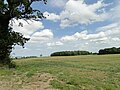
 Undulating fields east of Little Barningham - geograph.org.uk - 4191807.jpg 640 × 480 ; 223 kio
-

-

-
 View north across harvested field - geograph.org.uk - 543482.jpg 640 × 480 ; 70 kio
-
 View south into Barningham Green Plantation - geograph.org.uk - 543469.jpg 480 × 640 ; 126 kio
-
 View west on The Street in Little Barningham - geograph.org.uk - 543364.jpg 480 × 640 ; 49 kio
-
 Village Hall, Little Barningham - geograph.org.uk - 3938120.jpg 640 × 480 ; 70 kio
-
 Wheat crop by Watery Lane Plantation - geograph.org.uk - 3937637.jpg 640 × 480 ; 158 kio
-
 WW2 remains - geograph.org.uk - 4191817.jpg 640 × 480 ; 170 kio
-
 A brand-new farm shed - geograph.org.uk - 878410.jpg 640 × 447 ; 102 kio
-
 Entrance to Laurel Farm - geograph.org.uk - 543371.jpg 480 × 640 ; 77 kio
-
 Entrance to Mere Farm - geograph.org.uk - 543349.jpg 480 × 640 ; 66 kio
-
 Farmland near Squallham - geograph.org.uk - 512550.jpg 480 × 640 ; 98 kio
-
 Ferndale Farm in Little Barningham - geograph.org.uk - 543360.jpg 640 × 480 ; 86 kio
-
 Mere Farm - geograph.org.uk - 543351.jpg 640 × 480 ; 83 kio
-
 On the road to Wickmere - geograph.org.uk - 512548.jpg 640 × 480 ; 66 kio
-
 Private road and public footpath - geograph.org.uk - 543318.jpg 640 × 480 ; 73 kio
-
 Southwest past Mere Farm - geograph.org.uk - 543345.jpg 640 × 480 ; 61 kio
-
 Sugar beet waiting to be harvested - geograph.org.uk - 544839.jpg 640 × 480 ; 86 kio
-
 The Old Smithy - geograph.org.uk - 291448.jpg 640 × 480 ; 61 kio
-
 Wetland near Mannington Hall - geograph.org.uk - 279395.jpg 640 × 480 ; 170 kio


_-_geograph.org.uk_-_3663972.jpg)
_-_geograph.org.uk_-_3663974.jpg)


