Category:Little Burstead
Aller à la navigation
Aller à la recherche
village britannique  | |||||
| Téléverser des médias | |||||
| Nature de l’élément | |||||
|---|---|---|---|---|---|
| Lieu | Basildon, Essex, Angleterre de l'Est, Angleterre | ||||
 | |||||
Sous-catégories
Cette catégorie comprend 2 sous-catégories, dont les 2 ci-dessous.
Média dans la catégorie « Little Burstead »
Cette catégorie comprend 211 fichiers, dont les 200 ci-dessous.
(page précédente) (page suivante)-
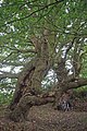 A Pair of Pollards - geograph.org.uk - 1672205.jpg 428 × 640 ; 101 kio
-
 Across Laindon Common - geograph.org.uk - 2115972.jpg 640 × 428 ; 102 kio
-
 An old barn at Botney Hill Farm - geograph.org.uk - 749245.jpg 640 × 480 ; 92 kio
-
 Angel in the Graveyard, St. Mary's Little Burstead - geograph.org.uk - 6149916.jpg 3 648 × 2 255 ; 3,57 Mio
-
 Approach to Little Burstead - geograph.org.uk - 3591764.jpg 640 × 394 ; 45 kio
-
 Arable Land near Wiggin's Lane, Little Burstead - geograph.org.uk - 6162773.jpg 3 648 × 2 736 ; 4,42 Mio
-
 Arable Land, Little Burstead - geograph.org.uk - 6149913.jpg 3 648 × 2 736 ; 3,27 Mio
-
 Barn on Sudburys Farm Road - geograph.org.uk - 6320001.jpg 1 024 × 768 ; 268 kio
-
 Barns, Broomhills Farm - geograph.org.uk - 3437035.jpg 640 × 480 ; 99 kio
-
 Barns, Broomhills Farm - geograph.org.uk - 6317160.jpg 1 024 × 684 ; 219 kio
-
 Blackthorn by football pitches - geograph.org.uk - 6316684.jpg 1 024 × 768 ; 367 kio
-
 Blind Lane - geograph.org.uk - 3437225.jpg 640 × 480 ; 166 kio
-
 Blind Lane at Long Shaw - geograph.org.uk - 4518845.jpg 3 072 × 1 728 ; 2,24 Mio
-
 Blossom on Laindon Common Road - geograph.org.uk - 5350120.jpg 4 000 × 3 000 ; 4,72 Mio
-
 Boot sale field, Dunton Wayletts - geograph.org.uk - 6318040.jpg 1 024 × 768 ; 246 kio
-
 Botney Hill Farm - geograph.org.uk - 2653501.jpg 640 × 426 ; 81 kio
-
 Botney Hill Farm, Little Burstead - geograph.org.uk - 6163980.jpg 1 920 × 1 280 ; 1,49 Mio
-
 Botney Hill Farm, Little Burstead - geograph.org.uk - 6163981.jpg 1 870 × 1 202 ; 1,11 Mio
-
 Botney Hill Road eastwards - geograph.org.uk - 3591743.jpg 640 × 513 ; 67 kio
-

-

-
 Botney Hill Road westwards - geograph.org.uk - 3591744.jpg 640 × 481 ; 68 kio
-
 Botney Hill Road, Little Burstead - geograph.org.uk - 6162604.jpg 1 920 × 1 280 ; 1,79 Mio
-
 Botney Hill Road, Little Burstead - geograph.org.uk - 6162606.jpg 1 920 × 1 280 ; 1,99 Mio
-
 Botney Hill Road, Little Burstead - geograph.org.uk - 6166497.jpg 1 920 × 1 280 ; 1,35 Mio
-
 Botney Hill Road, Little Burstead - geograph.org.uk - 6166499.jpg 1 848 × 1 162 ; 1,85 Mio
-
 Bridleway towards Laindon Common - geograph.org.uk - 6320070.jpg 1 024 × 768 ; 545 kio
-
 Bridleway towards Laindon Common - geograph.org.uk - 6320074.jpg 1 024 × 768 ; 518 kio
-
 Bridleway towards Laindon Common - geograph.org.uk - 6320086.jpg 1 024 × 768 ; 539 kio
-
 Brook towards the River Wid - geograph.org.uk - 6319911.jpg 1 024 × 768 ; 378 kio
-
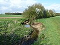 Brook towards the River Wid - geograph.org.uk - 6319968.jpg 1 024 × 768 ; 378 kio
-
 Burstead Farm shop - geograph.org.uk - 5537057.jpg 5 202 × 3 465 ; 3,34 Mio
-
 Byway north from Dunton Wayletts - geograph.org.uk - 6318400.jpg 1 024 × 768 ; 549 kio
-
 Byway north from Dunton Wayletts - geograph.org.uk - 6318422.jpg 1 024 × 768 ; 515 kio
-
 Byway north from Dunton Wayletts - geograph.org.uk - 6318430.jpg 1 024 × 768 ; 447 kio
-
 Byway north from Dunton Wayletts - geograph.org.uk - 6318443.jpg 1 024 × 768 ; 489 kio
-
 Byway north from Dunton Wayletts - geograph.org.uk - 6318462.jpg 1 024 × 768 ; 479 kio
-
 Byway north from Dunton Wayletts - geograph.org.uk - 6318483.jpg 1 024 × 768 ; 505 kio
-
 Byway south to Dunton Wayletts - geograph.org.uk - 6318470.jpg 768 × 1 024 ; 483 kio
-

-
 Close up, Elizabeth II postbox on Lower Dunton Road - geograph.org.uk - 6151762.jpg 2 247 × 4 082 ; 1,33 Mio
-
 Crouch Confluence - geograph.org.uk - 3053435.jpg 429 × 640 ; 80 kio
-
 Curious cattle - geograph.org.uk - 3437166.jpg 640 × 480 ; 165 kio
-
 Dead Trees Near Noak Hill - geograph.org.uk - 3053451.jpg 429 × 640 ; 93 kio
-
 Derelict looking glasshouse near Elmshaw's Farm - geograph.org.uk - 5537066.jpg 5 202 × 3 465 ; 4,16 Mio
-
 Derelict stableyard - geograph.org.uk - 3591765.jpg 640 × 421 ; 53 kio
-
 Ditch cleaning near Carvers Farm - geograph.org.uk - 6317661.jpg 1 024 × 768 ; 388 kio
-
 Ditch ^ Dunton Research Centre - geograph.org.uk - 3048766.jpg 429 × 640 ; 78 kio
-
 Ditch ^ Great Willow Herb - geograph.org.uk - 3048785.jpg 428 × 640 ; 78 kio
-
 Divided Trotterpaths^ - geograph.org.uk - 2115957.jpg 640 × 428 ; 114 kio
-
 Dried Up Crouch - geograph.org.uk - 2115903.jpg 428 × 640 ; 115 kio
-
 Dukes Head, Little Burstead - geograph.org.uk - 4521586.jpg 3 072 × 1 728 ; 1,33 Mio
-
 Electric Grid - geograph.org.uk - 2135719.jpg 1 024 × 694 ; 193 kio
-
 Elizabeth II postbox on Lower Dunton Road - geograph.org.uk - 6151759.jpg 3 928 × 3 283 ; 2,4 Mio
-
 End of Byway 45 - geograph.org.uk - 1672323.jpg 428 × 640 ; 82 kio
-
 Field edge running south from Sudburys Farm Road - geograph.org.uk - 6320026.jpg 1 024 × 768 ; 429 kio
-
 Field in Little Burstead - geograph.org.uk - 6162596.jpg 1 920 × 1 280 ; 1,53 Mio
-
 Field in Little Burstead - geograph.org.uk - 6162598.jpg 1 920 × 1 280 ; 1,33 Mio
-
 Field with Pylons - geograph.org.uk - 2135720.jpg 1 024 × 720 ; 173 kio
-
 Fields south of Botney Hill Road - geograph.org.uk - 3591745.jpg 640 × 481 ; 39 kio
-
 Fingerpost sign - geograph.org.uk - 2214131.jpg 1 500 × 2 000 ; 1,33 Mio
-
 Footbridge on footpath towards Little Burstead church - geograph.org.uk - 6317382.jpg 1 024 × 768 ; 377 kio
-
 Footbridge on footpath towards Little Burstead church - geograph.org.uk - 6317817.jpg 1 024 × 768 ; 498 kio
-
 Footbridge over ditch, Little Burstead - geograph.org.uk - 6316998.jpg 1 024 × 768 ; 508 kio
-
 Footpath across River Crouch - geograph.org.uk - 3436978.jpg 640 × 480 ; 196 kio
-
 Footpath across River Crouch - geograph.org.uk - 6316751.jpg 1 024 × 768 ; 583 kio
-

-
 Footpath at Apple Blossom Time - geograph.org.uk - 4458378.jpg 424 × 640 ; 125 kio
-
 Footpath in valley of River Crouch - geograph.org.uk - 6316741.jpg 1 024 × 768 ; 555 kio
-
 Footpath Near Carvers Farm - geograph.org.uk - 3048723.jpg 429 × 640 ; 82 kio
-
 Footpath Nearing Noak Hill - geograph.org.uk - 3053460.jpg 640 × 429 ; 85 kio
-
 Footpath on Field Boundary, Near Sudbury's Farm, Little Burstead - geograph.org.uk - 6135437.jpg 3 648 × 2 736 ; 4,3 Mio
-
 Footpath running north from Sudbury's Farm - geograph.org.uk - 6319987.jpg 1 024 × 768 ; 405 kio
-

-
 Footpath south from Botney Hill Road - geograph.org.uk - 3591714.jpg 640 × 466 ; 46 kio
-
 Footpath through Arable Land near Little Burstead Church - geograph.org.uk - 6149911.jpg 3 648 × 2 255 ; 3,15 Mio
-
 Footpath to Broomhill Chase, Little Burstead - geograph.org.uk - 6316925.jpg 1 024 × 768 ; 568 kio
-
 Footpath to Dunton Road - geograph.org.uk - 3048702.jpg 429 × 640 ; 83 kio
-
 Footpath to Dunton Road - geograph.org.uk - 3053446.jpg 640 × 429 ; 84 kio
-
 Footpath to Little Blayden's Wood - geograph.org.uk - 4458402.jpg 640 × 424 ; 107 kio
-
 Footpath to Little Burstead - geograph.org.uk - 3591731.jpg 640 × 491 ; 73 kio
-
 Footpath to Little Burstead - geograph.org.uk - 3591767.jpg 640 × 502 ; 35 kio
-
 Footpath to the church and Carvers Farm - geograph.org.uk - 3591748.jpg 640 × 445 ; 32 kio
-
 Footpath towards Carvers Farm - geograph.org.uk - 3591732.jpg 640 × 483 ; 40 kio
-
 Footpath towards Little Burstead church - geograph.org.uk - 6317375.jpg 1 024 × 768 ; 339 kio
-

-
 Ford Research Centre from New Road - geograph.org.uk - 3591725.jpg 640 × 456 ; 41 kio
-
 Forgotten Footbridge - geograph.org.uk - 3048748.jpg 429 × 640 ; 88 kio
-
 Frith Wood - geograph.org.uk - 3315022.jpg 2 000 × 3 008 ; 2,3 Mio
-
 Frith Wood - geograph.org.uk - 3437495.jpg 640 × 480 ; 211 kio
-
 Frith Wood - geograph.org.uk - 6320058.jpg 1 024 × 768 ; 556 kio
-
 From small beginnings - geograph.org.uk - 3258224.jpg 1 500 × 2 000 ; 2,91 Mio
-
 Gate to Viva Place, Billericay - geograph.org.uk - 5536994.jpg 5 202 × 3 465 ; 3,64 Mio
-
 Grassland west of Lower Dunton Road - geograph.org.uk - 6151667.jpg 800 × 600 ; 91 kio
-
 Green Lane (Byway), Little Burstead - geograph.org.uk - 6135413.jpg 3 648 × 2 736 ; 4,49 Mio
-
 Guinea fowl in a field - geograph.org.uk - 5350292.jpg 4 000 × 3 000 ; 4,75 Mio
-
 Hatches Farm Road passes Jobbers - geograph.org.uk - 3591719.jpg 640 × 469 ; 51 kio
-
 Hatches Farm Road sign - geograph.org.uk - 3591716.jpg 554 × 640 ; 106 kio
-
 Hatches Farm Road-Botney Hill Road junction - geograph.org.uk - 3591715.jpg 640 × 474 ; 50 kio
-
 Hatches Farm Road-Tye Common Road junction - geograph.org.uk - 3591749.jpg 640 × 453 ; 49 kio
-
 Heading for the Crouch - geograph.org.uk - 3053424.jpg 429 × 640 ; 87 kio
-
 Hedgerow east of Green Lane - geograph.org.uk - 6318453.jpg 1 024 × 768 ; 278 kio
-
 Hedgerow east of Green Lane - geograph.org.uk - 6318477.jpg 1 024 × 768 ; 301 kio
-
 Hedgerow trees - geograph.org.uk - 6318449.jpg 1 024 × 768 ; 295 kio
-
 Hedgerow trees - geograph.org.uk - 6320081.jpg 1 024 × 768 ; 329 kio
-

-
 Jobbers sign - geograph.org.uk - 3591720.jpg 640 × 413 ; 32 kio
-
 Laindon Common - geograph.org.uk - 2115927.jpg 640 × 428 ; 112 kio
-
 Laindon Common - geograph.org.uk - 3252898.jpg 2 000 × 1 500 ; 3,61 Mio
-
 Laindon Common - geograph.org.uk - 6149921.jpg 2 736 × 2 736 ; 5,28 Mio
-
 Laindon Common Fungi - geograph.org.uk - 2116007.jpg 428 × 640 ; 74 kio
-
 Land near Carvers Farm - geograph.org.uk - 6317806.jpg 1 024 × 768 ; 409 kio
-
 Little Burstead - geograph.org.uk - 2653490.jpg 640 × 426 ; 121 kio
-
 Little Burstead - geograph.org.uk - 3591750.jpg 640 × 468 ; 39 kio
-
 Little Burstead Common - geograph.org.uk - 6149918.jpg 2 736 × 2 736 ; 5,04 Mio
-
 Little Burstead to Dunton - geograph.org.uk - 3048691.jpg 640 × 429 ; 70 kio
-
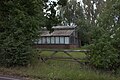
 Little Burstead Village Hall - geograph.org.uk - 3437000.jpg 640 × 480 ; 117 kio
-
 Little Bursted Golf Course - geograph.org.uk - 1672186.jpg 640 × 428 ; 58 kio
-
 Little used footpath - geograph.org.uk - 6317002.jpg 1 024 × 768 ; 288 kio
-
 Lower Dunton Road towards the A127 - geograph.org.uk - 6151669.jpg 800 × 600 ; 140 kio
-
 Marker post for circular walk - geograph.org.uk - 3591717.jpg 640 × 496 ; 93 kio
-
 New Road - geograph.org.uk - 3591768.jpg 640 × 472 ; 53 kio
-
 New Road - geograph.org.uk - 3591769.jpg 640 × 485 ; 55 kio
-
 New Road sign - geograph.org.uk - 3591771.jpg 640 × 454 ; 25 kio
-
 New Road towards Rectory Road - geograph.org.uk - 3591772.jpg 640 × 477 ; 47 kio
-
 New Road-Rectory Road junction - geograph.org.uk - 3591770.jpg 640 × 493 ; 66 kio
-
 Path on Laindon Common - geograph.org.uk - 5350089.jpg 4 000 × 3 000 ; 4,94 Mio
-
 Path on Laindon Common - geograph.org.uk - 5350131.jpg 4 000 × 3 000 ; 5 Mio
-
 Path through a field in Little Burstead - geograph.org.uk - 6162584.jpg 1 920 × 1 280 ; 1,55 Mio
-
 Path, Laindon Common - geograph.org.uk - 6316677.jpg 1 024 × 768 ; 578 kio
-
 Path, Laindon Common - geograph.org.uk - 6316679.jpg 1 024 × 768 ; 577 kio
-
 Public Footpath 20 to Babshole Farm - geograph.org.uk - 3591751.jpg 640 × 464 ; 78 kio
-
 Public footpath to Dunton Road - geograph.org.uk - 3591773.jpg 640 × 481 ; 49 kio
-
 Pylon, Dunton Plotlands - geograph.org.uk - 3804882.jpg 640 × 430 ; 41 kio
-
 Pylon, Dunton plotlands - geograph.org.uk - 4441550.jpg 640 × 430 ; 30 kio
-
 Rail Power - geograph.org.uk - 51782.jpg 640 × 482 ; 84 kio
-
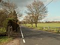
 Rectory Road northwards - geograph.org.uk - 3591734.jpg 640 × 478 ; 57 kio
-

-
 Rectory Road southwards - geograph.org.uk - 3591735.jpg 640 × 480 ; 51 kio
-
 Rectory Road southwards - geograph.org.uk - 3591752.jpg 640 × 493 ; 44 kio
-
 Rectory Road, leading to Little Burstead - geograph.org.uk - 749215.jpg 640 × 480 ; 87 kio
-
 Rectory Road, Little Burstead - geograph.org.uk - 6163976.jpg 1 864 × 1 190 ; 1,21 Mio
-
 Rectory Road, Little Burstead - geograph.org.uk - 6163978.jpg 1 920 × 1 280 ; 1,78 Mio
-
 Rectory Road, Little Burstead - geograph.org.uk - 6163979.jpg 1 920 × 1 280 ; 1,74 Mio
-
 River Crouch - Parish Boundary of Little Burstead - geograph.org.uk - 6149900.jpg 2 736 × 3 648 ; 4,16 Mio
-
 River Crouch near Noak Hill - geograph.org.uk - 5350271.jpg 4 000 × 3 000 ; 5,06 Mio
-
 River Crouch near Noak Hill - geograph.org.uk - 5350281.jpg 4 000 × 3 000 ; 4,71 Mio
-
 Road entrance to Langdon Visitor Centre, Essex Wildlife Trust - geograph.org.uk - 3333728.jpg 3 032 × 2 274 ; 2,53 Mio
-
 Rushy field with sheep - geograph.org.uk - 3437142.jpg 640 × 480 ; 104 kio
-
 Rushy field with sheep - geograph.org.uk - 6318411.jpg 1 024 × 768 ; 261 kio
-
 Salmon's Farm - geograph.org.uk - 3437478.jpg 640 × 480 ; 117 kio
-
 Salmon's Farm, Billericay - geograph.org.uk - 5537046.jpg 5 202 × 3 465 ; 2,82 Mio
-
 Scene in Little Burstead - geograph.org.uk - 5350153.jpg 4 000 × 3 000 ; 4,55 Mio
-
 Sheep Pasture, Little Burstead - geograph.org.uk - 6135350.jpg 3 648 × 2 255 ; 2,14 Mio
-
 Sign for Langdon Visitor Centre - geograph.org.uk - 3197216.jpg 640 × 480 ; 128 kio
-

-
 Signpost at the junction of Blind Lane and Sudbury's Farm Ln - geograph.org.uk - 5537000.jpg 5 202 × 3 465 ; 3,87 Mio
-
 Signs on New Road - geograph.org.uk - 3591775.jpg 640 × 565 ; 108 kio
-
 Small cabinet off Sudburys Farm Road - geograph.org.uk - 6320022.jpg 1 024 × 768 ; 542 kio
-
 Solar farm off Lower Dunton Road - geograph.org.uk - 6151671.jpg 800 × 600 ; 109 kio
-
 St Mary The Virgin Little Burstead - geograph.org.uk - 3048675.jpg 429 × 640 ; 79 kio
-

-
 St Mary's Church, Little Burstead - geograph.org.uk - 5349944.jpg 4 000 × 3 000 ; 4,82 Mio
-
 St Mary's Church, Little Burstead - geograph.org.uk - 5349946.jpg 4 000 × 3 000 ; 4,8 Mio
-
 St. Mary the Virgin, Little Burstead - geograph.org.uk - 6317339.jpg 1 024 × 768 ; 317 kio
-
 St. Mary the Virgin, Little Burstead - geograph.org.uk - 6317348.jpg 768 × 1 024 ; 416 kio
-
 Stile Near Sudbury's Farm - geograph.org.uk - 4458420.jpg 640 × 424 ; 103 kio
-
 Stream Near Larkins Farm - geograph.org.uk - 3053411.jpg 429 × 640 ; 109 kio
-
 Stump in boundary hedgerow - geograph.org.uk - 3315010.jpg 3 008 × 2 000 ; 2,92 Mio
-
 Sudbury's Farm - geograph.org.uk - 5537012.jpg 5 202 × 3 465 ; 3,77 Mio
-
 Sudbury's Farm Road - geograph.org.uk - 5537017.jpg 5 202 × 3 465 ; 3,93 Mio
-
 Sudbury's Farm Road, Little Burstead - geograph.org.uk - 6135443.jpg 3 648 × 2 255 ; 2,81 Mio
-
 Sudburys Farm Road - geograph.org.uk - 6319996.jpg 1 024 × 768 ; 375 kio
-
 Sudburys Farm Road - geograph.org.uk - 6320007.jpg 1 024 × 768 ; 299 kio
-
 The end of Frithwood Lane - geograph.org.uk - 6320046.jpg 1 024 × 768 ; 531 kio
-
 The end of Frithwood Lane - geograph.org.uk - 6320052.jpg 1 024 × 768 ; 491 kio
-
 The entrance to Little Burstead - geograph.org.uk - 5350188.jpg 4 000 × 3 000 ; 4,48 Mio
-
 The former school at Little Burstead - geograph.org.uk - 5350173.jpg 4 000 × 3 000 ; 4,58 Mio
-
 The grave of John Ismay French amidst others - geograph.org.uk - 3591740.jpg 640 × 442 ; 47 kio
-
 The grave of Percival Alfred Fothergill - geograph.org.uk - 3591741.jpg 640 × 580 ; 102 kio
-
 The Old School, Little Burstead - geograph.org.uk - 6316972.jpg 1 024 × 684 ; 301 kio
-
 The Rectory at Little Burstead - geograph.org.uk - 3591753.jpg 640 × 538 ; 69 kio
-
 The Rectory sign at Little Burstead - geograph.org.uk - 3591754.jpg 640 × 518 ; 85 kio
-
 The River Crouch, Near Noak Hill - geograph.org.uk - 3053444.jpg 429 × 640 ; 96 kio
-
 The war memorial at Little Burstead - geograph.org.uk - 5350144.jpg 4 000 × 3 000 ; 4,98 Mio
-
 The war memorial at Little Burstead - geograph.org.uk - 6162575.jpg 1 900 × 1 250 ; 1,6 Mio
-
 To St Mary the Virgin Little Burstead - geograph.org.uk - 3591742.jpg 640 × 446 ; 64 kio
-
 Tracks near Babshole Farm - geograph.org.uk - 4518848.jpg 3 072 × 1 728 ; 1,89 Mio
-
 Tractor tracks in the crop - geograph.org.uk - 3437456.jpg 640 × 480 ; 103 kio
-
 Tree between fields, Little Burstead - geograph.org.uk - 6317152.jpg 1 024 × 768 ; 299 kio
-
 Tree on Field Boundary, Little Burstead - geograph.org.uk - 6149908.jpg 3 374 × 2 085 ; 2,97 Mio
-
 Trees on Laindon Common - geograph.org.uk - 3314989.jpg 2 000 × 3 008 ; 2,77 Mio
-
 Tye Common Road - geograph.org.uk - 3251787.jpg 1 000 × 750 ; 176 kio
-
 Unnecessary and unsafe footbridge - geograph.org.uk - 6319903.jpg 1 024 × 768 ; 455 kio
-
 View SE from near Broomhills Farm - geograph.org.uk - 6317173.jpg 1 024 × 768 ; 233 kio
-

-
 View towards Great Burstead - geograph.org.uk - 2653479.jpg 426 × 640 ; 45 kio
-
 View towards James's Wood - geograph.org.uk - 6319978.jpg 1 024 × 768 ; 267 kio
-
 War memorial, Little Burstead - geograph.org.uk - 6316960.jpg 1 024 × 768 ; 285 kio
-
 Wheatsheaf Cottage, Little Burstead - geograph.org.uk - 6316955.jpg 1 024 × 684 ; 280 kio


,_Little_Burstead_-_geograph.org.uk_-_6135413.jpg)


