Category:Little Coxwell
Aller à la navigation
Aller à la recherche
localité britannique du comté anglais d'Oxfordshire  | |||||
| Téléverser des médias | |||||
| Nature de l’élément | |||||
|---|---|---|---|---|---|
| Lieu | Vale of White Horse, Oxfordshire, Angleterre du Sud-Est, Angleterre | ||||
| Population |
| ||||
| site officiel | |||||
 | |||||
English: Little Coxwell is a small village and civil parish in Oxfordshire, England, about east of the larger village of Great Coxwell. In 1974 it was transferred from Berkshire.
Sous-catégories
Cette catégorie comprend seulement la sous-catégorie ci-dessous.
L
Média dans la catégorie « Little Coxwell »
Cette catégorie comprend 38 fichiers, dont les 38 ci-dessous.
-
 Cyclist leaving Little Coxwell - geograph.org.uk - 6567682.jpg 640 × 480 ; 49 kio
-

-
 Disused Telephone Exchange - geograph.org.uk - 306553.jpg 640 × 480 ; 103 kio
-
 Eagle Tavern, Little Coxwell - geograph.org.uk - 4191949.jpg 640 × 480 ; 96 kio
-
 End of the track, Little Coxwell - geograph.org.uk - 5276328.jpg 3 246 × 2 604 ; 1,47 Mio
-
 Fernham Road by Gorse Farm - geograph.org.uk - 4218563.jpg 1 500 × 999 ; 211 kio
-
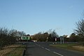 Fernham road meets the A420 - geograph.org.uk - 1125538.jpg 640 × 427 ; 39 kio
-
 Footpath to Little Coxwell - geograph.org.uk - 4218555.jpg 1 500 × 999 ; 408 kio
-
 Former chapel in Little Coxwell - geograph.org.uk - 6567656.jpg 640 × 480 ; 72 kio
-
 Eagle Tavern, Little Coxwell - geograph.org.uk - 1125361.jpg 640 × 427 ; 63 kio
-
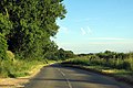
 Leaving Little Coxwell - geograph.org.uk - 1125517.jpg 640 × 427 ; 112 kio
-
 Little Coxwell by Andrew Smith.jpg 640 × 480 ; 130 kio
-
 Little Coxwell Village Pump - geograph.org.uk - 5275891.jpg 1 925 × 3 137 ; 1,32 Mio
-
 Lower Coxwell Camp hillfort, Onetree Hill - geograph.org.uk - 6194164.jpg 4 000 × 3 000 ; 4,76 Mio
-
 Lower Coxwell Camp hillfort, Onetree Hill - geograph.org.uk - 6194168.jpg 4 000 × 3 000 ; 5,11 Mio
-
 Manor Farm, Little Coxwell - geograph.org.uk - 6194178.jpg 4 000 × 3 000 ; 4,92 Mio
-
 No Way Out This Way - geograph.org.uk - 5276299.jpg 3 648 × 2 736 ; 2,62 Mio
-
 Phone box in Lower Coxwell - geograph.org.uk - 6567653.jpg 640 × 480 ; 59 kio
-
 Phone, Pump and Post Box, Little Coxwell - geograph.org.uk - 5275885.jpg 3 570 × 2 730 ; 1,51 Mio
-
 Pond at Little Coxwell - geograph.org.uk - 1125337.jpg 640 × 427 ; 121 kio
-
 Rural road to Fernham - geograph.org.uk - 4218568.jpg 1 500 × 999 ; 145 kio
-
 Rural road to Fernham - geograph.org.uk - 4218571.jpg 1 500 × 999 ; 202 kio
-
 St Mary, Little Coxwell, churchyard (a) - geograph.org.uk - 6567672.jpg 640 × 480 ; 119 kio
-
 St Mary, Little Coxwell, churchyard (b) - geograph.org.uk - 6567674.jpg 640 × 480 ; 126 kio
-
 St Mary, Little Coxwell, churchyard (b) - geograph.org.uk - 6567678.jpg 640 × 480 ; 73 kio
-
 St Mary, Little Coxwell, churchyard (c) - geograph.org.uk - 6567680.jpg 640 × 480 ; 101 kio
-
 St Mary, Little Coxwell, early August 2020 - geograph.org.uk - 6563004.jpg 640 × 480 ; 115 kio
-
 St Mary, Little Coxwell, lych gate - geograph.org.uk - 6567663.jpg 640 × 480 ; 103 kio
-
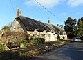 Thatched Terrace, Little Coxwell - geograph.org.uk - 5275897.jpg 3 514 × 2 546 ; 1,73 Mio
-
 The A420 passes the former Plough public house - geograph.org.uk - 4199293.jpg 1 500 × 999 ; 132 kio
-
 The A420 south of Coxwell - geograph.org.uk - 6294235.jpg 1 819 × 1 212 ; 1,36 Mio
-
 The A420 to Swindon - geograph.org.uk - 2576345.jpg 1 500 × 1 000 ; 199 kio
-
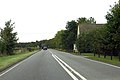
 The A420, Little Coxwell - geograph.org.uk - 6311291.jpg 1 920 × 1 280 ; 1,17 Mio
-
 The Plough - geograph.org.uk - 306488.jpg 640 × 480 ; 96 kio
-
 Village street, Little Coxwell - geograph.org.uk - 1125314.jpg 640 × 427 ; 72 kio
-
 Walnut Cottage, Great Coxwell - geograph.org.uk - 4192004.jpg 640 × 480 ; 121 kio
-
 West from Onetree Hill - geograph.org.uk - 5277538.jpg 1 600 × 1 053 ; 685 kio
-
 Southdown Farm - geograph.org.uk - 306476.jpg 640 × 480 ; 65 kio


_-_geograph.org.uk_-_6567672.jpg)
_-_geograph.org.uk_-_6567674.jpg)
_-_geograph.org.uk_-_6567678.jpg)
_-_geograph.org.uk_-_6567680.jpg)


