Category:Little Cressingham
Aller à la navigation
Aller à la recherche
English: Little Cressingham lies and had a population of 157 in 70 households as of the
localité britannique du comté anglais de Norfolk  | |||||
| Téléverser des médias | |||||
| Nature de l’élément | |||||
|---|---|---|---|---|---|
| Lieu | Breckland, Norfolk, Angleterre de l'Est, Angleterre | ||||
| Superficie |
| ||||
 | |||||
Sous-catégories
Cette catégorie comprend 5 sous-catégories, dont les 5 ci-dessous.
Média dans la catégorie « Little Cressingham »
Cette catégorie comprend 410 fichiers, dont les 200 ci-dessous.
(page précédente) (page suivante)-
 A Drainage Weir - geograph.org.uk - 278727.jpg 640 × 480 ; 98 kio
-
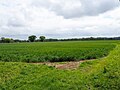
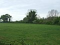
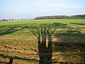
 Agricultural landscape - geograph.org.uk - 6059241.jpg 1 024 × 553 ; 193 kio
-
 All gated off - geograph.org.uk - 6116213.jpg 1 024 × 768 ; 243 kio
-
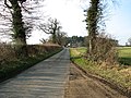
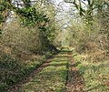
 Along Peddars Way - geograph.org.uk - 6136246.jpg 1 024 × 768 ; 213 kio
-
 An alley of pine trees - geograph.org.uk - 2252984.jpg 640 × 480 ; 181 kio
-
 Anglian water pumping station - geograph.org.uk - 6083171.jpg 1 024 × 769 ; 292 kio
-
 Approach to The Arms on School Road - geograph.org.uk - 2252953.jpg 640 × 480 ; 136 kio
-

-

-
 Approaching Fairstead from the south - geograph.org.uk - 2252845.jpg 640 × 480 ; 125 kio
-
 Approaching Fairstead on Fairstead Lane - geograph.org.uk - 2252634.jpg 640 × 480 ; 146 kio
-
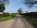
 Approaching Little Cressingham on Fairstead Lane - geograph.org.uk - 2252557.jpg 445 × 640 ; 102 kio
-
 Approaching the B1108 (Watton Road) - geograph.org.uk - 2252877.jpg 640 × 494 ; 122 kio
-

-
 Arable crop - geograph.org.uk - 6117085.jpg 1 024 × 768 ; 279 kio
-
 Arable farming - geograph.org.uk - 6116188.jpg 1 024 × 768 ; 163 kio
-
 Arable field from gateway - geograph.org.uk - 6124474.jpg 1 024 × 768 ; 240 kio
-
 Arable field with remains of maize crop - geograph.org.uk - 6117089.jpg 1 024 × 768 ; 269 kio
-
 Arable landscape - geograph.org.uk - 6117063.jpg 1 024 × 768 ; 242 kio
-
 Arable landscape - geograph.org.uk - 6136302.jpg 1 024 × 768 ; 322 kio
-
 Avenue of Pine - geograph.org.uk - 6004892.jpg 4 608 × 3 456 ; 2,76 Mio
-
 B1108 approaching Little Cressingham - geograph.org.uk - 5393171.jpg 640 × 480 ; 40 kio
-
 B1108 Brandon Road - geograph.org.uk - 5422963.jpg 800 × 608 ; 135 kio
-
 B1108 to Watton - geograph.org.uk - 6054943.jpg 1 024 × 768 ; 174 kio
-
 B1108 towards Bodney - geograph.org.uk - 6057447.jpg 1 024 × 768 ; 165 kio
-
 B1108 towards Bodney - geograph.org.uk - 6146518.jpg 1 024 × 768 ; 248 kio
-
 B1108 towards Watton - geograph.org.uk - 5393166.jpg 640 × 480 ; 70 kio
-
 B1108 towards Watton - geograph.org.uk - 6146508.jpg 1 024 × 768 ; 249 kio
-
 Back of old barn - geograph.org.uk - 6115899.jpg 1 024 × 768 ; 376 kio
-
 Barn by Fairstead, Little Cressingham - geograph.org.uk - 2252637.jpg 640 × 480 ; 153 kio
-
 Barn, Field Barn - geograph.org.uk - 5393214.jpg 640 × 480 ; 42 kio
-
 Bend in the B1108 towards Watton - geograph.org.uk - 5393144.jpg 640 × 480 ; 72 kio
-
 Bend in the stream - geograph.org.uk - 6039589.jpg 1 024 × 768 ; 328 kio
-
 Blocked Window - geograph.org.uk - 1954930.jpg 531 × 800 ; 147 kio
-
 Brandon Road (B1108) towards Watton - geograph.org.uk - 5393207.jpg 640 × 480 ; 97 kio
-
 Brandon Road (B1108) towards Watton - geograph.org.uk - 5393221.jpg 640 × 480 ; 85 kio
-
 Breckland landscape, STANTA - geograph.org.uk - 4601691.jpg 1 600 × 1 067 ; 234 kio
-
 Breckland landscape, STANTA - geograph.org.uk - 4602467.jpg 1 024 × 683 ; 170 kio
-
 Bridge and drainage ditch north of Hopton House - geograph.org.uk - 2252914.jpg 640 × 480 ; 149 kio
-
 Bridge by Hopton House, Little Cressingham - geograph.org.uk - 2252911.jpg 640 × 480 ; 97 kio
-
 Bridge north of Hopton House, Little Cressingham - geograph.org.uk - 2252919.jpg 640 × 512 ; 151 kio
-
 Bridge on Fairstead Lane, Little Cressingham - geograph.org.uk - 2252536.jpg 640 × 480 ; 109 kio
-
 Bridge On Minor Road - geograph.org.uk - 5192546.jpg 1 024 × 768 ; 222 kio
-

-
 Business entrance - geograph.org.uk - 6175557.jpg 1 024 × 768 ; 188 kio
-
 Caterpillar Climbing - geograph.org.uk - 1954966.jpg 531 × 800 ; 72 kio
-
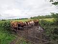
 Cattle and pasture at Threxton Hill - geograph.org.uk - 5424398.jpg 800 × 544 ; 93 kio
-
 Cattle grid - geograph.org.uk - 6067224.jpg 1 024 × 769 ; 369 kio
-
 Cattle on grazing meadow - geograph.org.uk - 6146520.jpg 1 024 × 768 ; 254 kio
-
 Cereal crop - geograph.org.uk - 6116222.jpg 1 024 × 768 ; 193 kio
-
 Cereal crop - geograph.org.uk - 6117079.jpg 1 024 × 768 ; 190 kio
-
 Cereal crop - geograph.org.uk - 6146481.jpg 1 024 × 768 ; 283 kio
-
 Cereal crop - geograph.org.uk - 6180413.jpg 1 024 × 768 ; 187 kio
-
 Cereal crop and woodland - geograph.org.uk - 6136237.jpg 1 024 × 768 ; 184 kio
-
 Cereal crop inside training area - geograph.org.uk - 6124441.jpg 1 024 × 768 ; 165 kio
-
 Cereal crop off Fairstead Lane, Little Cressingham - geograph.org.uk - 6060083.jpg 3 264 × 2 448 ; 1,63 Mio
-
 Cereals and Conifer hedge - geograph.org.uk - 6136316.jpg 1 024 × 582 ; 238 kio
-
 Channel to the Watermill-pump - geograph.org.uk - 1954524.jpg 800 × 531 ; 176 kio
-
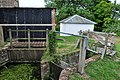 Channels to the Waterwheels - geograph.org.uk - 1954529.jpg 800 × 531 ; 169 kio
-
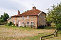
 Church Farm - geograph.org.uk - 293956.jpg 640 × 480 ; 100 kio
-
 Church Farm driveway - geograph.org.uk - 6189215.jpg 1 024 × 768 ; 146 kio
-
 Clean water outlet from Sewage farm - geograph.org.uk - 6189224.jpg 1 024 × 768 ; 407 kio
-
 Clermont Lodge, Little Cressingham - geograph.org.uk - 2252978.jpg 640 × 480 ; 108 kio
-
 Clermont Lodge, Little Cressingham - geograph.org.uk - 2252983.jpg 640 × 531 ; 95 kio
-
 Close up, Elizabeth II postbox, Threxton - geograph.org.uk - 5393798.jpg 1 143 × 1 973 ; 504 kio
-

-
 Country lane to Gt Cressingham - geograph.org.uk - 6124450.jpg 1 024 × 768 ; 276 kio
-
 Crop field off Brandon Road (B1108) - geograph.org.uk - 5393206.jpg 640 × 480 ; 49 kio
-
 Crop field towards The Triangle woodland - geograph.org.uk - 5393169.jpg 2 848 × 2 136 ; 1,16 Mio
-
 Crop field, Threxton Hill - geograph.org.uk - 5393182.jpg 640 × 442 ; 40 kio
-
 Cultivated field in cold January sunshine - geograph.org.uk - 2252633.jpg 640 × 443 ; 133 kio
-
 Cultivated field north of Fairstead Lane - geograph.org.uk - 2252631.jpg 640 × 480 ; 116 kio
-
 Cultivated field north of Hopton Farm - geograph.org.uk - 2252883.jpg 640 × 480 ; 147 kio
-

-

-

-

-
 Dairy Cottages - geograph.org.uk - 5393208.jpg 640 × 480 ; 54 kio
-

-
 Dead Maize Headland used for Pheasant cover - geograph.org.uk - 6059085.jpg 1 024 × 768 ; 247 kio
-
 Distant sheep doing what sheep do - geograph.org.uk - 6060251.jpg 3 264 × 2 448 ; 1,66 Mio
-
 Disused looking barn - geograph.org.uk - 6115898.jpg 1 024 × 768 ; 241 kio
-
 Doorway at St Andrews - geograph.org.uk - 1954911.jpg 531 × 800 ; 177 kio
-
 Drain south of Gravel Hill, Little Cressingham - geograph.org.uk - 2252906.jpg 640 × 472 ; 139 kio
-
 Easterly view of Threxton All Saints Churchyard - geograph.org.uk - 6189187.jpg 1 024 × 768 ; 293 kio
-
 Easterly view over fields - geograph.org.uk - 6176091.jpg 1 024 × 768 ; 169 kio
-
 End of the public road - geograph.org.uk - 6160301.jpg 3 456 × 2 592 ; 3,9 Mio
-
 End of Tottington Road, next stop Stanta - geograph.org.uk - 6060257.jpg 3 264 × 2 448 ; 2,02 Mio
-
 Entering Threxton - geograph.org.uk - 5393184.jpg 640 × 480 ; 56 kio
-
 Entering Watton - geograph.org.uk - 5393227.jpg 640 × 480 ; 61 kio
-
 Entrance gate to St.Andrew's Church - geograph.org.uk - 6176259.jpg 768 × 1 024 ; 223 kio
-
 Entrance to Claremont House Gardener's cottage - geograph.org.uk - 6004881.jpg 4 608 × 3 456 ; 2,65 Mio
-
 Entrance To Clermont House - geograph.org.uk - 1361531.jpg 640 × 480 ; 126 kio
-
 Entrance To Clermont House - geograph.org.uk - 1361593.jpg 640 × 480 ; 92 kio
-
 Entrance to industrial site - geograph.org.uk - 6083177.jpg 1 024 × 769 ; 174 kio
-
 Entrance to training area. STANTA - geograph.org.uk - 6059209.jpg 1 024 × 769 ; 197 kio
-
 Environmental Headland beside Barley crop - geograph.org.uk - 6176088.jpg 1 024 × 768 ; 322 kio
-
 Estate junction with B1108 Watton road - geograph.org.uk - 6183295.jpg 1 024 × 768 ; 236 kio
-
 Fairstead Lane, Little Cressingham - geograph.org.uk - 6060087.jpg 3 264 × 2 448 ; 1,78 Mio
-
 Fairstead, Little Cressingham - geograph.org.uk - 2252635.jpg 640 × 480 ; 172 kio
-
 Fairstead, Little Cressingham - geograph.org.uk - 2252644.jpg 640 × 480 ; 127 kio
-
 Farm driveway - geograph.org.uk - 6180402.jpg 1 024 × 768 ; 305 kio
-
 Farm road - geograph.org.uk - 6116219.jpg 1 024 × 768 ; 198 kio
-
 Farm track - geograph.org.uk - 6180441.jpg 1 024 × 768 ; 193 kio
-
 Farm track beside cereal crop - geograph.org.uk - 6054956.jpg 1 024 × 768 ; 237 kio
-

-
 Farm track to Gravel Hill, Little Cressingham - geograph.org.uk - 2252899.jpg 640 × 480 ; 149 kio
-
 Farm track to Threxton House - geograph.org.uk - 5999770.jpg 4 608 × 3 456 ; 1,8 Mio
-
 Farming inside training area - geograph.org.uk - 6118706.jpg 1 024 × 768 ; 198 kio
-
 Farmland near The Arms - geograph.org.uk - 4342887.jpg 1 280 × 851 ; 380 kio
-
 Fenced grassland - geograph.org.uk - 6117105.jpg 1 024 × 768 ; 301 kio
-
 Fenced in business unit - geograph.org.uk - 6083185.jpg 1 024 × 769 ; 189 kio
-
 Field adjacent dwelling - geograph.org.uk - 6176228.jpg 1 024 × 768 ; 389 kio
-
 Field Barn beyond the wheat, from Brandon Road - geograph.org.uk - 6159678.jpg 3 456 × 2 592 ; 3,91 Mio
-
 Field Barn Farm over stubble field - geograph.org.uk - 5913629.jpg 4 608 × 3 456 ; 4,27 Mio
-

-
 Field near Hopton Farm - geograph.org.uk - 5393147.jpg 640 × 480 ; 45 kio
-
 Field of Rape taken from minor road to Gt.Cressinham - geograph.org.uk - 6115890.jpg 1 024 × 768 ; 225 kio
-
 Field of Sugar beet - geograph.org.uk - 6141713.jpg 1 024 × 768 ; 242 kio
-
-

-
-
 Field west of Little Cressingham - geograph.org.uk - 2252869.jpg 640 × 480 ; 138 kio
-
 Field, Thexton Hill - geograph.org.uk - 5393187.jpg 640 × 480 ; 64 kio
-
 Fields north-west of Little Cressingham - geograph.org.uk - 2252581.jpg 640 × 480 ; 172 kio
-
 Fields south of Fairstead, Little Cressingham - geograph.org.uk - 2252665.jpg 640 × 480 ; 118 kio
-
 Fields west of The Arms, Little Cressingham - geograph.org.uk - 2252955.jpg 640 × 480 ; 127 kio
-
 Flint Bricked Window - geograph.org.uk - 1954946.jpg 531 × 800 ; 179 kio
-
 Fodder beet for sheep - geograph.org.uk - 6116190.jpg 1 024 × 768 ; 353 kio
-
 Forestry thinning operation - geograph.org.uk - 6176096.jpg 1 024 × 768 ; 443 kio
-

-
-
 Gate on footpath to The Fairstead - geograph.org.uk - 2252565.jpg 640 × 480 ; 178 kio
-
 Gated entrance to Old Rectory - geograph.org.uk - 6176234.jpg 1 024 × 768 ; 359 kio
-
 Gateway to military training area - geograph.org.uk - 1826779.jpg 640 × 427 ; 81 kio
-
 George VI postbox on Watton Road, Little Cressingham - geograph.org.uk - 5393775.jpg 2 848 × 2 136 ; 1,42 Mio
-
 Going North on Peddars Way - geograph.org.uk - 6136307.jpg 1 024 × 768 ; 366 kio
-
 Grass field - geograph.org.uk - 6117102.jpg 1 024 × 768 ; 262 kio
-
 Grass for grazing near Little Cressingham - geograph.org.uk - 6060247.jpg 3 264 × 2 448 ; 1,67 Mio
-
 Grazing beside drain - geograph.org.uk - 5393217.jpg 640 × 480 ; 61 kio
-
 Grazing, Bell Hill - geograph.org.uk - 5393142.jpg 640 × 480 ; 46 kio
-
 Hard Clump, Little Cressingham - geograph.org.uk - 2252938.jpg 640 × 480 ; 116 kio
-
 Hedge alongside rough pasture - geograph.org.uk - 6141701.jpg 1 024 × 768 ; 276 kio
-
 Hedge-lined path to The Fairstead - geograph.org.uk - 2252577.jpg 640 × 536 ; 220 kio
-

-
 House next to the Mill - geograph.org.uk - 1954503.jpg 800 × 531 ; 157 kio
-
 Housing at Little Cressingham - geograph.org.uk - 1954463.jpg 800 × 531 ; 115 kio
-
 Infrequently used road at Threxton - geograph.org.uk - 6160295.jpg 3 456 × 2 592 ; 3,95 Mio
-
 Inside St Andrew's Church - geograph.org.uk - 1954953.jpg 800 × 531 ; 81 kio
-
 Irrigation equipment - geograph.org.uk - 6059153.jpg 1 024 × 769 ; 186 kio
-
 Isolated Conifer hedge - geograph.org.uk - 6067126.jpg 1 024 × 686 ; 177 kio
-
 Ivy covered old barn - geograph.org.uk - 6180403.jpg 1 024 × 842 ; 335 kio
-

-
 Junction of Gt.Cressingham road and B1108 - geograph.org.uk - 6057441.jpg 1 024 × 768 ; 138 kio
-
 Junction with B1108 - geograph.org.uk - 6175600.jpg 1 024 × 768 ; 230 kio
-
 Junction with B1108 from Little Cressingham - geograph.org.uk - 6175537.jpg 1 024 × 768 ; 223 kio
-
 Lane beside All Saints' Church, Threxton - geograph.org.uk - 5393200.jpg 640 × 450 ; 67 kio
-
 Leaving Little Cressingham - geograph.org.uk - 6176246.jpg 1 024 × 768 ; 316 kio
-
 Leaving Little Cressingham - geograph.org.uk - 6176288.jpg 1 024 × 768 ; 287 kio
-
 Little Building - geograph.org.uk - 1954525.jpg 800 × 531 ; 153 kio
-
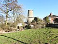
 Little Cressingham Combined Wind and Water Mill - geograph.org.uk - 5411052.jpg 480 × 640 ; 112 kio
-
 Little Cressingham combined wind and water mill - geograph.org.uk - 6060097.jpg 3 264 × 2 448 ; 1,73 Mio
-
 Little Cressingham combined wind and water mill - geograph.org.uk - 6060098.jpg 3 264 × 2 448 ; 1,82 Mio
-
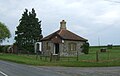
 Little Cressingham Library - geograph.org.uk - 5422746.jpg 800 × 517 ; 117 kio
-
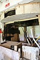
 Little Cressingham Mill - Bramah pump - geograph.org.uk - 3972153.jpg 640 × 427 ; 81 kio
-
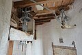
 Little Cressingham Mill - gear room - geograph.org.uk - 3979597.jpg 427 × 640 ; 87 kio
-
 Little Cressingham Mill - geograph.org.uk - 1954511.jpg 800 × 531 ; 183 kio
-
 Little Cressingham Mill - geograph.org.uk - 3979624.jpg 640 × 427 ; 70 kio
-
 Little Cressingham Mill - geograph.org.uk - 3979637.jpg 427 × 640 ; 84 kio
-

-

-
 Little Cressingham Mill - sack hoist - geograph.org.uk - 3979702.jpg 640 × 427 ; 66 kio
-
 Little Cressingham Mill - stone nut - geograph.org.uk - 3979582.jpg 427 × 640 ; 77 kio
-
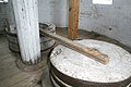
 Little Cressingham Mill - water mill stones - geograph.org.uk - 3979617.jpg 640 × 427 ; 80 kio
-
 Little Cressingham Mill - water supply - geograph.org.uk - 3979536.jpg 640 × 427 ; 102 kio
-
 Little Cressingham Mill - water wheel - geograph.org.uk - 3979555.jpg 640 × 427 ; 125 kio
-
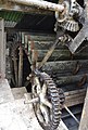
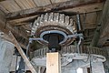 Little Cressingham Mill - windmill gearing - geograph.org.uk - 3979656.jpg 640 × 427 ; 72 kio
-
 Little Cressingham Mill - windmill gearing - geograph.org.uk - 3979670.jpg 640 × 427 ; 57 kio
-
-
 Little Cressingham War Memorial - geograph.org.uk - 5025687.jpg 2 502 × 3 267 ; 1,66 Mio
-
 Little Cressingham Watermill - geograph.org.uk - 1954521.jpg 800 × 531 ; 191 kio
-
 Little Cressingham wind and water mill - geograph.org.uk - 3972148.jpg 640 × 412 ; 140 kio
-
 Little Cressingham Wind-Water Mill - geograph.org.uk - 1954544.jpg 531 × 800 ; 108 kio
-
 Little Cressingham Wind-Water Mill - geograph.org.uk - 1954551.jpg 531 × 800 ; 109 kio
-
 Little Cressingham Wind-Watermill - geograph.org.uk - 1954458.jpg 800 × 531 ; 144 kio
-
 Little Cressingham Wind-Watermill - geograph.org.uk - 5422730.jpg 547 × 800 ; 77 kio
-

-

-
 Little Cressingham Wind-Watermill - sack hoist - geograph.org.uk - 4950853.jpg 640 × 394 ; 211 kio
-

-
-

-

-

-
 Little Cressingham Wind-Watermill - wheel - geograph.org.uk - 4950899.jpg 432 × 640 ; 258 kio
-
 Lodge at entrance to Threxton House - geograph.org.uk - 4438697.jpg 4 320 × 3 240 ; 3,96 Mio
-
 Lodge on Brandon Road (B1108) - geograph.org.uk - 5393203.jpg 640 × 407 ; 49 kio
-
 Lonesome Oak - geograph.org.uk - 6116225.jpg 768 × 1 024 ; 260 kio
-
 Long farm track - geograph.org.uk - 6116209.jpg 768 × 1 024 ; 269 kio
-
 Looking across cereals to distant hedgerow - geograph.org.uk - 6136241.jpg 1 024 × 768 ; 210 kio


_-_geograph.org.uk_-_2252877.jpg)
_from_the_south_-_geograph.org.uk_-_2252928.jpg)


_towards_Watton_-_geograph.org.uk_-_5393207.jpg)
_towards_Watton_-_geograph.org.uk_-_5393221.jpg)


_-_geograph.org.uk_-_5393206.jpg)


,_Little_Cressingham_-_geograph.org.uk_-_2252989.jpg)


,_Little_Cressingham_-_geograph.org.uk_-_2252935.jpg)


_-_geograph.org.uk_-_5393203.jpg)


