Category:Little Gaddesden
Aller à la navigation
Aller à la recherche
English: Little Gaddesden is a village in the English county of Hertfordshire three miles north of Berkhamsted. As well as Little Gaddesden village (population 694), the parish contains the settlements of Ashridge (population 53), Hudnall (population 139), and part of Ringshall (population 81).
village britannique  | |||||
| Téléverser des médias | |||||
| Nature de l’élément | |||||
|---|---|---|---|---|---|
| Lieu | Dacorum, Hertfordshire, Angleterre de l'Est, Angleterre | ||||
| Réputé identique à | Little Gaddesden (page en doublon, paroisse civile) | ||||
 | |||||
Sous-catégories
Cette catégorie comprend 7 sous-catégories, dont les 7 ci-dessous.
A
L
P
R
Média dans la catégorie « Little Gaddesden »
Cette catégorie comprend 195 fichiers, dont les 195 ci-dessous.
-
 A Bouncy Castle on the Lawn at Ashridge House on Fete Day - geograph.org.uk - 2972658.jpg 2 213 × 1 660 ; 688 kio
-
 A Clump of Fir Trees in the Gardens at Ashridge House - geograph.org.uk - 2972672.jpg 2 592 × 1 944 ; 1,16 Mio
-
 A house in Little Gaddesden - geograph.org.uk - 67411.jpg 640 × 480 ; 143 kio
-
 A Ring of Fir Trees in the Gardens at Ashridge House - geograph.org.uk - 2972674.jpg 2 114 × 1 586 ; 691 kio
-
 A tree lined footpath near Little Gaddesden - geograph.org.uk - 3265437.jpg 2 560 × 1 920 ; 862 kio
-
 Aldbury Common - geograph.org.uk - 5645211.jpg 2 304 × 1 728 ; 810 kio
-
 An Avenue in the Gardens at Ashridge House - geograph.org.uk - 2972702.jpg 2 192 × 1 644 ; 725 kio
-
 An Avenue in the Gardens at Ashridge House - geograph.org.uk - 2972706.jpg 2 203 × 1 652 ; 859 kio
-
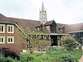
 Ashridge College on a sunny December Morning - geograph.org.uk - 3265528.jpg 2 560 × 1 920 ; 1 001 kio
-
 Ashridge Estate lane at Hudnall - geograph.org.uk - 174923.jpg 480 × 640 ; 119 kio
-
 Ashridge Executive Education (formerly Ashridge Business School) - geograph.org.uk - 5856354.jpg 1 600 × 1 200 ; 269 kio
-
 Ashridge Executive Education (formerly Ashridge Business School) - geograph.org.uk - 5856355.jpg 1 600 × 1 200 ; 174 kio
-
 Ashridge Golf Course - the fifth hole.jpg 2 592 × 1 944 ; 2,05 Mio
-
 Ashridge House - C19th cloisters - geograph.org.uk - 4118714.jpg 1 000 × 1 333 ; 936 kio
-
 Ashridge House - carvings on choir stalls - geograph.org.uk - 4118671.jpg 1 000 × 1 058 ; 814 kio
-
 Ashridge House - Ceiling painting - geograph.org.uk - 4117866.jpg 1 118 × 1 000 ; 881 kio
-
 Ashridge House - Choir stalls in chapel - geograph.org.uk - 4118665.jpg 1 000 × 1 557 ; 1,04 Mio
-
 Ashridge House - collapsed roof of grotto - geograph.org.uk - 4118975.jpg 1 333 × 1 000 ; 1,44 Mio
-
 Ashridge House - fan vaulting detail (loggia) - geograph.org.uk - 4117855.jpg 1 265 × 1 000 ; 702 kio
-
 Ashridge House - Fern House - geograph.org.uk - 4118986.jpg 1 333 × 1 000 ; 1,17 Mio
-
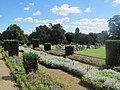
 Ashridge House - Formal gardens around fish pond - geograph.org.uk - 4119013.jpg 1 427 × 1 000 ; 1,15 Mio
-
 Ashridge House - from its grounds - geograph.org.uk - 4109794.jpg 1 333 × 1 000 ; 1 023 kio
-
 Ashridge House - Gateway from Monk's Garden - geograph.org.uk - 4118936.jpg 1 000 × 1 309 ; 1,14 Mio
-
 Ashridge House - geograph.org.uk - 2377309.jpg 1 280 × 960 ; 386 kio
-
 Ashridge House - Hoskins Room - fireplace - geograph.org.uk - 4117845.jpg 1 000 × 1 333 ; 941 kio
-
 Ashridge House - Hoskins Room colonnade - geograph.org.uk - 4117839.jpg 1 395 × 1 000 ; 998 kio
-
 Ashridge House - Lady Marian Alford Room - geograph.org.uk - 4117862.jpg 1 000 × 1 333 ; 1,07 Mio
-
 Ashridge House - Loggia - geograph.org.uk - 4117850.jpg 1 000 × 1 383 ; 929 kio
-
 Ashridge House - Main Hall - geograph.org.uk - 4109842.jpg 1 000 × 1 322 ; 895 kio
-
 Ashridge House - Minstrels Gallery above arches - geograph.org.uk - 4109882.jpg 1 000 × 1 333 ; 981 kio
-
 Ashridge House - Old pump - geograph.org.uk - 4118945.jpg 1 000 × 2 115 ; 1,67 Mio
-
 Ashridge House - Pretend Hammerbeam Roof - geograph.org.uk - 4109867.jpg 1 412 × 1 000 ; 965 kio
-
 Ashridge House - Queen Victoria's Oak - geograph.org.uk - 4118997.jpg 1 333 × 1 000 ; 1 013 kio
-
 Ashridge House - southern entrance to grotto - geograph.org.uk - 4118968.jpg 1 000 × 1 333 ; 1,05 Mio
-
 Ashridge House - The Chapel exterior - geograph.org.uk - 4118724.jpg 1 248 × 1 000 ; 903 kio
-
 Ashridge House - The Chapel interior - geograph.org.uk - 4118656.jpg 1 000 × 1 039 ; 801 kio
-
 Ashridge House - The Monks' Barn - geograph.org.uk - 4118919.jpg 1 068 × 1 000 ; 851 kio
-
 Ashridge House - The well - geograph.org.uk - 4118683.jpg 1 000 × 1 132 ; 1 011 kio
-
 Ashridge House - Victorian plaque attached to tree - geograph.org.uk - 4119004.jpg 1 333 × 1 000 ; 1,2 Mio
-
 Ashridge House - view through the Main Hall - geograph.org.uk - 4117869.jpg 1 000 × 1 333 ; 966 kio
-
 Ashridge House - Weather Vane Dial - geograph.org.uk - 4109858.jpg 1 023 × 1 000 ; 813 kio
-
 Ashridge House - Window above main entrance - geograph.org.uk - 4109805.jpg 1 000 × 1 182 ; 819 kio
-
 Ashridge House - Wyatt Room - geograph.org.uk - 4117873.jpg 1 089 × 1 000 ; 840 kio
-
 Ashridge House at sunset - geograph.org.uk - 2480225.jpg 2 549 × 1 246 ; 2,67 Mio
-
 Ashridge House in Spring - geograph.org.uk - 2857116.jpg 1 553 × 1 213 ; 1,1 Mio
-
 Ashridge in the snow - geograph.org.uk - 5699536.jpg 1 333 × 1 000 ; 1,15 Mio
-
 Ashridge Management College - front view - geograph.org.uk - 3092179.jpg 1 448 × 1 000 ; 1,04 Mio
-
 Ashridge Management College - garden feature - geograph.org.uk - 3092200.jpg 1 000 × 1 333 ; 1,32 Mio
-
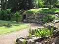
 Ashridge Management College - grotto - geograph.org.uk - 3092214.jpg 1 553 × 1 000 ; 1,8 Mio
-
 Ashridge Management College - Monk's garden - geograph.org.uk - 3092197.jpg 1 333 × 1 000 ; 1,51 Mio
-
 Ashridge Management College - rear view - geograph.org.uk - 3092184.jpg 1 333 × 1 000 ; 1,19 Mio
-
 Ashridge Management College northern façade - geograph.org.uk - 3052097.jpg 1 333 × 1 000 ; 1,24 Mio
-
 Ashridge Management College northern façade and snow - geograph.org.uk - 5699502.jpg 1 333 × 1 000 ; 661 kio
-
 Ashridge Park Grazing Land Near Woodyard Cottages - geograph.org.uk - 2627033.jpg 1 944 × 2 896 ; 1,2 Mio
-
 Ashridge, Little Gaddesden - geograph.org.uk - 3387364.jpg 640 × 422 ; 179 kio
-
 Autumn colours along the tree-lined avenue towards Ashridge House - geograph.org.uk - 5970281.jpg 3 648 × 2 736 ; 1,82 Mio
-
 Autumn Trees, Little Gaddesden - geograph.org.uk - 1579002.jpg 480 × 640 ; 152 kio
-
 Autumn Trees, Little Gaddesden - geograph.org.uk - 1579005.jpg 480 × 640 ; 133 kio
-
 Aylesbury Vale , Stag Wood - geograph.org.uk - 5726613.jpg 5 730 × 3 820 ; 6,29 Mio
-
 Badger Wood - geograph.org.uk - 2365358.jpg 2 592 × 1 944 ; 1,53 Mio
-
 Baling hay near Hudnall - geograph.org.uk - 1964125.jpg 2 643 × 1 389 ; 931 kio
-
 BBC TV Flog It on the Lawn at Ashridge House - geograph.org.uk - 3520277.jpg 3 648 × 2 736 ; 2,15 Mio
-
 Beautiful Brickwork Retaining Wall near to Ashridge Monument - geograph.org.uk - 2626810.jpg 2 896 × 1 944 ; 3,01 Mio
-
 Borough of Dacorum , Ashridge - geograph.org.uk - 5727369.jpg 6 000 × 4 000 ; 6,82 Mio
-
 Borough of Dacorum , Blue Cottage - geograph.org.uk - 5726605.jpg 6 000 × 4 000 ; 6,29 Mio
-
 Borough of Dacorum , Golf Club Road - geograph.org.uk - 5726609.jpg 5 603 × 3 735 ; 6,18 Mio
-
 Borough of Dacorum , Grassy Field - geograph.org.uk - 5727366.jpg 6 000 × 4 000 ; 7,18 Mio
-
 Borough of Dacorum , Sallow Copse - geograph.org.uk - 5726608.jpg 5 873 × 3 916 ; 7,17 Mio
-
 Borough of Dacorum , Woodland - geograph.org.uk - 5726606.jpg 6 000 × 4 000 ; 6,5 Mio
-
 Bouncy Castles at Ashridge House on Fete Day - geograph.org.uk - 2972657.jpg 1 797 × 2 396 ; 725 kio
-
 Bridleway to Church Farm, Little Gaddesden - geograph.org.uk - 193729.jpg 640 × 480 ; 91 kio
-
 Buttercup Meadow, Hudnall - geograph.org.uk - 174925.jpg 640 × 480 ; 119 kio
-
 Chiltern Way - geograph.org.uk - 1566955.jpg 640 × 480 ; 118 kio
-
 Chiltern Way - geograph.org.uk - 1566973.jpg 640 × 480 ; 109 kio
-
 Chiltern Way - path down towards Hemel Hempstead Road - geograph.org.uk - 6295054.jpg 4 608 × 3 456 ; 3,47 Mio
-
 Church Farm, Little Gaddesden - geograph.org.uk - 193731.jpg 640 × 480 ; 99 kio
-
 Church Farm, Little Gaddesden - geograph.org.uk - 2377237.jpg 1 280 × 960 ; 321 kio
-
 Copse in a large arable field - geograph.org.uk - 3265167.jpg 640 × 480 ; 134 kio
-
 Covetous Corner - Pond - geograph.org.uk - 5264764.jpg 2 560 × 1 920 ; 3,5 Mio
-
 Covetous Corner, Hudnall Common - geograph.org.uk - 174927.jpg 640 × 480 ; 110 kio
-
 Crowds at a Fete in the Gardens at Ashridge House - geograph.org.uk - 2972660.jpg 2 357 × 1 768 ; 1,03 Mio
-
 Dead Tree - geograph.org.uk - 1950439.jpg 2 376 × 2 316 ; 1,3 Mio
-
 Dead Tree ^ View of Copse - geograph.org.uk - 1939548.jpg 3 164 × 1 948 ; 1,23 Mio
-
 Entrance to Ashridge Golf Club - geograph.org.uk - 2416688.jpg 1 600 × 1 200 ; 583 kio
-
 Entrance to Ashridge Golf Club, Ringshall - geograph.org.uk - 2416693.jpg 1 600 × 1 200 ; 547 kio
-
 Fallow deer in the snow at Ashridge Estate - geograph.org.uk - 5699545.jpg 1 333 × 1 000 ; 975 kio
-
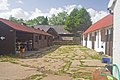
 Farm Buildings - geograph.org.uk - 1964002.jpg 3 456 × 2 304 ; 593 kio
-
 Farm yard Collection - geograph.org.uk - 1964048.jpg 2 481 × 1 620 ; 277 kio
-
 Fernery Garden and Fernery on Fete Day, Ashridge House - geograph.org.uk - 2972651.jpg 2 592 × 1 944 ; 1,22 Mio
-
 Filming for TV on the Staircase in Ashridge House - geograph.org.uk - 3520308.jpg 2 952 × 2 214 ; 865 kio
-
 Flower beds on the Terrace at Ashridge House - geograph.org.uk - 3520288.jpg 3 551 × 2 662 ; 1,69 Mio
-
 Footpath down dry valley - geograph.org.uk - 1962934.jpg 3 456 × 2 304 ; 1,23 Mio
-
 Former Estate Cottages, Ringshall, Ashridge Estate - geograph.org.uk - 3889185.jpg 4 000 × 3 000 ; 4,54 Mio
-
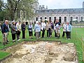
 Foundations of the Medieval Church, Ashridge House - geograph.org.uk - 2972343.jpg 2 736 × 3 648 ; 2,72 Mio
-
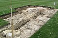 Foundations of the Medieval Church, Ashridge House - geograph.org.uk - 2972351.jpg 3 648 × 2 406 ; 2,97 Mio
-
 Gade House - geograph.org.uk - 1964999.jpg 2 670 × 2 028 ; 2,02 Mio
-
 Gatehouse at Brownlow Gate, Ashridge - geograph.org.uk - 3878832.jpg 4 320 × 3 240 ; 4,82 Mio
-
 GOC Berkhamsted & Frithsden 061 Golden Valley, Little Gaddesden (28509708845).jpg 4 288 × 3 216 ; 3,46 Mio
-
 GOC Berkhamsted & Frithsden 064 Golden Valley, Little Gaddesden (27893325874).jpg 4 149 × 3 115 ; 3,63 Mio
-
 GOC Berkhamsted & Frithsden 065 Golden Valley, Little Gaddesden (27893329354).jpg 4 288 × 3 216 ; 3,7 Mio
-
 GOC Berkhamsted & Frithsden 067 Golden Valley, Little Gaddesden (27893333134).jpg 4 288 × 3 216 ; 3,77 Mio
-
 Golden Valley, Ashridge - geograph.org.uk - 2377294.jpg 1 280 × 960 ; 559 kio
-
 Green Lane at the junction of Ringshall Road - geograph.org.uk - 5645207.jpg 2 304 × 1 728 ; 1,07 Mio
-
 Hill Wood - geograph.org.uk - 1964882.jpg 2 466 × 1 382 ; 1,15 Mio
-
 Hill Wood from footpath - geograph.org.uk - 1973624.jpg 640 × 427 ; 71 kio
-
 Horse riders at Hudnall Common - geograph.org.uk - 6295058.jpg 3 487 × 1 373 ; 1 021 kio
-
 House, Little Gaddesden - geograph.org.uk - 1561084.jpg 640 × 480 ; 131 kio
-
 House, Little Gaddesden - geograph.org.uk - 1579012.jpg 640 × 485 ; 141 kio
-
 House, Little Gaddesden - geograph.org.uk - 1579018.jpg 640 × 480 ; 131 kio
-
 House, Little Gaddesden - geograph.org.uk - 1579023.jpg 640 × 480 ; 112 kio
-
 Hudnall Common - geograph.org.uk - 2377210.jpg 1 280 × 960 ; 356 kio
-
 Hudnall Common - geograph.org.uk - 5645173.jpg 2 130 × 1 598 ; 1,21 Mio
-
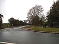
 Hudnall Corner crossroads - geograph.org.uk - 5644331.jpg 2 226 × 1 618 ; 1,21 Mio
-
 Hudnall Farm - geograph.org.uk - 1964704.jpg 2 661 × 1 830 ; 2 Mio
-
 Hudnall Lane - geograph.org.uk - 5644332.jpg 2 304 × 1 728 ; 823 kio
-
 Lampposts and trees in Ashridge College grounds - geograph.org.uk - 5699539.jpg 1 231 × 1 000 ; 695 kio
-
 Lamsey Farm - geograph.org.uk - 193359.jpg 640 × 329 ; 70 kio
-

-

-

-
 Little Gaddesden Telephone Exchange - geograph.org.uk - 1184160.jpg 640 × 480 ; 84 kio
-
 Little Gaddesden, Nettleden Road - geograph.org.uk - 141372.jpg 640 × 480 ; 94 kio
-
 Lone Horse Chestnut Tree, Ashridge Estate - geograph.org.uk - 2377345.jpg 960 × 1 280 ; 460 kio
-
 Long Wood, Clement's End - geograph.org.uk - 4547094.jpg 3 264 × 2 448 ; 3,49 Mio
-
 Looking North on the Wellingtonia Avenue towards Ashridge House - geograph.org.uk - 2972717.jpg 2 592 × 1 944 ; 1,04 Mio
-
 Nettleden - Wooded Pit - geograph.org.uk - 5264758.jpg 2 560 × 1 920 ; 3,86 Mio
-
 Nettleden Lodge - geograph.org.uk - 1964026.jpg 2 814 × 1 926 ; 272 kio
-
 Nettleden Road, Frithsden - geograph.org.uk - 4444761.jpg 2 560 × 1 920 ; 2,02 Mio
-
 Nettleden Road, Little Gaddesden - geograph.org.uk - 5645186.jpg 2 266 × 1 676 ; 870 kio
-
 Oak avenue - geograph.org.uk - 174926.jpg 480 × 640 ; 138 kio
-
 Pond Lane, Hudnall - geograph.org.uk - 5641533.jpg 2 266 × 1 676 ; 1,13 Mio
-
 Prince's Riding at dusk - geograph.org.uk - 2873772.jpg 1 000 × 1 333 ; 1,7 Mio
-
 Pulridge Wood on Nettleden Road - geograph.org.uk - 4443424.jpg 2 560 × 1 920 ; 2,13 Mio
-
 Rhododendrons on the edge of the Moat, Ashridge House - geograph.org.uk - 2972752.jpg 2 592 × 1 944 ; 1,49 Mio
-
 Rhododendrons on the side of the Moat, Ashridge House. - geograph.org.uk - 2972416.jpg 3 646 × 2 026 ; 1,97 Mio
-
 Rhododendrons on the Wellontonia Avenue, Ashridge House - geograph.org.uk - 2972745.jpg 2 253 × 1 690 ; 837 kio
-
 Ringshall , Parking Space - geograph.org.uk - 5732319.jpg 6 000 × 4 000 ; 6,92 Mio
-
 Ringshall Road - geograph.org.uk - 2416697.jpg 1 600 × 1 200 ; 583 kio
-
 Ringshall Road - geograph.org.uk - 5645209.jpg 2 304 × 1 728 ; 848 kio
-
 Rolling landscape - geograph.org.uk - 3265158.jpg 2 109 × 1 582 ; 1,59 Mio
-
 Scrap car in the copse - geograph.org.uk - 3265188.jpg 2 560 × 1 920 ; 924 kio
-
 Seats on the Terrace at Ashridge House - geograph.org.uk - 3520297.jpg 3 297 × 2 473 ; 1,8 Mio
-
 Shadows of the "Battlements" at Ashridge House - geograph.org.uk - 3520319.jpg 3 645 × 2 404 ; 2,15 Mio
-
 Snow covered gardens at Ashridge Management College - geograph.org.uk - 5699542.jpg 1 333 × 1 000 ; 939 kio
-
 Snow covered Golden Valley, Ashridge Estate - geograph.org.uk - 5699546.jpg 1 333 × 1 000 ; 1,13 Mio
-
 Spectacular Burst of Sunlight Ashridge Park near Woodyard Cottages - geograph.org.uk - 2627048.jpg 2 896 × 1 944 ; 3,19 Mio
-
 St Margaret's - geograph.org.uk - 5264774.jpg 1 920 × 2 560 ; 2,66 Mio
-
 St Peter ^ St Paul, Little Gaddesden - geograph.org.uk - 5054943.jpg 1 000 × 684 ; 238 kio
-
 St Peter ^ St Paul, Little Gaddesden - geograph.org.uk - 5054944.jpg 1 000 × 622 ; 238 kio
-
 St Peter ^ St Paul, Little Gaddesden - geograph.org.uk - 5054945.jpg 1 000 × 622 ; 258 kio
-
 Stable Yard - geograph.org.uk - 1964993.jpg 3 456 × 2 304 ; 1,8 Mio
-
 Stalls on a lawn in the Ashridge House Gardens - geograph.org.uk - 2972661.jpg 2 592 × 1 944 ; 1,01 Mio
-
 Terraced Cottages at Ringshall - Ashridge Estate - geograph.org.uk - 3889174.jpg 3 724 × 2 793 ; 1,59 Mio
-
 The Armorial Garden and Monks Barn, Ashridge House - geograph.org.uk - 2971680.jpg 3 648 × 2 736 ; 2,59 Mio
-
 The Armorial Garden, Ashridge House - geograph.org.uk - 2971673.jpg 3 515 × 2 636 ; 2,85 Mio
-
 The Drive to Ashridge House - geograph.org.uk - 3520266.jpg 3 626 × 2 417 ; 1,75 Mio
-
 The entrance to Home Farm, Little Gaddesden - geograph.org.uk - 4443110.jpg 2 560 × 1 920 ; 1,82 Mio
-
 The Entrance to the Souterrein, Ashridge House - geograph.org.uk - 2972434.jpg 1 701 × 2 268 ; 813 kio
-
 The Fernery Garden on Fete Day, Ashridge House - geograph.org.uk - 2972653.jpg 2 592 × 1 944 ; 1,19 Mio
-
 The Former Skating Rink, Ashridge House - geograph.org.uk - 2972388.jpg 3 648 × 2 736 ; 2,64 Mio
-
 The Former Skating Rink, Ashridge House - geograph.org.uk - 2972406.jpg 2 592 × 1 944 ; 1,02 Mio
-
 The Foundations of the Medieval Church, Ashridge House - geograph.org.uk - 2972362.jpg 3 648 × 2 736 ; 3,12 Mio
-
 The Golden Valley - geograph.org.uk - 3265530.jpg 2 560 × 1 920 ; 1,02 Mio
-
 The Herb Garden, Ashridge House - geograph.org.uk - 2972136.jpg 3 648 × 2 736 ; 3,05 Mio
-
 The Holm Oak Avenue, Ashridge House - geograph.org.uk - 2972140.jpg 3 648 × 2 736 ; 2,57 Mio
-
 The Holm Oak Avenue, looking North towards Ashridge House - geograph.org.uk - 2972724.jpg 2 026 × 1 520 ; 539 kio
-
 The Italianate Garden, Ashridge House - geograph.org.uk - 2972149.jpg 3 644 × 1 687 ; 1,65 Mio
-

-
 The Modern Garden behind the Monks Barn, Ashridge House - geograph.org.uk - 2972371.jpg 3 648 × 2 736 ; 2,26 Mio
-
 The Path to the Souterrein, Ashridge House - geograph.org.uk - 2972423.jpg 2 381 × 1 787 ; 932 kio
-
 The road next to the Golden Valley, Ashridge Estate - geograph.org.uk - 5699552.jpg 1 000 × 1 333 ; 1,28 Mio
-
 The Souterrein at Ashridge House - geograph.org.uk - 2972444.jpg 1 296 × 972 ; 627 kio
-
 The South Lawn at Ashridge House on Fete Day - geograph.org.uk - 2972665.jpg 2 274 × 1 705 ; 784 kio
-
 The Terrace Garden, Ashridge House - geograph.org.uk - 2972462.jpg 2 592 × 1 944 ; 886 kio
-
 Thunderdell Wood - geograph.org.uk - 1834402.jpg 3 648 × 2 736 ; 4,64 Mio
-
 Track Away From Woodyard Cottages - geograph.org.uk - 2627027.jpg 2 896 × 1 944 ; 1,36 Mio
-
 Track bridge, Ashridge Estate - geograph.org.uk - 5699549.jpg 1 333 × 1 000 ; 1,02 Mio
-
 Track leading to Prince's Riding Ashridge Park - geograph.org.uk - 2627058.jpg 2 896 × 1 944 ; 1,35 Mio
-
 Track near Covetous Corner - geograph.org.uk - 174929.jpg 480 × 640 ; 106 kio
-
 Tree by bridleway - geograph.org.uk - 1964143.jpg 2 463 × 1 654 ; 1,17 Mio
-
 Trees and contrails - geograph.org.uk - 263004.jpg 640 × 480 ; 77 kio
-
 Trees in Ashridge Park - geograph.org.uk - 1962951.jpg 3 456 × 2 073 ; 2,16 Mio
-
 Walking towards Hudnall - geograph.org.uk - 1965017.jpg 2 247 × 2 265 ; 1,67 Mio
-
 Well Farm - geograph.org.uk - 3878850.jpg 4 320 × 3 240 ; 5,5 Mio
-
 Wellingtonia Avenue with Rhododendrons, Ashridge House - geograph.org.uk - 2972145.jpg 3 648 × 2 736 ; 2,48 Mio
-
-
 Where the Bridge over the Moat should be. Ashridge House - geograph.org.uk - 2972758.jpg 1 003 × 752 ; 239 kio
-
 Winding bridleway - geograph.org.uk - 1964714.jpg 3 456 × 2 304 ; 2,35 Mio
-
 Window, Little Gaddesden - geograph.org.uk - 1579027.jpg 640 × 480 ; 169 kio
-
 Windrowing hay near Hudnall - geograph.org.uk - 1964104.jpg 1 653 × 1 230 ; 688 kio
-
 Yet another avenue in the gardens at Ashridge House - geograph.org.uk - 2972728.jpg 2 368 × 1 776 ; 757 kio
-
 Deer Leap swimming pool, Ringshall - geograph.org.uk - 67398.jpg 640 × 480 ; 134 kio
-
 Deer Leap swimming pool, Ringshall - geograph.org.uk - 67404.jpg 640 × 480 ; 157 kio
-
 Deer Leap swimming pool, Ringshall - geograph.org.uk - 67406.jpg 640 × 480 ; 139 kio
-
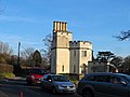
 Ringshall with castellated gatehouse - folly - geograph.org.uk - 83837.jpg 640 × 480 ; 149 kio


_-_geograph.org.uk_-_5856354.jpg)
_-_geograph.org.uk_-_5856355.jpg)


_-_geograph.org.uk_-_4117855.jpg)


.jpg)
.jpg)
.jpg)
.jpg)


