Category:Little Hadham
Vai alla navigazione
Vai alla ricerca
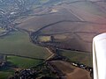
English: Little Hadham is a village in the Hertfordshire countryside. It sits along the A120 road, which connects it to the nearby town of Bishop's Stortford.
village and civil parish in the district of East Hertfordshire, Hertfordshire, England  | |||||
| Carica un file multimediale | |||||
| Istanza di | |||||
|---|---|---|---|---|---|
| Luogo | East Hertfordshire, Hertfordshire, Est dell'Inghilterra, Inghilterra | ||||
 | |||||
Sottocategorie
Questa categoria contiene le 5 sottocategorie indicate di seguito, su un totale di 5.
File nella categoria "Little Hadham"
Questa categoria contiene 63 file, indicati di seguito, su un totale di 63.
-
 Albury Road, Little Hadham - geograph.org.uk - 4832041.jpg 2 284 × 1 702; 1,14 MB
-

-
 Bus shelter on Hadham Road - geograph.org.uk - 4233272.jpg 640 × 428; 220 KB
-
 Cereal crop and pylons - geograph.org.uk - 6218669.jpg 800 × 600; 107 KB
-
 Copse - geograph.org.uk - 253402.jpg 640 × 480; 131 KB
-
 Cottage on Ford Hill, Hadham Ford - geograph.org.uk - 6363253.jpg 1 878 × 1 214; 1,51 MB
-
 Cottages on Hadham Road, Hadham Ford - geograph.org.uk - 2917698.jpg 1 600 × 1 200; 499 KB
-
 Crossroads, Little Hadham - geograph.org.uk - 3886196.jpg 640 × 480; 111 KB
-
 East end of Hoecroft Lane - geograph.org.uk - 4233257.jpg 640 × 480; 208 KB
-
 Entrance to Little Hadham - geograph.org.uk - 3297442.jpg 640 × 480; 74 KB
-
 Farm Place, Bury Green - geograph.org.uk - 5836718.jpg 3 264 × 2 448; 3,8 MB
-
 Farmland at Standon - geograph.org.uk - 5684273.jpg 3 264 × 2 448; 3,58 MB
-
 Footbridge - geograph.org.uk - 253408.jpg 640 × 480; 149 KB
-
 Footpath heading towards Albury Lodge - geograph.org.uk - 579615.jpg 640 × 425; 69 KB
-
 Footpath near Bury Green - geograph.org.uk - 6410191.jpg 3 702 × 2 468; 4,77 MB
-
 Ford at Hadham Ford - geograph.org.uk - 5185183.jpg 3 000 × 2 000; 6,14 MB
-
 Garden on Ford Hill, Hadham Ford - geograph.org.uk - 6363254.jpg 1 920 × 1 280; 1,97 MB
-
 Hadham Road, Hadham Ford - geograph.org.uk - 2917702.jpg 1 600 × 1 200; 598 KB
-
 Hadham Road, Hadham Ford - geograph.org.uk - 4831460.jpg 2 154 × 1 506; 1,08 MB
-
 Hadham Road, Little Hadham - geograph.org.uk - 4833822.jpg 2 156 × 1 596; 873 KB
-
 Hadham Road, Little Hadham - geograph.org.uk - 5359562.jpg 2 304 × 1 728; 1,32 MB
-
 House in the woods - geograph.org.uk - 421477.jpg 640 × 480; 141 KB
-
 Ideal Farm at Braughing Friars - geograph.org.uk - 5478108.jpg 3 264 × 2 448; 3,46 MB
-
 Junction of Hadham Road and Stortford Road - geograph.org.uk - 2917063.jpg 1 600 × 1 200; 665 KB
-
 Junction of Hadham Road and Stortford Road - geograph.org.uk - 2917064.jpg 1 600 × 1 200; 673 KB
-
 Lane from Bury Green to Green Street - geograph.org.uk - 4233246.jpg 640 × 480; 241 KB
-
 Snow in Bury Green, Little Hadham - geograph.org.uk - 451731.jpg 640 × 480; 90 KB
-
 Little Hadham crossroads, Herts. - geograph.org.uk - 217312.jpg 640 × 480; 71 KB
-
 Little Hadham Village Hall - geograph.org.uk - 4001969.jpg 4 320 × 3 240; 3,46 MB
-
 Little Hadham, Albury Road - geograph.org.uk - 3825879.jpg 640 × 477; 90 KB
-

-
 Little Hadham, Ford at Hadham Ford - geograph.org.uk - 3824734.jpg 640 × 480; 84 KB
-

-

-

-
 Little Hadham, Queer Wood - geograph.org.uk - 3818071.jpg 640 × 480; 98 KB
-

-
 March blossom - geograph.org.uk - 3886151.jpg 640 × 480; 236 KB
-
 Millfield Lane - geograph.org.uk - 6409584.jpg 6 000 × 4 000; 6,37 MB
-
 Old footpath signs - geograph.org.uk - 253395.jpg 480 × 640; 131 KB
-
 Old wooden sign - geograph.org.uk - 253410.jpg 640 × 480; 137 KB
-
 Phone box used as a book exchange, Little Hadham - geograph.org.uk - 4001961.jpg 1 996 × 2 160; 2,36 MB
-
 Postbox, notice board, seat - geograph.org.uk - 3886137.jpg 640 × 480; 221 KB
-
 Power lines - geograph.org.uk - 238380.jpg 480 × 640; 146 KB
-
 Public footpaths in Little Hadham - geograph.org.uk - 1214303.jpg 640 × 480; 80 KB
-
 Pylons - geograph.org.uk - 234176.jpg 640 × 480; 100 KB
-
 River Ash at Hadham Ford - geograph.org.uk - 3825854.jpg 640 × 480; 97 KB
-
 River Ash at Little Hadham - geograph.org.uk - 3825864.jpg 640 × 477; 93 KB
-
 River Ash valley, Little Hadham - geograph.org.uk - 82828.jpg 640 × 480; 75 KB
-
 Road junction in Bury Green - geograph.org.uk - 6410219.jpg 6 000 × 4 000; 6,25 MB
-
 Road junction, Little Hadham (geograph 3297453).jpg 640 × 480; 62 KB
-
 Roadside interest, Hadham Ford - geograph.org.uk - 3886174.jpg 640 × 428; 123 KB
-
-
 The entrance to Lime Grove, Little Hadham - geograph.org.uk - 6363257.jpg 1 848 × 1 162; 1,45 MB
-
 The footpath to Albury Lodge - geograph.org.uk - 720269.jpg 640 × 425; 72 KB
-
 Track to Church End Farm - geograph.org.uk - 4233284.jpg 640 × 480; 246 KB
-
 Tudor building in Little Hadham - geograph.org.uk - 6363256.jpg 1 798 × 1 054; 1,05 MB
-
 View from Albury Road, Little Hadham - geograph.org.uk - 4832069.jpg 2 304 × 1 728; 899 KB
-
 View west from Millfield Lane - geograph.org.uk - 4233264.jpg 640 × 480; 183 KB
-
 Waiting at the Lights at Little Hadham - geograph.org.uk - 2975559.jpg 2 560 × 1 920; 1,09 MB
-
 Waiting at the lights, Little Hadham - geograph.org.uk - 2917651.jpg 1 600 × 1 200; 390 KB
-
 Why Little Hadham needs a bypass - geograph.org.uk - 6410658.jpg 6 000 × 4 000; 5,17 MB
-


.jpg)


