Category:Little Harrowden
Vai alla navigazione
Vai alla ricerca
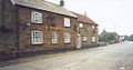
English: Little Harrowden is a village in Northamptonshire nearly three miles north-west of Wellingborough, off the A509. The village is one of the longest and narrowest parishes in Northamptonshire and is built around the Church of St Mary the Virgin, which dates back to circa 1190. The parish has a population of between 800-900 and this is spread across various occupations from industrial in the east to farming in the west.
village and civil parish in Northamptonshire, United Kingdom  | |||||
| Carica un file multimediale | |||||
| Istanza di | |||||
|---|---|---|---|---|---|
| Luogo | North Northamptonshire, Northamptonshire, Midlands Orientali, Inghilterra | ||||
 | |||||
Sottocategorie
Questa categoria contiene un'unica sottocategoria, indicata di seguito.
L
File nella categoria "Little Harrowden"
Questa categoria contiene 11 file, indicati di seguito, su un totale di 11.
-
 Ammunition magazines - geograph.org.uk - 945607.jpg 640 × 480; 45 KB
-
 Entrance to Little Harrowden - geograph.org.uk - 4170314.jpg 640 × 457; 39 KB
-
 Farmland by the Midland Main Line - geograph.org.uk - 4744487.jpg 640 × 426; 48 KB
-
 Farmland near Furness Cottages - geograph.org.uk - 4744488.jpg 640 × 426; 49 KB
-
 Field drain to the River Ise - geograph.org.uk - 4782823.jpg 640 × 285; 36 KB
-
 Kettering Road looking towards Hill Side and Hill Top Farm - geograph.org.uk - 6224879.jpg 1 920 × 1 280; 1,17 MB
-
 Kettering Road, Little Harrowden - geograph.org.uk - 6224882.jpg 1 878 × 1 214; 1,4 MB
-
 Old ICI Ammunition magazines - geograph.org.uk - 945603.jpg 640 × 480; 56 KB
-
 Thatched Cottage, Little Harrowden - geograph.org.uk - 2409970.jpg 768 × 1 024; 275 KB
-

-