Category:Little Hucklow
Vai alla navigazione
Vai alla ricerca
village and civil parish in Derbyshire Dales district, Derbyshire, England  | |||||
| Carica un file multimediale | |||||
| Istanza di | |||||
|---|---|---|---|---|---|
| Luogo | Derbyshire Dales, Derbyshire, Midlands Orientali, Inghilterra | ||||
 | |||||
Sottocategorie
Questa categoria contiene le 2 sottocategorie indicate di seguito, su un totale di 2.
B
- The Blind Bull (6 F)
C
- Coplow Dale (1 F)
File nella categoria "Little Hucklow"
Questa categoria contiene 68 file, indicati di seguito, su un totale di 68.
-
 Coplow Dale Farm - geograph.org.uk - 6137249.jpg 1 024 × 683; 233 KB
-
 Cottage in Windmill - geograph.org.uk - 3103355.jpg 4 345 × 2 897; 2,7 MB
-
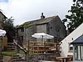
 Cottage renovation in Coplow Dale - geograph.org.uk - 3103281.jpg 3 820 × 2 729; 2,8 MB
-
 Cow and calf on Hucklow Moor - geograph.org.uk - 5386734.jpg 3 636 × 4 904; 3,42 MB
-
 Derbyshire UK parish map highlighting Little Hucklow.svg 888 × 1 308; 2,34 MB
-
 Derelict barn at Little Hucklow - geograph.org.uk - 2651401.jpg 3 264 × 2 448; 4,38 MB
-
 Dew pond, barn and Durham Edge - geograph.org.uk - 1565422.jpg 640 × 426; 53 KB
-
 Driving past Little Hucklow - geograph.org.uk - 2644145.jpg 4 000 × 3 000; 2,92 MB
-
 Dry valley at Little Hucklow - geograph.org.uk - 2651172.jpg 3 264 × 2 448; 4,07 MB
-
 Entering the Hamlet of Windmill - geograph.org.uk - 1019229.jpg 640 × 480; 77 KB
-
 Entrance to Tideslow Farm camping site - geograph.org.uk - 2967742.jpg 800 × 600; 162 KB
-
 Ewe and lambs above Little Hucklow - geograph.org.uk - 5386739.jpg 4 858 × 3 427; 4,44 MB
-
 Ewe and lambs south of Forest Lane - geograph.org.uk - 5386748.jpg 4 842 × 3 516; 4,58 MB
-
 Farm buildings at Coplow Dale - geograph.org.uk - 2512995.jpg 3 648 × 2 736; 5,31 MB
-

-
 Field pattern near Little Hucklow - geograph.org.uk - 2873057.jpg 1 024 × 780; 194 KB
-
 Fields ^ walls S of Little Hucklow - geograph.org.uk - 6374534.jpg 5 184 × 2 920; 6,67 MB
-
 Final effluent sampling point - geograph.org.uk - 1564637.jpg 640 × 480; 67 KB
-
 Footpath at High Rake - geograph.org.uk - 6131962.jpg 1 600 × 1 200; 1,03 MB
-
 Footpath towards Little Hucklow - geograph.org.uk - 1591587.jpg 640 × 480; 175 KB
-
 Forest Lane - geograph.org.uk - 2093309.jpg 3 296 × 2 472; 1,12 MB
-
 Forest Lane Farm - geograph.org.uk - 408.jpg 640 × 480; 371 KB
-
 Forest Lane Little Hucklow - geograph.org.uk - 4075203.jpg 1 024 × 768; 124 KB
-
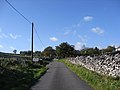
 Forest Lane west of Little Hucklow - geograph.org.uk - 3103286.jpg 4 608 × 3 072; 3,16 MB
-
 Garden and rear of lead miner's house at Little Hucklow - geograph.org.uk - 2651398.jpg 3 264 × 2 448; 5,16 MB
-
 Garden at Coplow Dale - geograph.org.uk - 1963266.jpg 640 × 480; 89 KB
-
 Gatehouse, Little Hucklow - geograph.org.uk - 2967730.jpg 800 × 600; 163 KB
-
 High Rake - geograph.org.uk - 3452259.jpg 2 048 × 1 536; 619 KB
-
 High Rake Lead Mine - geograph.org.uk - 256758.jpg 640 × 427; 100 KB
-
 High Rake Mine, ruins - geograph.org.uk - 4397069.jpg 4 912 × 3 264; 6,81 MB
-
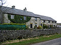
 House and barn at Little Hucklow - geograph.org.uk - 2651177.jpg 3 264 × 2 448; 3,65 MB
-
 House and former barn at Little Hucklow - geograph.org.uk - 2651333.jpg 3 264 × 2 448; 3,79 MB
-
 House in the hamlet of Windmill - geograph.org.uk - 3103349.jpg 4 224 × 2 816; 2,41 MB
-
 Houses at Little Hucklow - geograph.org.uk - 2651337.jpg 3 264 × 2 448; 4,48 MB
-
 Little Hucklow - geograph.org.uk - 1019235.jpg 640 × 480; 62 KB
-
 Little Hucklow - geograph.org.uk - 88381.jpg 640 × 480; 189 KB
-
 Little Hucklow is in the dip - geograph.org.uk - 1565412.jpg 640 × 480; 58 KB
-
 Little Hucklow Sunday School - geograph.org.uk - 2651407.jpg 3 264 × 2 448; 3,74 MB
-

-
 Little Hucklow, Sunday School - geograph.org.uk - 6131958.jpg 1 600 × 1 200; 425 KB
-
 Little hucklow.jpg 1 214 × 1 012; 237 KB
-
 Manor House, Little Hucklow.jpg 1 800 × 1 350; 566 KB
-
 Newlands farm Coplow Dale - geograph.org.uk - 4075218.jpg 1 024 × 768; 156 KB
-
 Nosy Cow^ - geograph.org.uk - 3103292.jpg 3 072 × 4 608; 3,33 MB
-
 Old tractor at a farm entrance in Coplow Dale - geograph.org.uk - 3103274.jpg 4 197 × 2 998; 2,8 MB
-
 Pasture at High Rake - geograph.org.uk - 2655831.jpg 3 264 × 2 448; 4,12 MB
-
 Powerline on Pittlemere Lane - geograph.org.uk - 4075197.jpg 1 024 × 768; 130 KB
-
 Riddle in the Dark Peak - geograph.org.uk - 2270803.jpg 1 969 × 1 132; 1,74 MB
-
 Sheep in winter, Coplow Dale - geograph.org.uk - 4322028.jpg 4 912 × 3 264; 6,5 MB
-
 Site of the High Rake Lead Mine - geograph.org.uk - 1728186.jpg 3 296 × 2 472; 1 008 KB
-
 Small field barn, Little Hucklow - geograph.org.uk - 4322014.jpg 4 912 × 3 264; 6,34 MB
-
 Small quarry remains on Forest Lane - geograph.org.uk - 1944304.jpg 640 × 480; 66 KB
-
 South View farm Little Hucklow - geograph.org.uk - 4075209.jpg 1 024 × 768; 106 KB
-
 Stile leading to Tideslow Rake - geograph.org.uk - 3176062.jpg 4 298 × 3 070; 2,92 MB
-
 Stone-walled fields sloping up to Little Hucklow - geograph.org.uk - 6137245.jpg 1 024 × 683; 192 KB
-
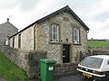
 Sunday School, Little Hucklow - geograph.org.uk - 1564660.jpg 640 × 494; 60 KB
-
 Sunlight through clouds - geograph.org.uk - 4322038.jpg 4 912 × 3 264; 3,91 MB
-
 Telephone box and old barn in Little Hucklow - geograph.org.uk - 3103337.jpg 4 191 × 2 994; 3,24 MB
-

-

-
 Track near Bushy Heath Farm - geograph.org.uk - 2093328.jpg 3 296 × 2 472; 1,04 MB
-
 View from Caravan Club C.L - geograph.org.uk - 1398941.jpg 640 × 480; 68 KB
-
 View of Little Hucklow - geograph.org.uk - 2873054.jpg 1 024 × 677; 161 KB
-
 Walking up to Little Hucklow - geograph.org.uk - 1564622.jpg 640 × 480; 57 KB
-
 Washhouse Bottom - geograph.org.uk - 3927165.jpg 3 008 × 2 000; 4,93 MB
-
 Wicker chair abandoned at road side - geograph.org.uk - 1565463.jpg 640 × 487; 88 KB
-
 Windmill, former mining village - geograph.org.uk - 4397103.jpg 4 912 × 3 264; 7,69 MB
-
 Woodland, High Rake - geograph.org.uk - 4761861.jpg 640 × 426; 47 KB


