Category:Little Paxton
Vai alla navigazione
Vai alla ricerca
English: Little Paxton in Cambridgeshire, England is a village near Great Paxton north of St Neots. It is in the district and historic county of Huntingdonshire. Until the 1970s it was a minor village and the church was under threat of closure. The building of a housing estate and a junior school revived its fortunes and the establishment of the Paxton Pits Nature Reserve around part of the nearby gravel pits has brought visitors to the village.
villaggio inglese  | |||||
| Carica un file multimediale | |||||
| Istanza di | |||||
|---|---|---|---|---|---|
| Luogo | Huntingdonshire, Cambridgeshire, Est dell'Inghilterra, Inghilterra | ||||
| Considerato essere uguale a | Little Paxton (pagina Wikimedia duplicata, parrocchia civile dell'Inghilterra) | ||||
 | |||||
Sottocategorie
Questa categoria contiene le 2 sottocategorie indicate di seguito, su un totale di 2.
J
L
- Little Paxton Pits (3 F)
File nella categoria "Little Paxton"
Questa categoria contiene 116 file, indicati di seguito, su un totale di 116.
-
 A1 by Little Paxton - geograph.org.uk - 6324565.jpg 1 024 × 576; 67 KB
-
 A1 near Little Paxton - geograph.org.uk - 3129924.jpg 640 × 480; 75 KB
-
 A1 near Little Paxton - geograph.org.uk - 4668212.jpg 640 × 379; 29 KB
-
 A1 northbound - geograph.org.uk - 4534981.jpg 640 × 478; 46 KB
-
 A1 northbound - geograph.org.uk - 4534985.jpg 640 × 480; 51 KB
-
 A1 northbound - geograph.org.uk - 466200.jpg 640 × 480; 69 KB
-
 B1041 bridge, A1 - geograph.org.uk - 4668214.jpg 640 × 369; 35 KB
-
 B1041 road bridge across A1 - geograph.org.uk - 5895665.jpg 1 024 × 656; 150 KB
-
 B1043 towards Great Paxton - geograph.org.uk - 442818.jpg 640 × 480; 71 KB
-
 B1043 towards St Neots - geograph.org.uk - 442817.jpg 640 × 318; 46 KB
-
 Boardwalk, Paxton Pits - geograph.org.uk - 4996309.jpg 1 600 × 1 200; 1,25 MB
-
 Car park, Paxton Pits - geograph.org.uk - 4996317.jpg 1 600 × 1 188; 695 KB
-
 Cloudy Lake, Paxton Pits Nature Reserve - geograph.org.uk - 2726844.jpg 4 000 × 3 000; 4,08 MB
-
 Country road near Little Paxton - geograph.org.uk - 2102994.jpg 640 × 383; 123 KB
-
 Ditch by Great Ouse - geograph.org.uk - 4996297.jpg 1 600 × 1 098; 668 KB
-
 Down stream on the Kym - geograph.org.uk - 1278962.jpg 640 × 480; 134 KB
-
 Education Centre at Paxton Pits Nature Reserve - geograph.org.uk - 2726840.jpg 4 000 × 3 000; 4,32 MB
-
 Entrance to Little Paxton Quarry - geograph.org.uk - 2726841.jpg 4 000 × 3 000; 4,46 MB
-
 Farm track exit - entrance - geograph.org.uk - 1278939.jpg 640 × 480; 78 KB
-
 Farmland near Little Paxton - geograph.org.uk - 3129895.jpg 640 × 480; 78 KB
-
 Farmland near the A1 - geograph.org.uk - 3129900.jpg 640 × 506; 75 KB
-
 Farmland near the A1 - geograph.org.uk - 3129928.jpg 640 × 480; 87 KB
-
 Farmland towards Little Paxton Wood - geograph.org.uk - 3129935.jpg 640 × 480; 70 KB
-
 Farmland towards the A1 - geograph.org.uk - 3129906.jpg 640 × 480; 86 KB
-
 Footbridge and B1041 crossing the Great Ouse - geograph.org.uk - 4996212.jpg 1 600 × 1 200; 786 KB
-
 Footbridge over River Great Ouse - geograph.org.uk - 3129888.jpg 640 × 480; 87 KB
-
 Ford and footbridge near Hail Weston - geograph.org.uk - 3129944.jpg 640 × 480; 107 KB
-
 Glimpse of a train passing - Paxton Hill - August 2013 - panoramio.jpg 4 000 × 3 000; 2,34 MB
-
 Glimpse of the new windfarm around Toseland from Paxton Pits - August 2013 - panoramio.jpg 3 000 × 4 000; 1,65 MB
-
 Gordon Road, Little Paxton - geograph.org.uk - 4952931.jpg 1 600 × 1 248; 664 KB
-
 Gravel pits at Little Paxton - geograph.org.uk - 222064.jpg 640 × 599; 99 KB
-
 Gravel plant - Little Paxton - geograph.org.uk - 1547935.jpg 640 × 414; 98 KB
-
 Great Meadow - geograph.org.uk - 4996289.jpg 1 600 × 1 200; 917 KB
-

-
 Great River Ouse, St Neots - geograph.org.uk - 1260341.jpg 640 × 480; 95 KB
-
 Hail Weston Ford and Footbridge - geograph.org.uk - 1495351.jpg 640 × 480; 165 KB
-
 Hail Weston Ford from the North Side - geograph.org.uk - 1278953.jpg 640 × 480; 112 KB
-
 Hail Weston Ford looking north - geograph.org.uk - 1278971.jpg 640 × 480; 114 KB
-
 Hayling Avenue, Little Paxton - geograph.org.uk - 3129916.jpg 640 × 480; 54 KB
-
 Hayling Lake, Paxton Pits - geograph.org.uk - 4996306.jpg 1 600 × 1 200; 477 KB
-
 Hayling Walk, Little Paxton - geograph.org.uk - 707441.jpg 640 × 480; 103 KB
-
 Heronry South Lake, Paxton Pits Nature Reserve - geograph.org.uk - 2726843.jpg 4 000 × 3 000; 4,44 MB
-
 High Street - geograph.org.uk - 1732947.jpg 2 592 × 1 944; 2,21 MB
-
 High Street, Little Paxton - geograph.org.uk - 1206516.jpg 640 × 428; 97 KB
-
 High Street, Little Paxton - geograph.org.uk - 3129918.jpg 640 × 480; 62 KB
-
 Houses by the Great Ouse - geograph.org.uk - 4996223.jpg 1 600 × 1 025; 576 KB
-
 Island in the Great Ouse - geograph.org.uk - 4996225.jpg 1 600 × 1 200; 616 KB
-
 Lake at Paxton Pits - 30th August 2013 - panoramio.jpg 4 000 × 3 000; 1,63 MB
-
 Lake in late summer - Paxton Pits - August 2013 - panoramio.jpg 4 000 × 3 000; 2,12 MB
-

-

-
 Late summer - Paxton Pits - August 2013 - panoramio.jpg 4 000 × 3 000; 1,58 MB
-
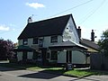
 The Anchor, Little Paxton - geograph.org.uk - 1255263.jpg 640 × 480; 73 KB
-
 Little Paxton Cemetery - geograph.org.uk - 3129933.jpg 640 × 480; 84 KB
-
 Little Paxton Lane - geograph.org.uk - 1732964.jpg 2 592 × 1 944; 2,41 MB
-
 Little Paxton Village Sign - geograph.org.uk - 1260281.jpg 480 × 640; 89 KB
-
 Lock No. 9 - geograph.org.uk - 3788653.jpg 4 320 × 3 240; 6,38 MB
-
 Looking north from Hail Weston Ford - geograph.org.uk - 1495271.jpg 640 × 480; 169 KB
-
 Mill Lane - geograph.org.uk - 1732976.jpg 2 592 × 1 944; 2,35 MB
-
 Mill Lane heading north - geograph.org.uk - 3129891.jpg 640 × 480; 83 KB
-
 New flats on a Great Ouse island - geograph.org.uk - 4996208.jpg 1 600 × 1 200; 586 KB
-
 Old aggregate yard at Paxton Pits - August 2013 - panoramio.jpg 3 896 × 2 858; 1,32 MB
-
 Old Milepost - geograph.org.uk - 2883552.jpg 768 × 1 024; 404 KB
-
 Old Milepost - geograph.org.uk - 2883556.jpg 1 024 × 768; 240 KB
-
 Ouse Valley Way - geograph.org.uk - 4996286.jpg 1 600 × 1 200; 987 KB
-
 Ouse Valley Way - geograph.org.uk - 4996293.jpg 1 600 × 1 200; 879 KB
-
 Ouse Valley Way - geograph.org.uk - 4996302.jpg 1 600 × 1 200; 808 KB
-
 Ouse Valley Way - geograph.org.uk - 4996338.jpg 1 600 × 1 200; 971 KB
-
 Ouse Valley Way east of Little Paxton - geograph.org.uk - 708320.jpg 566 × 440; 153 KB
-
 Ouse Valley Way, Paxton Pits - geograph.org.uk - 4996320.jpg 1 600 × 1 200; 1,27 MB
-
 Papermill Lock development continuing - geograph.org.uk - 4996191.jpg 1 600 × 1 200; 519 KB
-
 Papermill Lock development continuing - geograph.org.uk - 4996204.jpg 1 600 × 1 200; 624 KB
-
 Papermill Lock sales office - geograph.org.uk - 4996186.jpg 1 200 × 1 600; 644 KB
-
 Path and meadow, Paxton Pits - geograph.org.uk - 4996312.jpg 1 600 × 1 200; 767 KB
-
 Path in Paxton Pits Nature Reserve - geograph.org.uk - 2726845.jpg 4 000 × 3 000; 4,36 MB
-
 Paxton Pits Nature Reserve - geograph.org.uk - 1206569.jpg 640 × 428; 116 KB
-
 Permissive path, Paxton Pits - geograph.org.uk - 4996337.jpg 1 600 × 1 216; 843 KB
-
 Pollarded willow by the Great Ouse - geograph.org.uk - 4996299.jpg 1 600 × 1 200; 865 KB
-
 River Great Ouse - geograph.org.uk - 3788659.jpg 4 320 × 3 240; 4,08 MB
-
 River Great Ouse - geograph.org.uk - 4996301.jpg 1 600 × 1 200; 617 KB
-
 River Great Ouse at Little Paxton.jpg 972 × 1 296; 601 KB
-
 River Great Ouse, St Neots - geograph.org.uk - 684755.jpg 640 × 480; 63 KB
-
 River Kym, Hail Weston Ford - geograph.org.uk - 1495290.jpg 640 × 480; 200 KB
-
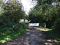
 Road closure gates - geograph.org.uk - 1278947.jpg 640 × 480; 97 KB
-
 Road to Hail Weston - geograph.org.uk - 1987614.jpg 640 × 480; 64 KB
-
 Rudd Lake, Paxton Pits - geograph.org.uk - 4996315.jpg 1 600 × 1 207; 522 KB
-
 Samuel Jones Crescent - geograph.org.uk - 4996164.jpg 1 600 × 1 200; 672 KB
-
 Samuel Jones Crescent - geograph.org.uk - 4996169.jpg 1 600 × 1 200; 477 KB
-
 Samuel Jones Crescent - geograph.org.uk - 4996181.jpg 1 600 × 1 200; 575 KB
-
 Scrub growth alongside the river - Paxton Pits - August 2013 - panoramio.jpg 4 000 × 3 000; 2,47 MB
-
 Skipper Way - geograph.org.uk - 4996227.jpg 1 600 × 1 247; 665 KB
-
 Sluice on the Great Ouse - geograph.org.uk - 4996220.jpg 1 200 × 1 600; 803 KB
-
 St James' Cottage, Little Paxton - geograph.org.uk - 1260083.jpg 640 × 480; 79 KB
-
 St James' Little Paxton - geograph.org.uk - 3788656.jpg 4 320 × 3 240; 4,56 MB
-
 St James's Church, Little Paxton - geograph.org.uk - 3129910.jpg 640 × 480; 59 KB
-
 St James's church, Little Paxton - geograph.org.uk - 3219831.jpg 1 600 × 1 200; 400 KB
-
 St Neots Housing development - geograph.org.uk - 1260333.jpg 640 × 480; 63 KB
-
 St Neots Lock No.9 - geograph.org.uk - 1260326.jpg 480 × 640; 75 KB
-
 St Neots lock, Little Paxton - geograph.org.uk - 707098.jpg 640 × 480; 95 KB
-
 St Neots Sluice. - geograph.org.uk - 1226545.jpg 640 × 480; 69 KB
-
 The Anchor Inn, High Street, Little Paxton - geograph.org.uk - 2733827.jpg 4 000 × 3 000; 2,47 MB
-
 The Anchor, Little Paxton - geograph.org.uk - 3129914.jpg 640 × 482; 56 KB
-
 The Great River Ouse, St Neots - geograph.org.uk - 1260311.jpg 640 × 480; 72 KB
-
 The Mill House - geograph.org.uk - 3788667.jpg 4 320 × 3 240; 4,32 MB
-
-
 Track to Paxton Lakes Sailing Club - geograph.org.uk - 3129921.jpg 640 × 480; 124 KB
-
 Track towards Quarry, Little Paxton - geograph.org.uk - 3129923.jpg 480 × 640; 69 KB
-

-
 Turning for Little Paxton - geograph.org.uk - 3320781.jpg 640 × 452; 30 KB
-
 Upstream from Hail Weston Ford - geograph.org.uk - 1278967.jpg 640 × 480; 96 KB
-
 Visitor Centre, Paxton Pits - geograph.org.uk - 4996316.jpg 1 600 × 1 200; 667 KB
-
 Water lillies - Paxton Pits - August 2013 - panoramio.jpg 4 000 × 3 000; 1,91 MB
-
 Weedy Lake, Paxton Pits Nature Reserve - geograph.org.uk - 2726839.jpg 4 000 × 3 000; 4,35 MB
-

-
 Roadside Meteorological Sensor Mast - geograph.org.uk - 536195.jpg 480 × 640; 50 KB
-
 Sewage works entrance - geograph.org.uk - 442814.jpg 640 × 531; 77 KB


