Category:Little Totham
Aller à la navigation
Aller à la recherche
English: Little Totham is a village in Essex, England, with a population of about 300. The parish extends from the extensive common and heath-land of Tiptree down to the River Blackwater. The village lies about 6 miles 10 km) from Maldon and 5 miles (8 km) from Tiptree and lies on the back road between Goldhanger and the Maldon to Colchester road. It is part of Maldon District Council.
village britannique .jpg) | |||||
| Téléverser des médias | |||||
| Nature de l’élément | |||||
|---|---|---|---|---|---|
| Lieu | Maldon, Essex, Angleterre de l'Est, Angleterre | ||||
 | |||||
Sous-catégories
Cette catégorie comprend 2 sous-catégories, dont les 2 ci-dessous.
L
S
- The Swan, Little Totham (3 F)
Média dans la catégorie « Little Totham »
Cette catégorie comprend 52 fichiers, dont les 52 ci-dessous.
-
 Beckingham Street, Little Totham - geograph.org.uk - 4535019.jpg 640 × 480 ; 123 kio
-
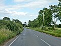
 Bend in Maldon Road (B1026), Wash Bridge - geograph.org.uk - 5381944.jpg 640 × 480 ; 93 kio
-
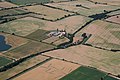 Chappel Farm - geograph.org.uk - 2191015.jpg 1 600 × 1 067 ; 430 kio
-
 Chigborough Road - geograph.org.uk - 5381928.jpg 640 × 480 ; 83 kio
-
 Crop field, Wash Bridge - geograph.org.uk - 5381936.jpg 640 × 480 ; 62 kio
-
 Evangelical Church, Little Totham, Essex - geograph.org.uk - 2037917.jpg 640 × 458 ; 112 kio
-
 Field east of Little Totham Road - geograph.org.uk - 6386002.jpg 1 600 × 1 067 ; 402 kio
-
 Field of wheat - geograph.org.uk - 3526420.jpg 640 × 480 ; 93 kio
-
 Footpath Junction Near The Haven Farm - geograph.org.uk - 3451871.jpg 640 × 424 ; 75 kio
-

-
 Footpath signpost near Clarks Farm, Little Totham - geograph.org.uk - 4324563.jpg 2 736 × 3 420 ; 4,72 Mio
-
 Footpath to Little Totham Hall - geograph.org.uk - 3451996.jpg 640 × 424 ; 79 kio
-
 Footpath to Rook Hall - geograph.org.uk - 6342666.jpg 4 825 × 3 216 ; 3,73 Mio
-
 Footpath towards Little Totham church - geograph.org.uk - 4535012.jpg 640 × 480 ; 115 kio
-
 Footpath ^ Farm Machinery - geograph.org.uk - 3452053.jpg 640 × 424 ; 82 kio
-
 Footpath ^ Signs of Spring - geograph.org.uk - 3452030.jpg 424 × 640 ; 111 kio
-
 Gadwall Lake, Chigborough Lakes - geograph.org.uk - 3526450.jpg 640 × 480 ; 102 kio
-
 Gadwall Lake, Chigborough Lakes Nature Reserve - geograph.org.uk - 4314938.jpg 1 600 × 1 064 ; 393 kio
-

-
 Grazing near Chigborough Farm - geograph.org.uk - 5381926.jpg 640 × 480 ; 50 kio
-
 Green Lane - geograph.org.uk - 3451903.jpg 640 × 424 ; 99 kio
-
 Green Lane, Little Totham - geograph.org.uk - 6385990.jpg 1 067 × 1 600 ; 672 kio
-
 Horses and sheep near Chappel Farm, Little Totham - geograph.org.uk - 4416797.jpg 1 024 × 683 ; 169 kio
-
 Lake at Little Totham Hall - geograph.org.uk - 4314947.jpg 1 600 × 1 064 ; 574 kio
-
 Lake near Little Tottham Hall - geograph.org.uk - 3452040.jpg 640 × 424 ; 58 kio
-

-
 Minor road, Wash Bridge - geograph.org.uk - 5381941.jpg 640 × 480 ; 68 kio
-
 Near Vine Farm - geograph.org.uk - 3451887.jpg 424 × 640 ; 100 kio
-
 Office Lane - geograph.org.uk - 4535161.jpg 640 × 480 ; 150 kio
-
 Old Farm - geograph.org.uk - 3451981.jpg 640 × 424 ; 62 kio
-
 Part of Totham Plains - geograph.org.uk - 6385986.jpg 1 600 × 1 067 ; 340 kio
-
 Path to Green Lane - geograph.org.uk - 3451896.jpg 424 × 640 ; 78 kio
-
 Playground in Little Totham - geograph.org.uk - 3451929.jpg 640 × 424 ; 95 kio
-
 Pond by the Footpath to Little Totham Hall (geograph 3451988).jpg 640 × 424 ; 101 kio
-
 Stream in Little Totham - geograph.org.uk - 3451960.jpg 424 × 640 ; 87 kio
-
 The Swan, Little Totham - geograph.org.uk - 6385995.jpg 1 600 × 1 067 ; 426 kio
-
 The Village Pond Little Totham - geograph.org.uk - 3451941.jpg 640 × 424 ; 94 kio
-
 The White House - geograph.org.uk - 3451972.jpg 640 × 424 ; 64 kio
-
 Totham Plains - geograph.org.uk - 4535173.jpg 640 × 480 ; 129 kio
-
 Towards Beckingham St - geograph.org.uk - 3440975.jpg 424 × 640 ; 70 kio
-
 Towards Little Tottham Hall - geograph.org.uk - 3452063.jpg 424 × 640 ; 66 kio
-
 Tree on Maldon Road east of Heybridge - geograph.org.uk - 6081530.jpg 1 920 × 1 280 ; 1,36 Mio
-
 Wash Lane - geograph.org.uk - 4317966.jpg 1 600 × 1 064 ; 573 kio
-
 Winding lane east of Heybridge - geograph.org.uk - 5911308.jpg 1 024 × 777 ; 166 kio
-
-
 Blind Lane - geograph.org.uk - 288186.jpg 640 × 426 ; 107 kio
-
 Chigborough Road - geograph.org.uk - 262633.jpg 640 × 423 ; 64 kio
-
 Farmhouse at Little Renters Farm - geograph.org.uk - 262682.jpg 640 × 480 ; 71 kio
-
 Farmhouse at Voucher's Farm - geograph.org.uk - 262645.jpg 640 × 426 ; 63 kio
-
 Old barn at Brick House Farm - geograph.org.uk - 262696.jpg 640 × 480 ; 93 kio
-
 Wash Lane - geograph.org.uk - 288169.jpg 640 × 426 ; 104 kio
-

,_Wash_Bridge_-_geograph.org.uk_-_5381944.jpg)


.jpg)


