Category:Little Whelnetham
Aller à la navigation
Aller à la recherche
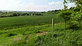
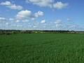
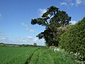
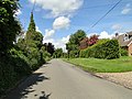
English: Little Whelnetham is a village and civil parish in the St Edmundsbury district of Suffolk in eastern England. Located around two miles south of Bury St Edmunds, in 2005 its population was 180.[1]
localité britannique du comté anglais de Suffolk  | |||||
| Téléverser des médias | |||||
| Nature de l’élément | |||||
|---|---|---|---|---|---|
| Lieu | St Edmundsbury, Suffolk, Angleterre de l'Est, Angleterre | ||||
 | |||||
- ↑ Erreur de référence : Balise
<ref>incorrecte : aucun texte n’a été fourni pour les références nomméespopulation
Sous-catégories
Cette catégorie comprend seulement la sous-catégorie ci-dessous.
M
Média dans la catégorie « Little Whelnetham »
Cette catégorie comprend 26 fichiers, dont les 26 ci-dessous.
-
 A ploughed field by Rushbrooke Wood - geograph.org.uk - 2262472.jpg 3 648 × 2 736 ; 2,38 Mio
-
 Brick built railway building - geograph.org.uk - 1125238.jpg 640 × 480 ; 146 kio
-
 Byway near Little Welnetham - geograph.org.uk - 1125130.jpg 640 × 480 ; 84 kio
-
 Close up, Victorian postbox and bus stop, Welnetham - geograph.org.uk - 5388126.jpg 1 215 × 2 238 ; 625 kio
-
 Crop Field Near Little Welnetham - geograph.org.uk - 5773767.jpg 2 104 × 1 184 ; 515 kio
-
 Crop field near Little Welnetham Hall - geograph.org.uk - 5371865.jpg 640 × 480 ; 64 kio
-
 Footpath beside Little Welnetham Hall - geograph.org.uk - 5371863.jpg 640 × 480 ; 76 kio
-
 Footpath, Little Welnetham - geograph.org.uk - 5371868.jpg 640 × 480 ; 84 kio
-
 Furrowed field, Little Welnetham - geograph.org.uk - 5371883.jpg 640 × 480 ; 77 kio
-
 Grazing, Sicklesmere - geograph.org.uk - 5371853.jpg 640 × 480 ; 75 kio
-
 Heading south east towards Little Welnetham - geograph.org.uk - 5371858.jpg 640 × 480 ; 70 kio
-
 House in Little Welnetham - geograph.org.uk - 5371874.jpg 640 × 480 ; 103 kio
-
 Out For A Walk, Classic Car (8575131382).jpg 2 019 × 1 342 ; 4,25 Mio
-
 Line walk - geograph.org.uk - 1018913.jpg 480 × 640 ; 158 kio
-
 Line walk, Little Whelnetham - geograph.org.uk - 1368062.jpg 640 × 427 ; 128 kio
-
 Line Walk, Little Whelnetham - geograph.org.uk - 199328.jpg 427 × 640 ; 142 kio
-
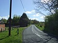
 Little W(h)elnetham - geograph.org.uk - 4504682.jpg 1 024 × 768 ; 404 kio
-
 Main road through Little Welnetham - geograph.org.uk - 5371878.jpg 640 × 480 ; 107 kio
-
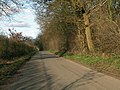
 Minor road towards Little Welnetham - geograph.org.uk - 5371856.jpg 640 × 480 ; 81 kio
-
 Part of Linkwood Road - geograph.org.uk - 2262489.jpg 3 648 × 2 736 ; 1,6 Mio
-
 Rush hour in Little Welnetham - geograph.org.uk - 5079441.jpg 640 × 480 ; 81 kio
-
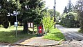
 Victorian postbox and bus stop, Welnetham - geograph.org.uk - 5388125.jpg 2 562 × 1 847 ; 1,04 Mio
-
 Victorian Postbox Next To Bus Stop - geograph.org.uk - 5773773.jpg 2 104 × 1 184 ; 554 kio
-
 Water Lane to Little Whelnetham - geograph.org.uk - 2077384.jpg 640 × 480 ; 93 kio
-
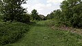 Welnetham Railway Line Walk - geograph.org.uk - 5773762.jpg 2 104 × 1 184 ; 435 kio
-
 Where's The Bridge Gone^ - geograph.org.uk - 1125741.jpg 640 × 480 ; 138 kio


.jpg)


elnetham_-_geograph.org.uk_-_4504682.jpg)


