Category:Littleborough, Greater Manchester
Zur Navigation springen
Zur Suche springen
Stadt in der Metropolregion Greater Manchester in England  | |||||
| Medium hochladen | |||||
| Ist ein(e) | |||||
|---|---|---|---|---|---|
| Ort | Metropolitan Borough of Rochdale, Greater Manchester, North West England, England | ||||
 | |||||
Unterkategorien
Es werden 17 von insgesamt 17 Unterkategorien in dieser Kategorie angezeigt:
In Klammern die Anzahl der enthaltenen Kategorien (K), Seiten (S), Dateien (D)
B
C
- Chelburn Reservoirs (18 D)
- Clough, Littleborough (9 D)
- Cowberry Hill, Littleborough (8 D)
H
- Hollingworth Lake (135 D)
L
- Littleborough Viaduct (7 D)
- Lydgate, Littleborough (12 D)
R
- Reddyshore Scout Gate (8 D)
- Rock Nook Mill (1 D)
S
- Shore Mill War Memorial (1 D)
- Summit, Littleborough (52 D)
T
Medien in der Kategorie „Littleborough, Greater Manchester“
Folgende 200 Dateien sind in dieser Kategorie, von 235 insgesamt.
(vorherige Seite) (nächste Seite)-

-
 A gate on the path alongside Hollingworth Brook - geograph.org.uk - 3801583.jpg 1.024 × 768; 288 KB
-
 A path off Blackstone Edge Old Road - geograph.org.uk - 2773345.jpg 800 × 600; 121 KB
-
 A Place in the Country (6116793935).jpg 4.107 × 2.738; 7,78 MB
-
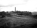
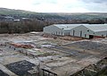 Akzo Nobel site, Littleborough - geograph.org.uk - 343318.jpg 640 × 452; 117 KB
-
 All clear for take off - geograph.org.uk - 319250.jpg 640 × 425; 84 KB
-
 Allotments below Shore - geograph.org.uk - 2220389.jpg 3.872 × 2.592; 2,38 MB
-
 Ancient and Modern. - geograph.org.uk - 570413.jpg 427 × 640; 273 KB
-

-
 Arch Bridge at Littleborough - geograph.org.uk - 929036.jpg 640 × 480; 70 KB
-
 Bandstand, Hare Hill Park.jpg 3.008 × 2.000; 3,61 MB
-
 Bar House - geograph.org.uk - 1272040.jpg 640 × 480; 56 KB
-
 Bar House on the A58 - geograph.org.uk - 3467545.jpg 640 × 480; 56 KB
-
 Birch Hill Clock Tower - geograph.org.uk - 6485364.jpg 5.616 × 2.836; 1,51 MB
-
 Blackbird (39013628).jpeg 1.366 × 2.048; 363 KB
-
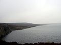 Blackstone Edge Reservoir.jpg 2.816 × 2.112; 593 KB
-
 Blasting Shelters at Utley Edge. - geograph.org.uk - 224809.jpg 640 × 480; 96 KB
-
 BlatchinworthAndCalderbrookRochdaleAncientParish.png 450 × 492; 25 KB
-
 Bleak House (6110053674).jpg 4.285 × 2.371; 3,7 MB
-
 Bookshop Flickr 19 May 2024.jpg 2.176 × 2.176; 4 MB
-
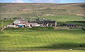
 Booth Hollins Farm, Clegg Moor - geograph.org.uk - 96525.jpg 640 × 480; 119 KB
-
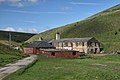 Booth Hollins Mill.jpg 3.888 × 2.592; 1,5 MB
-
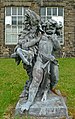 Boy and Goat (8695792475).jpg 2.313 × 3.683; 7,5 MB
-
 Brearley - geograph.org.uk - 401294.jpg 640 × 472; 118 KB
-
 Brearley Farm - geograph.org.uk - 2371686.jpg 3.872 × 2.592; 4,93 MB
-
 Bridge over Castle Clough - geograph.org.uk - 4833354.jpg 1.600 × 1.200; 715 KB
-
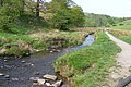
 Bridge over Ealees Brook at Lane Foot - geograph.org.uk - 3801577.jpg 1.024 × 768; 313 KB
-
 Bridleway north of A58 - geograph.org.uk - 1115138.jpg 640 × 480; 83 KB
-
 Bu-Val Buses W17 BLU rear.jpg 2.400 × 1.800; 1,33 MB
-
 Bu-Val Buses W17 BLU.jpg 2.400 × 1.800; 1,05 MB
-

-
 Business units on Todmorden Road - geograph.org.uk - 1910326.jpg 3.872 × 2.592; 4,57 MB
-

-

-
 Car park re-surfacing - geograph.org.uk - 784717.jpg 640 × 480; 109 KB
-
 Cattle grid near Owlet Hall - geograph.org.uk - 2325566.jpg 1.600 × 1.198; 359 KB
-
 Church Street - geograph.org.uk - 497453.jpg 640 × 480; 80 KB
-
 Church Street - geograph.org.uk - 6485332.jpg 5.760 × 3.244; 1,89 MB
-
 Church Street Railway Bridge - geograph.org.uk - 1869906.jpg 1.200 × 900; 255 KB
-
 Church Street, Littleborough - panoramio.jpg 3.072 × 2.304; 1,76 MB
-
 Clegg Hall area - geograph.org.uk - 477793.jpg 640 × 490; 66 KB
-
 Cloise - geograph.org.uk - 1870321.jpg 1.200 × 900; 263 KB
-
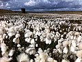 Common cottongrass at Light Hazzles Reservoir.jpg 640 × 478; 123 KB
-
 Cottage garden at Ealees - geograph.org.uk - 3671948.jpg 4.000 × 2.366; 3,53 MB
-
-
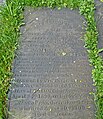
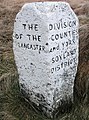 County boundary stone near Littleborough.jpg 475 × 640; 159 KB
-
 Cricket pavilion - geograph.org.uk - 450424.jpg 640 × 480; 120 KB
-
 Dearnley Old Hall-geograph.org.uk-4522201.jpg 640 × 427; 192 KB
-
 Disused Quarry at Utley Edge. - geograph.org.uk - 224807.jpg 640 × 480; 78 KB
-
 Dividing Line (4436287670).jpg 1.860 × 1.860; 4,7 MB
-
 Drinking fountain, Hare Hill Park.jpg 1.280 × 958; 1,42 MB
-
 Dry Mere on Clegg Moor - geograph.org.uk - 648342.jpg 640 × 480; 44 KB
-
 Ealees Brook - geograph.org.uk - 2325468.jpg 1.600 × 1.198; 561 KB
-
 Ealees Brook.JPG 3.264 × 2.176; 1,46 MB
-
 Ealees Valley - geograph.org.uk - 2404921.jpg 2.592 × 1.944; 893 KB
-
 Ealees, Littleborough - geograph.org.uk - 401314.jpg 474 × 640; 142 KB
-
 East Street - geograph.org.uk - 1270294.jpg 480 × 640; 69 KB
-
 Egerton Street, Littleborough - geograph.org.uk - 2773337.jpg 800 × 600; 91 KB
-
 Electric Beach Tanning Salon - geograph.org.uk - 1281782.jpg 640 × 480; 96 KB
-
 Entrance to Shore Lane Farm - geograph.org.uk - 2325586.jpg 1.600 × 1.198; 521 KB
-
 Farfield Community Nature Site - geograph.org.uk - 1229187.jpg 640 × 428; 127 KB
-
 Farm off Blackstone Edge Old Road - geograph.org.uk - 1980454.jpg 640 × 432; 103 KB
-
 Farmhouse at Brearley, near Littleborough - geograph.org.uk - 96517.jpg 640 × 480; 150 KB
-
 Farmland off Halifax Road - geograph.org.uk - 3467536.jpg 640 × 480; 44 KB
-
 First Manchester's Citaro (6078288012).jpg 4.000 × 3.000; 4,98 MB
-
 Footbridge on Shore Lane Brook - geograph.org.uk - 3801464.jpg 1.024 × 768; 390 KB
-
 Footbridges on the path to Ealees - geograph.org.uk - 5681605.jpg 1.600 × 1.200; 734 KB
-

-
 Footpath on a farm track near Syke, Littleborough - geograph.org.uk - 6117966.jpg 2.000 × 1.500; 1,04 MB
-
-
 Former pub at Gale - geograph.org.uk - 3563661.jpg 3.872 × 2.592; 3,36 MB
-
 Former Toll House, Littleborough.jpg 1.483 × 1.020; 433 KB
-

-
 Grazing land to Windy Bank Bridge - geograph.org.uk - 1429701.jpg 640 × 480; 58 KB
-
 Grazing of Halifax Road - geograph.org.uk - 3467542.jpg 640 × 480; 45 KB
-
 Grazing, Littleborough - geograph.org.uk - 3467527.jpg 640 × 480; 57 KB
-
 Halifax Road (A58) - geograph.org.uk - 1873832.jpg 640 × 480; 99 KB
-
 Halifax Road (A58), Littleborough - geograph.org.uk - 3467533.jpg 640 × 480; 65 KB
-
 Halifax Road, Littleborough - geograph.org.uk - 2179571.jpg 1.632 × 1.224; 520 KB
-
 Halifax Road, Littleborough - geograph.org.uk - 2179579.jpg 1.632 × 1.224; 601 KB
-
 Hare Hill House - geograph.org.uk - 497507.jpg 640 × 480; 99 KB
-
 Hare Hill House, Littleborough - geograph.org.uk - 5485961.jpg 4.000 × 3.000; 4,14 MB
-
 Hare Hill Park - geograph.org.uk - 497563.jpg 640 × 480; 94 KB
-
 Hare Hill Park, Littleborough - geograph.org.uk - 5485956.jpg 1.280 × 847; 986 KB
-
 Higher Shore Road - geograph.org.uk - 2220385.jpg 3.872 × 2.592; 2,26 MB
-
 Higher Shore Road - geograph.org.uk - 2220393.jpg 3.872 × 2.592; 1,28 MB
-
 Hollingworth Brook.JPG 3.264 × 2.176; 1,42 MB
-
 Hollingworth Road, Littleborough - geograph.org.uk - 6054672.jpg 640 × 480; 75 KB
-

-
 Houses at the Top of Hollingworth Road - geograph.org.uk - 680708.jpg 640 × 414; 258 KB
-
 Houses for sale - geograph.org.uk - 1132149.jpg 640 × 470; 115 KB
-
 In Life respected & in Death regretted (14313530595).jpg 2.753 × 3.194; 8,35 MB
-
 Is Health then no defence against thy Pow'r (8696894532).jpg 2.763 × 3.372; 7,89 MB
-
 Knowl Farm - geograph.org.uk - 3488487.jpg 3.888 × 2.394; 1,3 MB
-
 Land reclamation, Littleborough - geograph.org.uk - 2874703.jpg 420 × 640; 85 KB
-
 Light Hazzles Farm - geograph.org.uk - 4833380.jpg 1.600 × 1.200; 537 KB
-
 Light Hazzles Farm across the infant River Roch - geograph.org.uk - 4833378.jpg 1.600 × 1.200; 476 KB
-
 Limefield Terrace - geograph.org.uk - 1870357.jpg 1.200 × 900; 217 KB
-

-
 Through the Arch at Dawn - geograph.org.uk - 424158.jpg 640 × 481; 65 KB
-
 Littleborough (15391059518).jpg 2.944 × 2.748; 5,67 MB
-
 Littleborough (27635665036).jpg 3.072 × 2.304; 1,4 MB
-
 Littleborough (27670977935).jpg 3.072 × 2.304; 1,35 MB
-
 Littleborough (Rochdale) - Holy Trinity Church - geograph.org.uk - 6338224.jpg 5.184 × 2.920; 5,74 MB
-
 Littleborough - geograph.org.uk - 5763622.jpg 5.184 × 2.744; 1,8 MB
-
 Littleborough Cricket Club - geograph.org.uk - 2498063.jpg 1.600 × 1.200; 289 KB
-
 Littleborough Lakeside Cricket Club - geograph.org.uk - 2498080.jpg 1.600 × 1.200; 400 KB
-
 Littleborough Post Office - geograph.org.uk - 1908054.jpg 640 × 490; 131 KB
-
 Littleborough Rushbearing Festival 2010 - geograph.org.uk - 1980250.jpg 640 × 480; 134 KB
-
 Littleborough Station (14360101743).jpg 3.273 × 2.964; 6,89 MB
-
 Littleborough.jpg 1.778 × 1.144; 1,64 MB
-
 LNERs K1 And K4 Near Littleborough.jpg 2.946 × 1.830; 2,65 MB
-
 M62 Viaduct - geograph.org.uk - 34072.jpg 639 × 479; 152 KB
-
 Memorial to Laurence Newall, Littleborough (8700224544).jpg 2.229 × 3.009; 6,17 MB
-
 Middle Wood Lane, Shore - geograph.org.uk - 1864841.jpg 1.600 × 1.200; 394 KB
-
 Mill, Littleborough (14340394585).jpg 2.919 × 3.649; 8,33 MB
-
 Moorland Panorama above Littleborough - geograph.org.uk - 3990008.jpg 14.435 × 3.001; 7,75 MB
-
 New Development - geograph.org.uk - 6500459.jpg 6.000 × 3.565; 1,73 MB
-

-
 Oil Mill Bridge - geograph.org.uk - 1870866.jpg 2.816 × 2.112; 1,93 MB
-

-

-

-

-

-

-
 Old Boundary Marker on Littleborough Bridge (geograph 6701617).jpg 960 × 720; 130 KB
-
 Old Boundary Marker on Rochdale Road (geograph 6717603).jpg 960 × 720; 120 KB
-

-

-

-

-
-

-

-

-
 On field path, E of Clegg's Wood, Littleborough - geograph.org.uk - 6338228.jpg 5.184 × 2.920; 6,38 MB
-

-

-

-

-
 Overflow (2882416597).jpg 1.920 × 2.560; 4,33 MB
-

-
 Path along the edge of the moor, Littleborough - geograph.org.uk - 5484238.jpg 2.000 × 1.500; 1,06 MB
-
 Peat Moorland - geograph.org.uk - 1802973.jpg 2.816 × 2.112; 3,57 MB
-
 Pennine Bridleway, East of Benny Hill - geograph.org.uk - 343347.jpg 640 × 480; 118 KB
-
 Pennine Bridleway, High Lee Slack - geograph.org.uk - 377839.jpg 640 × 480; 104 KB
-
 Pennine Bridleway, Hollingworth Lake - geograph.org.uk - 343354.jpg 640 × 480; 131 KB
-
 Pennine Bridleway, Longden End Valley - geograph.org.uk - 326951.jpg 640 × 480; 104 KB
-
 Pennine Bridleway, Syke Moor - geograph.org.uk - 343343.jpg 640 × 480; 106 KB
-
 Pennine Way - geograph.org.uk - 59485.jpg 480 × 640; 131 KB
-
 Pink Ladies Littleborough - geograph.org.uk - 702611.jpg 384 × 640; 88 KB
-
 Plaque on Littleborough Church (6130568529).jpg 2.685 × 1.431; 2,61 MB
-
 PN52WWO at Littleborough (27351293210).jpg 3.072 × 2.304; 1,35 MB
-

-
 Private Housing, Littleborough. - geograph.org.uk - 89127.jpg 640 × 433; 111 KB
-
 Quayside (2883263302).jpg 2.446 × 1.920; 3,81 MB
-
 Railway Bridge - geograph.org.uk - 497444.jpg 640 × 480; 70 KB
-
 Railway Street - geograph.org.uk - 1908094.jpg 640 × 480; 102 KB
-
 Reservoir near Moor Gate Farm - geograph.org.uk - 4406033.jpg 1.600 × 1.200; 547 KB
-
 River Roch - geograph.org.uk - 1270295.jpg 480 × 640; 78 KB
-
 River Roch - geograph.org.uk - 497424.jpg 640 × 480; 106 KB
-

-

-
 River Roch Aqueduct.jpg 800 × 600; 501 KB
-
 Riverside Nursing Home - geograph.org.uk - 1908127.jpg 640 × 466; 116 KB
-
 Rock Nook Mill, Littleborough (14982699554).jpg 3.251 × 4.608; 10,24 MB
-
 Rock Nook Mill, Littleborough. - geograph.org.uk - 929039.jpg 640 × 480; 92 KB
-
 Rocks - geograph.org.uk - 369268.jpg 640 × 480; 133 KB
-
 Round-shaped building in Littleborough.jpg 3.072 × 2.304; 1,81 MB
-
 Sharp bend on Deep Lane, Littleborough - geograph.org.uk - 6117885.jpg 2.000 × 1.500; 1,01 MB
-
 Sheep at Sheep Bank Farm - geograph.org.uk - 2371719.jpg 3.872 × 2.592; 4,23 MB
-
 Shop, Halifax Road, Littleborough - geograph.org.uk - 2179577.jpg 1.630 × 999; 518 KB
-
 Shore Fold - geograph.org.uk - 1864856.jpg 1.600 × 1.200; 510 KB
-
 Shore Fold, Shore - geograph.org.uk - 727693.jpg 640 × 479; 164 KB
-
 Shore from the west - geograph.org.uk - 2219160.jpg 3.872 × 2.592; 1,99 MB
-
 Shore Lane Brook.JPG 3.264 × 2.176; 1,55 MB
-

-

-
 Small Valley - geograph.org.uk - 1115870.jpg 640 × 480; 94 KB
-
 Snow sign on Halifax Road - geograph.org.uk - 3296792.jpg 640 × 450; 112 KB
-
 Stile on path from Ealees to Whittaker - geograph.org.uk - 4465574.jpg 1.024 × 768; 293 KB
-
 Stone slab footbridge near Owlet Hall - geograph.org.uk - 2325545.jpg 1.600 × 1.198; 737 KB
-
 Storm clouds over Stormer Hill - geograph.org.uk - 4465603.jpg 1.024 × 768; 183 KB
-
 Swaindrod Lane - geograph.org.uk - 1870339.jpg 800 × 600; 153 KB
-
 Swaindrod Lane in the mist - geograph.org.uk - 4158883.jpg 640 × 480; 61 KB
-
 Swaindrod Lane, Littleborough - geograph.org.uk - 5590477.jpg 2.000 × 1.500; 663 KB
-
 Syke - geograph.org.uk - 400470.jpg 480 × 640; 101 KB
-

-
 Syke Farm, Littleborough - geograph.org.uk - 6117956.jpg 2.000 × 1.409; 1.015 KB
-
 Telecommunications Mast - geograph.org.uk - 1870395.jpg 900 × 1.200; 155 KB
-
 The Aiggin Stone - geograph.org.uk - 469.jpg 640 × 427; 64 KB
-
 The Aiggin Stone.jpg 640 × 312; 223 KB
-
 The Bandstand - geograph.org.uk - 497541.jpg 640 × 480; 119 KB
-
 The Bar House, Stormer Hill Bar - geograph.org.uk - 2051548.jpg 900 × 600; 207 KB
-
-
 The Fountain - geograph.org.uk - 497551.jpg 640 × 480; 135 KB
-
 The Lake at Littleborough, c.1892.jpg 2.313 × 1.524; 1,02 MB
-
 The Library - geograph.org.uk - 497525.jpg 640 × 480; 106 KB
-


.jpg)


.jpeg)


.jpg)


.jpg)


.jpg)


.jpg)


_-_geograph.org.uk_-_1873832.jpg)
,_Littleborough_-_geograph.org.uk_-_3467533.jpg)


.jpg)
.jpg)


.jpg)
.jpg)
.jpg)
_-_Holy_Trinity_Church_-_geograph.org.uk_-_6338224.jpg)


.jpg)


.jpg)

.jpg)


.jpg)
.jpg)


.jpg)


.jpg)
.jpg)


.jpg)


.jpg)


,_near_Littleborough_-_geograph.org.uk_-_96532.jpg)


