Category:Littlebury
Aller à la navigation
Aller à la recherche
English: Littlebury is a village in north-west Essex outside Saffron Walden. It has around 600 people in Littlebury itself, the village of Littlebury Green and the hamlets of Catmere End and Chapel End. It is around a mile and a half from the market town of Saffron Walden and fifteen miles south of Cambridge, the nearest city.

village britannique .jpg) | |||||
| Téléverser des médias | |||||
| Nature de l’élément | |||||
|---|---|---|---|---|---|
| Lieu | Uttlesford, Essex, Angleterre de l'Est, Angleterre | ||||
 | |||||
Sous-catégories
Cette catégorie comprend 5 sous-catégories, dont les 5 ci-dessous.
Média dans la catégorie « Littlebury »
Cette catégorie comprend 331 fichiers, dont les 200 ci-dessous.
(page précédente) (page suivante)-
 'Bob' at Audley End - geograph.org.uk - 4412029.jpg 4 000 × 2 250 ; 7,47 Mio
-
 'Bob' at Audley End - geograph.org.uk - 4412036.jpg 4 000 × 2 250 ; 7,92 Mio
-
 'Bob' at Audley End - geograph.org.uk - 4412044.jpg 4 347 × 2 445 ; 6,07 Mio
-
 'Bob' at Audley End - geograph.org.uk - 4412047.jpg 4 000 × 2 666 ; 7,54 Mio
-
 'Bob' at Audley End - geograph.org.uk - 4412055.jpg 4 000 × 2 666 ; 6,48 Mio
-

-
 A dip in the lane - geograph.org.uk - 3888460.jpg 1 200 × 935 ; 1,25 Mio
-
 A public footpath near Littlebury - geograph.org.uk - 5039071.jpg 4 608 × 3 456 ; 6,5 Mio
-
 A track off Merton Place - geograph.org.uk - 4628502.jpg 4 000 × 3 000 ; 4,25 Mio
-
 Adam Bridge, Audley End - geograph.org.uk - 6158630.jpg 1 024 × 768 ; 284 kio
-
 Apple orchard, Audley End - geograph.org.uk - 5553132.jpg 1 600 × 1 064 ; 491 kio
-
 Arable land by the M11 - geograph.org.uk - 2720432.jpg 640 × 430 ; 50 kio
-
 Arable landscape - geograph.org.uk - 5586486.jpg 640 × 426 ; 38 kio
-
 Arable landscape - geograph.org.uk - 5586499.jpg 640 × 426 ; 44 kio
-
 Audley End - geograph.org.uk - 3406536.jpg 4 320 × 3 240 ; 3,94 Mio
-
 Audley End House - geograph.org.uk - 5635743.jpg 640 × 480 ; 100 kio
-
 Audley End House - geograph.org.uk - 6253326.jpg 800 × 529 ; 66 kio
-
 Audley End House from the west - geograph.org.uk - 5562337.jpg 1 600 × 1 064 ; 413 kio
-
 Audley End Stables - geograph.org.uk - 6158603.jpg 1 024 × 768 ; 249 kio
-
 Audley End Stables - geograph.org.uk - 6253329.jpg 800 × 486 ; 111 kio
-
 Audley End system of lock on the river Cam - geograph.org.uk - 1834098.jpg 1 664 × 936 ; 725 kio
-
 Audley End Tunnel, 1951 - geograph.org.uk - 5044013.jpg 2 398 × 1 428 ; 1,67 Mio
-
 Audley End west front, morning - geograph.org.uk - 5553114.jpg 1 600 × 1 064 ; 353 kio
-
 Audley End, aerial 2019 (1) - geograph.org.uk - 6303746.jpg 1 024 × 683 ; 194 kio
-
 Audley End, aerial 2019 (2) - geograph.org.uk - 6303749.jpg 1 024 × 683 ; 173 kio
-
 Audley End, boathouse and Stable Bridge - geograph.org.uk - 5908390.jpg 1 024 × 1 024 ; 1,44 Mio
-
 Audley End, gardens and River Cam, from the Tea Bridge - geograph.org.uk - 5561995.jpg 1 600 × 1 064 ; 645 kio
-
 Audley End, gardens and River Cam, near the Tea Bridge - geograph.org.uk - 5562081.jpg 1 600 × 1 064 ; 751 kio
-
 Audley End, grapes and wasp trap - geograph.org.uk - 5908656.jpg 1 024 × 768 ; 1,06 Mio
-
 Audley End, looking up the Cam from the Tea Bridge - geograph.org.uk - 5562479.jpg 1 064 × 1 600 ; 528 kio
-
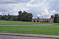 Audley End, stables, cricket field and the Cam - geograph.org.uk - 4643095.jpg 1 024 × 683 ; 899 kio
-
 Audley End, Sunday cricket - geograph.org.uk - 5908367.jpg 1 024 × 768 ; 880 kio
-
 Audley End, the Adam Bridge - geograph.org.uk - 4108723.jpg 1 024 × 768 ; 1 002 kio
-
 Audley End, the Stables, the Cam and the Stable Bridge - geograph.org.uk - 5908363.jpg 1 024 × 768 ; 1 009 kio
-
 Audley End, the Tea Bridge - geograph.org.uk - 5562000.jpg 1 600 × 1 064 ; 468 kio
-
 B1383 towards Littlebury - geograph.org.uk - 6253340.jpg 800 × 600 ; 134 kio
-
 B1383 winding through Littlebury (geograph 4222903).jpg 1 500 × 1 077 ; 1,38 Mio
-
 Big fields, pylons and the M11 - geograph.org.uk - 3888401.jpg 1 200 × 900 ; 1,1 Mio
-
 Bordeaux Farm - geograph.org.uk - 5576795.jpg 640 × 425 ; 53 kio
-
 Bordeaux Farm - geograph.org.uk - 5576798.jpg 640 × 426 ; 63 kio
-
 Bridge on Strethall Road (geograph 3209608).jpg 640 × 480 ; 83 kio
-
 Bridge over the M11 near Littlebury Green - geograph.org.uk - 6240741.jpg 800 × 533 ; 600 kio
-
 Bridge over the M11 Southbound - geograph.org.uk - 6240749.jpg 800 × 533 ; 628 kio
-
 Bridge over the River Cam, north of Audley End - geograph.org.uk - 5392973.jpg 1 600 × 1 064 ; 682 kio
-
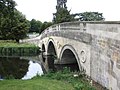 Bridge, designed by Robert Adam, Audley End - geograph.org.uk - 2484042.jpg 1 024 × 768 ; 224 kio
-
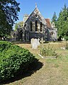
 Building to west of Holy Trinity Church, Littlebury (geograph 4031578).jpg 4 320 × 3 240 ; 4,31 Mio
-
 Cam valley farmland - geograph.org.uk - 5576803.jpg 640 × 426 ; 64 kio
-
 Cambridge bound express - geograph.org.uk - 2189410.jpg 640 × 410 ; 73 kio
-
 Cambridge line at Littlebury - geograph.org.uk - 3889883.jpg 640 × 480 ; 149 kio
-
 Cambridge Lodge, Audley End - geograph.org.uk - 5395374.jpg 1 600 × 1 064 ; 375 kio
-
 Catmere End - geograph.org.uk - 2484149.jpg 1 024 × 768 ; 196 kio
-
 Catmere End - geograph.org.uk - 4040072.jpg 4 320 × 3 240 ; 2,93 Mio
-
 Cereals in a field - geograph.org.uk - 5586483.jpg 640 × 426 ; 41 kio
-
 Cereals in a field - geograph.org.uk - 5586493.jpg 640 × 426 ; 29 kio
-
 Chapel Green to Littlebury Green - geograph.org.uk - 3888768.jpg 1 200 × 900 ; 1,52 Mio
-
 Chestnut Avenue - geograph.org.uk - 4054488.jpg 1 600 × 1 064 ; 651 kio
-
 Chestnut Avenue - geograph.org.uk - 4628347.jpg 4 000 × 3 000 ; 4 Mio
-
 Chestnut Avenue - geograph.org.uk - 4628350.jpg 4 000 × 3 000 ; 4,04 Mio
-
 Chestnut Avenue, near Audley End, Essex - geograph.org.uk - 223774.jpg 640 × 480 ; 70 kio
-
 Clayhall Cottages - geograph.org.uk - 5927089.jpg 1 200 × 857 ; 228 kio
-
 Copse by Springwell Road, Springwell - geograph.org.uk - 5586803.jpg 1 944 × 1 386 ; 711 kio
-
 Copse by Springwell Road, Springwell - geograph.org.uk - 5586844.jpg 1 944 × 1 384 ; 817 kio
-
 Countryside near Freewood Farm - geograph.org.uk - 4055308.jpg 1 600 × 1 064 ; 428 kio
-
 Cricket at Audley End - geograph.org.uk - 5907795.jpg 1 024 × 768 ; 1,22 Mio
-
 Crop field north of Littlebury - geograph.org.uk - 5400490.jpg 640 × 432 ; 49 kio
-
 Crop field, Littlebury - geograph.org.uk - 5400487.jpg 640 × 394 ; 48 kio
-
 Crop fields near Little Chesterford - geograph.org.uk - 5399124.jpg 640 × 368 ; 46 kio
-
 Crop marks in field west of Littlebury, aerial 2019 (1) - geograph.org.uk - 6303779.jpg 1 024 × 683 ; 141 kio
-
 Crop marks in field west of Littlebury, aerial 2019 (2) - geograph.org.uk - 6303784.jpg 1 024 × 683 ; 153 kio
-
 Crop marks in field west of Littlebury, aerial 2019 (3) - geograph.org.uk - 6303787.jpg 1 024 × 683 ; 155 kio
-
 Crossroads near Littlebury Green - geograph.org.uk - 3494389.jpg 2 882 × 2 160 ; 1,64 Mio
-
 Cutting, south of Great Chesterford Station - geograph.org.uk - 5576789.jpg 640 × 426 ; 95 kio
-
 Cycling to Littlebury Green - geograph.org.uk - 3888758.jpg 1 200 × 900 ; 1,28 Mio
-
 Direction Sign - geograph.org.uk - 4957457.jpg 768 × 1 024 ; 187 kio
-
 Driveway to Ring Hill Fort near Audley End - geograph.org.uk - 5038613.jpg 4 608 × 3 456 ; 6,15 Mio
-
 Earthen field north of Spring Wood - geograph.org.uk - 4222951.jpg 1 500 × 977 ; 1,5 Mio
-
 Entrance to The Ring Cottage - geograph.org.uk - 4410601.jpg 4 000 × 2 666 ; 7,3 Mio
-
 Entrance to track off the main road north of Audley End - geograph.org.uk - 5372755.jpg 1 600 × 1 064 ; 356 kio
-
 Espaliered apple trees in the kitchen garden, Audley End - geograph.org.uk - 5562563.jpg 1 600 × 1 064 ; 691 kio
-
 Farmland and woodland - geograph.org.uk - 3765573.jpg 640 × 430 ; 59 kio
-
 Farmland by the M11 - geograph.org.uk - 2720429.jpg 640 × 430 ; 41 kio
-
 Farmland by the M11 - geograph.org.uk - 2720438.jpg 640 × 430 ; 40 kio
-
 Farmland in the Cam Valley - geograph.org.uk - 3765571.jpg 640 × 430 ; 51 kio
-
 Farmland near Littlebury - geograph.org.uk - 6253344.jpg 800 × 600 ; 126 kio
-
 Farmland on the Audley Estate - geograph.org.uk - 400792.jpg 640 × 480 ; 60 kio
-
 Farmland towards Charles's Plantation - geograph.org.uk - 6253337.jpg 640 × 410 ; 85 kio
-
 Farmland, Cornwallis Hill - geograph.org.uk - 3765584.jpg 640 × 430 ; 39 kio
-
 Farmland, Littlebury - geograph.org.uk - 5586481.jpg 640 × 426 ; 35 kio
-
 Field north of Audley End - geograph.org.uk - 5554320.jpg 1 600 × 1 064 ; 462 kio
-
 Field off the Icknield Way - geograph.org.uk - 5758523.jpg 5 202 × 3 465 ; 2,62 Mio
-
 Fields by Springwell Road - geograph.org.uk - 3209617.jpg 640 × 427 ; 91 kio
-
 Fields near Littlebury Green - geograph.org.uk - 3889812.jpg 640 × 480 ; 140 kio
-
 Footbridge across the M11 - geograph.org.uk - 1970051.jpg 640 × 430 ; 58 kio
-
 Footbridge crosses the M11 - geograph.org.uk - 2722436.jpg 640 × 427 ; 51 kio
-
 Footbridge over the M11 - geograph.org.uk - 1969412.jpg 640 × 279 ; 62 kio
-
 Footbridge over the M11 - geograph.org.uk - 2587904.jpg 640 × 374 ; 58 kio
-
 Footbridge, M11 - geograph.org.uk - 3759135.jpg 640 × 468 ; 41 kio
-
 Footpath - geograph.org.uk - 4503018.jpg 1 024 × 768 ; 220 kio
-
 Footpath - geograph.org.uk - 4503043.jpg 768 × 1 024 ; 295 kio
-
 Footpath And Track - geograph.org.uk - 5065324.jpg 1 024 × 768 ; 214 kio
-
 Gates at the Cambridge Lodge entrance, Audley End - geograph.org.uk - 5396250.jpg 1 600 × 1 064 ; 567 kio
-
 Grapes in the glasshouses, Audley End - geograph.org.uk - 5562546.jpg 1 600 × 1 064 ; 445 kio
-
 Grazing near Bordeaux Farms - geograph.org.uk - 5399121.jpg 640 × 426 ; 56 kio
-
 Great Chesterford from the air - geograph.org.uk - 2869561.jpg 640 × 480 ; 139 kio
-
 Greenhouses in the walled garden, Audley End - geograph.org.uk - 5924921.jpg 2 000 × 1 500 ; 1 Mio
-
 Herbs in the kitchen garden, Audley End - geograph.org.uk - 5562560.jpg 1 600 × 1 064 ; 755 kio
-
 Herbs in the walled garden, Audley End - geograph.org.uk - 5924912.jpg 2 000 × 1 500 ; 1,12 Mio
-
 High Balks - geograph.org.uk - 6053398.jpg 1 024 × 768 ; 229 kio
-
 Howe Wood - geograph.org.uk - 3889864.jpg 640 × 480 ; 98 kio
-
 Howe Wood - geograph.org.uk - 6053231.jpg 1 024 × 768 ; 291 kio
-
 Howe Wood - geograph.org.uk - 6053295.jpg 1 024 × 768 ; 240 kio
-
 In the glasshouses, Audley End - geograph.org.uk - 5562556.jpg 1 600 × 1 064 ; 473 kio
-
 In the walled garden, Audley End - geograph.org.uk - 5924935.jpg 2 000 × 1 500 ; 1,12 Mio
-
 J9, M11 - geograph.org.uk - 4841211.jpg 640 × 426 ; 34 kio
-
 Junction near Littebury Green - geograph.org.uk - 4040039.jpg 4 287 × 2 700 ; 4,08 Mio
-
 Kitchen garden area, Audley End - geograph.org.uk - 5562182.jpg 1 600 × 1 064 ; 601 kio
-
 Lake, Audley End - geograph.org.uk - 5635740.jpg 640 × 480 ; 107 kio
-
 Large wheat field by the M11 - geograph.org.uk - 2587908.jpg 640 × 430 ; 63 kio
-

-
 Linear woodland and farmland - geograph.org.uk - 3765578.jpg 640 × 430 ; 39 kio
-
 Littlebury - geograph.org.uk - 5576818.jpg 640 × 426 ; 84 kio
-
 Littlebury and Holy Trinity church (geograph 3406555).jpg 4 320 × 3 240 ; 4,21 Mio
-
 Littlebury churchyard and Flint Cottage - geograph.org.uk - 6251014.jpg 819 × 1 024 ; 1,25 Mio
-
 Littlebury churchyard and King's Mill - geograph.org.uk - 6251019.jpg 1 024 × 1 024 ; 1,41 Mio
-
 Littlebury churchyard in August - geograph.org.uk - 6250659.jpg 819 × 1 024 ; 1,33 Mio
-
 Littlebury from Strethall Road - geograph.org.uk - 6053377.jpg 1 024 × 768 ; 285 kio
-
 Littlebury Green - geograph.org.uk - 4054509.jpg 1 600 × 1 064 ; 544 kio
-
 Littlebury Green - geograph.org.uk - 4503037.jpg 1 024 × 767 ; 246 kio
-
 Littlebury Green Rd crosses the M11 - geograph.org.uk - 1969419.jpg 640 × 365 ; 74 kio
-
 Littlebury Green Rd overbridge, M11 - geograph.org.uk - 2587900.jpg 640 × 484 ; 87 kio
-
 Littlebury Green Road - geograph.org.uk - 6053228.jpg 1 024 × 768 ; 384 kio
-
 Littlebury Green Road Bridge - geograph.org.uk - 2722427.jpg 640 × 495 ; 52 kio
-
 Littlebury Green Road Bridge - geograph.org.uk - 3759120.jpg 640 × 430 ; 43 kio
-
 Littlebury Green Road Bridge, M11 - geograph.org.uk - 3765580.jpg 640 × 404 ; 55 kio
-
 Littlebury Green, phone box and daffodils - geograph.org.uk - 3889510.jpg 1 200 × 902 ; 1,54 Mio
-
 Littlebury Green, the start of a track to Catmere End - geograph.org.uk - 3889079.jpg 1 200 × 857 ; 1,28 Mio
-
 Littlebury Green, the start of the path to Elmdon - geograph.org.uk - 3889506.jpg 1 200 × 802 ; 1,37 Mio
-
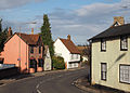
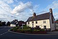
 Littlebury High Street - geograph.org.uk - 6250549.jpg 1 024 × 682 ; 711 kio
-
 Littlebury parish, Chapman and Andre map, 1777, 3-2.jpg 843 × 562 ; 566 kio
-
 Littlebury, a bend in the High Street - geograph.org.uk - 6250546.jpg 1 024 × 732 ; 803 kio
-
 Littlebury, at the corner of Strethall Road - geograph.org.uk - 6250647.jpg 1 024 × 1 024 ; 1,07 Mio
-
 Littlebury, Church Walk - geograph.org.uk - 6250861.jpg 1 024 × 768 ; 947 kio
-
 Littlebury, colour-washed walls - geograph.org.uk - 6250654.jpg 1 024 × 731 ; 835 kio
-
 Littlebury, down Walden Road - geograph.org.uk - 6250543.jpg 819 × 1 024 ; 873 kio
-
 Littlebury, fields and woods in August - geograph.org.uk - 6250596.jpg 1 024 × 768 ; 1 014 kio
-
 Littlebury, Flint Cottage - geograph.org.uk - 6250857.jpg 819 × 1 024 ; 1,16 Mio
-
 Littlebury, historic houses on Walden Road - geograph.org.uk - 6250536.jpg 1 024 × 731 ; 743 kio
-
 Littlebury, Holy Trinity - geograph.org.uk - 6250853.jpg 819 × 1 024 ; 1,34 Mio
-
 Littlebury, King's Mill - geograph.org.uk - 6251041.jpg 1 024 × 768 ; 837 kio
-
 Littlebury, King's Mill and a willow - geograph.org.uk - 6250522.jpg 1 024 × 1 024 ; 1,51 Mio
-
 Littlebury, Strethall Road railway bridge - geograph.org.uk - 6250620.jpg 1 024 × 819 ; 1,1 Mio
-
 Littlebury, the corner of Merton Place - geograph.org.uk - 6250605.jpg 1 024 × 732 ; 902 kio
-
 Littlebury, the corner of Mill Lane and Walden Road - geograph.org.uk - 6250519.jpg 1 024 × 732 ; 886 kio
-
 Littlebury, the line to Cambridge - geograph.org.uk - 6250617.jpg 1 024 × 683 ; 977 kio
-
 Littlebury, The Thatched Cottage - geograph.org.uk - 6250540.jpg 1 024 × 731 ; 847 kio
-
 Littlebury, towards the tunnel - geograph.org.uk - 6250612.jpg 1 024 × 683 ; 1 017 kio
-
 Littlebury.jpg 1 536 × 1 024 ; 256 kio
-
 London Road (B1383) towards Littlebury - geograph.org.uk - 5523376.jpg 640 × 480 ; 77 kio
-
 London Road - geograph.org.uk - 4410592.jpg 3 973 × 2 648 ; 7,78 Mio
-
 London Road - geograph.org.uk - 4628359.jpg 4 000 × 3 000 ; 4,29 Mio
-
 Looking east over Duck Street towards Saffron Walden - geograph.org.uk - 5393091.jpg 1 600 × 1 064 ; 272 kio
-
 Looking north along the valley of the River Cam, from Audley End - geograph.org.uk - 5390365.jpg 1 600 × 1 064 ; 553 kio
-
 Looking towards the valley of the River Cam - geograph.org.uk - 4628515.jpg 4 000 × 3 000 ; 4,06 Mio
-
 Looking up the B1383 towards Littlebury - geograph.org.uk - 5553137.jpg 1 600 × 1 064 ; 328 kio
-
 M11 - a plethora of signs - geograph.org.uk - 2640733.jpg 640 × 428 ; 89 kio
-
 M11 - Journey time trial - geograph.org.uk - 2640678.jpg 640 × 428 ; 77 kio
-
 M11 - Strethall Road bridge - geograph.org.uk - 2640704.jpg 640 × 428 ; 102 kio
-
 M11 approaching half mile to A11 sign - geograph.org.uk - 3455322.jpg 1 457 × 881 ; 704 kio
-
 M11 approaching junction 9 - geograph.org.uk - 2640716.jpg 640 × 428 ; 84 kio
-
 M11 crossing Chestnut Avenue - geograph.org.uk - 5927069.jpg 1 600 × 1 200 ; 278 kio
-
 M11 cutting through Heavy Hill - geograph.org.uk - 3765575.jpg 640 × 430 ; 52 kio
-
 M11 electricity cables crossing - geograph.org.uk - 3546904.jpg 2 625 × 1 482 ; 1,86 Mio
-
 M11 going up the hill - geograph.org.uk - 2640693.jpg 640 × 428 ; 96 kio
-
 M11 junction 9 - geograph.org.uk - 2640747.jpg 640 × 428 ; 94 kio
-
 M11 looking south - geograph.org.uk - 6053347.jpg 1 024 × 768 ; 186 kio
-
 M11 Motorway bridge, near Littlebury Green - geograph.org.uk - 2484119.jpg 1 024 × 768 ; 169 kio
-
 M11 northbound approaching Junction 9 - geograph.org.uk - 3522214.jpg 1 581 × 867 ; 638 kio
-
 M11 northbound near Audley End - geograph.org.uk - 3455311.jpg 1 632 × 1 063 ; 803 kio
-
 M11 northbound, Streethall Road Bridge - geograph.org.uk - 3546937.jpg 2 187 × 1 212 ; 1,36 Mio
-
 M11 road bridge west of Littlebury, aerial 2019 - geograph.org.uk - 6303754.jpg 1 024 × 683 ; 99 kio
-
 M11 South of Great Chesterford - geograph.org.uk - 6240732.jpg 800 × 533 ; 574 kio
-
 M11 south of junction for A11 - geograph.org.uk - 3890203.jpg 640 × 480 ; 94 kio
-
 M11, Heavy Hill - geograph.org.uk - 2720435.jpg 640 × 430 ; 45 kio
-
 M11, junction 9 - geograph.org.uk - 2587910.jpg 640 × 430 ; 57 kio
-
 M11, Junction 9 - geograph.org.uk - 3765508.jpg 640 × 430 ; 40 kio
-
 M11, northbound - geograph.org.uk - 3759133.jpg 640 × 430 ; 45 kio
-
 M11, northbound - geograph.org.uk - 3759138.jpg 640 × 470 ; 42 kio
-
 M11, northbound - geograph.org.uk - 4841092.jpg 640 × 426 ; 33 kio
-
 M11, northbound - geograph.org.uk - 4841099.jpg 640 × 426 ; 34 kio
-
 M11, northbound, Heavy Hill - geograph.org.uk - 4841095.jpg 640 × 426 ; 40 kio
-
 M11, southbound, Heavy Hill - geograph.org.uk - 3765576.jpg 640 × 430 ; 50 kio
-
 M11, Strethall Road Bridge - geograph.org.uk - 3765579.jpg 640 × 430 ; 56 kio
-
 Main street, Littlebury Green - geograph.org.uk - 4054507.jpg 1 600 × 1 064 ; 374 kio
-
 Meadow in the kitchen garden area, Audley End - geograph.org.uk - 5562549.jpg 1 600 × 1 064 ; 546 kio
-
 Merton Place crosses the railway - geograph.org.uk - 4628506.jpg 4 000 × 3 000 ; 4,26 Mio
-
 Merton Place crosses the railway - geograph.org.uk - 4628513.jpg 4 000 × 3 000 ; 4,21 Mio
-
 Milestone north of Littlebury, Essex. - geograph.org.uk - 83539.jpg 640 × 480 ; 202 kio
-
 Minor road crosses the M11 near Littlebury - geograph.org.uk - 3494396.jpg 4 320 × 3 240 ; 2,9 Mio
-
 Mobile phone mast near Littlebury Green (2) - geograph.org.uk - 4040013.jpg 4 320 × 3 240 ; 4,89 Mio
-
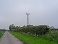 Mobile phone mast near Littlebury Green - geograph.org.uk - 3494328.jpg 4 320 × 3 240 ; 2,92 Mio


_-_geograph.org.uk_-_6303746.jpg)
_-_geograph.org.uk_-_6303749.jpg)


.jpg)


.jpg)


_-_geograph.org.uk_-_6303779.jpg)
_-_geograph.org.uk_-_6303784.jpg)
_-_geograph.org.uk_-_6303787.jpg)


.jpg)


_towards_Littlebury_-_geograph.org.uk_-_5523376.jpg)


_-_geograph.org.uk_-_4040013.jpg)
