Category:Llanarthney
Vai alla navigazione
Vai alla ricerca
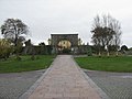
Centro abitato britannico .jpg) Eglwys Sant Dewi, Llanarthne | |||||
| Carica un file multimediale | |||||
| Istanza di | |||||
|---|---|---|---|---|---|
| Luogo | Carmarthenshire, Galles | ||||
 | |||||
Cymraeg: Pentref yn Sir Gaerfyrddin yw Llanarthne (Saesneg Llanarthney). Fe'i lleolir 12 km i'r dwyrain o Gaerfyrddin a 10 km i'r de-orllewin o Landeilo. Mae'n gartref i Ardd Fotaneg Genedlaethol Cymru ers y flwyddyn 2000. Mae 721 o bobl yn byw yng nghymuned Llanarthne, 61% ohonynt yn siarad Cymraeg (Cyfrifiad 2001).
English: Llanarthney is a village and community in Carmarthenshire, Wales, located 12 kilometres to the east of Carmarthen and 10 kilometres to the south-west of Llandeilo. It has a population of 738, of whom 61% are Welsh-speaking (2001 UK Census).
Sottocategorie
Questa categoria contiene le 5 sottocategorie indicate di seguito, su un totale di 5.
File nella categoria "Llanarthney"
Questa categoria contiene 200 file, indicati di seguito, su un totale di 333.
(pagina precedente) (pagina successiva)-
 "Look, it's time you did this for yourself." - geograph.org.uk - 1986584.jpg 2 000 × 1 328; 2,21 MB
-
 'Pi' sculpture by Rawleigh Clay - geograph.org.uk - 5737068.jpg 2 612 × 2 448; 1,65 MB
-
-

-

-
-

-
 A view towards the Stable Block - geograph.org.uk - 3547245.jpg 640 × 480; 125 KB
-
 Afon Tywi valley from the B4300 - geograph.org.uk - 2641093.jpg 3 648 × 2 736; 1,56 MB
-

-
 Apothecaries' Hall - geograph.org.uk - 4230798.jpg 1 670 × 3 056; 1,96 MB
-
 Aqualab - National Botanic Garden of Wales - geograph.org.uk - 1985489.jpg 2 000 × 1 328; 2,82 MB
-
 Aquilegia 'Red Hobbit' - geograph.org.uk - 3543108.jpg 640 × 480; 83 KB
-
 Arch and Principality House - geograph.org.uk - 4229087.jpg 3 264 × 2 448; 4,24 MB
-
 Artificial Waterfall, Pont Felin Gât - geograph.org.uk - 2243680.jpg 1 024 × 768; 380 KB
-

-
 Autumn crocus - geograph.org.uk - 6283689.jpg 480 × 640; 154 KB
-
 Autumnal scene - geograph.org.uk - 1069675.jpg 640 × 480; 140 KB
-

-
 B4297 road - geograph.org.uk - 6284098.jpg 640 × 480; 59 KB
-
 Banksia baxteri - National Botanic Garden of Wales - geograph.org.uk - 1985582.jpg 2 000 × 1 328; 2,2 MB
-
 Bend in the B4297 near Penrhiwgoch - geograph.org.uk - 1812485.jpg 2 048 × 1 536; 1,4 MB
-
 Birch Avenue - geograph.org.uk - 4229289.jpg 3 264 × 2 448; 4,93 MB
-
 Blasted tree, National Botanic Garden of Wales - geograph.org.uk - 5792704.jpg 2 560 × 1 806; 3,95 MB
-
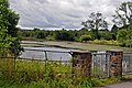
 Bridge between two lakes, National Botanical Garden of Wales - geograph.org.uk - 6218499.jpg 2 000 × 1 500; 1,23 MB
-

-

-
 Bridge over the Gwynon - geograph.org.uk - 5069824.jpg 1 200 × 900; 360 KB
-

-
 Bryncadw Pond, National Botanic Garden of Wales - geograph.org.uk - 5792603.jpg 2 560 × 1 708; 3,9 MB
-

-
 Busy time for the Farm - geograph.org.uk - 1333933.jpg 640 × 480; 94 KB
-
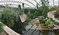
 Butterfly House at the National Botanic Garden of Wales - geograph.org.uk - 5736948.jpg 3 264 × 2 448; 2,79 MB
-
 Caercwm - geograph.org.uk - 1069697.jpg 640 × 480; 117 KB
-
 Capel y Bedyddwyr, Penrhiwgoch - geograph.org.uk - 2556721.jpg 4 000 × 3 000; 2,17 MB
-
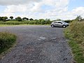 Car Park by Paxton's Tower - geograph.org.uk - 4151478.jpg 3 264 × 2 448; 3,15 MB
-
 Carp in pool - geograph.org.uk - 2762506.jpg 3 264 × 2 448; 2,89 MB
-
 Cascade in Waun Las nature reserve - geograph.org.uk - 5069852.jpg 1 200 × 900; 354 KB
-

-
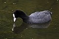 Coot - National Botanic Garden of Wales - geograph.org.uk - 1985476.jpg 2 000 × 1 328; 2,08 MB
-
 Course of the dismantled railway at Dryslwyn - geograph.org.uk - 1812511.jpg 2 048 × 1 536; 1,39 MB
-
 Court Yard and Restaurant - geograph.org.uk - 2762653.jpg 3 264 × 2 448; 2,9 MB
-
 Croeso - Welcome - geograph.org.uk - 4952450.jpg 3 264 × 2 448; 2,73 MB
-
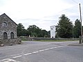 Crossroads in Llanarthne village, Camarthenshire - geograph.org.uk - 2072128.jpg 1 600 × 1 200; 382 KB
-
 Cwmfelingât, Llanarthne - geograph.org.uk - 3296180.jpg 690 × 518; 251 KB
-
 Date stone in bridge - geograph.org.uk - 3815711.jpg 2 292 × 1 794; 861 KB
-
 Derlwyn Isaf - geograph.org.uk - 4086145.jpg 640 × 480; 101 KB
-
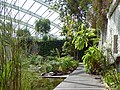
 Details of the Great Glasshouse (1) - geograph.org.uk - 4229273.jpg 1 718 × 1 535; 925 KB
-
 Details of the Great Glasshouse (2) - geograph.org.uk - 4229278.jpg 2 551 × 1 602; 1,57 MB
-
 Disused cottage near Dryslwyn - geograph.org.uk - 3156283.jpg 4 000 × 3 000; 2,51 MB
-
 Disused phonebox on the B4310, Cefn Abbey - geograph.org.uk - 3594765.jpg 4 320 × 3 240; 2,96 MB
-
 Double Walled Garden and Tropical House - geograph.org.uk - 3542985.jpg 640 × 480; 120 KB
-

-
 Dragonfly Sculpture. - geograph.org.uk - 496086.jpg 480 × 640; 102 KB
-
-
 Dryslwyn Bridge over the River Tywi - geograph.org.uk - 4148914.jpg 3 264 × 2 448; 2,83 MB
-
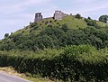
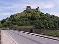 Dryslwyn Castle - geograph.org.uk - 3815699.jpg 3 264 × 2 448; 3,81 MB
-
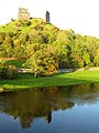 Dryslwyn Castle - geograph.org.uk - 5150084.jpg 3 000 × 4 000; 2,74 MB
-
 Dryslwyn Castle - geograph.org.uk - 5899889.jpg 2 592 × 1 944; 1,5 MB
-
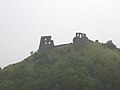 Dryslwyn Castle - geograph.org.uk - 6284113.jpg 640 × 480; 27 KB
-
 Earth stars in the Great Glasshouse - geograph.org.uk - 4230837.jpg 3 264 × 2 448; 5,01 MB
-
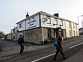 Emlyn Arms (geograph 4084565).jpg 640 × 480; 61 KB
-

-
-

-
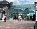
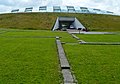
 Entrance to the National Botanic Garden of Wales - geograph.org.uk - 5428540.jpg 1 024 × 768; 158 KB
-

-
 Evening light on the Towy - geograph.org.uk - 5150067.jpg 3 919 × 2 107; 842 KB
-
 Ffarm y Wern Farm - geograph.org.uk - 4086119.jpg 640 × 531; 115 KB
-
 Ffynon Luan Farm - geograph.org.uk - 5981073.jpg 3 264 × 2 448; 2,25 MB
-
 Field, with tree - geograph.org.uk - 1819083.jpg 2 048 × 1 536; 1,36 MB
-
 First view of Dryslwyn Castle - geograph.org.uk - 3815799.jpg 2 599 × 1 975; 858 KB
-
 Footbridge near Pont Felin-gât - geograph.org.uk - 5826734.jpg 1 024 × 768; 317 KB
-

-
 Former Chalybeate Spring Pont Felin Gât - geograph.org.uk - 2243687.jpg 1 024 × 768; 307 KB
-
 Former school, Capel Dewi - geograph.org.uk - 3594774.jpg 4 320 × 3 240; 2,79 MB
-
 Fountain, National Botanic Garden of Wales - geograph.org.uk - 6217960.jpg 2 000 × 1 500; 1,23 MB
-

-
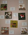 Fungi at The National Botanic Garden of Wales - geograph.org.uk - 5737071.jpg 2 235 × 2 792; 1,72 MB
-
-
 Gallery, Gift Shop and Y Cwtch at NBGW - geograph.org.uk - 4229247.jpg 3 264 × 2 448; 4,63 MB
-

-
 Gate to a field, near road between Maesybont and Penrhiwgoch - geograph.org.uk - 1812468.jpg 2 048 × 1 536; 1,27 MB
-
 Ger - Near Plas Uchaf - geograph.org.uk - 4086103.jpg 640 × 480; 100 KB
-
 Glasgoed Isaf - geograph.org.uk - 4086130.jpg 640 × 480; 84 KB
-
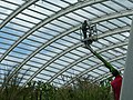 Glasshouse maintenance - geograph.org.uk - 3545930.jpg 640 × 480; 129 KB
-
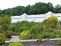
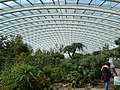
 Great Glass House - geograph.org.uk - 2762551.jpg 3 264 × 2 448; 2,98 MB
-
 Great Glasshouse - geograph.org.uk - 6283673.jpg 480 × 640; 88 KB
-

-
 Hedge and field view at Cwm-Du Triangulation Pillar - geograph.org.uk - 4743613.jpg 4 000 × 3 000; 4,3 MB
-
 Helichrysum in the Great Glasshouse - geograph.org.uk - 3547400.jpg 640 × 480; 57 KB
-
 Hen Heol - Old Road - geograph.org.uk - 4084569.jpg 640 × 480; 82 KB
-
 Herbal plants at the National Botanic Garden of Wales - geograph.org.uk - 4230812.jpg 2 444 × 1 377; 1,17 MB
-
 Ice House, National Botanic Garden of Wales - geograph.org.uk - 5792661.jpg 2 560 × 1 708; 3,08 MB
-
 In the Apothecary Garden, National Botanic Garden of Wales - geograph.org.uk - 6226188.jpg 2 000 × 1 455; 1,05 MB
-
 In the Double Walled Garden - geograph.org.uk - 3542980.jpg 640 × 480; 134 KB
-
 In the Double Walled Garden - geograph.org.uk - 3547303.jpg 640 × 480; 163 KB
-
 In the Stable Block - geograph.org.uk - 3547273.jpg 640 × 480; 130 KB
-
 Inflatable Stonehenge - geograph.org.uk - 3005223.jpg 1 785 × 1 207; 967 KB
-
 Inside looking out - National Botanic Garden of Wales - geograph.org.uk - 1985567.jpg 2 000 × 1 328; 2,01 MB
-
 Inside the Glass House, National Botanic Garden of Wales - geograph.org.uk - 5792757.jpg 1 920 × 2 877; 3,25 MB
-
 Inside the Great Glasshouse (1) - geograph.org.uk - 3545905.jpg 640 × 480; 155 KB
-
 Inside the Great Glasshouse (2) - geograph.org.uk - 3545912.jpg 640 × 480; 167 KB
-
 Inside the Great Glasshouse (3) - geograph.org.uk - 3545917.jpg 640 × 480; 139 KB
-
 Inside the Great Glasshouse (4) - geograph.org.uk - 3545923.jpg 640 × 480; 149 KB
-
 Inside the Great Glasshouse - geograph.org.uk - 4228729.jpg 3 264 × 2 448; 4,87 MB
-
-
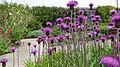
 Japanese Garden - geograph.org.uk - 2755531.jpg 800 × 600; 258 KB
-
 Japanese Garden - geograph.org.uk - 5400410.jpg 3 264 × 2 448; 3,62 MB
-
 Japanese garden, National Botanic Garden of Wales - geograph.org.uk - 5792716.jpg 2 560 × 1 708; 3,43 MB
-
 King Protea - National Botanic Garden of Wales - geograph.org.uk - 1985594.jpg 2 000 × 1 328; 1,98 MB
-
 Lake at the National Botanic Gardens - geograph.org.uk - 5400461.jpg 3 264 × 2 448; 3,6 MB
-
 Lake, National Botanic Garden of Wales - geograph.org.uk - 2568798.jpg 2 000 × 1 435; 1,37 MB
-
 Lane approaching its junction with the B4310 - geograph.org.uk - 3594761.jpg 4 320 × 3 240; 2,97 MB
-
 Lane past the gastro pub, Y Polyn - geograph.org.uk - 3156295.jpg 3 280 × 2 493; 3,25 MB
-
 Lane to the B4310 - geograph.org.uk - 3594759.jpg 4 320 × 3 240; 2,75 MB
-

-
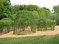 Living willow structures at NBGW - geograph.org.uk - 4954141.jpg 3 264 × 2 448; 5,73 MB
-
 Llanarthne on the B4300 (geograph 4955379).jpg 3 264 × 2 448; 2,86 MB
-
 Llanarthne war memorial (geograph 6874794).jpg 1 200 × 1 600; 715 KB
-
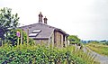 Llanarthney former station geograph-3754654-by-Ben-Brooksbank.jpg 2 338 × 1 392; 2,57 MB
-
 Llwybr Capel Dewi - Capel Dewi Path - geograph.org.uk - 5903504.jpg 1 024 × 768; 271 KB
-
 Llwybr Llanarthne Path - geograph.org.uk - 4084568.jpg 640 × 480; 66 KB
-
 Llwybr Penrhiwgoch Path - geograph.org.uk - 4086073.jpg 640 × 480; 109 KB
-

-
 Llwybr Tir Clun Path - geograph.org.uk - 4085489.jpg 640 × 480; 128 KB
-
 Llwybr troed Llanarthne footpath - geograph.org.uk - 2790159.jpg 690 × 518; 241 KB
-

-
 Llwynpiod Farm - geograph.org.uk - 5982132.jpg 3 264 × 2 448; 2,83 MB
-
 Llyn Canol - National Botanic Garden of Wales - geograph.org.uk - 1985632.jpg 2 000 × 1 328; 2,62 MB
-
 Looking down the cascade in Waun Las - geograph.org.uk - 5069847.jpg 1 200 × 900; 329 KB
-
 Looking to Graig Fawr at Llanarthne - geograph.org.uk - 4229230.jpg 3 264 × 2 448; 4,02 MB
-
 Machlud Haul Dryslwyn Sunset - geograph.org.uk - 2612595.jpg 690 × 517; 51 KB
-
 Marsh Orchid, National Botanic Garden of Wales - geograph.org.uk - 5792682.jpg 2 560 × 1 708; 2,53 MB
-
 Middleton Hall - Caermarthenshire.jpeg 900 × 689; 420 KB
-
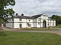 Middleton Hall - geograph.org.uk - 5400454.jpg 3 264 × 2 448; 2,34 MB
-
 Milestone - Carmarthen 4 - geograph.org.uk - 4331918.jpg 480 × 640; 90 KB
-
 Milestone - Carmarthen 5 - geograph.org.uk - 4331927.jpg 480 × 640; 140 KB
-
 Milestone - Carmarthen 6 - geograph.org.uk - 4331882.jpg 480 × 640; 138 KB
-
 Milestone - Carmarthen 8 - geograph.org.uk - 4331958.jpg 480 × 640; 129 KB
-
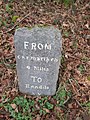 Milestone - Carmarthen 9 - geograph.org.uk - 4331952.jpg 480 × 640; 129 KB
-
 Milestone - Nantgaredig 1 - geograph.org.uk - 4331874.jpg 480 × 640; 117 KB
-
 Milestone - Nantgaredig 3 - geograph.org.uk - 4331891.jpg 480 × 640; 138 KB
-
 Minor Road by Paxton's Tower - geograph.org.uk - 4151483.jpg 3 264 × 2 448; 4,45 MB
-
 Minor road from Clos Glas - geograph.org.uk - 5982130.jpg 3 264 × 2 448; 2,04 MB
-
 National Botanic Garden of Wales - geograph.org.uk - 6283682.jpg 480 × 640; 46 KB
-
 National Botanic Garden of Wales - geograph.org.uk - 6285870.jpg 640 × 480; 77 KB
-
 National Botanic Garden of Wales on a mid November afternoon - geograph.org.uk - 2695803.jpg 3 456 × 2 592; 3,35 MB
-
 National Botanic Gardens - geograph.org.uk - 5400451.jpg 5 160 × 3 086; 5,4 MB
-
-

-
-
 Old barn and black bag silage. - geograph.org.uk - 1333923.jpg 605 × 640; 152 KB
-
 Old level crossing gate, Dryslwyn - geograph.org.uk - 1812516.jpg 2 048 × 1 536; 1,4 MB
-
-

-

-

-

-

-

-

-

-
 On reflection - National Botanic Garden of Wales - geograph.org.uk - 1985646.jpg 2 000 × 1 600; 2,54 MB
-

-
 Ordnance Survey Cut Mark - geograph.org.uk - 4060351.jpg 480 × 640; 112 KB
-
 Ordnance Survey Cut Mark - geograph.org.uk - 4591741.jpg 480 × 640; 136 KB
-
 Ordnance Survey Cut Mark - geograph.org.uk - 4591743.jpg 480 × 640; 129 KB
-
 Ordnance Survey Cut Mark - geograph.org.uk - 4591747.jpg 480 × 640; 94 KB
-
 Ordnance Survey Cut Mark - geograph.org.uk - 4591758.jpg 480 × 640; 131 KB
-
 Ordnance Survey Cut Mark - geograph.org.uk - 4658202.jpg 480 × 640; 101 KB
-
 Ordnance Survey Cut Mark - geograph.org.uk - 5198940.jpg 640 × 446; 76 KB
-
 Ordnance Survey Cut Mark - geograph.org.uk - 5198944.jpg 640 × 431; 115 KB
-
 Ordnance Survey Cut Mark - geograph.org.uk - 5198951.jpg 640 × 437; 72 KB
-
 Ordnance Survey Cut Mark - geograph.org.uk - 5198955.jpg 640 × 404; 109 KB
-
 Ordnance Survey Cut Mark - geograph.org.uk - 5216301.jpg 640 × 343; 68 KB
-
 Ordnance Survey Cut Mark - geograph.org.uk - 5216308.jpg 640 × 374; 80 KB
-
 Ordnance Survey Flush Bracket (873) - geograph.org.uk - 3542601.jpg 480 × 640; 104 KB
-
 Ordnance Survey Flush Bracket (874) - geograph.org.uk - 3542599.jpg 480 × 640; 98 KB
-

-
 Ordnance Survey Flush Bracket - geograph.org.uk - 3542593.jpg 480 × 640; 122 KB
-
 Ordnance Survey Flush Bracket 873 - geograph.org.uk - 4743857.jpg 4 000 × 3 000; 3,39 MB
-
 Ordnance Survey Flush Bracket 874 - geograph.org.uk - 4743861.jpg 4 000 × 3 000; 4,03 MB
-
 Ordnance Survey Flush Bracket 875 - geograph.org.uk - 4743862.jpg 4 000 × 3 000; 4,93 MB
-
 Ordnance Survey Flush Bracket G2979 - geograph.org.uk - 4743864.jpg 640 × 480; 120 KB
-
 Ordnance Survey Rivet - geograph.org.uk - 4331873.jpg 480 × 640; 88 KB
-
 Ordnance Survey Rivet - geograph.org.uk - 4331880.jpg 480 × 640; 88 KB
-
 Ordnance Survey Rivet - geograph.org.uk - 4331885.jpg 640 × 480; 92 KB
-
 Part of National Botanic Garden of Wales - geograph.org.uk - 5840856.jpg 1 024 × 768; 172 KB
-

-
 Part of the Ghost Forest at NBGW - geograph.org.uk - 5736999.jpg 3 264 × 2 448; 4,33 MB
-
 Pasture land by Caercwm - geograph.org.uk - 1069699.jpg 640 × 480; 113 KB
-
 Path in the Great Glasshouse - geograph.org.uk - 4228750.jpg 3 264 × 2 448; 5,37 MB
-
 Path in the National Botanic Garden - geograph.org.uk - 5826737.jpg 1 024 × 768; 328 KB
-
 Path in the NBGW - geograph.org.uk - 4955370.jpg 3 264 × 2 448; 3,48 MB
-
 Paxton's Tower Lodge - geograph.org.uk - 1495883.jpg 640 × 480; 96 KB
-
 Paxton's Tower near Llanarthne, Camarthenshire - geograph.org.uk - 2072122.jpg 1 600 × 1 200; 223 KB
-
-
 Pi Sculpture - geograph.org.uk - 2755516.jpg 600 × 800; 127 KB
-


_-_geograph.org.uk_-_4229273.jpg)
_-_geograph.org.uk_-_4229278.jpg)


.jpg)


_-_geograph.org.uk_-_3545905.jpg)
_-_geograph.org.uk_-_3545912.jpg)
_-_geograph.org.uk_-_3545917.jpg)
_-_geograph.org.uk_-_3545923.jpg)


.jpg)
.jpg)


_-_geograph.org.uk_-_3542601.jpg)
_-_geograph.org.uk_-_3542599.jpg)
_-_geograph.org.uk_-_3542622.jpg)


