Category:Llanfair-ar-y-bryn
Vai alla navigazione
Vai alla ricerca
Cymraeg: Cymuned yn Sir Gaerfyrddin yw Llanfair-ar-y-bryn. Mae'r enw yn fwyaf adnabyddus oherwydd i'r emynydd William Williams gael ei eni yn y plwyf a'i gladdu ym mynwent eglwys Llanfair-ar-y-bryn, ar fryn ychydig i'r gogledd o dref Llanymddyfri.
English: Llanfair-ar-y-bryn is a rural community in Carmarthenshire, Wales, located between Llandovery and the border with Powys.
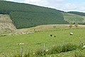
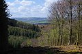
community and parish in Carmarthenshire, Wales  Heart of Wales Line and Sugar Loaf, Llanfair-ar-y-bryn.  | |||||
| Carica un file multimediale | |||||
| Istanza di | |||||
|---|---|---|---|---|---|
| Luogo | Carmarthenshire, Galles | ||||
| Popolazione |
| ||||
| Superficie |
| ||||
 | |||||
Sottocategorie
Questa categoria contiene le 10 sottocategorie indicate di seguito, su un totale di 10.
B
- Babel, Carmarthenshire (3 F)
C
L
P
- Pantycelyn, Llanfair-ar-y-bryn (10 F)
- Pentre-ty-gwyn (5 F)
R
S
- Sugar Loaf Tunnel (Wales) (5 F)
- Sugar Loaf, Carmarthenshire (6 F)
T
- Twm Sion Cati's cave (2 F)
Y
File nella categoria "Llanfair-ar-y-bryn"
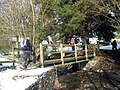
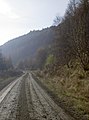
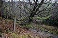
Questa categoria contiene 200 file, indicati di seguito, su un totale di 747.
(pagina precedente) (pagina successiva)-
 A boulder barrier - geograph.org.uk - 1496334.jpg 640 × 480; 163 KB
-
 A Crychan Forest scene - geograph.org.uk - 5760726.jpg 1 200 × 798; 654 KB
-
 A Crychan Forest viewpoint - geograph.org.uk - 5760718.jpg 1 200 × 768; 463 KB
-

-

-
 A gateway to Mwmffri - geograph.org.uk - 2823648.jpg 2 304 × 1 704; 1,75 MB
-
 A hill of timber - geograph.org.uk - 2823645.jpg 2 304 × 1 704; 1,62 MB
-
 A sign for Ystradffin - geograph.org.uk - 2379479.jpg 640 × 480; 87 KB
-
 A483 and the Sugar Loaf - geograph.org.uk - 2347503.jpg 1 600 × 1 063; 402 KB
-

-

-
 A483 marker 190 near Cynghordy - geograph.org.uk - 5411058.jpg 800 × 600; 266 KB
-
 A483 on a shelf near Sugar Loaf - geograph.org.uk - 5455795.jpg 800 × 600; 110 KB
-
 A483 roadside barrier near Cynghordy - geograph.org.uk - 5411047.jpg 800 × 734; 181 KB
-
 Above Afon Lwynor - geograph.org.uk - 2013499.jpg 640 × 427; 214 KB
-
 Above Afon Lwynor - geograph.org.uk - 2013507.jpg 640 × 426; 192 KB
-
 Above the Tywi-Towey valley - geograph.org.uk - 4673329.jpg 1 024 × 680; 295 KB
-
 Access land at Bryn Nicol - geograph.org.uk - 2013540.jpg 640 × 427; 223 KB
-

-
-

-
 Across Nant Lwynor - geograph.org.uk - 2013569.jpg 640 × 427; 224 KB
-
 Afon Bran - geograph.org.uk - 6084146.jpg 2 048 × 1 536; 769 KB
-
 Afon Brân - geograph.org.uk - 1226654.jpg 426 × 640; 93 KB
-
 Afon Brân - geograph.org.uk - 2015681.jpg 640 × 427; 259 KB
-
 Afon Brân valley - geograph.org.uk - 1223662.jpg 640 × 426; 67 KB
-
 Afon Crychan and Cwm Crychan scene - geograph.org.uk - 5760415.jpg 795 × 1 200; 597 KB
-
 Afon Gwydderig below Pont Wen - geograph.org.uk - 5697110.jpg 5 179 × 3 451; 5,25 MB
-
 Afon Twyi and Dinas - geograph.org.uk - 1220374.jpg 640 × 426; 64 KB
-
 Afon Twyi, Gallt-y-Bere - geograph.org.uk - 5696391.jpg 4 845 × 3 451; 4,55 MB
-
 Afon Tywi (geograph 7312752).jpg 4 032 × 3 024; 6,83 MB
-
 Afon Tywi bridge at Gallt-y-bere - geograph.org.uk - 2662775.jpg 3 648 × 2 736; 3,56 MB
-

-

-

-
-
 Afon Tywi north-west of Rhandirmwyn - geograph.org.uk - 2361508.jpg 800 × 557; 332 KB
-
 Afon Tywi north-west of Rhandirmwyn - geograph.org.uk - 2361513.jpg 800 × 570; 312 KB
-

-
-

-

-

-
 Air shaft near Sugar Loaf - geograph.org.uk - 786424.jpg 427 × 640; 76 KB
-
 Allt Glyn-moch - geograph.org.uk - 5980846.jpg 1 024 × 768; 367 KB
-
 Along the Llyn Brianne - geograph.org.uk - 4497782.jpg 1 024 × 683; 102 KB
-
 Approaching the farmland at Cwm-coed-oeron - geograph.org.uk - 5760784.jpg 1 200 × 833; 554 KB
-

-
 At the summit of Dinas Hill - geograph.org.uk - 1970432.jpg 640 × 480; 78 KB
-
 Babel village hall - geograph.org.uk - 2734445.jpg 2 304 × 1 704; 1,67 MB
-
 Back along the Nave - geograph.org.uk - 4268191.jpg 1 024 × 683; 106 KB
-
 Back entrance to Twm Sion Catti's Cave - geograph.org.uk - 1970466.jpg 640 × 480; 121 KB
-
 Banc Cefngarreg - geograph.org.uk - 5980796.jpg 1 024 × 767; 298 KB
-
 Banc Cefngarreg - geograph.org.uk - 5980818.jpg 1 024 × 768; 286 KB
-
 Banc Cefngarreg - geograph.org.uk - 5980833.jpg 1 024 × 768; 189 KB
-
 Bench mark on - geograph.org.uk - 4267441.jpg 533 × 800; 144 KB
-
 Bier on the Roof - geograph.org.uk - 4268193.jpg 1 024 × 683; 72 KB
-
 Boundary fence on Cefn Waun-lwyd - geograph.org.uk - 1222980.jpg 640 × 426; 99 KB
-
 Brecon Beacons from Sugar Loaf - geograph.org.uk - 4595030.jpg 640 × 382; 51 KB
-
 Bridge over Afon Tywi - geograph.org.uk - 3497296.jpg 640 × 480; 574 KB
-
 Bridge over Afon Tywi, Galt-y-Bere - geograph.org.uk - 5696368.jpg 640 × 426; 102 KB
-
 Bridge over the Spillway - geograph.org.uk - 4497475.jpg 1 024 × 683; 191 KB
-

-

-
 Bryn Nicol - geograph.org.uk - 5960219.jpg 1 024 × 768; 199 KB
-
 Bryn Nicol - geograph.org.uk - 5960227.jpg 1 024 × 768; 265 KB
-
 Bryn Nicol - geograph.org.uk - 5960246.jpg 1 024 × 768; 261 KB
-
 Bryn Nicol - geograph.org.uk - 6084167.jpg 2 048 × 1 536; 1 MB
-

-
 Bwlch Cynnant, Cynghordy - geograph.org.uk - 2147476.jpg 690 × 518; 185 KB
-
 Bwlch-Cynnant - geograph.org.uk - 1223676.jpg 426 × 640; 95 KB
-
 Bwlch-y-ffin - geograph.org.uk - 1221093.jpg 640 × 426; 67 KB
-
 By the southern edge of Crychan Forest - geograph.org.uk - 5760657.jpg 1 200 × 783; 506 KB
-

-

-

-
 Byway to Rhandirmwyn, Carmarthenshire - geograph.org.uk - 2363649.jpg 479 × 640; 159 KB
-
 Byway to Rhandirmwyn, Carmarthenshire - geograph.org.uk - 2363658.jpg 480 × 640; 168 KB
-
 Cairn on Cefn Ystrad-ffin - geograph.org.uk - 1218363.jpg 640 × 426; 95 KB
-
 Camping at Rhandirmwyn - geograph.org.uk - 3498255.jpg 640 × 480; 519 KB
-
 Capel Cefnarthen (geograph 5645994).jpg 640 × 480; 72 KB
-
 Capel Salem Chapel - geograph.org.uk - 4095882.jpg 640 × 404; 76 KB
-

-

-
 Catkins - geograph.org.uk - 1226668.jpg 640 × 426; 73 KB
-
 Cattle grid at the start of the mountain road - geograph.org.uk - 3498277.jpg 1 000 × 750; 840 KB
-
 Cattle in a field near Cwm Bargeod - geograph.org.uk - 4673325.jpg 1 024 × 680; 247 KB
-
 Cefn Hafod y Maen - geograph.org.uk - 4095827.jpg 640 × 480; 122 KB
-
 Cefn Hafod-y-maen - geograph.org.uk - 1218427.jpg 640 × 426; 101 KB
-
 Cefn Hafod-y-maen - geograph.org.uk - 1222963.jpg 640 × 426; 91 KB
-
 Cefn Llwydlo - geograph.org.uk - 6058765.jpg 1 024 × 768; 309 KB
-
 Cefn Ystrad Ffin - geograph.org.uk - 4356602.jpg 640 × 480; 100 KB
-
 Cefn Ystrad-ffin - geograph.org.uk - 1218391.jpg 640 × 426; 97 KB
-
 Cerrig Cedny - geograph.org.uk - 4095855.jpg 640 × 480; 77 KB
-
 Cerrig Cedny - geograph.org.uk - 4356612.jpg 640 × 480; 93 KB
-
 Cerrig Tywi - geograph.org.uk - 2196187.jpg 690 × 518; 192 KB
-

-
 Chapel Ruin - geograph.org.uk - 4156142.jpg 640 × 480; 116 KB
-
 Child with a Cross - geograph.org.uk - 4267014.jpg 533 × 800; 146 KB
-
 Churchyard at the West end - geograph.org.uk - 4267016.jpg 1 024 × 683; 195 KB
-
 Churchyard by the Path - geograph.org.uk - 4267009.jpg 1 024 × 683; 202 KB
-
 Churchyard on the North side - geograph.org.uk - 4267024.jpg 1 024 × 683; 218 KB
-
 Chwarel Ystradffin Quarry - geograph.org.uk - 4095871.jpg 640 × 480; 120 KB
-
 Climbing Dinas hill - geograph.org.uk - 3770957.jpg 640 × 480; 76 KB
-
 Coedwigoedd y Fwng Forestry - geograph.org.uk - 4363366.jpg 640 × 480; 113 KB
-
 Country road at Babel - geograph.org.uk - 3496557.jpg 1 024 × 680; 317 KB
-
 Country road near Dolfallt - geograph.org.uk - 4688214.jpg 1 024 × 680; 237 KB
-
 Country road near Hafod-y-pant - geograph.org.uk - 1223670.jpg 640 × 426; 79 KB
-
 Country road near Pentre-ty-Gwyn - geograph.org.uk - 3496552.jpg 1 024 × 680; 185 KB
-
 Country road west of Cynghordy - geograph.org.uk - 4673031.jpg 531 × 800; 185 KB
-
 Craggy hillside above the Tywi - geograph.org.uk - 3770940.jpg 640 × 480; 101 KB
-
 Craig Bron y Cwrt, Rhandirmwyn - geograph.org.uk - 1982294.jpg 690 × 518; 172 KB
-
 Craig Clungwyn - geograph.org.uk - 1220961.jpg 640 × 426; 74 KB
-

-
-

-

-

-

-
 Crychan forest - geograph.org.uk - 2823631.jpg 2 304 × 1 704; 1,58 MB
-
 Crychan forest - geograph.org.uk - 2823636.jpg 1 704 × 2 304; 1,73 MB
-

-
 Crychan Forest - sign with 199 grid references - geograph.org.uk - 5760289.jpg 1 200 × 795; 628 KB
-
 Crychan Forest - track and waymarker post 31 - geograph.org.uk - 5760346.jpg 1 200 × 826; 642 KB
-
 Crychan Forest scene - geograph.org.uk - 5760314.jpg 1 200 × 806; 590 KB
-
 Crychan Forest track - in sunshine^ - geograph.org.uk - 5760543.jpg 1 200 × 814; 585 KB
-
 Crychan Forest track junction - geograph.org.uk - 5760504.jpg 1 200 × 795; 523 KB
-
 Crychan Forest waymarker post 105 - geograph.org.uk - 5760797.jpg 1 200 × 795; 552 KB
-
 Crychan Forest waymarker post 118 - geograph.org.uk - 5760711.jpg 1 200 × 795; 663 KB
-
 Crychan Forest waymarker post 99 - geograph.org.uk - 5760510.jpg 1 200 × 795; 607 KB
-
 Crychan Forest, a break in the trees - geograph.org.uk - 5760744.jpg 1 200 × 787; 688 KB
-
 Crychan Forest, area felled and replanted - geograph.org.uk - 5760700.jpg 1 200 × 795; 532 KB
-
 Crychan Forest, forest track by the Afon Crychan - geograph.org.uk - 5760386.jpg 1 200 × 804; 626 KB
-
 Crychan forest, near Esgair Berfedd - geograph.org.uk - 2823640.jpg 2 304 × 1 704; 1,7 MB
-

-

-
 Cut for the track - geograph.org.uk - 1496323.jpg 640 × 480; 87 KB
-
 Cwm below Cefn Hafod-y-maen - geograph.org.uk - 1222959.jpg 640 × 426; 106 KB
-
 Cwm Clyd - geograph.org.uk - 5985954.jpg 1 024 × 768; 205 KB
-
 Cwm Crychan - geograph.org.uk - 5760497.jpg 1 200 × 857; 658 KB
-

-
 Cwm Crychan, view down the valley - geograph.org.uk - 5760425.jpg 1 200 × 795; 656 KB
-
 Cwm Cynnant - geograph.org.uk - 4363362.jpg 640 × 426; 64 KB
-
 Cwm Gwennol - geograph.org.uk - 3458820.jpg 1 024 × 680; 221 KB
-
 Cwm Gwennol - geograph.org.uk - 6000571.jpg 1 024 × 768; 158 KB
-
 Cwm Nant y Bai - geograph.org.uk - 4902876.jpg 640 × 480; 116 KB
-
 Cwm Nant y ffin - geograph.org.uk - 1220975.jpg 640 × 426; 76 KB
-
 Cwm Nant y ffin - geograph.org.uk - 1221123.jpg 640 × 426; 88 KB
-

-
-

-

-

-
-

-
 Cyffordd o draciau - A junction of tracks - geograph.org.uk - 5985961.jpg 1 024 × 768; 331 KB
-
 Cynant Farm - geograph.org.uk - 1222682.jpg 640 × 426; 105 KB
-

-
 Cynghordy railway station, Carmarthenshire - geograph.org.uk - 4000229.jpg 1 024 × 768; 291 KB
-
 Cynghordy railway station, Carmarthenshire - geograph.org.uk - 4000237.jpg 1 024 × 768; 228 KB
-
-
 Cynghordy Station - geograph.org.uk - 3440840.jpg 800 × 539; 194 KB
-
 Cynghordy Station, Carmarthenshire - geograph.org.uk - 2369953.jpg 640 × 446; 129 KB
-
 Cynghordy Station, Carmarthenshire - geograph.org.uk - 2369960.jpg 640 × 504; 163 KB
-
 Cynghordy Viaduct - geograph.org.uk - 5531708.jpg 3 264 × 2 448; 2,62 MB
-
 Cynnant - geograph.org.uk - 4363348.jpg 640 × 426; 105 KB
-
 Cynnant Fawr - geograph.org.uk - 1222972.jpg 426 × 640; 89 KB
-
 Descent of Nant Lwynor - geograph.org.uk - 2013593.jpg 428 × 640; 222 KB
-
 Dinas Bach - geograph.org.uk - 1134612.jpg 640 × 481; 123 KB
-
 Dinas viewed from the east - geograph.org.uk - 1222988.jpg 426 × 640; 48 KB
-
 Display, shelter and gateway - geograph.org.uk - 3498262.jpg 1 000 × 750; 1,32 MB
-

-
 Disused quarry - geograph.org.uk - 1970401.jpg 640 × 480; 78 KB
-
 Disused quarry in Crychan - geograph.org.uk - 2734490.jpg 1 704 × 2 304; 2,24 MB
-
 Dolau Bran Farm - geograph.org.uk - 938001.jpg 640 × 480; 91 KB
-
 Dolaugwynion - geograph.org.uk - 1226572.jpg 640 × 426; 105 KB
-
 Downhill walking in the Crychan Forest - geograph.org.uk - 5760369.jpg 1 200 × 795; 605 KB
-
 Drive to Garddfady farm - geograph.org.uk - 3496262.jpg 1 024 × 680; 244 KB
-
 Drive to Melin-y-coed - geograph.org.uk - 4672424.jpg 800 × 531; 178 KB
-
 Drive up to Nantllyndir - geograph.org.uk - 937949.jpg 640 × 480; 131 KB
-
 Duck pond, Rhydfelen, Cil-y-cwm Road - geograph.org.uk - 6401224.jpg 5 179 × 3 451; 6,72 MB
-
 Dugoedydd Fach - geograph.org.uk - 4095883.jpg 640 × 480; 86 KB
-

-

-
 East end of - geograph.org.uk - 4267443.jpg 1 024 × 683; 171 KB
-

-
 Easy with the leaflet - geograph.org.uk - 1496347.jpg 640 × 480; 141 KB
-
 Edward VII post-box - geograph.org.uk - 3524446.jpg 2 976 × 3 968; 2,75 MB
-

-

-
 Engine House, Nantymwyn Mine - geograph.org.uk - 2700611.jpg 967 × 717; 220 KB
-
 Entrance road to Gilfach near Cynghordy - geograph.org.uk - 5411019.jpg 800 × 600; 205 KB
-
 Entrance to Clynsaer Farm near Cynghordy - geograph.org.uk - 5411000.jpg 800 × 538; 103 KB
-
 Entrance to western arm of Llyn Brianne - geograph.org.uk - 5696250.jpg 5 179 × 3 451; 5,78 MB
-
 Esgair Berfedd - geograph.org.uk - 3496563.jpg 1 024 × 680; 267 KB
-
 Esgair Berfedd - geograph.org.uk - 4095807.jpg 640 × 480; 60 KB
-
-
 Extensive view west over the Crychan Forest - geograph.org.uk - 5760762.jpg 1 200 × 795; 510 KB
-
 Farm drive and right of way - geograph.org.uk - 4672997.jpg 800 × 531; 168 KB
-


.jpg)


.jpg)

_Sugar_Loaf_-_geograph.org.uk_-_2358259.jpg)


