Category:Llangathen
Aller à la navigation
Aller à la recherche
village britannique  | |||||
| Téléverser des médias | |||||
| Nature de l’élément | |||||
|---|---|---|---|---|---|
| Lieu | Carmarthenshire, pays de Galles | ||||
| Population |
| ||||
| Superficie |
| ||||
 | |||||
Cymraeg: Pentref a chymuned yn Sir Gaerfyrddin yw Llangathen. Saif ychydig i'r gorllewon o dref Llandeilo, ac i'r de o'r briffordd A40 rhwng Llandeilo a Chaerfyrddin. Mae Afon Tywi ychydig i'r de o'r pentref. Bu pobl yn byw yn yr ardal ers o leiaf Oes yr Haearn, ond datblygodd pentref Llangathen ei hun o dan nawdd teulu Phillipse o Aberglasney yn ystod y 19eg ganrif. Dyddia'r eglwys o'r Canol oesoedd, ac mae'n gysegredig i Sant Cathen. Ceir cofeb nodedig i'r Esgob Anthony Rudd o Dyddewi ynddi, sy'n dyddio o ddechrau'r 17eg ganrif.
Sous-catégories
Cette catégorie comprend 6 sous-catégories, dont les 6 ci-dessous.
Média dans la catégorie « Llangathen »
Cette catégorie comprend 260 fichiers, dont les 200 ci-dessous.
(page précédente) (page suivante)-
 A colourful corner of the walled garden at Aberglasney - geograph.org.uk - 6230978.jpg 4 000 × 3 000 ; 2,89 Mio
-
 A40 approaching Drysylwyn crossroads - geograph.org.uk - 2936450.jpg 640 × 481 ; 49 kio
-
 A40 at Allt Llwyncelyn - geograph.org.uk - 4531927.jpg 1 920 × 1 497 ; 926 kio
-
 A40 at Penybanc crossroads - geograph.org.uk - 2936501.jpg 640 × 481 ; 59 kio
-
 A40 east of Broad Oak - geograph.org.uk - 2936481.jpg 640 × 480 ; 44 kio
-
 A40 east of Broad Oak - geograph.org.uk - 4531034.jpg 3 531 × 1 611 ; 927 kio
-
 A40 east of Broad Oak - geograph.org.uk - 4531682.jpg 1 920 × 974 ; 412 kio
-
 A40 eastbound at Lanlash - geograph.org.uk - 2936462.jpg 640 × 481 ; 47 kio
-
 A40 eastbound at Pentrefelin - geograph.org.uk - 2936491.jpg 640 × 480 ; 60 kio
-
 Aberglasney - geograph.org.uk - 6230198.jpg 4 000 × 3 000 ; 2,91 Mio
-
 Aberglasney - geograph.org.uk - 6231106.jpg 4 000 × 3 000 ; 2,45 Mio
-
 Aberglasney Gardens - geograph.org.uk - 6230929.jpg 4 000 × 3 000 ; 2,88 Mio
-
 Aberglasney House - geograph.org.uk - 4147409.jpg 3 264 × 2 448 ; 2,86 Mio
-
 Aberglasney House - geograph.org.uk - 6213632.jpg 2 000 × 1 500 ; 884 kio
-
 Aberglasney house - geograph.org.uk - 6231109.jpg 4 000 × 3 000 ; 2,35 Mio
-
 Aberglasney House from top of back garden - geograph.org.uk - 6372391.jpg 768 × 1 024 ; 245 kio
-
 Aberglasney House, Carmarthenshire - geograph.org.uk - 6131340.jpg 2 492 × 1 624 ; 291 kio
-
 Aberglasney mansion from the parapet walk around the Cloister Garden - geograph.org.uk - 6231142.jpg 4 000 × 3 000 ; 2,58 Mio
-
 Aberglasney woodlands - geograph.org.uk - 6231050.jpg 4 000 × 3 000 ; 2,87 Mio
-
 Alltygaer Woods - geograph.org.uk - 4086218.jpg 640 × 480 ; 63 kio
-
 Ancient yew - geograph.org.uk - 6862958.jpg 1 536 × 2 048 ; 1,52 Mio
-

-
 Archway leading to the Cloister Garden, Aberglasney - geograph.org.uk - 6231140.jpg 4 000 × 3 000 ; 2,54 Mio
-
 Autumn in Carmarthenshire - geograph.org.uk - 1019051.jpg 640 × 427 ; 192 kio
-
 Below Cwmagol - geograph.org.uk - 1016513.jpg 640 × 427 ; 176 kio
-
 Bench and tree, Aberglasney Gardens - geograph.org.uk - 6131350.jpg 2 850 × 1 650 ; 613 kio
-
 Broad Oak - geograph.org.uk - 4531024.jpg 1 920 × 1 205 ; 435 kio
-
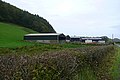
 Broad Oak Farm - geograph.org.uk - 6862622.jpg 2 048 × 1 536 ; 1,19 Mio
-
 Broad Oak village boundary sign - geograph.org.uk - 2936474.jpg 640 × 480 ; 59 kio
-
 Brynhafodfawr - geograph.org.uk - 1019103.jpg 640 × 427 ; 191 kio
-
 Buildings at Alltygaer - geograph.org.uk - 1018816.jpg 640 × 427 ; 181 kio
-
 Buttercup meadow - geograph.org.uk - 6862960.jpg 2 048 × 1 536 ; 1,65 Mio
-
 Bythynnod ar groesffordd - Cottages at a crossroads - geograph.org.uk - 6569332.jpg 1 024 × 768 ; 275 kio
-
 Cadw sign for Dryslwyn Castle - geograph.org.uk - 3815655.jpg 2 604 × 2 107 ; 1,11 Mio
-
 Capel Penrheol - geograph.org.uk - 6862243.jpg 2 048 × 1 536 ; 1,21 Mio
-
 Capel Penrheol - Penrheol Chapel - geograph.org.uk - 5661129.jpg 640 × 480 ; 104 kio
-
 Castell Dryslwyn - Dryslwyn Castle - geograph.org.uk - 6531718.jpg 1 024 × 768 ; 108 kio
-
 Castell Dryslwyn - Dryslwyn Castle - geograph.org.uk - 6531732.jpg 1 024 × 768 ; 202 kio
-
 Cattle grazing on the banks of the Tywi - geograph.org.uk - 6862962.jpg 2 048 × 1 536 ; 1,02 Mio
-
 Chapel at Rhyd-y-Wrach - geograph.org.uk - 1016664.jpg 640 × 427 ; 193 kio
-
 Cilfargen - geograph.org.uk - 1016651.jpg 640 × 427 ; 186 kio
-
 Cilsan Bridge - geograph.org.uk - 6862965.jpg 2 048 × 1 536 ; 1,44 Mio
-
 Cilsan Ford - geograph.org.uk - 6137392.jpg 3 000 × 2 000 ; 7,54 Mio
-
 Cloister Garden, Aberglasney - geograph.org.uk - 6131344.jpg 3 008 × 1 569 ; 575 kio
-
 Country lane to Cilwern - geograph.org.uk - 6862606.jpg 1 536 × 2 048 ; 1,69 Mio
-
 Country road - geograph.org.uk - 6284134.jpg 640 × 480 ; 62 kio
-
 Country road - geograph.org.uk - 6284197.jpg 640 × 480 ; 114 kio
-
 Country road - geograph.org.uk - 6284647.jpg 640 × 480 ; 67 kio
-
 Crossroads and Tollgate Cottage - geograph.org.uk - 573700.jpg 640 × 480 ; 119 kio
-
 Cyffordd ffordd fach - Minor road junction - geograph.org.uk - 4086171.jpg 640 × 480 ; 62 kio
-
 Cyrraedd Derwen Fawr - Arriving at Broak Oak - geograph.org.uk - 5621615.jpg 640 × 480 ; 105 kio
-
 Da yng nghornel cae - Cattle at corner of field - geograph.org.uk - 5644087.jpg 640 × 480 ; 106 kio
-
 Discharge pipe into a woodland stream - geograph.org.uk - 6862223.jpg 958 × 1 280 ; 508 kio
-
 Dryslwyn Bridge over the River Tywi - geograph.org.uk - 4148914.jpg 3 264 × 2 448 ; 2,83 Mio
-
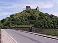
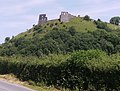
 Dryslwyn Castle - geograph.org.uk - 3815637.jpg 2 248 × 1 912 ; 628 kio
-
 Dryslwyn Castle - geograph.org.uk - 3815699.jpg 3 264 × 2 448 ; 3,81 Mio
-
 Dryslwyn Castle - geograph.org.uk - 4312774.jpg 640 × 480 ; 136 kio
-
 Dryslwyn Castle - geograph.org.uk - 4416593.jpg 1 600 × 1 064 ; 458 kio
-
 Dryslwyn Castle - geograph.org.uk - 5150084.jpg 3 000 × 4 000 ; 2,74 Mio
-
 Dryslwyn Castle - geograph.org.uk - 5899889.jpg 2 592 × 1 944 ; 1,5 Mio
-
 Dryslwyn Castle - geograph.org.uk - 6284113.jpg 640 × 480 ; 27 kio
-
 Dryslwyn Castle - Outer Bailey - geograph.org.uk - 4416621.jpg 1 600 × 1 064 ; 470 kio
-
 DV 77 No.21 Grongar Hill.png 1 313 × 821 ; 3,09 Mio
-
 Elevenses above the Tywi - geograph.org.uk - 1016476.jpg 640 × 427 ; 195 kio
-
 Entrance to Brennyn’s Cwtch - geograph.org.uk - 6862239.jpg 2 048 × 1 536 ; 1,69 Mio
-
 Entrance to car park and picnic area, Dryslwyn - geograph.org.uk - 1812527.jpg 2 048 × 1 536 ; 1,29 Mio
-
 Entrance to Cilwern - geograph.org.uk - 1019054.jpg 640 × 427 ; 200 kio
-
 Entrance to Hafod - geograph.org.uk - 6862231.jpg 2 048 × 1 536 ; 1,89 Mio
-
 Entrance to Hafodneddyn - geograph.org.uk - 1019052.jpg 640 × 427 ; 195 kio
-
 Farm buildings at Cadfan - geograph.org.uk - 6862609.jpg 2 048 × 1 536 ; 1,58 Mio
-
 Farm gates - geograph.org.uk - 6863740.jpg 2 048 × 1 536 ; 1,67 Mio
-
 Farmland at Wern-fawr - geograph.org.uk - 1016491.jpg 640 × 427 ; 207 kio
-
 Farmland at Wern-fawr - geograph.org.uk - 1018688.jpg 640 × 427 ; 180 kio
-
 Farmland in the Afon Tywi valley - geograph.org.uk - 573711.jpg 640 × 480 ; 97 kio
-
 Farmland near Alltygaer - geograph.org.uk - 1016525.jpg 640 × 427 ; 199 kio
-
 Farmland near Birdshill Farm - geograph.org.uk - 1016489.jpg 640 × 427 ; 194 kio
-
 Farmland near Cildderi - geograph.org.uk - 1016646.jpg 640 × 427 ; 161 kio
-
 Field at Brynhafodfawr - geograph.org.uk - 1016805.jpg 640 × 427 ; 190 kio
-
 First view of Dryslwyn Castle - geograph.org.uk - 3815799.jpg 2 599 × 1 975 ; 858 kio
-
 Footpath at Grongar - geograph.org.uk - 1018692.jpg 640 × 427 ; 232 kio
-
 Ford at Glannant - geograph.org.uk - 1016667.jpg 640 × 427 ; 237 kio
-
 Former chapel at Tirllan - geograph.org.uk - 1019050.jpg 640 × 427 ; 207 kio
-
 Former Gatehouse and Cobbled Road at Aberglasney - geograph.org.uk - 6739123.jpg 1 600 × 900 ; 1,12 Mio
-
 Former gatehouse at Aberglasney - geograph.org.uk - 6231132.jpg 4 000 × 3 000 ; 2,91 Mio
-
 Ger - Near Cilsan Bridge - geograph.org.uk - 4086285.jpg 640 × 480 ; 111 kio
-
 Ger - Near Ffarm y Grongar Farm - geograph.org.uk - 4086235.jpg 640 × 480 ; 143 kio
-
 Glandulas Lodge - geograph.org.uk - 2094241.jpg 1 600 × 1 200 ; 471 kio
-
 Glannant Ford - geograph.org.uk - 6137267.jpg 3 000 × 2 000 ; 6,85 Mio
-
 Gron Gaer - geograph.org.uk - 6864988.jpg 2 048 × 1 536 ; 1,18 Mio
-
 Grongar Farm - geograph.org.uk - 1016497.jpg 640 × 427 ; 203 kio
-
 Heol Cwmysgyfarnog - Cwmysgyfarnog Road - geograph.org.uk - 5621603.jpg 640 × 480 ; 91 kio
-

-
 Heol Ffarm y Wern Farm Road - geograph.org.uk - 4086477.jpg 640 × 480 ; 85 kio
-
 Heol ger Brynhafod Fawr - Road near Brynhafod Fawr - geograph.org.uk - 6569361.jpg 1 024 × 768 ; 287 kio
-
 Heol i Gapel Isaac - Road to Capel Isaac - geograph.org.uk - 6569342.jpg 1 024 × 768 ; 249 kio
-

-
 House on a road junction at Llangathen - geograph.org.uk - 6231154.jpg 4 000 × 3 000 ; 2,42 Mio
-
 House, with Outhouses, Dryslwyn - geograph.org.uk - 1502684.jpg 640 × 480 ; 127 kio
-
 Information about the siege - geograph.org.uk - 3815816.jpg 1 767 × 1 176 ; 336 kio
-
 Information about the siege - geograph.org.uk - 3815820.jpg 1 983 × 2 838 ; 865 kio
-
 Information sign about Dryslwyn Castle - geograph.org.uk - 3815775.jpg 3 264 × 2 448 ; 3,96 Mio
-
 Into the woodlands at Aberglasney - geograph.org.uk - 6231011.jpg 4 000 × 3 000 ; 2,87 Mio
-
 Just off the A40 - geograph.org.uk - 1016499.jpg 640 × 427 ; 185 kio
-
 Lan - geograph.org.uk - 1016670.jpg 640 × 427 ; 223 kio
-
 Late spring in Aberglasney gardens - geograph.org.uk - 6231058.jpg 4 000 × 3 000 ; 2,84 Mio
-
 Llangathen geograph-3565441-by-Ben-Brooksbank.jpg 2 392 × 1 437 ; 3,05 Mio
-
 Llangathen Village Hall - geograph.org.uk - 4668586.jpg 1 200 × 900 ; 222 kio
-
 Llangathen Village Hall - geograph.org.uk - 6213677.jpg 2 000 × 1 498 ; 734 kio
-
 Llwybr ceffyl ger Dryslwyn - Bridleway near Dryslwyn - geograph.org.uk - 6574087.jpg 1 024 × 768 ; 341 kio
-
 Llwybr ceffyl ger Dryslwyn - Bridleway near Dryslwyn - geograph.org.uk - 6574090.jpg 1 024 × 768 ; 251 kio
-
 Llwybr ceffyl ger Lanlash - A bridleway near Lanlash - geograph.org.uk - 6574071.jpg 1 024 × 767 ; 375 kio
-
 Llwybr Ceffyl Ty Newydd - Ty Newydd Bridleway - geograph.org.uk - 5661117.jpg 640 × 480 ; 124 kio
-
 Llwybr Ceffyl Ty Newydd - Ty Newydd Bridleway - geograph.org.uk - 5661120.jpg 640 × 480 ; 129 kio
-
 Llwybr Cyhoeddus - Public Footpath - geograph.org.uk - 5661111.jpg 640 × 480 ; 163 kio
-

-

-

-
 Llwybr ger Dryslwyn - Path near Dryslwyn - geograph.org.uk - 6574084.jpg 1 024 × 768 ; 366 kio
-
 Llwybr ger Pen-y-banc - Path near Pen-y-banc - geograph.org.uk - 5644097.jpg 640 × 479 ; 123 kio
-
 Llwybr i Ddryslwyn - Path to Dryslwyn - geograph.org.uk - 6574079.jpg 1 024 × 768 ; 355 kio
-
 Llwybr i Landeilo - Path to Llandeilo - geograph.org.uk - 5644111.jpg 640 × 480 ; 107 kio
-

-
 Llwybr Llethr Cadfan - Llethr Cadfan Path - geograph.org.uk - 5673226.jpg 640 × 480 ; 125 kio
-
 Llwybr Pant y Glien - Pant y Glien Path - geograph.org.uk - 5661125.jpg 640 × 480 ; 159 kio
-
 Llwybr Ty Newydd - Ty Newydd Path - geograph.org.uk - 5661104.jpg 640 × 480 ; 142 kio
-
 Lollipop trees in the Lower Walled Garden, Aberglasney - geograph.org.uk - 6213548.jpg 2 000 × 1 500 ; 1,34 Mio
-
 Meadow flowers - geograph.org.uk - 6862211.jpg 2 048 × 1 536 ; 1,47 Mio
-
 Mynediad i gae - Access to field - geograph.org.uk - 6569357.jpg 1 024 × 768 ; 178 kio
-
 Near Rhiw'r-dorth - geograph.org.uk - 1019104.jpg 640 × 427 ; 202 kio
-
 Near Rhiw'r-dorth - geograph.org.uk - 1019105.jpg 640 × 427 ; 194 kio
-
 Near Rhiw-yr-adar - geograph.org.uk - 1018686.jpg 640 × 427 ; 171 kio
-
 Ninfarium, Aberglasney - geograph.org.uk - 6231151.jpg 4 000 × 3 000 ; 2,73 Mio
-
 Oak bench, Aberglasney - geograph.org.uk - 6231069.jpg 4 000 × 3 000 ; 2,86 Mio
-
 Old kissing gate - geograph.org.uk - 6862954.jpg 1 536 × 2 048 ; 1,55 Mio
-
 Ordnance Survey 1GL Bolt - geograph.org.uk - 4369346.jpg 480 × 640 ; 140 kio
-
 Ordnance Survey Cut Mark - geograph.org.uk - 4658205.jpg 480 × 640 ; 110 kio
-
 Ordnance Survey Cut Mark - geograph.org.uk - 5198864.jpg 640 × 395 ; 110 kio
-
 Ordnance Survey Cut Mark - geograph.org.uk - 6778167.jpg 761 × 1 024 ; 153 kio
-
 Ordnance Survey Cut Mark - geograph.org.uk - 6778169.jpg 1 024 × 647 ; 217 kio
-
 Ordnance Survey Cut Mark - geograph.org.uk - 6778170.jpg 1 024 × 769 ; 235 kio
-
 Ordnance Survey Cut Mark - geograph.org.uk - 6778173.jpg 827 × 1 024 ; 250 kio
-
 Ordnance Survey Cut Mark - geograph.org.uk - 6778176.jpg 730 × 1 024 ; 257 kio
-
 Ordnance Survey Cut Mark - geograph.org.uk - 6778179.jpg 1 024 × 678 ; 205 kio
-
 Ordnance Survey Cut Mark - geograph.org.uk - 6778180.jpg 1 024 × 817 ; 283 kio
-
 Ordnance Survey Cut Mark - geograph.org.uk - 6778183.jpg 1 024 × 827 ; 349 kio
-
 Ordnance Survey Cut Mark - geograph.org.uk - 6778184.jpg 1 024 × 892 ; 199 kio
-
 Ordnance Survey Cut Mark - geograph.org.uk - 6778186.jpg 1 024 × 808 ; 207 kio
-
 Ordnance Survey Cut Mark - geograph.org.uk - 6778189.jpg 1 024 × 601 ; 226 kio
-
 Ordnance Survey Cut Mark - geograph.org.uk - 6782117.jpg 1 024 × 636 ; 176 kio
-
 Ordnance Survey Cut Mark - geograph.org.uk - 6782121.jpg 1 024 × 628 ; 171 kio
-
 Ordnance Survey Cut Mark - geograph.org.uk - 6782126.jpg 801 × 1 024 ; 234 kio
-
 Ordnance Survey Cut Mark - geograph.org.uk - 6782135.jpg 1 024 × 821 ; 219 kio
-
 Ordnance Survey Cut Mark - geograph.org.uk - 6782137.jpg 1 024 × 792 ; 228 kio
-
 Ordnance Survey Cut Mark - geograph.org.uk - 6782140.jpg 1 024 × 735 ; 279 kio
-
 Ordnance Survey Cut Mark - geograph.org.uk - 6782142.jpg 1 024 × 860 ; 204 kio
-
 Ordnance Survey Rivet - geograph.org.uk - 6778192.jpg 1 024 × 842 ; 353 kio
-
 Ordnance Survey Rivet - geograph.org.uk - 6782112.jpg 723 × 1 024 ; 202 kio
-
 Ordnance Survey Rivet - geograph.org.uk - 6782133.jpg 875 × 1 024 ; 230 kio
-
 Pair of motor cycles and riders - geograph.org.uk - 3815677.jpg 2 099 × 951 ; 461 kio
-
 Pantgwyn - geograph.org.uk - 1019099.jpg 640 × 427 ; 198 kio
-
 Pasture at Cilwern - geograph.org.uk - 1016655.jpg 640 × 427 ; 190 kio
-
 Pasture at Glannant - geograph.org.uk - 1019056.jpg 640 × 427 ; 162 kio
-
 Pasture at Lanlash - geograph.org.uk - 1018804.jpg 640 × 427 ; 184 kio
-
 Pasture at Ty-newydd - geograph.org.uk - 1019058.jpg 640 × 427 ; 178 kio
-
 Path across the Stream Garden, Aberglasney - geograph.org.uk - 6213539.jpg 2 000 × 1 500 ; 1,5 Mio
-
 Path in Aberglasney gardens - geograph.org.uk - 6231074.jpg 3 000 × 4 000 ; 2,6 Mio
-
 Path in the Jubilee Garden, Aberglasney - geograph.org.uk - 6213609.jpg 2 000 × 1 500 ; 1,37 Mio
-
 Path to the woodlands at Aberglasney - geograph.org.uk - 6231105.jpg 4 000 × 3 000 ; 2,97 Mio
-
 Paths in the woodlands at Aberglasney - geograph.org.uk - 6231055.jpg 4 000 × 3 000 ; 2,87 Mio
-
 Picnic area at Dryslwyn - geograph.org.uk - 3815651.jpg 2 752 × 1 545 ; 1,08 Mio
-
 Pompren Cilsan - Cilsan Footbridge - geograph.org.uk - 6569328.jpg 1 024 × 768 ; 294 kio
-
 Pompren Nant Hir - Nant Hir Footbridge - geograph.org.uk - 5661139.jpg 640 × 480 ; 128 kio
-
 Pond with sculptured leaves at Aberglasney - geograph.org.uk - 6230203.jpg 4 000 × 3 000 ; 2,89 Mio
-
 Pond, Aberglasney - geograph.org.uk - 6231084.jpg 4 000 × 3 000 ; 2,79 Mio
-
 Pont Myddyfi - geograph.org.uk - 1019108.jpg 640 × 427 ; 203 kio
-
 Pont Rhiw-yr-adar - geograph.org.uk - 1016484.jpg 427 × 640 ; 232 kio
-
 Pont Rhyd y Wrach - geograph.org.uk - 5661134.jpg 640 × 480 ; 111 kio
-
 Pont y Dryslwyn - geograph.org.uk - 2556728.jpg 4 000 × 3 000 ; 2,74 Mio
-
 Pont y Dryslwyn - geograph.org.uk - 472187.jpg 480 × 640 ; 102 kio
-
 Post Office and general store - geograph.org.uk - 6284201.jpg 640 × 480 ; 81 kio
-
 Post Office and general store - geograph.org.uk - 6284210.jpg 640 × 480 ; 82 kio
-
 Pretty climbing plant on Aberglasney walled garden - geograph.org.uk - 6230975.jpg 4 000 × 3 000 ; 2,9 Mio
-
 Primula japonicas at Aberglasney - geograph.org.uk - 6231072.jpg 4 000 × 3 000 ; 2,87 Mio
-
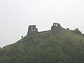
 Remains of Dryslwyn castle - geograph.org.uk - 3156266.jpg 4 000 × 3 000 ; 3,17 Mio
-
 Remains of Dryslwyn castle - geograph.org.uk - 3156275.jpg 4 000 × 3 000 ; 3,18 Mio
-
 Rhyd Afon Dulais - Afon Dulais Ford - geograph.org.uk - 5621556.jpg 640 × 480 ; 134 kio
-
 Rhyd Cilsan - Cilsan Ford - geograph.org.uk - 6569324.jpg 1 024 × 768 ; 283 kio
-
 Rickety fence, Llangathen - geograph.org.uk - 6864986.jpg 1 536 × 2 048 ; 1,27 Mio
-
 River Dulas in flood - geograph.org.uk - 2094252.jpg 1 600 × 1 200 ; 396 kio
-
 River Towy flood plain near Dryslwyn Castle - geograph.org.uk - 4312782.jpg 640 × 480 ; 109 kio
-
 River Towy looking west from Dryslwyn Bridge - geograph.org.uk - 1812501.jpg 2 048 × 1 536 ; 1,36 Mio
-
 Road junction - geograph.org.uk - 6284205.jpg 640 × 480 ; 82 kio
-
 Road junction near Pantgwyn - geograph.org.uk - 6862206.jpg 2 048 × 1 536 ; 1,92 Mio
-
 Road junction near Rhiw-yr-adar - geograph.org.uk - 1444263.jpg 640 × 480 ; 70 kio
-
 Roof in need of some repair - geograph.org.uk - 766634.jpg 640 × 480 ; 108 kio
-
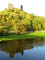
 Ruins of Dryslwyn Castle - geograph.org.uk - 2556726.jpg 4 000 × 3 000 ; 2,08 Mio
-
 Ruins of Dryslwyn Castle - geograph.org.uk - 2556730.jpg 4 000 × 3 000 ; 2,36 Mio
-
 Ruins of Dryslwyn Castle - geograph.org.uk - 2556732.jpg 4 000 × 3 000 ; 2,25 Mio
-
 Siege of Dryslwyn - geograph.org.uk - 3815836.jpg 2 836 × 1 806 ; 1,24 Mio
-
 Siege of Dryslwyn - geograph.org.uk - 3815846.jpg 2 487 × 2 404 ; 1,7 Mio


_-_geograph.org.uk_-_1415205.jpg)


