Category:Llangurig
Vai alla navigazione
Vai alla ricerca

Cymraeg: Pentref ym Mhowys (yng nghymuned o'r un enw) yw Llangurig. Fe'i lleolir ar Afon Gwy yng ngogledd-orllewin y sir, ar gyffordd yr A44 a'r A470 tua 3 milltir i'r de o Lanidloes.
English: Llangurig is a village (in the community of the same name) in Powys, within the historic county boundaries of Montgomeryshire, mid Wales, lying on the River Wye.
village and community in the county of Powys, Wales  | |||||
| Carica un file multimediale | |||||
| Istanza di | |||||
|---|---|---|---|---|---|
| Luogo | Powys, Galles | ||||
| Altezza sul mare |
| ||||
| sito web ufficiale | |||||
 | |||||
Sottocategorie
Questa categoria contiene le 5 sottocategorie indicate di seguito, su un totale di 5.
B
- Black Lion Hotel, Llangurig (6 F)
- Blue Bell Inn, Llangurig (6 F)
C
L
P
- Plynlimon Gauging Station (6 F)
File nella categoria "Llangurig"
Questa categoria contiene 200 file, indicati di seguito, su un totale di 572.
(pagina precedente) (pagina successiva)-

-
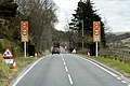
 A Road - geograph.org.uk - 838285.jpg 640 × 399; 109 KB
-
 A view across Cwm Tarennig - geograph.org.uk - 6045817.jpg 1 024 × 768; 420 KB
-

-
 A view of Llangurig from Bryncylla NLW3361465.jpg 607 × 460; 36 KB
-
 A view of Llangurig from Felin Fawr NLW3363548.jpg 595 × 426; 46 KB
-
 A view of Llangurig from The Black Lion NLW3361467.jpg 608 × 463; 54 KB
-
 A view over Abertrinant - geograph.org.uk - 4291065.jpg 640 × 480; 226 KB
-
 A view over the upper Severn Valley - geograph.org.uk - 288512.jpg 640 × 480; 174 KB
-

-
 A44 at Llwyn-yr-hyddod - geograph.org.uk - 3120796.jpg 640 × 437; 65 KB
-
 A44 at Pant Mawr - geograph.org.uk - 4551737.jpg 3 072 × 2 304; 1,51 MB
-
 A44 at Pant Mawr - geograph.org.uk - 5013512.jpg 640 × 427; 391 KB
-

-
 A44 near Pont Rhydgaled - geograph.org.uk - 5013393.jpg 640 × 427; 345 KB
-
 A44 Road - geograph.org.uk - 213646.jpg 640 × 480; 76 KB
-
 A470 at Llanidloes - geograph.org.uk - 5013769.jpg 640 × 427; 338 KB
-
 A470 between Llanidloes and Cwmbelan - geograph.org.uk - 5013871.jpg 640 × 427; 349 KB
-
 A470 near to Dolfach - geograph.org.uk - 5013893.jpg 640 × 480; 430 KB
-
 A470 near to Llangurig - geograph.org.uk - 5013636.jpg 640 × 480; 334 KB
-
 A470 road to Llangurig in Powys - geograph.org.uk - 6213213.jpg 1 440 × 960; 1,69 MB
-
 A470 road to Llangurig in Powys - geograph.org.uk - 6213215.jpg 1 440 × 960; 1,62 MB
-
 A470 south at Pentre - geograph.org.uk - 3120452.jpg 640 × 505; 58 KB
-
 Abertrinant and the Wye Valley - geograph.org.uk - 4294509.jpg 480 × 640; 242 KB
-
 Above Abertrinant, Esgair Ychion - geograph.org.uk - 4307928.jpg 480 × 640; 217 KB
-
 Above Afon Hore - geograph.org.uk - 2560931.jpg 2 592 × 1 944; 2,05 MB
-
 Abutments of Mid Wales Railway bridge - geograph.org.uk - 901824.jpg 1 024 × 768; 1,32 MB
-

-
 Across the Wye Valley from Esgair Ychion - geograph.org.uk - 4307932.jpg 480 × 640; 226 KB
-
 Across the Wye Valley south of Llangurig, Powys - geograph.org.uk - 6213217.jpg 1 600 × 900; 1,45 MB
-
 Afon Bochan - geograph.org.uk - 2962121.jpg 1 024 × 768; 264 KB
-
 Afon Diliw - geograph.org.uk - 4250521.jpg 1 024 × 688; 145 KB
-
 Afon Diliw footbridge and lane beyond - geograph.org.uk - 4250549.jpg 1 024 × 678; 121 KB
-
 Afon Dulas, Cwmbelan - geograph.org.uk - 4765562.jpg 1 600 × 1 200; 659 KB
-
 Afon Gwy - geograph.org.uk - 251348.jpg 640 × 480; 88 KB
-
 Afon Gwy - River Wye - geograph.org.uk - 1262699.jpg 640 × 480; 106 KB
-
 Afon Gwy - River Wye near Glangwy - geograph.org.uk - 1403313.jpg 640 × 428; 218 KB
-
-
-

-
 At the edge of the forest - geograph.org.uk - 2303284.jpg 640 × 480; 223 KB
-

-
 Autumn colour at Coed y Gelli - geograph.org.uk - 4227174.jpg 3 264 × 2 448; 6,33 MB
-
 B4518 heading north to Llanidloes - geograph.org.uk - 5028306.jpg 1 024 × 768; 157 KB
-
 Barn amongst the fields - geograph.org.uk - 2435649.jpg 1 000 × 750; 374 KB
-
 Between the bridges on the B4518 at Tylwch - geograph.org.uk - 5028526.jpg 1 024 × 768; 168 KB
-
 Blaen Afon Gwy - Source of the Wye River - geograph.org.uk - 6155629.jpg 1 024 × 767; 233 KB
-

-

-
 Bridleway signage, Llangurig - geograph.org.uk - 4765540.jpg 1 600 × 1 200; 614 KB
-
 Bridleway to Cefn farm - geograph.org.uk - 2435631.jpg 1 000 × 750; 496 KB
-
 Buttercup meadow, north of Maes-socyn - geograph.org.uk - 5028277.jpg 1 024 × 768; 158 KB
-
 Cae Gaer Roman fortlet - geograph.org.uk - 6010262.jpg 1 024 × 507; 142 KB
-

-

-
 Cattle grazing neat Tan-y-llwyn - geograph.org.uk - 1933735.jpg 1 000 × 750; 414 KB
-
 Cefn Hirbrysg viewed from Pen y Foel - geograph.org.uk - 2507773.jpg 3 072 × 2 304; 3,13 MB
-
 Ceredigion sign on the A44 at Eisteddfa Gurig - geograph.org.uk - 4551747.jpg 3 007 × 2 253; 3,16 MB
-
 Church spire, Llangurig - geograph.org.uk - 4259053.jpg 1 600 × 1 181; 414 KB
-
 Clearing, Esgair Ychion - geograph.org.uk - 4291064.jpg 480 × 640; 277 KB
-
 Coed Hafren - Hafren Forest - geograph.org.uk - 6155644.jpg 1 024 × 768; 254 KB
-
 Coed Hafren - Hafren Forest - geograph.org.uk - 6155645.jpg 1 024 × 768; 261 KB
-

-
 Craig Tylwch - geograph.org.uk - 5028532.jpg 768 × 1 024; 519 KB
-
 Craigllwyn, Tylwch - geograph.org.uk - 5028537.jpg 1 024 × 768; 147 KB
-

-

-
 Cwm Brithgwm and the Wye Valley - geograph.org.uk - 2507787.jpg 9 566 × 2 107; 2,48 MB
-
 Cwm Hore - Hore Valley - geograph.org.uk - 6155638.jpg 1 024 × 768; 186 KB
-
 Cwm Nant Esgair Wen, Esgair Ychion - geograph.org.uk - 4307873.jpg 640 × 480; 247 KB
-
 Cwm Nant Esgair Wen, Esgair Ychion - geograph.org.uk - 4307916.jpg 480 × 640; 248 KB
-
 Cwm Nant Esgair Wen, Esgair Ychion - geograph.org.uk - 4307918.jpg 480 × 640; 257 KB
-
 Cwm Ystwyth - geograph.org.uk - 4552347.jpg 800 × 531; 125 KB
-
 Cwm Ystwyth Valley - geograph.org.uk - 4108269.jpg 1 333 × 1 000; 1,05 MB
-
 Dead-end road heading for Glan-rhyd - geograph.org.uk - 2435705.jpg 1 000 × 750; 405 KB
-

-
 Dyffryn Gwy - Wye Valley - geograph.org.uk - 1251924.jpg 640 × 480; 62 KB
-
 Eastbound A44, Pant Mawr - geograph.org.uk - 5013519.jpg 640 × 427; 355 KB
-
 Eastbound A44, Penlon - geograph.org.uk - 5013521.jpg 640 × 480; 413 KB
-
 Ebenezer - geograph.org.uk - 2852864.jpg 640 × 427; 48 KB
-
 Ebenezer chapel, Llangurig - geograph.org.uk - 3015846.jpg 640 × 480; 56 KB
-
 Eisteddfa Gurig - geograph.org.uk - 4744445.jpg 800 × 531; 122 KB
-
 Entering Ceredigion on the A44 at Eisteddfa Gurig - geograph.org.uk - 4551745.jpg 3 072 × 2 304; 1,76 MB
-
 Entering Llangurig on the A44 - geograph.org.uk - 4551702.jpg 2 912 × 2 181; 1,85 MB
-
 Entrance to Blaen-y-glyn Farm - geograph.org.uk - 3094469.jpg 4 320 × 3 240; 2,87 MB
-
 Entrance to Llangurig - geograph.org.uk - 3935015.jpg 640 × 448; 61 KB
-
 Entrance to Llangurig - geograph.org.uk - 3935023.jpg 640 × 464; 73 KB
-

-
 Esgair Clochfaen forest - geograph.org.uk - 2609260.jpg 2 592 × 1 944; 1,38 MB
-
 Esgair Ganol - geograph.org.uk - 1241733.jpg 640 × 480; 110 KB
-
 Esgair Ychion forest - geograph.org.uk - 2609090.jpg 2 592 × 1 944; 1,29 MB
-
 Farm Bailey Bridge over River Wye - geograph.org.uk - 4637344.jpg 640 × 480; 116 KB
-
 Farm buildings, Lower Glynbrochan - geograph.org.uk - 3094463.jpg 4 320 × 3 240; 2,96 MB
-
 Farm gate at Llidiart Coch - geograph.org.uk - 1171725.jpg 640 × 480; 200 KB
-
 Farm track from Pen-hyle-mawr - geograph.org.uk - 2962526.jpg 768 × 1 024; 203 KB
-
 Farmland above Pontbrenllwyd - geograph.org.uk - 2980944.jpg 3 872 × 2 592; 3,94 MB
-
 Felled tree, Esgair Ychion - geograph.org.uk - 4307901.jpg 640 × 480; 270 KB
-
 Fence Corner - geograph.org.uk - 4157237.jpg 3 456 × 4 608; 3,4 MB
-
 Fence line into the Cyff valley - geograph.org.uk - 2463502.jpg 480 × 640; 285 KB
-
 Field by Tan-y-llwyn - geograph.org.uk - 1933730.jpg 1 000 × 750; 383 KB
-
 Field near Dol-y-gors farm - geograph.org.uk - 2435578.jpg 1 000 × 669; 299 KB
-
 Field near Glynhafren - geograph.org.uk - 968436.jpg 640 × 428; 102 KB
-
 Field near Pen-pontbren - geograph.org.uk - 901801.jpg 1 024 × 768; 1,04 MB
-
 Field of sheep - geograph.org.uk - 3241844.jpg 640 × 480; 52 KB
-
 Field overlooking valley - geograph.org.uk - 2962696.jpg 768 × 1 024; 227 KB
-
 Fields above the Dulas valley - geograph.org.uk - 2435664.jpg 1 000 × 669; 346 KB
-
 Fields around Pant-y-rhedyn farm - geograph.org.uk - 1909855.jpg 1 000 × 750; 354 KB
-
 Fields around Trafel-gwyn - geograph.org.uk - 979679.jpg 640 × 480; 93 KB
-
 Fields by the Afon Brochan - geograph.org.uk - 1849154.jpg 640 × 428; 96 KB
-
 Fields near Hafod-wen - geograph.org.uk - 968362.jpg 640 × 428; 121 KB
-
 Fields overlooking Llanidloes - geograph.org.uk - 2962367.jpg 1 024 × 552; 144 KB
-
 Fields south of A44 near Rhos Y Castell - geograph.org.uk - 4541826.jpg 2 000 × 1 500; 1,28 MB
-
 Flume on Nant Tanllwyth - geograph.org.uk - 2982692.jpg 3 872 × 2 592; 7,01 MB
-
 Flume on the River Severn - geograph.org.uk - 2981550.jpg 3 872 × 2 592; 5,81 MB
-
 Foel Goch - geograph.org.uk - 1910742.jpg 640 × 426; 109 KB
-

-
 Foot-cycle bridge over Afon Diliw - geograph.org.uk - 1103626.jpg 640 × 480; 250 KB
-
 Footbridge by intermittent ford - geograph.org.uk - 968450.jpg 640 × 428; 173 KB
-
 Footbridge near Glynhafren - geograph.org.uk - 2485379.jpg 640 × 480; 329 KB
-
 Footbridge over the Nant Ffos-casaf - geograph.org.uk - 4283297.jpg 1 232 × 820; 1,5 MB
-
 Footbridge over the River Severn near Ty-ĉoch - geograph.org.uk - 2733985.jpg 3 872 × 2 592; 6,76 MB
-
 Footpath sign and stile, Afon Dulas - geograph.org.uk - 4765561.jpg 1 600 × 1 200; 796 KB
-
 Footpath towards Llanidloes - geograph.org.uk - 2962126.jpg 768 × 1 024; 239 KB
-
 Ford across the River Wye - geograph.org.uk - 2979859.jpg 3 872 × 2 592; 5,29 MB
-
 Forest and valley side east of Llangurig, Powys - geograph.org.uk - 2533993.jpg 1 024 × 657; 437 KB
-
 Forest track at Esgair Ychion - geograph.org.uk - 2223890.jpg 640 × 480; 266 KB
-
 Forestry Access Gate - geograph.org.uk - 1113049.jpg 640 × 480; 250 KB
-
 Forestry on Esgair Ychion - geograph.org.uk - 4291035.jpg 480 × 640; 270 KB
-
 Forestry on Esgair Ychion - geograph.org.uk - 4294527.jpg 640 × 480; 274 KB
-
 Forestry on Esgair Ychion - geograph.org.uk - 4307862.jpg 480 × 640; 306 KB
-
 Forestry road - Esgair Ychion - geograph.org.uk - 4291040.jpg 640 × 480; 198 KB
-
 Forestry road - Esgair Ychion - geograph.org.uk - 4291043.jpg 480 × 640; 234 KB
-
-
 Forestry road at Rhos Lydan - geograph.org.uk - 1114191.jpg 640 × 480; 203 KB
-
 Forestry road near Pant-yr-esgair - geograph.org.uk - 968519.jpg 640 × 428; 109 KB
-
 Forestry road near Pen Cloddiau - geograph.org.uk - 2220888.jpg 640 × 480; 208 KB
-
 Forestry road on Esgair Ychion - geograph.org.uk - 4289154.jpg 640 × 480; 192 KB
-
 Forestry road on Esgair Ychion - geograph.org.uk - 4289157.jpg 640 × 480; 248 KB
-
 Forestry Road on Esgair Ychion - geograph.org.uk - 4289159.jpg 640 × 480; 253 KB
-
 Forestry road on Esgair Ychion - geograph.org.uk - 4289160.jpg 640 × 480; 225 KB
-
 Forestry road on Esgair Ychion - geograph.org.uk - 4289161.jpg 640 × 480; 208 KB
-
 Forestry road on Esgair Ychion - geograph.org.uk - 4289164.jpg 480 × 640; 192 KB
-
 Forestry road on Esgair Ychion - geograph.org.uk - 4289171.jpg 640 × 480; 223 KB
-
 Forestry road on Esgair Ychion - geograph.org.uk - 4294528.jpg 640 × 480; 247 KB
-
 Forestry road to Esgair Ychion - geograph.org.uk - 781764.jpg 640 × 480; 190 KB
-
 Forestry road, Esgair Wen - geograph.org.uk - 4307922.jpg 640 × 480; 278 KB
-
 Forestry road, Esgair Ychion - geograph.org.uk - 4291045.jpg 640 × 480; 223 KB
-
 Forestry road, Esgair Ychion - geograph.org.uk - 4291047.jpg 640 × 480; 226 KB
-
 Forestry road, Esgair Ychion - geograph.org.uk - 4291057.jpg 640 × 480; 239 KB
-
 Forestry road, Esgair Ychion - geograph.org.uk - 4291058.jpg 640 × 480; 232 KB
-
 Forestry road, Esgair Ychion - geograph.org.uk - 4291059.jpg 480 × 640; 269 KB
-
 Forestry road, Esgair Ychion - geograph.org.uk - 4291066.jpg 640 × 480; 169 KB
-
 Forestry road, Esgair Ychion - geograph.org.uk - 4294501.jpg 480 × 640; 246 KB
-
 Forestry road, Esgair Ychion - geograph.org.uk - 4294503.jpg 640 × 480; 275 KB
-
 Forestry road, Esgair Ychion - geograph.org.uk - 4294513.jpg 640 × 480; 259 KB
-
 Forestry road, Esgair Ychion - geograph.org.uk - 4294520.jpg 640 × 480; 238 KB
-
 Forestry road, Esgair Ychion - geograph.org.uk - 4294533.jpg 640 × 480; 284 KB
-
 Forestry road, Esgair Ychion - geograph.org.uk - 4301422.jpg 640 × 480; 271 KB
-
 Forestry road, Esgair Ychion - geograph.org.uk - 4301425.jpg 640 × 480; 239 KB
-
 Forestry road, Esgair Ychion - geograph.org.uk - 4301432.jpg 480 × 640; 207 KB
-
 Forestry road, Esgair Ychion - geograph.org.uk - 4301438.jpg 640 × 480; 237 KB
-
 Forestry road, Esgair Ychion - geograph.org.uk - 4301442.jpg 640 × 480; 242 KB
-
 Forestry road, Esgair Ychion - geograph.org.uk - 4301446.jpg 640 × 480; 240 KB
-
 Forestry road, Esgair Ychion - geograph.org.uk - 4302533.jpg 640 × 480; 256 KB
-
 Forestry road, Esgair Ychion - geograph.org.uk - 4302537.jpg 640 × 480; 248 KB
-
 Forestry road, Esgair Ychion - geograph.org.uk - 4307859.jpg 640 × 480; 245 KB
-
 Forestry road, Esgair Ychion - geograph.org.uk - 4307868.jpg 480 × 640; 238 KB
-
 Forestry road, Esgair Ychion - geograph.org.uk - 4307877.jpg 480 × 640; 226 KB
-
 Forestry road, Esgair Ychion - geograph.org.uk - 4307880.jpg 640 × 480; 196 KB
-
 Forestry road, Esgair Ychion - geograph.org.uk - 4307885.jpg 640 × 480; 206 KB
-
 Forestry road, Esgair Ychion - geograph.org.uk - 4307888.jpg 480 × 640; 202 KB
-
 Forestry road, Esgair Ychion - geograph.org.uk - 4307890.jpg 480 × 640; 218 KB
-
 Forestry road, Esgair Ychion - geograph.org.uk - 4307900.jpg 640 × 480; 237 KB
-
 Forestry road, Esgair Ychion - geograph.org.uk - 4307904.jpg 640 × 480; 224 KB
-
 Forestry road, Esgair Ychion - geograph.org.uk - 4307907.jpg 640 × 480; 222 KB
-
 Forestry road, Esgair Ychion - geograph.org.uk - 4307910.jpg 640 × 480; 255 KB
-
 Forestry road, Esgair Ychion - geograph.org.uk - 4307912.jpg 640 × 480; 240 KB
-
 Forestry road, Esgair Ychion - geograph.org.uk - 4307933.jpg 640 × 480; 227 KB
-
 Forestry road, Esgair Ychion - geograph.org.uk - 4307940.jpg 640 × 480; 291 KB
-
 Forestry road, Esgair Ychion - geograph.org.uk - 4307945.jpg 640 × 480; 294 KB
-
 Forestry road. Esgair Ychion - geograph.org.uk - 4307894.jpg 640 × 480; 247 KB
-
 Forestry track leading to Drum Maen - geograph.org.uk - 1113842.jpg 640 × 480; 258 KB
-

-
 Forestry, Esgair Ychion - geograph.org.uk - 4307871.jpg 480 × 640; 268 KB
-
 Forestry, Esgair Ychion - geograph.org.uk - 4307938.jpg 480 × 640; 334 KB
-
 Former mining activity in Nant Iago - geograph.org.uk - 2977663.jpg 3 872 × 2 592; 5,21 MB
-
 Frozen vegetation - geograph.org.uk - 4291067.jpg 480 × 640; 182 KB
-
 Gate at woodland edge - geograph.org.uk - 2962459.jpg 768 × 1 024; 288 KB
-
 Gate into the pasture - geograph.org.uk - 968615.jpg 640 × 480; 111 KB
-
 Gate on Bryn Mawr - geograph.org.uk - 2844802.jpg 640 × 427; 112 KB
-
 Gated Forestry track - geograph.org.uk - 251090.jpg 640 × 480; 128 KB
-
 Gated road near Cefn-y-cownen - geograph.org.uk - 2980933.jpg 3 872 × 2 592; 4,41 MB
-
 Gated track at Waen Goch - geograph.org.uk - 1115895.jpg 640 × 480; 131 KB
-
 Gorse lining a clough above the Severn valley - geograph.org.uk - 2734003.jpg 3 872 × 2 592; 4,39 MB
-
 Graiglas - geograph.org.uk - 3094458.jpg 4 320 × 3 240; 3,03 MB
-
 Grassland above Tylwch - geograph.org.uk - 1899728.jpg 640 × 426; 84 KB
-
 Grazing and woodland on the hill - geograph.org.uk - 1849071.jpg 640 × 428; 113 KB
-
 Grazing land west of Cefn-y-cownen farm - geograph.org.uk - 1848960.jpg 800 × 536; 162 KB
-
 Grazing near Tan-y-llwyn - geograph.org.uk - 1933727.jpg 1 000 × 750; 434 KB
-
 Grazing on the hill - geograph.org.uk - 1849063.jpg 640 × 428; 136 KB


