Category:Llanrhian
Vai alla navigazione
Vai alla ricerca
comunità del Galles  Eglwys Sant Rhian, Llanrhian | |||||
| Carica un file multimediale | |||||
| Istanza di | |||||
|---|---|---|---|---|---|
| Prende il nome da |
| ||||
| Luogo | Pembrokeshire, Galles | ||||
 | |||||
Cymraeg: Llanrhian, pentre a chymuned yn Sir Benfro, Cymru.
Sottocategorie
Questa categoria contiene le 9 sottocategorie indicate di seguito, su un totale di 9.
A
L
- St Hywel, Llanhywel (8 F)
P
- Penparc, Pembrokeshire (1 F)
S
- St Rhian's Church, Llanrhian (4 F)
T
- Tyrch quarry (1 F)
Y
- Ynys Deullyn (12 F)
File nella categoria "Llanrhian"
Questa categoria contiene 200 file, indicati di seguito, su un totale di 628.
(pagina precedente) (pagina successiva)-
 'Tato newi' in Llanrhian - geograph.org.uk - 929465.jpg 640 × 480; 105 KB
-
 2010 Wales Pembrokeshire Community Llanrhian map.svg 512 × 393; 1 018 KB
-
 2024 Wales Pembrokeshire Community Llanrhian map.svg 512 × 393; 1,19 MB
-
 A Glimpse of Daisies - geograph.org.uk - 4960277.jpg 2 908 × 2 032; 1,3 MB
-
 A grey day at the Blue Lagoon - geograph.org.uk - 2315833.jpg 640 × 415; 102 KB
-
 A lane in the early morning sun - Cwmwdig Water - geograph.org.uk - 2990455.jpg 4 288 × 3 216; 3,38 MB
-
 A tidy house - geograph.org.uk - 894837.jpg 640 × 480; 75 KB
-
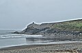
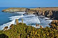
 A View Over Abereiddi Bay - geograph.org.uk - 3917659.jpg 1 024 × 768; 424 KB
-
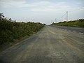
 A487 at Croes Goch village boundary - geograph.org.uk - 3273169.jpg 640 × 480; 28 KB
-
 A487 at Croes-goch - geograph.org.uk - 6216059.jpg 1 280 × 851; 378 KB
-
 A487 at Llwynduris - geograph.org.uk - 3273172.jpg 640 × 481; 37 KB
-
 A487 at Maes Y Dalar - geograph.org.uk - 3273168.jpg 640 × 481; 34 KB
-
 A487 at Penygroes Villas - geograph.org.uk - 3273170.jpg 640 × 480; 32 KB
-
 A487 Entering Croes-goch - geograph.org.uk - 2985817.jpg 3 556 × 1 957; 1,9 MB
-
 A487 Junction for Llanhowel Church - geograph.org.uk - 2985811.jpg 4 245 × 2 472; 2,75 MB
-
 A487 near Croes-Goch - geograph.org.uk - 2486192.jpg 640 × 480; 49 KB
-
 A487, near Croes-Goch - geograph.org.uk - 2125584.jpg 640 × 480; 63 KB
-
 Aber Draw - geograph.org.uk - 6386770.jpg 1 536 × 2 048; 1,07 MB
-
 Aber Draw and Trefin Mill - geograph.org.uk - 3919980.jpg 1 024 × 768; 458 KB
-
 Aber Draw, near Trefin - geograph.org.uk - 1861443.jpg 640 × 427; 96 KB
-
 Aber Draw, near Trefin - geograph.org.uk - 1861450.jpg 640 × 427; 90 KB
-
 Aber Draw, near Trefin - geograph.org.uk - 1861462.jpg 640 × 427; 74 KB
-
 Aber Draw, near Trefin, Pembrokeshire - geograph.org.uk - 6288226.jpg 1 600 × 1 200; 368 KB
-
 Aber Draw, the bay at Trefin - geograph.org.uk - 1861519.jpg 640 × 425; 80 KB
-
 Aber Draw, Trefin Bay - geograph.org.uk - 1861533.jpg 640 × 427; 109 KB
-
 Aber Draw, Trefin Bay - geograph.org.uk - 1861564.jpg 640 × 427; 89 KB
-
 Aber Felin, Trefin - geograph.org.uk - 6389218.jpg 2 048 × 1 536; 1,04 MB
-
 Abereiddi - Aberiddy - geograph.org.uk - 4441172.jpg 640 × 480; 96 KB
-
 Abereiddi Bay - geograph.org.uk - 2575972.jpg 640 × 480; 112 KB
-
 Abereiddi Bay - geograph.org.uk - 4845758.jpg 5 472 × 3 648; 5,94 MB
-
 Abereiddi Bay - geograph.org.uk - 5280848.jpg 3 264 × 2 448; 3,01 MB
-
 Abereiddi Bay - geograph.org.uk - 6028282.jpg 3 599 × 2 399; 1,4 MB
-
 Abereiddi Bay Pebble Beach - geograph.org.uk - 3917652.jpg 1 024 × 768; 466 KB
-
 Abereiddy - geograph.org.uk - 6216191.jpg 1 280 × 851; 412 KB
-
 Abereiddy - panoramio (1).jpg 3 888 × 2 592; 5,35 MB
-
 Abereiddy - panoramio.jpg 3 888 × 2 592; 5,98 MB
-
 Abereiddy Bay - geograph.org.uk - 4577702.jpg 5 714 × 3 653; 2,41 MB
-
 Abereiddy Bay - geograph.org.uk - 4579571.jpg 5 414 × 3 600; 2,6 MB
-
 Abereiddy Bay - panoramio (1).jpg 3 888 × 2 592; 6,15 MB
-
 Abereiddy Bay - panoramio.jpg 3 888 × 2 592; 3,04 MB
-
 Abereiddy bay from Abereiddy Tower - geograph.org.uk - 4619529.jpg 960 × 1 280; 280 KB
-
 Abereiddy Bay, Pembrokeshire - geograph.org.uk - 4983921.jpg 1 600 × 1 133; 339 KB
-
 Abereiddy Beach - geograph.org.uk - 2983308.jpg 4 288 × 3 216; 3,76 MB
-
 Abereiddy Beach - geograph.org.uk - 4960176.jpg 2 048 × 1 536; 688 KB
-
 Abereiddy Beach - geograph.org.uk - 6216179.jpg 1 280 × 851; 539 KB
-
 Abereiddy car park and bay - geograph.org.uk - 1930067.jpg 640 × 480; 152 KB
-
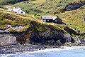
 Abereiddy cottages - geograph.org.uk - 4894271.jpg 640 × 480; 69 KB
-
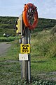 Abereiddy emergency equipment - geograph.org.uk - 6216195.jpg 851 × 1 280; 454 KB
-
 Abereiddy reed-bed - geograph.org.uk - 4894284.jpg 640 × 480; 88 KB
-
 Abereiddy Tower (1) - geograph.org.uk - 4985484.jpg 1 600 × 1 182; 289 KB
-
 Abereiddy Tower (2) - geograph.org.uk - 4985493.jpg 1 600 × 1 200; 380 KB
-
 Access Stairs - Traeth Llyfn - geograph.org.uk - 2983440.jpg 3 216 × 4 288; 3,59 MB
-
 Across the bay to Abereiddy - geograph.org.uk - 4985640.jpg 1 600 × 1 200; 217 KB
-
 Aerial ropeway, Blue Lagoon - geograph.org.uk - 3158010.jpg 640 × 480; 82 KB
-
 Altar candle - geograph.org.uk - 6199604.jpg 2 252 × 3 003; 1,31 MB
-
 Approaching Croesgoch - geograph.org.uk - 4828378.jpg 1 600 × 1 067; 399 KB
-
 Approaching Porthgain village - geograph.org.uk - 6285260.jpg 2 592 × 1 944; 1,59 MB
-
 Approaching The Junction To Llanhowell - geograph.org.uk - 4816112.jpg 1 600 × 1 067; 133 KB
-
 Arfordir ar Daith - geograph.org.uk - 4842853.jpg 2 448 × 3 264; 1,75 MB
-
 Arfordir ger Ynys Deullyn - Coast near Ynys Deullyn - geograph.org.uk - 4322851.jpg 3 264 × 2 448; 3,68 MB
-
 Art gallery in Porthgain - geograph.org.uk - 3979810.jpg 640 × 360; 47 KB
-
 Artists impression of Porthgain - geograph.org.uk - 5422863.jpg 839 × 567; 164 KB
-
 Artramont Arms, Croes-goch - geograph.org.uk - 2651880.jpg 3 589 × 2 668; 1,01 MB
-
 B4330, east of Croes-Goch - geograph.org.uk - 2125465.jpg 640 × 480; 30 KB
-
 Bae Abereiddi - Abereiddy Bay - geograph.org.uk - 4202139.jpg 3 600 × 2 400; 4,06 MB
-
 Bae Abereiddi - Abereiddy Bay - geograph.org.uk - 4202149.jpg 3 600 × 2 400; 4,09 MB
-
 Bank House - geograph.org.uk - 5403842.jpg 3 264 × 2 448; 2,13 MB
-
 Barn at Portheiddy - geograph.org.uk - 2990468.jpg 4 029 × 2 781; 2,96 MB
-
 Beach at Abereiddi - geograph.org.uk - 6305780.jpg 5 184 × 3 888; 5,05 MB
-
 Beach at Traeth Llyfn near Abereiddy - geograph.org.uk - 4396447.jpg 1 600 × 1 067; 555 KB
-
 Beach platform - geograph.org.uk - 4894328.jpg 640 × 480; 89 KB
-
 Beach platform - geograph.org.uk - 4899466.jpg 640 × 480; 83 KB
-
-
 Benchmark on Llanhowel Church - geograph.org.uk - 4711746.jpg 640 × 427; 64 KB
-
 Bend in the road near Llanon - geograph.org.uk - 3016986.jpg 640 × 480; 44 KB
-
 Bickny Near Penparc - geograph.org.uk - 4929035.jpg 1 600 × 939; 292 KB
-
 Bird's eye view from Pen Clegyr - geograph.org.uk - 2011796.jpg 800 × 600; 137 KB
-
 Black medick (Medicago lupulina) - geograph.org.uk - 944326.jpg 510 × 640; 164 KB
-
 Blue Lagoon - panoramio (21).jpg 3 888 × 2 592; 5,11 MB
-
 Blue Lagoon At Abereiddy - geograph.org.uk - 4396429.jpg 1 600 × 1 067; 366 KB
-
 Bolted on - geograph.org.uk - 945172.jpg 480 × 640; 113 KB
-
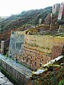 Brickworks Ruins at Porthgain - geograph.org.uk - 3390230.jpg 720 × 960; 188 KB
-
 Bridlepath to Trefacwn - geograph.org.uk - 5657355.jpg 4 592 × 3 056; 4,05 MB
-
 Bulkhead from 1859 wreck - geograph.org.uk - 1474576.jpg 640 × 480; 90 KB
-
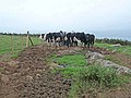
 Bullocks at Llanwg - geograph.org.uk - 3158082.jpg 640 × 480; 92 KB
-
 Buttercup Meadow - geograph.org.uk - 4960116.jpg 3 264 × 2 448; 4,38 MB
-
 Buy your new potatoes... - geograph.org.uk - 929469.jpg 480 × 640; 94 KB
-
 Bwythynnod ger Trefin - Cottages near Trefin - geograph.org.uk - 4322659.jpg 3 264 × 2 448; 3,79 MB
-
 Caerhafod Lodge access drive - geograph.org.uk - 1332806.jpg 640 × 425; 86 KB
-
 Cairns near Porthgain harbour - geograph.org.uk - 6240615.jpg 5 184 × 3 888; 5,91 MB
-
 Car Park at Abereiddy - geograph.org.uk - 1816235.jpg 640 × 480; 70 KB
-
 Cattle feeding - geograph.org.uk - 3158067.jpg 640 × 480; 89 KB
-
 Cerbyd Mill - geograph.org.uk - 4959608.jpg 3 264 × 2 448; 1,52 MB
-
 Cerbyd River - geograph.org.uk - 4959642.jpg 2 448 × 3 264; 3,24 MB
-
 Cerrig Gwylan - geograph.org.uk - 2097709.jpg 1 024 × 753; 140 KB
-
 Cerrig Gwylan - geograph.org.uk - 2990474.jpg 4 006 × 2 910; 2,77 MB
-
 Cerrig Gwylan - geograph.org.uk - 4845891.jpg 3 021 × 1 993; 4,37 MB
-
 Cerrig Gwylan From a Lichen-encrusted Mainland - geograph.org.uk - 2983290.jpg 3 216 × 4 288; 3,09 MB
-
 Cerrig Wylan - geograph.org.uk - 3158016.jpg 640 × 480; 60 KB
-
 Cerrig Wylan - geograph.org.uk - 3158023.jpg 640 × 480; 89 KB
-
 Cliff diving board, Blue Lagoon - geograph.org.uk - 3158003.jpg 640 × 480; 73 KB
-
 Cliff face - geograph.org.uk - 6255989.jpg 1 536 × 2 048; 1,32 MB
-
 Cliffs near the entrance to Porthgain - geograph.org.uk - 4623666.jpg 6 000 × 4 000; 4,3 MB
-
 Cliffs, west side of Aber Draw beach - geograph.org.uk - 1517056.jpg 640 × 482; 133 KB
-
 Clifftop Footpath - geograph.org.uk - 3920071.jpg 1 024 × 768; 431 KB
-

-
 Coast near Aber Draw - geograph.org.uk - 5502390.jpg 4 896 × 3 672; 6,93 MB
-
 Coastal barley fields on Ynys Barry - geograph.org.uk - 4623861.jpg 6 000 × 4 000; 4,02 MB
-
 Coastal Fields - Cwmwdig Water - geograph.org.uk - 2983325.jpg 4 288 × 3 216; 3,78 MB
-
 Coastal hinterland above Llanlleifer - geograph.org.uk - 4623820.jpg 6 000 × 4 000; 5,07 MB
-
 Coastal pasture - geograph.org.uk - 1518365.jpg 640 × 480; 129 KB
-
 Coastal path above Pwll Olfa - geograph.org.uk - 1861657.jpg 640 × 425; 87 KB
-
 Coastal path above Traeth Llyfn - geograph.org.uk - 4623429.jpg 6 000 × 4 000; 5,84 MB
-
 Coastal path sign - geograph.org.uk - 3997681.jpg 3 872 × 2 592; 3,02 MB
-
 Coastal path, Abereiddy - geograph.org.uk - 6216201.jpg 1 280 × 851; 543 KB
-
 Coasteering at the Blue Lagoon - geograph.org.uk - 1931308.jpg 640 × 480; 101 KB
-

-

-
 Colofnau ger Porthgain - Columns near Porthgain - geograph.org.uk - 4322552.jpg 3 264 × 2 448; 3,61 MB
-
 Concrete water trough near Treglemais - geograph.org.uk - 3683611.jpg 4 592 × 3 056; 2,84 MB
-
 Contrasting cliffs - geograph.org.uk - 4894353.jpg 480 × 640; 103 KB
-
 Cottage - Abereiddy - geograph.org.uk - 4966954.jpg 3 264 × 2 448; 3,2 MB
-
 Cottage next to the chapel, Trefin - geograph.org.uk - 5767822.jpg 1 600 × 1 200; 471 KB
-
 Cottages at Croes-goch - geograph.org.uk - 6082684.jpg 640 × 480; 61 KB
-
 Cottages at Portheiddy - geograph.org.uk - 1929439.jpg 640 × 480; 119 KB
-
 Cottages at Trefin - geograph.org.uk - 4958687.jpg 3 264 × 2 448; 2,1 MB
-
 Cottages at Trefin - geograph.org.uk - 4960304.jpg 3 264 × 2 448; 2,77 MB
-
 Cottages in Trefin - geograph.org.uk - 3158077.jpg 640 × 480; 90 KB
-
 Cottages south of Abereiddy - geograph.org.uk - 4985507.jpg 1 600 × 1 200; 429 KB
-
 Crab Pots - geograph.org.uk - 4848446.jpg 5 181 × 3 570; 6,81 MB
-
 Crabs but no Dogs - geograph.org.uk - 4848423.jpg 1 745 × 1 581; 2,67 MB
-
 Croesgoch - geograph.org.uk - 4960108.jpg 3 264 × 2 448; 2,09 MB
-
 Croesgoch Baptist Chapel - geograph.org.uk - 5657475.jpg 4 592 × 3 056; 3,63 MB
-
 Croesgoch Farm Stores - geograph.org.uk - 4816694.jpg 3 281 × 1 923; 698 KB
-
 Crossroads Signpost - geograph.org.uk - 5217734.jpg 2 448 × 3 264; 2,41 MB
-
 Culporth a Thraeth Llyfn - Culporth and Traeth Llyfn - geograph.org.uk - 4322473.jpg 3 264 × 2 448; 3,54 MB
-
 Cwm Abereiddy - geograph.org.uk - 4966970.jpg 3 264 × 2 448; 2,49 MB
-
 Cwmwdig Farm - geograph.org.uk - 2983323.jpg 4 051 × 2 866; 3,17 MB
-
 Cyffredin, Abereiddy - geograph.org.uk - 4966964.jpg 3 264 × 2 448; 2,98 MB
-

-

-
 Disused Brickworks - geograph.org.uk - 4848549.jpg 5 472 × 3 648; 6,51 MB
-

-
 Double bend towards Pont y Cerbyd - geograph.org.uk - 2134487.jpg 640 × 480; 114 KB
-
 Ebb tide at Aber Draw - geograph.org.uk - 1517047.jpg 640 × 477; 116 KB
-
 Entering Llanrhian from the south - geograph.org.uk - 418214.jpg 640 × 452; 73 KB
-
 Erinfa Holiday Cottages - geograph.org.uk - 4960144.jpg 3 264 × 2 448; 3,87 MB
-
 Evening at Porthgain - geograph.org.uk - 6199608.jpg 3 145 × 2 003; 1,88 MB
-
 Family of ravens at Llanlleifer - geograph.org.uk - 1853433.jpg 640 × 415; 89 KB
-
 Farm Buildings - geograph.org.uk - 2178509.jpg 640 × 480; 42 KB
-
 Farmhouse Porch - geograph.org.uk - 4960081.jpg 2 448 × 3 264; 2,31 MB
-
 Farmland near Trefin - geograph.org.uk - 6285253.jpg 2 592 × 1 944; 1,63 MB
-
 Farmland near Treglamais - geograph.org.uk - 6162698.jpg 1 024 × 768; 259 KB
-
 Farmyard at Llannoy - geograph.org.uk - 5657494.jpg 3 963 × 2 642; 1,6 MB
-
 Farmyard at Treglemais Fawr - geograph.org.uk - 3683600.jpg 4 228 × 2 819; 3,74 MB
-
 Fferm Ynys Barri - geograph.org.uk - 4396542.jpg 1 600 × 1 067; 390 KB
-
 Ffordd Y Felin - geograph.org.uk - 4542847.jpg 4 752 × 3 168; 5,52 MB
-
 Ffordd Y Felin - geograph.org.uk - 4542850.jpg 4 752 × 3 168; 4,53 MB
-
 Ffordd Y Felin towards Trefin, Pembrokeshire - geograph.org.uk - 6288239.jpg 1 600 × 1 200; 632 KB
-
 Ffordd yr Afon Bridge, Trefin - geograph.org.uk - 4701772.jpg 640 × 427; 90 KB
-
 Field above Henllys - geograph.org.uk - 4623725.jpg 6 000 × 4 000; 5,38 MB
-
 Field below Henllys - geograph.org.uk - 4623697.jpg 6 000 × 4 000; 4,96 MB
-

-
 Field boundary near Abereiddi - geograph.org.uk - 4082930.jpg 640 × 360; 66 KB
-
 Field Edge at Cwmwdig Water - geograph.org.uk - 2983319.jpg 4 288 × 2 657; 3,17 MB
-

-
 Field of cut hay - geograph.org.uk - 5826223.jpg 3 264 × 2 448; 4,01 MB
-
 Fields below Caerhafod - geograph.org.uk - 4623738.jpg 6 000 × 4 000; 4,79 MB
-
 Fields near Trefin - geograph.org.uk - 2317229.jpg 640 × 415; 102 KB
-
 Fishing workshop in Porthgain - geograph.org.uk - 5767715.jpg 1 600 × 1 200; 643 KB
-
 Floral Display - geograph.org.uk - 6194038.jpg 2 048 × 1 536; 701 KB
-
 Footbridge, Abereiddy - geograph.org.uk - 1816220.jpg 640 × 480; 112 KB
-
 Footpath and Stile - geograph.org.uk - 4845703.jpg 3 370 × 4 793; 5,74 MB
-
 Footpath and track to Cwmwdig - geograph.org.uk - 1827714.jpg 640 × 480; 219 KB
-
 Footpath junction, Abereiddy - geograph.org.uk - 1816231.jpg 640 × 480; 97 KB
-
 Footpath leading away from Porthgain - geograph.org.uk - 4623687.jpg 6 000 × 4 000; 5,91 MB
-
 Former quarry near Porthgain - geograph.org.uk - 4623645.jpg 6 000 × 4 000; 4,88 MB
-
 Gateway above Porthgain - geograph.org.uk - 4623836.jpg 6 000 × 4 000; 5,89 MB
-
 Gateway to Porthgain - geograph.org.uk - 4842804.jpg 2 346 × 3 130; 1,34 MB
-
 Gorse bushes on the cliffs - geograph.org.uk - 1861343.jpg 640 × 427; 99 KB
-
 Gorse-covered cliff top - geograph.org.uk - 1861308.jpg 640 × 427; 68 KB
-
 Grid Reference Marker - geograph.org.uk - 5219848.jpg 3 264 × 2 448; 2,43 MB
-
 Grid Reference Marker Post - geograph.org.uk - 4841464.jpg 3 264 × 2 448; 2,74 MB
-
 Gull Rocks from the mainland - geograph.org.uk - 928402.jpg 640 × 480; 90 KB
-
 Gun from the Liberty Ship 'Dan Beard' - geograph.org.uk - 2983360.jpg 4 288 × 3 216; 3,55 MB
-

-
 Harbour and brickworks Porthgain - geograph.org.uk - 4960141.jpg 2 048 × 1 536; 699 KB
-
 Harbour entrance at Porthgain - geograph.org.uk - 1933408.jpg 640 × 480; 137 KB
-
 Harbwr Porthgain - Porthgain Harbour - geograph.org.uk - 4322540.jpg 3 264 × 2 448; 3,81 MB
-
 Head of old machine in quarry - geograph.org.uk - 2034992.jpg 800 × 600; 169 KB
-
 Headland across Traeth Llyfn - geograph.org.uk - 4845877.jpg 5 472 × 3 648; 6,68 MB
-
 Headlands near Abercastle - geograph.org.uk - 1867252.jpg 444 × 640; 82 KB
-
 Heatherlea - geograph.org.uk - 2985814.jpg 2 534 × 2 211; 1,46 MB
-
 Heatherlea - geograph.org.uk - 4960101.jpg 3 264 × 2 448; 3,3 MB
-
 Heatherlea Near Croesgoch - geograph.org.uk - 4928988.jpg 3 351 × 1 849; 1,01 MB
-
 Hen chwarel ger Porthgain - Old quarry near Porthgain - geograph.org.uk - 4322515.jpg 3 264 × 2 448; 3,9 MB
-
 Hen Felin Trefin - The old Trefin Mill - geograph.org.uk - 4322656.jpg 3 264 × 2 448; 3,63 MB
-
 Hmm, what is it^ - geograph.org.uk - 2035021.jpg 800 × 600; 157 KB
-
 Holiday cottages at Tai-bach - geograph.org.uk - 3683582.jpg 4 592 × 3 056; 3,16 MB
-
 House at Cwmwdig Water - geograph.org.uk - 5217742.jpg 3 264 × 2 448; 1,66 MB


.jpg)


.jpg)


_-_geograph.org.uk_-_4985484.jpg)
_-_geograph.org.uk_-_4985493.jpg)


_-_geograph.org.uk_-_944326.jpg)
.jpg)


