Category:Llanwinio
Vai alla navigazione
Vai alla ricerca
Cymraeg: Pentref a chymuned yn Sir Gaerfyrddin yw Llanwinio. Saif yng ngorllewin y sir, i'r gogledd o Sanclêr. Cysegrwyd eglwys Llawinio, yn dyddio o 1846, i Sant Gwynlo.
English: Llanwinio is a village and community (civil parish) located in Carmarthenshire, Wales. It is divided into 2 sections: the Eastern and Western Division. The population is 1035; 422 in the Eastern and 613 in the Western Division.
comunità del Galles  | |||||
| Carica un file multimediale | |||||
| Istanza di | |||||
|---|---|---|---|---|---|
| Luogo | Carmarthenshire, Galles | ||||
| Popolazione |
| ||||
| Superficie |
| ||||
 | |||||
Sottocategorie
Questa categoria contiene le 2 sottocategorie indicate di seguito, su un totale di 2.
C
- Cwmbach, Carmarthenshire (1 F)
- Cwmfelin Mynach (2 F)
File nella categoria "Llanwinio"
Questa categoria contiene 67 file, indicati di seguito, su un totale di 67.
-
 A long wait at Cwmbach Cross - geograph.org.uk - 580812.jpg 640 × 480; 134 KB
-
 Allt Blaen Gelli Wood - geograph.org.uk - 2144893.jpg 690 × 517; 165 KB
-
 Allt Blaengelli - geograph.org.uk - 4567988.jpg 640 × 480; 133 KB
-
 Barn roofs of Esgairddeugoed farm - geograph.org.uk - 1346613.jpg 640 × 480; 74 KB
-
 Cae Chwarae Tom Blaentrafle - geograph.org.uk - 3321533.jpg 3 264 × 2 448; 3,5 MB
-
 Carmarthenshire 'Footpath' 19-74 - geograph.org.uk - 5639920.jpg 1 200 × 800; 336 KB
-
 Children's play area - geograph.org.uk - 3321486.jpg 3 264 × 2 448; 1,4 MB
-
 Children's play equipment - geograph.org.uk - 3321553.jpg 3 264 × 2 448; 1,01 MB
-
 Coed Ffawydd Gelliwen Beech Trees - geograph.org.uk - 2144932.jpg 690 × 518; 226 KB
-
 Comic agricultural signs - geograph.org.uk - 3260803.jpg 2 983 × 1 882; 850 KB
-
 Cross road - geograph.org.uk - 6471833.jpg 2 048 × 1 536; 1,42 MB
-
 Down to Cwmfelin Mynach - geograph.org.uk - 1346609.jpg 597 × 640; 63 KB
-
 Entrance to Penhenrhiw, Llanwinio - geograph.org.uk - 981168.jpg 640 × 480; 135 KB
-
 Farm House and out buildings - geograph.org.uk - 3260818.jpg 3 264 × 2 448; 4,32 MB
-
 Farm road to Trehws - geograph.org.uk - 1346596.jpg 595 × 640; 88 KB
-
 Field near Llain, Llanwinio - geograph.org.uk - 981153.jpg 640 × 480; 82 KB
-
 Fields near Caerlleon, Llanwinio - geograph.org.uk - 1020097.jpg 640 × 416; 69 KB
-
 Footbridge and river - geograph.org.uk - 1811763.jpg 640 × 480; 147 KB
-
 Footpath bridge near Cwmbach - geograph.org.uk - 3411215.jpg 600 × 450; 142 KB
-
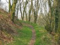
 Hen heol Llanwinio Old Road - geograph.org.uk - 3841077.jpg 640 × 496; 157 KB
-
 Honey Icecream - geograph.org.uk - 3260828.jpg 1 615 × 955; 237 KB
-
 Horse with friends - geograph.org.uk - 3006065.jpg 3 264 × 2 448; 3,84 MB
-
 Icicles on rock face - geograph.org.uk - 3813859.jpg 2 958 × 1 439; 1,32 MB
-
 Llanwinio churchyard - geograph.org.uk - 981158.jpg 640 × 480; 103 KB
-
 Llanwinio Common - geograph.org.uk - 821473.jpg 640 × 434; 47 KB
-
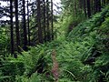
 Llwybr Ceffyl Cwmbach Bridleway - geograph.org.uk - 3841067.jpg 640 × 480; 130 KB
-

-
 Metal plaque with rusting screws - geograph.org.uk - 3321500.jpg 1 471 × 1 274; 299 KB
-
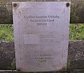
 Moriah Chapel at Blaenwaun - geograph.org.uk - 3474453.jpg 4 000 × 3 000; 2,56 MB
-
 Old gate at Tyddyn Farm - geograph.org.uk - 1430663.jpg 640 × 480; 104 KB
-
 Old workhorse - geograph.org.uk - 1346617.jpg 640 × 480; 64 KB
-
 Ordnance Survey Cut Mark - geograph.org.uk - 3524921.jpg 4 000 × 3 000; 4,41 MB
-
 Ordnance Survey Cut Mark - geograph.org.uk - 5166421.jpg 640 × 481; 106 KB
-
 Ordnance Survey Cut Mark - geograph.org.uk - 6309470.jpg 1 024 × 917; 422 KB
-
 Ordnance Survey Cut Mark - geograph.org.uk - 6403872.jpg 1 024 × 799; 408 KB
-
 Ordnance Survey Cut Mark - geograph.org.uk - 6403875.jpg 1 024 × 757; 311 KB
-
 Ordnance Survey Cut Mark - geograph.org.uk - 6403879.jpg 1 024 × 704; 304 KB
-
 Ordnance Survey Cut Mark - geograph.org.uk - 6403883.jpg 1 024 × 800; 201 KB
-
 Ordnance Survey Cut Mark - geograph.org.uk - 6403922.jpg 1 024 × 823; 223 KB
-
 Ordnance Survey Cut Mark - geograph.org.uk - 6403932.jpg 1 024 × 923; 314 KB
-
 Overgrown gate near Afon Cynin - geograph.org.uk - 2126007.jpg 800 × 600; 136 KB
-
 Pasture near Blaengelli, Llanwinio - geograph.org.uk - 1020102.jpg 640 × 427; 77 KB
-
 Pasture near Blaenllain, Llanwinio - geograph.org.uk - 981146.jpg 640 × 480; 106 KB
-
 Pasture near Iet-goch, Llanwinio - geograph.org.uk - 961888.jpg 640 × 480; 86 KB
-
 Potato lifter - geograph.org.uk - 3006052.jpg 3 264 × 2 448; 3,92 MB
-
 River Cynin from Country Road - geograph.org.uk - 1313952.jpg 640 × 480; 149 KB
-
 Riverbank protection - geograph.org.uk - 1313947.jpg 593 × 640; 179 KB
-
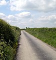
 Road junction at Caerleon - geograph.org.uk - 6471835.jpg 2 048 × 1 536; 1,5 MB
-
 Road junction near Fron, Llanwinio - geograph.org.uk - 981164.jpg 640 × 480; 93 KB
-
 Road to Tyddyn Farm - geograph.org.uk - 1430658.jpg 640 × 480; 98 KB
-
 Roller waiting for dry weather - geograph.org.uk - 1430668.jpg 640 × 480; 55 KB
-

-
 Sign in Welsh and English - geograph.org.uk - 3321515.jpg 2 994 × 2 170; 1,01 MB
-
 Sports field with spectator stand - geograph.org.uk - 3321542.jpg 3 264 × 2 448; 1,16 MB
-
 St Gwinio's Church at Llanwinio - geograph.org.uk - 3475557.jpg 4 000 × 3 000; 4,52 MB
-
 Steep descent into Gelli-wen - geograph.org.uk - 981171.jpg 640 × 436; 112 KB
-
 The view from Ffynnonwen - geograph.org.uk - 907049.jpg 640 × 454; 57 KB
-
 The village of Blaenwaun, Camarthenshire, Wales.jpg 4 000 × 3 000; 2,54 MB
-
 Track at Tyddyn Farm - geograph.org.uk - 1430654.jpg 640 × 480; 80 KB
-
 Track to Blaentrafle, Llanwinio - geograph.org.uk - 1020095.jpg 640 × 427; 75 KB
-
 Track to Cilgryman Fach, Llanwinio - geograph.org.uk - 961887.jpg 640 × 439; 89 KB
-
 Trefyw, Llanwinio - geograph.org.uk - 961885.jpg 640 × 480; 88 KB
-
 Trehws farm entrance - geograph.org.uk - 1346599.jpg 640 × 480; 93 KB
-
 Wales Carmarthenshire Community Llanwinio map.svg 512 × 399; 1,12 MB
-
 Waun fawr farm near Blaenwaun. - geograph.org.uk - 1430638.jpg 640 × 480; 87 KB
-
 Church of St Gwinio - geograph.org.uk - 605885.jpg 640 × 480; 111 KB
-
 House near Llanwinio - geograph.org.uk - 580924.jpg 640 × 480; 109 KB


