Category:Llay
Aller à la navigation
Aller à la recherche
village au Royaume-Uni  Canolfan y Chwarelwyr  | |||||
| Téléverser des médias | |||||
| Nature de l’élément | |||||
|---|---|---|---|---|---|
| Lieu | Wrexham, pays de Galles | ||||
| Population |
| ||||
| Superficie |
| ||||
 | |||||
Cymraeg: Pentref ym mwrdeistref sirol Wrecsam, gogledd-ddwyrain Cymru, yw Llai (llurguniad Saesneg diweddar: Llay). Mae'r pentrefi cyfagos yn cynnwys Gwersyllt a Gresford. Hyd y 1960au, roedd Llai yn bentref glofaol gyda'r mwyafrif o'r pentrefwyr yn gweithio yn y lofa leol.
English: Llay ( Welsh: Llai meaning meadow) is a village in the county of Wrexham, Wales. It borders with several other villages including Gwersyllt and Gresford. Prior to the 1960s, Llay was a coal mining village with the pit being a big employer for the village. At the 2001 Census, the population of the village was 4,905.
Média dans la catégorie « Llay »
Cette catégorie comprend 103 fichiers, dont les 103 ci-dessous.
-
 A483 - Gresford Road overbridge - geograph.org.uk - 2250365.jpg 640 × 480 ; 59 kio
-
 A483 near Gresford - geograph.org.uk - 6170001.jpg 1 280 × 851 ; 457 kio
-
 B5573 bridge over A483 - geograph.org.uk - 4488515.jpg 1 530 × 1 018 ; 927 kio
-
 Bare trees and fields - geograph.org.uk - 1251666.jpg 640 × 493 ; 97 kio
-
-
 Beeston Castle from Gegin Lane - geograph.org.uk - 317078.jpg 640 × 426 ; 110 kio
-
 Bench mark on Bradley Mill Bridge - geograph.org.uk - 4306396.jpg 640 × 480 ; 131 kio
-
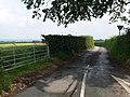
 Bend in New Llay Road (B5425) - geograph.org.uk - 6164040.jpg 800 × 600 ; 98 kio
-
 Bog in Alyn Waters Country Park - geograph.org.uk - 2840230.jpg 640 × 480 ; 132 kio
-
 Bradley Mill Bridge and a bench mark - geograph.org.uk - 4306409.jpg 640 × 480 ; 120 kio
-
 Bridge over the A483 - geograph.org.uk - 329123.jpg 640 × 426 ; 118 kio
-
 Bryn Alyn farm near Wrexham - geograph.org.uk - 2840240.jpg 640 × 480 ; 58 kio
-

-

-
 Cereal crop off Rackery Lane (B5373) - geograph.org.uk - 6164071.jpg 800 × 600 ; 87 kio
-
 Coal dram outside Llay Miner's Welfare Institute - geograph.org.uk - 2841013.jpg 640 × 480 ; 107 kio
-
 Cobbler's Lane - geograph.org.uk - 1508455.jpg 640 × 480 ; 92 kio
-
 Cottages on Chapel Lane, near Llay - geograph.org.uk - 204717.jpg 640 × 480 ; 81 kio
-
 Country Lane near Alyn Waters - geograph.org.uk - 3960905.jpg 3 968 × 2 976 ; 2,93 Mio
-
 Crop field and hedgerow near Rackery Hall - geograph.org.uk - 6164066.jpg 800 × 600 ; 112 kio
-
 Crossroads - geograph.org.uk - 328877.jpg 640 × 426 ; 81 kio
-
 Crown Inn, Llay - geograph.org.uk - 204709.jpg 640 × 480 ; 86 kio
-
 Dark Lane - geograph.org.uk - 1251686.jpg 640 × 480 ; 51 kio
-
 Dual use path beside Llay New Road, Llay - geograph.org.uk - 6164043.jpg 800 × 600 ; 86 kio
-
 Elizabeth II postbox on Llay New Road, Llay - geograph.org.uk - 6164650.jpg 1 815 × 3 624 ; 1,38 Mio
-
 Entrance to Llay Quarry - geograph.org.uk - 2808217.jpg 640 × 480 ; 74 kio
-
 Fairoaks Crescent, Llay - geograph.org.uk - 6171206.jpg 1 280 × 851 ; 362 kio
-
 Farmyard clutter - geograph.org.uk - 1251699.jpg 640 × 480 ; 53 kio
-
 Field beside the River Alyn - Afon Alun - geograph.org.uk - 2840290.jpg 640 × 480 ; 69 kio
-
 Fields above the River Alyn - Afon Alun - geograph.org.uk - 2840346.jpg 640 × 480 ; 66 kio
-
 Footbridge over the River Alyn - Afon Alun - geograph.org.uk - 2840352.jpg 640 × 480 ; 145 kio
-

-
 Forest Road, Llay - geograph.org.uk - 6170394.jpg 1 280 × 851 ; 490 kio
-
 Gates to Alyn Waters Country Park - geograph.org.uk - 2840216.jpg 640 × 480 ; 69 kio
-
 Grazing and hedgerow off New Llay Road - geograph.org.uk - 6164038.jpg 800 × 600 ; 132 kio
-
 Grazing off New Llay Road - geograph.org.uk - 6164039.jpg 800 × 600 ; 100 kio
-
 Gresford Rd - geograph.org.uk - 1251672.jpg 640 × 480 ; 271 kio
-
 Gresford Rd - geograph.org.uk - 317075.jpg 640 × 430 ; 93 kio
-
 Gresford Road - geograph.org.uk - 1254755.jpg 640 × 480 ; 96 kio
-
 Gresford Road outlook - geograph.org.uk - 1251678.jpg 640 × 480 ; 54 kio
-
 Harrison House - geograph.org.uk - 6164061.jpg 800 × 600 ; 137 kio
-
 Hope Mountain - geograph.org.uk - 317088.jpg 640 × 426 ; 94 kio
-
 Houses on Llay New Road - geograph.org.uk - 6164041.jpg 800 × 463 ; 67 kio
-
 Houses on Llay New Road, Llay - geograph.org.uk - 6164651.jpg 4 748 × 3 029 ; 2,57 Mio
-
 Isolated gateway near Bry Alyn farm - geograph.org.uk - 2840287.jpg 640 × 480 ; 107 kio
-
 Llai, near Hope, 1794.jpg 815 × 635 ; 409 kio
-
 Llay Industrial Estate south - geograph.org.uk - 204706.jpg 640 × 480 ; 94 kio
-
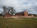
 Llay Miners Welfare Institute - geograph.org.uk - 6171233.jpg 1 280 × 851 ; 379 kio
-
 Llay Miners' Welfare Institute - geograph.org.uk - 6021783.jpg 4 000 × 3 000 ; 2,44 Mio
-
 Llay New Road - geograph.org.uk - 6171380.jpg 1 280 × 851 ; 379 kio
-
 Llay New Road - geograph.org.uk - 6171398.jpg 1 280 × 851 ; 459 kio
-
 Llay New Road, Llay - geograph.org.uk - 2483786.jpg 640 × 274 ; 44 kio
-
 Llay New Road, Llay - geograph.org.uk - 6164047.jpg 800 × 493 ; 69 kio
-
 Llay Road, Llay - geograph.org.uk - 6164050.jpg 800 × 600 ; 93 kio
-
 Llay Road, Llay - geograph.org.uk - 6164055.jpg 800 × 600 ; 144 kio
-
 Mason's mark on Bradley Mill Bridge - geograph.org.uk - 4306455.jpg 640 × 480 ; 147 kio
-
 Mason's mark on Bradley Mill Bridge ^2 - geograph.org.uk - 4307043.jpg 640 × 480 ; 199 kio
-
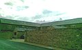
 Meadow Barns, Llay - geograph.org.uk - 2808224.jpg 640 × 480 ; 47 kio
-
 Meadow Rise, Llay - geograph.org.uk - 6170521.jpg 1 280 × 851 ; 354 kio
-
 Miners Welfare Institute, Llay - geograph.org.uk - 6164048.jpg 800 × 600 ; 96 kio
-
 Nant-y-Gaer Rd Crossroads - geograph.org.uk - 328942.jpg 640 × 426 ; 69 kio
-
 New houses in Llay - geograph.org.uk - 6170824.jpg 1 280 × 851 ; 559 kio
-

-
 Old Milestone by the B5102, Llay Road, Llay parish - geograph.org.uk - 6050944.jpg 774 × 1 177 ; 375 kio
-
 Old Milestone by the B5102, Straight Mile, Llay - geograph.org.uk - 6098124.jpg 765 × 1 185 ; 306 kio
-
 Part of Alyn Waters Country Park - geograph.org.uk - 2840208.jpg 640 × 480 ; 68 kio
-
 Part of Alyn Waters Country Park - geograph.org.uk - 2840223.jpg 640 × 480 ; 70 kio
-

-

-
 Part of Wilderness Mill Farm near Wrexham - geograph.org.uk - 2840301.jpg 640 × 480 ; 88 kio
-
 Rackery Lane (B5373) - geograph.org.uk - 6164064.jpg 800 × 600 ; 167 kio
-
 Rackery Lane (B5373) near Rackery Hall - geograph.org.uk - 6164072.jpg 800 × 600 ; 94 kio
-
 Roundabout on Llay Road - geograph.org.uk - 6164049.jpg 800 × 600 ; 70 kio
-

-

-
 Second Home - geograph.org.uk - 1248540.jpg 480 × 640 ; 81 kio
-
 Sign for the Crown Inn, Llay - geograph.org.uk - 6164059.jpg 593 × 800 ; 81 kio
-
 Sign of the Times - geograph.org.uk - 328867.jpg 640 × 426 ; 95 kio
-
 St Francis of Assisi Roman Catholic Church, Llay - geograph.org.uk - 6171221.jpg 1 280 × 851 ; 315 kio
-
 The 'Quarry' - geograph.org.uk - 1248536.jpg 480 × 640 ; 67 kio
-
 The Crown Inn Junction - geograph.org.uk - 1248529.jpg 640 × 480 ; 94 kio
-
 The Crown Inn, Llay - geograph.org.uk - 2808191.jpg 640 × 480 ; 55 kio
-
 The Crown Inn, Llay - geograph.org.uk - 6164057.jpg 800 × 536 ; 75 kio
-
 The Meadow Barns, Llay Hall Farm - geograph.org.uk - 2483787.jpg 640 × 388 ; 38 kio
-
 The Meadow Barns, Llay Hall Farm - geograph.org.uk - 2483788.jpg 640 × 333 ; 46 kio
-

-
 The Miners Welfare Institute, Llay - geograph.org.uk - 2808204.jpg 640 × 480 ; 46 kio
-
-
 The Sharp factory at Llay - geograph.org.uk - 2808170.jpg 640 × 480 ; 65 kio
-
 The War Memorial - geograph.org.uk - 1248548.jpg 640 × 480 ; 82 kio
-
 View towards a hill of mining waste near Wrexham - geograph.org.uk - 2840250.jpg 640 × 480 ; 102 kio
-
 Wales Wrexham Community Llay map.svg 512 × 362 ; 495 kio
-
 Worms Wood - geograph.org.uk - 328853.jpg 640 × 426 ; 165 kio
-
 Yew tree at Bryn Alyn farm near Wrexham - geograph.org.uk - 2840243.jpg 640 × 480 ; 78 kio
-
 Chicken Farm - geograph.org.uk - 328842.jpg 640 × 426 ; 127 kio
-
 Ffordd Nant-y-Gaer - geograph.org.uk - 328566.jpg 640 × 427 ; 60 kio
-
 Gresford Rd - geograph.org.uk - 328890.jpg 640 × 426 ; 130 kio
-
 Llay Miners Welfare Institute - geograph.org.uk - 204700.jpg 640 × 480 ; 88 kio
-
 Oaktree Farm - geograph.org.uk - 315902.jpg 640 × 385 ; 112 kio
-
 The Llay Cemetery - geograph.org.uk - 328858.jpg 640 × 426 ; 115 kio
-
 The Llay hunt - geograph.org.uk - 329207.jpg 640 × 426 ; 82 kio
-
 Up Singret Hill - geograph.org.uk - 328904.jpg 640 × 426 ; 109 kio
-
 Valley near Caer-Estyn - geograph.org.uk - 274598.jpg 640 × 480 ; 196 kio


_-_geograph.org.uk_-_6164040.jpg)


_-_geograph.org.uk_-_6164071.jpg)


_-_geograph.org.uk_-_6164064.jpg)
_near_Rackery_Hall_-_geograph.org.uk_-_6164072.jpg)


