Category:Loch Long, Highland
Naar navigatie springen
Naar zoeken springen

English: Loch Long is a sea loch situated on the western coast of Scotland, in the Highlands. It is a popular destination for tourists and fishermen.
Nederlands: Loch Long ( Schots-Gaelisch: Loch Bracadail) is een inham aan de westkust van Schotland. In het westelijke uiteinde van de inham vormen Loch Duich, een andere inham, en Loch Long samen Loch Alsh.
Highland   | |||||
| Media uploaden | |||||
| Is een | |||||
|---|---|---|---|---|---|
| Locatie | Highland, Schotse Hooglanden, Schotland | ||||
 | |||||
Media in categorie "Loch Long, Highland"
Deze categorie bevat de volgende 46 bestanden, van in totaal 46.
-
 A Ghlas-sgeir Islet in Loch Long - geograph.org.uk - 71571.jpg 640 × 282; 39 kB
-
 Admiralty Chart No 2676 Loch Alsh and Loch Duich, Published 1859.jpg 16.188 × 11.115; 71,68 MB
-
 An arm of Loch Long - geograph.org.uk - 5845243.jpg 2.592 × 1.944; 1,24 MB
-
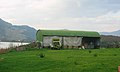 Barn, Loch Long. - geograph.org.uk - 68334.jpg 640 × 385; 36 kB
-
 Beach, Conchra. - geograph.org.uk - 68338.jpg 640 × 480; 79 kB
-
 Ceann-an-oba. - geograph.org.uk - 68321.jpg 640 × 480; 67 kB
-
-
 February morning on Loch Long - geograph.org.uk - 2291167.jpg 1.280 × 848; 618 kB
-
 Head of Loch Long - geograph.org.uk - 1104387.jpg 640 × 359; 55 kB
-
 Head of Loch Long - geograph.org.uk - 2095529.jpg 1.600 × 1.200; 1,04 MB
-
 Kint.jpg 912 × 373; 190 kB
-
 Loch Long - geograph.org.uk - 1104361.jpg 640 × 480; 64 kB
-
 Loch Long - geograph.org.uk - 1349533.jpg 640 × 384; 60 kB
-
 Loch Long - geograph.org.uk - 1380699.jpg 1.024 × 685; 1,11 MB
-
 Loch Long - geograph.org.uk - 2979591.jpg 640 × 360; 209 kB
-
 Loch Long - geograph.org.uk - 3514760.jpg 1.500 × 877; 888 kB
-
 Loch Long - geograph.org.uk - 5406621.jpg 640 × 427; 94 kB
-
 Loch Long - geograph.org.uk - 5406625.jpg 640 × 427; 129 kB
-
 Loch Long - geograph.org.uk - 68328.jpg 640 × 480; 94 kB
-
 Loch Long - geograph.org.uk - 831042.jpg 640 × 457; 312 kB
-
 Loch Long - the narrows - geograph.org.uk - 833175.jpg 640 × 399; 64 kB
-
 Loch Long and Sgumain Coinntich - geograph.org.uk - 9320.jpg 640 × 456; 72 kB
-
 Loch Long at Bundalloch - geograph.org.uk - 1172017.jpg 480 × 640; 55 kB
-
 Loch Long near Conchra - geograph.org.uk - 3529731.jpg 750 × 563; 65 kB
-
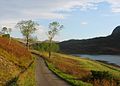 Loch Long road. - geograph.org.uk - 68333.jpg 640 × 459; 69 kB
-
 Loch Long, by Conchra - geograph.org.uk - 1380685.jpg 1.000 × 669; 329 kB
-
 Loch Long, Sallachy. - geograph.org.uk - 68324.jpg 640 × 480; 81 kB
-
 Loch Long, the North Shore - geograph.org.uk - 1349526.jpg 640 × 384; 64 kB
-
 Loch Long, the North Shore - geograph.org.uk - 1349549.jpg 640 × 384; 79 kB
-
 Loch Long, the North Shore - geograph.org.uk - 1349594.jpg 427 × 640; 82 kB
-
 Loch Long, the North Shore - geograph.org.uk - 1357180.jpg 640 × 427; 65 kB
-
 Loch Long, the South-East Shore - geograph.org.uk - 1349544.jpg 640 × 384; 76 kB
-
 Loch Long, the South-East Shore - geograph.org.uk - 1349548.jpg 640 × 384; 48 kB
-
 Loch Long, the South-East Shore - geograph.org.uk - 1357140.jpg 640 × 384; 67 kB
-
 Loch Long, the South-East Shore - geograph.org.uk - 1357174.jpg 640 × 384; 55 kB
-
 Loch Long.jpg 640 × 480; 65 kB
-
 Lochalsh.jpg 922 × 655; 52 kB
-
 Old Arrochar Pier, Loch Long, Argyll and Bute, Scotlland. Pier remnants.jpg 4.596 × 3.442; 5,47 MB
-
 Sallachy and Loch Long - geograph.org.uk - 9374.jpg 640 × 453; 53 kB
-
 Stream flowing into Loch Long - geograph.org.uk - 3514138.jpg 1.500 × 996; 1,57 MB
-
 The head of Loch Long - geograph.org.uk - 1380743.jpg 1.000 × 669; 269 kB
-
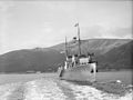
 The Royal Navy during the Second World War A17311.jpg 800 × 601; 55 kB
-

-
 Underneath the Loch Long Bridge - geograph.org.uk - 1355826.jpg 600 × 480; 59 kB
-
 Arable land, Bundalloch. - geograph.org.uk - 68335.jpg 640 × 480; 50 kB
-
 Head of Loch Long - geograph.org.uk - 9309.jpg 640 × 480; 85 kB


