Category:Lockerley
Aller à la navigation
Aller à la recherche
village britannique  | |||||
| Téléverser des médias | |||||
| Nature de l’élément | |||||
|---|---|---|---|---|---|
| Lieu | Test Valley, Hampshire, Angleterre du Sud-Est, Angleterre | ||||
| site officiel | |||||
 | |||||
English: Lockerley is a village and civil parish in Hampshire, England on the border with Wiltshire. The village lies on the southern bank of the River Dun about two miles upstream from its confluence with the River Test and about to the south-east and is about 7 miles from Salisbury.
Sous-catégories
Cette catégorie comprend 3 sous-catégories, dont les 3 ci-dessous.
J
L
- Lockerley Baptist church (14 F)
Média dans la catégorie « Lockerley »
Cette catégorie comprend 101 fichiers, dont les 101 ci-dessous.
-
 Approaching Newtown on Newtown Road - geograph.org.uk - 2175782.jpg 640 × 480 ; 133 kio
-
 Attractive roadside on Mount Lane - geograph.org.uk - 3411763.jpg 800 × 600 ; 116 kio
-
 Barn near Tote Hill - geograph.org.uk - 2181473.jpg 640 × 480 ; 132 kio
-
 Bench Mark, Lockerley Bridge - geograph.org.uk - 2318419.jpg 479 × 640 ; 98 kio
-
 Betts Farm Cottage - geograph.org.uk - 3411539.jpg 800 × 512 ; 99 kio
-
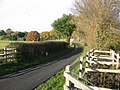
 Bridge, Lockerley - geograph.org.uk - 2318417.jpg 640 × 480 ; 68 kio
-
 Buildings at Mount Pleasant Farm - geograph.org.uk - 3411745.jpg 800 × 469 ; 79 kio
-
 Butts Green, Butt's Green - geograph.org.uk - 2385371.jpg 640 × 480 ; 79 kio
-
 Carter's Clay Road, Newtown - geograph.org.uk - 5911831.jpg 1 024 × 684 ; 351 kio
-
 Cattle and sheep near Chapel Farm - geograph.org.uk - 2181491.jpg 640 × 480 ; 166 kio
-
 Chapel Lane near Tote Hill - geograph.org.uk - 2176362.jpg 640 × 480 ; 161 kio
-
 Cooks Lane, near Butt's Green - geograph.org.uk - 2385381.jpg 640 × 480 ; 108 kio
-
 Corner of field on Chapel Lane - geograph.org.uk - 5669718.jpg 640 × 427 ; 100 kio
-
-
 Disused Railway Siding - geograph.org.uk - 322587.jpg 640 × 480 ; 122 kio
-
 Driveway and house at Chapel Farm - geograph.org.uk - 3411735.jpg 800 × 600 ; 147 kio
-
 Driveway to Chapel Farm - geograph.org.uk - 2176356.jpg 640 × 480 ; 161 kio
-
 Dunwood Manor Golf Course 7th hole - geograph.org.uk - 2867283.jpg 3 648 × 2 736 ; 2,51 Mio
-
 East Dean Road junction - geograph.org.uk - 2879700.jpg 3 472 × 2 563 ; 1,56 Mio
-
 East Tytherley Road, Lockerley - geograph.org.uk - 5911801.jpg 1 024 × 684 ; 211 kio
-
 Entrance to Hazelwood Farm - geograph.org.uk - 2175779.jpg 640 × 480 ; 219 kio
-
 Entrance to Lockerley Manor - geograph.org.uk - 3411768.jpg 800 × 600 ; 202 kio
-
 Farmland to the NW of Mount Lane - geograph.org.uk - 2182586.jpg 640 × 480 ; 172 kio
-
 Farmland to the W of Chapel Lane - geograph.org.uk - 2181484.jpg 640 × 480 ; 150 kio
-
 Farmland to the W of Mount Lane - geograph.org.uk - 2182584.jpg 640 × 480 ; 148 kio
-

-
 Field boundary alongside Chapel Lane - geograph.org.uk - 2181488.jpg 640 × 480 ; 163 kio
-
 Field edge following Mount Lane - geograph.org.uk - 2182591.jpg 640 × 480 ; 104 kio
-

-
 Field west of The Banks - geograph.org.uk - 5911825.jpg 1 024 × 684 ; 377 kio
-
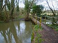 Footbridge over the River Dun near Lockerley - geograph.org.uk - 3411544.jpg 800 × 600 ; 170 kio
-
 Footpath across farmland at Tote Hill - geograph.org.uk - 2181476.jpg 640 × 480 ; 141 kio
-
 Footpath arrives at Carter's Clay Road - geograph.org.uk - 3411706.jpg 800 × 600 ; 133 kio
-
 Footpath between Butt's Green and Lockerley - geograph.org.uk - 5651092.jpg 640 × 427 ; 126 kio
-
 Footpath enters woodland south of Lockerley - geograph.org.uk - 3411749.jpg 800 × 600 ; 197 kio
-

-
 Footpath leading south west from The Banks - geograph.org.uk - 3411722.jpg 600 × 800 ; 180 kio
-

-
 Footpath running beside Chapel Lane - geograph.org.uk - 2181481.jpg 480 × 640 ; 210 kio
-
 Footpath to Critchell's Green - geograph.org.uk - 2174351.jpg 480 × 640 ; 159 kio
-
 Gas installation - geograph.org.uk - 4764548.jpg 640 × 480 ; 73 kio
-
 Gates, Lockerley - geograph.org.uk - 2319680.jpg 640 × 480 ; 90 kio
-
 Glebe Field entrance, Lockerley - geograph.org.uk - 2319716.jpg 640 × 481 ; 72 kio
-
 Grave stones near Chapel Farm - geograph.org.uk - 2176353.jpg 640 × 480 ; 206 kio
-
 Gravestones at Chapel Farm - geograph.org.uk - 3411741.jpg 800 × 563 ; 172 kio
-
 Hedgerow along Mount Lane towards Butt's Green - geograph.org.uk - 2182599.jpg 640 × 480 ; 122 kio
-
 Holbury Mill, Lockerley - geograph.org.uk - 669265.jpg 640 × 480 ; 87 kio
-
 House on the edge of Butt's Green - geograph.org.uk - 5651095.jpg 640 × 427 ; 98 kio
-
 Houses on the edge of Lockerley Green - geograph.org.uk - 5651090.jpg 640 × 427 ; 79 kio
-

-
 It's going to be a muddy walk - geograph.org.uk - 3411551.jpg 800 × 600 ; 175 kio
-
 Junction of roads south of Lockerley - geograph.org.uk - 3411775.jpg 800 × 600 ; 125 kio
-
 Junction of The Square with Newtown Road - geograph.org.uk - 2175790.jpg 640 × 480 ; 147 kio
-
 Kings Arms - geograph.org.uk - 399534.jpg 640 × 480 ; 100 kio
-
 Lockerley - Home Farm Flats - geograph.org.uk - 1291911.jpg 640 × 480 ; 82 kio
-
 Lockerley - South Lodge - geograph.org.uk - 1291900.jpg 640 × 480 ; 82 kio
-
 Lockerley - South Lodge - geograph.org.uk - 1291909.jpg 640 × 480 ; 82 kio
-
 Lockerley - Village Store - geograph.org.uk - 2599690.jpg 800 × 600 ; 105 kio
-
 Lockerley Old Baptist Burial Ground - geograph.org.uk - 2155428.jpg 1 600 × 899 ; 502 kio
-
 Lockerley Post Ofiice stores - geograph.org.uk - 656890.jpg 640 × 480 ; 83 kio
-
 Lockerley Road bridge under Wessex Main Line - geograph.org.uk - 2880251.jpg 3 397 × 2 284 ; 1,6 Mio
-
 Lockerley Road southeast of Lockerley - geograph.org.uk - 2880253.jpg 3 343 × 2 395 ; 1,24 Mio
-
 Lockerley War Memorial Hall - geograph.org.uk - 634368.jpg 640 × 475 ; 90 kio
-
 Lockerly Road at Butts Green - geograph.org.uk - 3652456.jpg 3 648 × 2 736 ; 1,52 Mio
-
 Lockerly Road enters Lockerly - geograph.org.uk - 3652441.jpg 3 009 × 2 431 ; 1,07 Mio
-
 Mount Lane just N of Mount Pleasant - geograph.org.uk - 2182554.jpg 640 × 480 ; 217 kio
-
 Mount Lane looking towards Lockerley - geograph.org.uk - 3411759.jpg 600 × 800 ; 206 kio
-
 Ordnance Survey Cut Mark - geograph.org.uk - 4935612.jpg 640 × 612 ; 166 kio
-
 Owls Lodge - geograph.org.uk - 424724.jpg 640 × 480 ; 131 kio
-
 Railway bridge at Lockerley - geograph.org.uk - 3411794.jpg 800 × 600 ; 101 kio
-
 Road with telephone box at Butt's Green - geograph.org.uk - 3411784.jpg 800 × 600 ; 155 kio
-
 Romsey Road, Lockerley - geograph.org.uk - 5911813.jpg 1 024 × 684 ; 264 kio
-
 Sharp right hand bend in Mount Lane - geograph.org.uk - 2182571.jpg 640 × 480 ; 174 kio
-
 Sheep and house on edge of Kent's Oak - geograph.org.uk - 5844262.jpg 1 024 × 683 ; 254 kio
-
 Sheep in field at Butler's Wood Farm - geograph.org.uk - 5844260.jpg 1 024 × 683 ; 230 kio
-
 Stile and footpath from Chapel Lane - geograph.org.uk - 2182007.jpg 640 × 480 ; 141 kio
-
 Stile on footpath towards Critchell's Green - geograph.org.uk - 2182603.jpg 640 × 480 ; 186 kio
-
 The Gatehouse - geograph.org.uk - 383565.jpg 625 × 460 ; 121 kio
-
 The Glebe Field, Lockerley - geograph.org.uk - 2319747.jpg 640 × 480 ; 55 kio
-
 The Street passes Lockerly Motors - geograph.org.uk - 3652473.jpg 3 648 × 2 736 ; 1,59 Mio
-
 Tote Hill Cottage on Chapel Lane - geograph.org.uk - 2180974.jpg 640 × 480 ; 180 kio
-
 Towards Butt's Green, Lockerley - geograph.org.uk - 5911808.jpg 1 024 × 684 ; 305 kio
-
 Track and footpath towards Carter's Clay - geograph.org.uk - 2175767.jpg 640 × 480 ; 162 kio
-
 View across field to houses at Carter's Clay - geograph.org.uk - 5669719.jpg 640 × 427 ; 88 kio
-
 View across the valley from Tote Hill - geograph.org.uk - 2176358.jpg 640 × 480 ; 120 kio
-
 View along Chapel Lane - geograph.org.uk - 2181494.jpg 640 × 480 ; 212 kio
-
 View along Chapel Lane, Tote Hill - geograph.org.uk - 2180968.jpg 640 × 480 ; 204 kio
-
 View along Mount Lane towards Butt's Green - geograph.org.uk - 2182578.jpg 640 × 480 ; 179 kio
-

-

-
 View from Chapel Lane to Mount Lane - geograph.org.uk - 2182548.jpg 640 × 480 ; 199 kio
-
 View from Chapel Lane towards Carter's Clay - geograph.org.uk - 2180970.jpg 640 × 480 ; 115 kio
-

-
 View looking NW along Mount Lane - geograph.org.uk - 2182564.jpg 640 × 480 ; 205 kio
-
 View N along Chapel Lane, Tote Hill - geograph.org.uk - 2181468.jpg 640 × 480 ; 167 kio
-
 View NW along Chapel Lane near Carter's Clay - geograph.org.uk - 2181999.jpg 640 × 480 ; 172 kio
-
 View past Merry Trees on Chapel Lane, Tote Hill - geograph.org.uk - 2180982.jpg 640 × 480 ; 151 kio
-
 View towards Carter's Clay from Chapel Lane - geograph.org.uk - 2181478.jpg 640 × 480 ; 198 kio
-
 Winter afternoon view towards Deanhill Barn - geograph.org.uk - 2189386.jpg 640 × 480 ; 71 kio
-
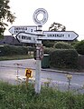
 Road Sign - geograph.org.uk - 406272.jpg 640 × 480 ; 97 kio
-
 Road with confused signs, Lockerley - geograph.org.uk - 634279.jpg 640 × 480 ; 48 kio


