Category:Londonthorpe and Harrowby Without
Aller à la navigation
Aller à la recherche

paroisse civile du Lincolnshire, en Angleterre | |||||
| Téléverser des médias | |||||
| Nature de l’élément | |||||
|---|---|---|---|---|---|
| Lieu | South Kesteven, Lincolnshire, Midlands de l'Est, Angleterre | ||||
| Comprend | |||||
 | |||||
Sous-catégories
Cette catégorie comprend 11 sous-catégories, dont les 11 ci-dessous.
Média dans la catégorie « Londonthorpe and Harrowby Without »
Cette catégorie comprend 130 fichiers, dont les 130 ci-dessous.
-
 A grade II listed bus shelter (geograph 6712717).jpg 3 749 × 4 148 ; 7,38 Mio
-
 A pair of Land Settlement Association houses - geograph.org.uk - 5675276.jpg 1 024 × 768 ; 195 kio
-
 A small stream crosses the golf course - geograph.org.uk - 1764575.jpg 2 848 × 2 136 ; 2,96 Mio
-
 A tee off area on Belton Park golf course - geograph.org.uk - 1764679.jpg 2 848 × 2 136 ; 2,98 Mio
-
 A52 (High Dike) - geograph.org.uk - 4214714.jpg 640 × 480 ; 242 kio
-
 A52 approaching roundabout - geograph.org.uk - 3076522.jpg 640 × 480 ; 47 kio
-
 A52 Eastbound - geograph.org.uk - 4217036.jpg 640 × 480 ; 253 kio
-
 A52 heading west - geograph.org.uk - 3076518.jpg 640 × 480 ; 44 kio
-
 A52 near Cold Harbour - geograph.org.uk - 4214562.jpg 640 × 480 ; 284 kio
-

-
 A52 towards Spalding and Boston - geograph.org.uk - 4214555.jpg 640 × 480 ; 271 kio
-
 A52 westbound - geograph.org.uk - 5787029.jpg 640 × 439 ; 39 kio
-
 A52 westbound - geograph.org.uk - 5787038.jpg 640 × 419 ; 42 kio
-
 A52 westbound - geograph.org.uk - 5787043.jpg 640 × 480 ; 51 kio
-
 A52 westbound - geograph.org.uk - 5787050.jpg 640 × 420 ; 45 kio
-
 Access road to underground reservoir - geograph.org.uk - 3076029.jpg 640 × 480 ; 74 kio
-

-
 An uphill A52 heading east - geograph.org.uk - 3176072.jpg 640 × 480 ; 71 kio
-
 B6403 towards Colsterworth - geograph.org.uk - 3076527.jpg 640 × 480 ; 76 kio
-
 B6403, High Dike near Old Somerby - geograph.org.uk - 4214548.jpg 640 × 427 ; 223 kio
-

-
 Belton Lane, Grantham - geograph.org.uk - 3905418.jpg 4 272 × 2 848 ; 5,82 Mio
-
 Belton Park golf course - geograph.org.uk - 1764567.jpg 2 848 × 2 136 ; 3,05 Mio
-
 Belton Park Golf Course - geograph.org.uk - 4116914.jpg 640 × 480 ; 279 kio
-
 Belton Park Golf Course - geograph.org.uk - 4117005.jpg 640 × 480 ; 327 kio
-
 Cottage on Harrowby Lane - geograph.org.uk - 208800.jpg 640 × 427 ; 65 kio
-
 Cottages at Harrowby - geograph.org.uk - 5675330.jpg 1 024 × 768 ; 122 kio
-
 Covered reservoir, Harrowby - geograph.org.uk - 5674115.jpg 1 024 × 768 ; 123 kio
-
 Crop field off Turnor Road - geograph.org.uk - 3076041.jpg 640 × 480 ; 93 kio
-
 Cross country fence - geograph.org.uk - 1764624.jpg 2 848 × 2 136 ; 2,86 Mio
-
 Drifting snow on Whalebone Lane (geograph 3382319).jpg 640 × 480 ; 70 kio
-
 Drifting snow on Whalebone Lane - geograph.org.uk - 3382313.jpg 640 × 480 ; 53 kio
-
 Driveway to Manthorpe Mill - geograph.org.uk - 3947034.jpg 3 776 × 2 520 ; 3,86 Mio
-
 Entrance to Grantham (Somerby) Driving Test Centre - geograph.org.uk - 6215796.jpg 2 592 × 1 944 ; 1,39 Mio
-
 Entrance to Londonthorpe Wood near Grantham - geograph.org.uk - 1764673.jpg 2 848 × 2 136 ; 3,04 Mio
-
 Farm building, Spittlegate Heath Farm - geograph.org.uk - 3176064.jpg 640 × 404 ; 35 kio
-
 Farm track heading north near Londonthorpe - geograph.org.uk - 3076074.jpg 640 × 480 ; 106 kio
-
 Farm track near Harrowby Hall - geograph.org.uk - 5675325.jpg 1 024 × 760 ; 272 kio
-
 Farmland near Grantham - geograph.org.uk - 3346654.jpg 640 × 480 ; 56 kio
-
 Farmland near Londonthorpe - geograph.org.uk - 3076072.jpg 640 × 480 ; 87 kio
-
 Farmland off High Dike - geograph.org.uk - 3076044.jpg 640 × 480 ; 90 kio
-
 Farmland off High Dike - geograph.org.uk - 3076057.jpg 640 × 480 ; 48 kio
-
 Farmland off the B6403 - geograph.org.uk - 3076525.jpg 640 × 480 ; 34 kio
-
 Farmland off Turnor Road - geograph.org.uk - 341108.jpg 640 × 427 ; 83 kio
-
 Farmland off Whalebone Lane - geograph.org.uk - 3176073.jpg 640 × 480 ; 89 kio
-
 Fence and Gate, Belton Park - geograph.org.uk - 4117011.jpg 640 × 480 ; 333 kio
-
 Field edge, Spittlegate Heath - geograph.org.uk - 6322113.jpg 1 024 × 768 ; 186 kio
-

-
 Footpath off Turnor Road - geograph.org.uk - 3076036.jpg 640 × 480 ; 121 kio
-
 Footpath towards Londonthorpe - geograph.org.uk - 3076085.jpg 640 × 492 ; 73 kio
-
 Former Land Settlement Association smallholding - geograph.org.uk - 5674126.jpg 1 024 × 768 ; 161 kio
-
 Former Land Settlement Association smallholding - geograph.org.uk - 5675286.jpg 1 024 × 768 ; 285 kio
-
 Grantham (Somerby) Driving Test Centre - geograph.org.uk - 6215815.jpg 2 592 × 1 944 ; 1,38 Mio
-
 Grassland and pylons - geograph.org.uk - 6212790.jpg 1 024 × 768 ; 185 kio
-
 Green Lane near Harrowby - geograph.org.uk - 208801.jpg 640 × 427 ; 128 kio
-
 Hall Farm Cottages - geograph.org.uk - 5674375.jpg 1 024 × 768 ; 139 kio
-
 Hall farm house (geograph 6712731).jpg 6 252 × 4 164 ; 3,95 Mio
-
 Harrowby from Turnor Lane - geograph.org.uk - 5675355.jpg 1 024 × 768 ; 126 kio
-
 Harrowby Hall Farm - geograph.org.uk - 5674098.jpg 1 024 × 768 ; 184 kio
-
 Harrowby Lane - geograph.org.uk - 2881780.jpg 1 280 × 853 ; 487 kio
-
 Harrowby Lane heading east - geograph.org.uk - 3076030.jpg 640 × 480 ; 86 kio
-
 HARROWBY SETTLEMENTS.jpg 2 307 × 1 648 ; 1,05 Mio
-
 High Dike (B6403) heading north - geograph.org.uk - 3076050.jpg 640 × 480 ; 84 kio
-
 High Dike (B6403) heading north - geograph.org.uk - 3076059.jpg 640 × 480 ; 81 kio
-
 High Dike (B6403) heading north - geograph.org.uk - 3076062.jpg 640 × 480 ; 65 kio
-
 High Dike (B6403) heading north - geograph.org.uk - 3076066.jpg 640 × 480 ; 103 kio
-
 High Dike (B6403) heading north - geograph.org.uk - 3076070.jpg 640 × 480 ; 71 kio
-
 Junction of Whalebone Lane with the A52 - geograph.org.uk - 3176077.jpg 640 × 480 ; 71 kio
-
 Junction on B6403 - geograph.org.uk - 3899952.jpg 4 272 × 2 848 ; 4,74 Mio
-
 Lake in a country park - geograph.org.uk - 1764473.jpg 2 848 × 2 136 ; 3,06 Mio
-
 Lake in the park - geograph.org.uk - 1764459.jpg 2 848 × 2 136 ; 3,17 Mio
-
 Land Settlement Association houses - geograph.org.uk - 5674088.jpg 1 024 × 768 ; 185 kio
-
 Lincolnshire landscape - geograph.org.uk - 4326871.jpg 640 × 430 ; 37 kio
-
 Londonthorpe poppies - geograph.org.uk - 473513.jpg 640 × 427 ; 88 kio
-
 Londonthorpe Road - geograph.org.uk - 3905430.jpg 4 272 × 2 848 ; 5,18 Mio
-
 Londonthorpe Wood - geograph.org.uk - 208678.jpg 640 × 427 ; 172 kio
-
 Meadow near Heath Farm with Triangulation Pillar - geograph.org.uk - 3890809.jpg 4 000 × 3 000 ; 4,85 Mio
-
 Minor road towards Belton - geograph.org.uk - 3076087.jpg 640 × 480 ; 72 kio
-
 Minor Road towards Grantham - geograph.org.uk - 3076081.jpg 640 × 480 ; 64 kio
-
 New woodland creation at Londonthorpe Wood - geograph.org.uk - 2390354.jpg 1 024 × 681 ; 480 kio
-
 Newgate Lane - geograph.org.uk - 2881782.jpg 1 280 × 853 ; 359 kio
-
 Newgate Lane towards Londonthorpe - geograph.org.uk - 3899747.jpg 4 272 × 2 848 ; 6,21 Mio
-
 Pair of Land Settlement Association houses - geograph.org.uk - 5674519.jpg 1 024 × 768 ; 105 kio
-
 Perimeter fence, Army Barracks - geograph.org.uk - 3176070.jpg 640 × 480 ; 150 kio
-
 Prince William of Gloucester Barracks (ex RAF Spitalgate) - geograph.org.uk - 6260596.jpg 4 608 × 3 072 ; 5,98 Mio
-
 Public Footpath at end of Turnor Road - geograph.org.uk - 2881797.jpg 682 × 1 024 ; 277 kio
-
 Pylons near Londonthorpe - geograph.org.uk - 5674145.jpg 1 024 × 768 ; 98 kio
-
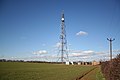 Radio mast - geograph.org.uk - 130334.jpg 640 × 427 ; 55 kio
-
 Radio mast at British Gas Alma wood site - geograph.org.uk - 2877717.jpg 682 × 1 024 ; 156 kio
-
 Red and White - geograph.org.uk - 473518.jpg 640 × 427 ; 114 kio
-
 Road Junction with A52 - geograph.org.uk - 3187598.jpg 3 088 × 2 056 ; 1,1 Mio
-
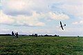 Silent Flight National Finals - geograph.org.uk - 1062728.jpg 640 × 425 ; 66 kio
-
 Single Land Settlement Association House - geograph.org.uk - 5675270.jpg 1 024 × 768 ; 120 kio
-
 Snowy parkland - geograph.org.uk - 1624537.jpg 640 × 426 ; 59 kio
-
 Somerby Hill near Army Barracks - geograph.org.uk - 2881799.jpg 1 280 × 853 ; 351 kio
-
 Somerby Hill, A52 - geograph.org.uk - 4214810.jpg 640 × 480 ; 278 kio
-
 Somerby Hill, Grantham - geograph.org.uk - 4214811.jpg 640 × 480 ; 250 kio
-
 South Lodge, Belton Park (geograph 6632875).jpg 1 024 × 768 ; 238 kio
-
 Spring is in the air - geograph.org.uk - 5354114.jpg 4 608 × 3 456 ; 3,41 Mio
-
 The B6403, High Dike joins the A52 - geograph.org.uk - 2995547.jpg 800 × 600 ; 79 kio
-
 The Hermitage - geograph.org.uk - 5363774.jpg 1 024 × 683 ; 420 kio
-
 The Hermitage - geograph.org.uk - 5363780.jpg 1 024 × 683 ; 403 kio
-
 The old flying field at RAF Spitalgate - geograph.org.uk - 6260601.jpg 4 608 × 3 072 ; 4,78 Mio
-
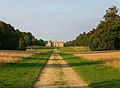 The southern approach to Belton House through the park - geograph.org.uk - 2146244.jpg 1 024 × 752 ; 203 kio
-
 The Witham valley - geograph.org.uk - 6363614.jpg 1 024 × 768 ; 102 kio
-
 Three against one - geograph.org.uk - 5354119.jpg 2 961 × 2 219 ; 1,52 Mio
-
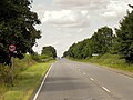
 Towards Grantham - geograph.org.uk - 2624390.jpg 640 × 497 ; 96 kio
-
 Track beside Londonthorpe Wood (geograph 3076080).jpg 640 × 480 ; 112 kio
-
 Track off Londonthorpe Road - geograph.org.uk - 3905458.jpg 4 272 × 2 848 ; 7,51 Mio
-
 Track off Whalebone Lane - geograph.org.uk - 3104833.jpg 1 504 × 2 256 ; 2,02 Mio
-
 Turnor Road - geograph.org.uk - 3899736.jpg 4 272 × 2 848 ; 5,84 Mio
-
 Turnor road facing east - geograph.org.uk - 2881788.jpg 1 280 × 853 ; 379 kio
-
 Turnor Road heading east - geograph.org.uk - 3076039.jpg 640 × 480 ; 75 kio
-
 Turnor Road heading east towards the B6403 - geograph.org.uk - 3076043.jpg 640 × 480 ; 64 kio
-
 Undergoing conversion - geograph.org.uk - 5678832.jpg 1 024 × 768 ; 193 kio
-
 Uphill track at the side of Londonthorpe Wood, Grantham - geograph.org.uk - 1764662.jpg 2 848 × 2 136 ; 3,15 Mio
-
 View towards Bellmount Plantation - geograph.org.uk - 5674132.jpg 1 024 × 768 ; 161 kio
-
 View towards Londonthorpe from Bellmount Plantation - geograph.org.uk - 5674051.jpg 1 024 × 768 ; 158 kio
-
 Wentworth Drive - geograph.org.uk - 3349185.jpg 640 × 480 ; 52 kio
-
 West Towthorpe Hollow Pond, Belton Estate - geograph.org.uk - 268021.jpg 640 × 427 ; 85 kio
-
 Westbound A52 - geograph.org.uk - 4214779.jpg 640 × 480 ; 255 kio
-
 Whalebone Lane - geograph.org.uk - 3079067.jpg 2 256 × 1 504 ; 1,95 Mio
-
 Whalebone Lane - geograph.org.uk - 3176074.jpg 640 × 480 ; 115 kio
-
 Whalebone Lane - geograph.org.uk - 3205224.jpg 1 600 × 2 220 ; 657 kio
-
 Whalebone Lane - geograph.org.uk - 3205254.jpg 640 × 420 ; 111 kio
-
 Whalebone Lane - geograph.org.uk - 3382306.jpg 640 × 480 ; 66 kio
-
 Whalebone Lane - geograph.org.uk - 6322114.jpg 1 024 × 768 ; 349 kio
-
 Woodnook, the home of Kesteven RFC - geograph.org.uk - 2995558.jpg 800 × 600 ; 84 kio
-
 East Towthorpe Hollow Pond, Belton Park - geograph.org.uk - 268027.jpg 640 × 427 ; 103 kio
-
 Strip woodland on High Dike - geograph.org.uk - 341125.jpg 640 × 427 ; 104 kio
.jpg)


_-_geograph.org.uk_-_4214714.jpg)


.jpg)


_Driving_Test_Centre_-_geograph.org.uk_-_6215796.jpg)


_Driving_Test_Centre_-_geograph.org.uk_-_6215815.jpg)


.jpg)


_heading_north_-_geograph.org.uk_-_3076050.jpg)
_heading_north_-_geograph.org.uk_-_3076059.jpg)
_heading_north_-_geograph.org.uk_-_3076062.jpg)
_heading_north_-_geograph.org.uk_-_3076066.jpg)
_heading_north_-_geograph.org.uk_-_3076070.jpg)


_-_geograph.org.uk_-_6260596.jpg)


.jpg)


.jpg)


