Category:Long Compton
Aller à la navigation
Aller à la recherche
village britannique | |||||
| Téléverser des médias | |||||
| Nature de l’élément | |||||
|---|---|---|---|---|---|
| Lieu | Stratford-on-Avon, Warwickshire, Midlands de l'Ouest, Angleterre | ||||
| Population |
| ||||
| Superficie |
| ||||
 | |||||
English: Long Compton is a village and civil parish in Warwickshire, England near the extreme southern tip of Warwickshire, and close to the border with Oxfordshire. It is part of the district of Stratford-on-Avon and in the 2001 census had a population of 705.
Sous-catégories
Cette catégorie comprend 7 sous-catégories, dont les 7 ci-dessous.
L
- Long Compton War Memorial (3 F)
- Lychgate in Long Compton (18 F)
R
S
T
- The King Stone, Warwickshire (45 F)
- The Red Lion, Long Compton (5 F)
Média dans la catégorie « Long Compton »
Cette catégorie comprend 238 fichiers, dont les 200 ci-dessous.
(page précédente) (page suivante)-
 'Taste of the Country', Long Compton - geograph.org.uk - 1854683.jpg 640 × 480 ; 95 kio
-
 A field of maize and a view - geograph.org.uk - 1556818.jpg 640 × 480 ; 107 kio
-
 A spraying we will go - geograph.org.uk - 1930345.jpg 4 000 × 3 000 ; 3,32 Mio
-
 A3400 drops down the hill - geograph.org.uk - 2004447.jpg 640 × 480 ; 105 kio
-

-
 A3400 nearing Long Compton - geograph.org.uk - 4851865.jpg 640 × 481 ; 44 kio
-
 A3400 south of Long Compton - geograph.org.uk - 4851873.jpg 640 × 480 ; 55 kio
-
 A3400 towards Stratford-upon-Avon - geograph.org.uk - 6237292.jpg 1 024 × 684 ; 290 kio
-
 A3400 towards Stratford-upon-Avon - geograph.org.uk - 6237298.jpg 1 024 × 684 ; 301 kio
-
 A3400 towards Stratford-upon-Avon - geograph.org.uk - 6237306.jpg 1 024 × 684 ; 367 kio
-
 A3400 towards Stratford-upon-Avon - geograph.org.uk - 6237330.jpg 1 024 × 684 ; 340 kio
-
 Across the field - geograph.org.uk - 2005769.jpg 4 000 × 3 000 ; 2,92 Mio
-
 All weather path - geograph.org.uk - 1339829.jpg 640 × 457 ; 416 kio
-
 Allotments by Ashby Farm - geograph.org.uk - 1928986.jpg 4 000 × 3 000 ; 3,47 Mio
-
 Along the top of Whichford Wood - geograph.org.uk - 450335.jpg 640 × 477 ; 102 kio
-
 Approaching Neakings - geograph.org.uk - 1559798.jpg 640 × 480 ; 109 kio
-
 Arable farmland near Cherington - geograph.org.uk - 6175641.jpg 1 024 × 768 ; 293 kio
-
 Avenue of Oaks - geograph.org.uk - 1541669.jpg 640 × 480 ; 103 kio
-
 Avenue of trees - geograph.org.uk - 6175646.jpg 1 024 × 768 ; 258 kio
-
 Barton Road - geograph.org.uk - 1557938.jpg 640 × 480 ; 82 kio
-
 Blocking the gate - geograph.org.uk - 1621438.jpg 640 × 480 ; 149 kio
-
 Bridleway by Weston Mill - geograph.org.uk - 4763352.jpg 640 × 480 ; 68 kio
-
 Bridleway passing Weston Gardens - geograph.org.uk - 6175644.jpg 1 024 × 768 ; 311 kio
-
 Bucolic Warwickshire - geograph.org.uk - 1930313.jpg 4 000 × 3 000 ; 3,51 Mio
-
 Building work on hold^ - geograph.org.uk - 1930372.jpg 4 000 × 3 000 ; 2,71 Mio
-
 Butlers Hill crossroads - geograph.org.uk - 1930289.jpg 4 000 × 3 000 ; 2,48 Mio
-
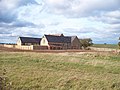
 Butlers Hill Farmhouse - geograph.org.uk - 1930293.jpg 4 000 × 3 000 ; 4,73 Mio
-
 Butlers Hill fishing lakes - geograph.org.uk - 1930319.jpg 4 000 × 3 000 ; 1,98 Mio
-
 Butlers Road - geograph.org.uk - 1930301.jpg 4 000 × 3 000 ; 2,91 Mio
-
 Butlers Road - geograph.org.uk - 1930329.jpg 4 000 × 3 000 ; 3,16 Mio
-
 Butlers Road - geograph.org.uk - 1930340.jpg 4 000 × 3 000 ; 3,29 Mio
-
 Butlers Road Farm - geograph.org.uk - 1930325.jpg 4 000 × 3 000 ; 3,77 Mio
-
 Butlers Road Farm - geograph.org.uk - 1930387.jpg 4 000 × 3 000 ; 3,11 Mio
-
 Coates Barn - geograph.org.uk - 1559584.jpg 640 × 480 ; 85 kio
-
 Common fields met here once - geograph.org.uk - 1560080.jpg 640 × 480 ; 103 kio
-
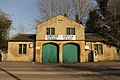 Compton Garage - geograph.org.uk - 3895811.jpg 1 024 × 683 ; 266 kio
-
 Compton Garage, Long Compton - geograph.org.uk - 1323961.jpg 640 × 480 ; 105 kio
-
 Compton Pools - geograph.org.uk - 1211443.jpg 480 × 640 ; 207 kio
-
 Compton Pools - geograph.org.uk - 1211459.jpg 640 × 480 ; 225 kio
-
 Compton Scorpion Manor - geograph.org.uk - 179954.jpg 640 × 480 ; 68 kio
-
 Cotswolds view - geograph.org.uk - 1339837.jpg 640 × 457 ; 267 kio
-
 Cottage on Harrow Hill - geograph.org.uk - 1556843.jpg 640 × 480 ; 80 kio
-
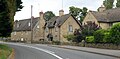
 Cottages at Long Compton (1) - geograph.org.uk - 1928998.jpg 4 000 × 3 000 ; 3,53 Mio
-
 Cottages at Long Compton - geograph.org.uk - 1929005.jpg 4 000 × 3 000 ; 3,45 Mio
-
 Cottages, Long Compton - geograph.org.uk - 6237323.jpg 1 024 × 500 ; 258 kio
-
 Country road passing through Weston Park - geograph.org.uk - 6175660.jpg 1 024 × 768 ; 229 kio
-
 Country road passing through Weston Park - geograph.org.uk - 6175668.jpg 1 024 × 768 ; 225 kio
-
 Crossroads (1) - geograph.org.uk - 1929093.jpg 4 000 × 3 000 ; 3,9 Mio
-
 Crossroads (2) - geograph.org.uk - 1929095.jpg 4 000 × 3 000 ; 2,96 Mio
-
 Crossroads (3) - geograph.org.uk - 1929099.jpg 4 000 × 3 000 ; 2,94 Mio
-
 Crossroads (4) - geograph.org.uk - 1929103.jpg 4 000 × 3 000 ; 3,23 Mio
-
 Dark Lane Coppice - geograph.org.uk - 4763346.jpg 640 × 480 ; 63 kio
-
 Descent to Long Compton - geograph.org.uk - 3342701.jpg 640 × 427 ; 173 kio
-
 Detail of petrol pump, Long Compton - geograph.org.uk - 1854673.jpg 640 × 480 ; 122 kio
-
 Down the field - geograph.org.uk - 1928981.jpg 4 000 × 3 000 ; 2,56 Mio
-
 Down the hill - geograph.org.uk - 2005790.jpg 4 000 × 3 000 ; 3,39 Mio
-
 Dual carriageway track - geograph.org.uk - 2005793.jpg 4 000 × 3 000 ; 4,27 Mio
-
 Ebenezer Chapel, Long Compton - geograph.org.uk - 1930392.jpg 3 000 × 4 000 ; 3,21 Mio
-
 Entrance to Great Rough Brow - geograph.org.uk - 3342782.jpg 640 × 439 ; 215 kio
-
 Entrance to the fishing lakes - geograph.org.uk - 1930317.jpg 4 000 × 3 000 ; 4,96 Mio
-
 Ever steeper - geograph.org.uk - 2005771.jpg 4 000 × 3 000 ; 4,49 Mio
-
 Fallow field - geograph.org.uk - 271846.jpg 640 × 480 ; 103 kio
-
 Farm buildings at Neakings - geograph.org.uk - 2264703.jpg 640 × 480 ; 110 kio
-
 Farm buildings at Weston Mill - geograph.org.uk - 1541771.jpg 640 × 480 ; 70 kio
-
 Farm buildings, Butlers Road - geograph.org.uk - 1930309.jpg 4 000 × 3 000 ; 4,41 Mio
-
 Farm equipment - geograph.org.uk - 2005798.jpg 4 000 × 3 000 ; 3,15 Mio
-
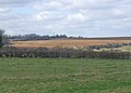
 Farmland - geograph.org.uk - 389278.jpg 640 × 481 ; 55 kio
-
 Farmland by the Rollright Stones - geograph.org.uk - 5551823.jpg 1 600 × 1 200 ; 502 kio
-
 Farmland near Barton-on-the-Heath - geograph.org.uk - 6174041.jpg 1 024 × 768 ; 289 kio
-
 Farmland north of Barton Road - geograph.org.uk - 6174061.jpg 1 024 × 768 ; 227 kio
-
 Field above Long Compton - geograph.org.uk - 512021.jpg 640 × 426 ; 152 kio
-
 Field at Back Lane, Long Compton - geograph.org.uk - 1854632.jpg 640 × 480 ; 101 kio
-
 Field between Long Compton Woods - geograph.org.uk - 6266732.jpg 1 024 × 768 ; 307 kio
-
 Field edge bridleway - geograph.org.uk - 1654809.jpg 640 × 480 ; 68 kio
-
 Field edge footpath - geograph.org.uk - 1929084.jpg 4 000 × 3 000 ; 3,69 Mio
-
 Field west of Cheriton - geograph.org.uk - 2451160.jpg 640 × 480 ; 68 kio
-
 Fields above Long Compton - geograph.org.uk - 450378.jpg 640 × 477 ; 111 kio
-
 Fields west of Long Compton - geograph.org.uk - 2451550.jpg 640 × 480 ; 83 kio
-
 Final resting place^ - geograph.org.uk - 1930371.jpg 4 000 × 3 000 ; 3,05 Mio
-
 Footpath ascends Redcliff Hill - geograph.org.uk - 6266722.jpg 1 024 × 768 ; 261 kio
-
 Footpath from Long Compton towards Redcliff Hill - geograph.org.uk - 6266735.jpg 1 024 × 768 ; 163 kio
-
 Footpath heads towards southern edge of Whichford Wood - geograph.org.uk - 6266728.jpg 1 024 × 768 ; 213 kio
-
 Footpath meets the road - geograph.org.uk - 1928991.jpg 4 000 × 3 000 ; 3,91 Mio
-
 Footpath to Long Compton - geograph.org.uk - 3342694.jpg 320 × 640 ; 170 kio
-
 From Long Compton Woods - geograph.org.uk - 2395973.jpg 640 × 480 ; 76 kio
-
 Fullbrook and beyond - geograph.org.uk - 1559777.jpg 640 × 480 ; 66 kio
-
 Gate and road name sign, Back Lane, Long Compton - geograph.org.uk - 1854644.jpg 640 × 480 ; 137 kio
-
 Gate to field west of Cheriton - geograph.org.uk - 2451166.jpg 640 × 313 ; 64 kio
-
 Gated public road - geograph.org.uk - 6175642.jpg 1 024 × 768 ; 268 kio
-
 Georgian house - geograph.org.uk - 2005764.jpg 4 000 × 3 000 ; 3,3 Mio
-
 Great Rough Brow - geograph.org.uk - 3342767.jpg 640 × 427 ; 218 kio
-
 Great Rough Brow - geograph.org.uk - 3342770.jpg 640 × 427 ; 216 kio
-
 Harrow Hill Barn from Mill Farm - geograph.org.uk - 1557921.jpg 640 × 480 ; 89 kio
-
 Harrow Hill near Long Compton - geograph.org.uk - 2744924.jpg 502 × 640 ; 167 kio
-
 Heading towards Stalls Coppice - geograph.org.uk - 1556726.jpg 640 × 480 ; 90 kio
-
 Hillside above Long Compton - geograph.org.uk - 4775668.jpg 6 000 × 4 000 ; 4,27 Mio
-
 Horse shelter - geograph.org.uk - 1929068.jpg 4 000 × 3 000 ; 3,28 Mio
-
 Into open fields - geograph.org.uk - 1929040.jpg 4 000 × 3 000 ; 3,53 Mio
-
 Into the woods - geograph.org.uk - 2005773.jpg 4 000 × 3 000 ; 3,5 Mio
-
 Join the track - geograph.org.uk - 2005767.jpg 4 000 × 3 000 ; 5,38 Mio
-
 Junction with the A3400 in Long Compton - geograph.org.uk - 2451556.jpg 640 × 480 ; 85 kio
-
 Kingstone House - geograph.org.uk - 1929061.jpg 4 000 × 3 000 ; 3,05 Mio
-
 Land at Yerdley Farm, Long Compton - geograph.org.uk - 1854623.jpg 640 × 480 ; 85 kio
-
 Langley Cottage, Broad Street, Long Compton - geograph.org.uk - 1854582.jpg 640 × 480 ; 76 kio
-
 Late bluebells in Long Compton Woods - geograph.org.uk - 2395983.jpg 640 × 480 ; 142 kio
-
 Leave the track - geograph.org.uk - 2005768.jpg 4 000 × 3 000 ; 5,02 Mio
-
 Old petrol pump - geograph.org.uk - 213722.jpg 480 × 640 ; 113 kio
-
 Long Compton church - geograph.org.uk - 6174066.jpg 1 024 × 768 ; 251 kio
-
 Long Compton from the King Stone - geograph.org.uk - 125136.jpg 640 × 480 ; 124 kio
-
 Long Compton from the Macmillan Way - geograph.org.uk - 1928963.jpg 4 000 × 3 000 ; 2,26 Mio
-
 Long Compton Road Junction - geograph.org.uk - 6166795.jpg 1 600 × 1 200 ; 461 kio
-
 Long Compton Village Hall - geograph.org.uk - 5488334.jpg 1 024 × 768 ; 161 kio
-
 Long Compton Woods - geograph.org.uk - 2005772.jpg 4 000 × 3 000 ; 3,3 Mio
-
 Long Compton, chapel - geograph.org.uk - 5488356.jpg 1 024 × 768 ; 126 kio
-
 Long Compton, entrance - geograph.org.uk - 5488749.jpg 1 024 × 768 ; 161 kio
-
 Long Compton-Lane leading to Mill Farm - geograph.org.uk - 6166812.jpg 1 600 × 1 200 ; 628 kio
-
 Long Copse - geograph.org.uk - 1930334.jpg 4 000 × 3 000 ; 3,03 Mio
-
 Long straight road - geograph.org.uk - 1930362.jpg 4 000 × 3 000 ; 3,37 Mio
-

-
-

-

-
 Looking North-East - geograph.org.uk - 313947.jpg 640 × 480 ; 97 kio
-

-
 Looking North-West over Fullbrook - geograph.org.uk - 313940.jpg 640 × 480 ; 79 kio
-
 Looking towards Long Compton - geograph.org.uk - 2630170.jpg 1 600 × 1 200 ; 506 kio
-
 Main Road A3400 - geograph.org.uk - 1929024.jpg 4 000 × 3 000 ; 3,74 Mio
-
 Maize crop near Coombe Farm, Long Compton - geograph.org.uk - 213713.jpg 640 × 480 ; 169 kio
-
 Malthouse Lane - geograph.org.uk - 6266747.jpg 1 024 × 768 ; 235 kio
-
 Meeting of the ways - geograph.org.uk - 1621429.jpg 640 × 480 ; 96 kio
-
 Mill Farm - geograph.org.uk - 1557930.jpg 640 × 480 ; 76 kio
-
 Minor road leading to Weston Park - geograph.org.uk - 1542846.jpg 640 × 480 ; 117 kio
-
 Minor road rising from the village of Long Compton - geograph.org.uk - 2951804.jpg 2 112 × 2 816 ; 2,17 Mio
-
 Minor road running past Weston Gardens and Weston Park - geograph.org.uk - 6266760.jpg 768 × 1 024 ; 317 kio
-
 Muddy going - geograph.org.uk - 2900701.jpg 4 320 × 3 240 ; 4,86 Mio
-
 Neakings barn - geograph.org.uk - 2264698.jpg 640 × 480 ; 134 kio
-
 Of hedge and sky - geograph.org.uk - 5954470.jpg 1 600 × 900 ; 400 kio
-
 Old Barn - geograph.org.uk - 1559747.jpg 640 × 480 ; 87 kio
-
 Old Dunlop sign, Compton Garage - geograph.org.uk - 1854678.jpg 640 × 480 ; 87 kio
-
 Old machinery scrapyard (1) - geograph.org.uk - 1930364.jpg 4 000 × 3 000 ; 1,92 Mio
-
 Old machinery scrapyard (2) - geograph.org.uk - 1930366.jpg 4 000 × 3 000 ; 3,71 Mio
-
 Old Milepost by the A3400, Long Compton (geograph 5487408).jpg 3 146 × 4 392 ; 1,62 Mio
-
 Old Milepost by the A3400, North of Long Compton (geograph 5487415).jpg 3 456 × 4 608 ; 1,87 Mio
-
 Old petrol pump - geograph.org.uk - 3895816.jpg 683 × 1 024 ; 260 kio
-
 Old petrol pump - geograph.org.uk - 3895820.jpg 683 × 1 024 ; 318 kio
-
 Old Toll House by the A3400, (geograph 6114466).jpg 640 × 516 ; 155 kio
-
 Old Toll House, Little Rollright - geograph.org.uk - 6115293.jpg 1 024 × 696 ; 398 kio
-
 Old Wayside Cross (geograph 6501715).jpg 720 × 960 ; 287 kio
-
 Out of the field - geograph.org.uk - 1929038.jpg 4 000 × 3 000 ; 4,65 Mio
-
 Over the crest - geograph.org.uk - 2005774.jpg 4 000 × 3 000 ; 3,4 Mio
-
 Over the stream - geograph.org.uk - 2005766.jpg 4 000 × 3 000 ; 3,79 Mio
-
 Packing up after the Rollright Fayre 2015 - geograph.org.uk - 4775612.jpg 6 000 × 4 000 ; 6,4 Mio
-
 Passing footpath to The Stalls - geograph.org.uk - 4763348.jpg 640 × 480 ; 64 kio
-
 Path leaves the road - geograph.org.uk - 2264714.jpg 640 × 480 ; 135 kio
-
 Path to Long Compton - geograph.org.uk - 2396023.jpg 640 × 480 ; 57 kio
-
 Path towards Whichford Wood - geograph.org.uk - 450351.jpg 640 × 477 ; 119 kio
-
 Permissive bridleway - geograph.org.uk - 1929107.jpg 4 000 × 3 000 ; 3,4 Mio
-
 Permissive footpath - geograph.org.uk - 1929115.jpg 4 000 × 3 000 ; 3,62 Mio
-
 Pheasant rearing pen - geograph.org.uk - 2005794.jpg 4 000 × 3 000 ; 3,27 Mio
-
 Road to Little Rollright - geograph.org.uk - 1929075.jpg 4 000 × 3 000 ; 4,08 Mio
-
 Road to Long Compton - geograph.org.uk - 1556851.jpg 640 × 480 ; 112 kio
-
 Rolling wheatfield in Weston Park - geograph.org.uk - 6175659.jpg 1 024 × 768 ; 201 kio
-
 Seven Shires Way - geograph.org.uk - 2689157.jpg 640 × 480 ; 90 kio
-
 Seven Shires Way - geograph.org.uk - 2689161.jpg 640 × 480 ; 80 kio
-
 Shakespeare's Way - geograph.org.uk - 4762941.jpg 640 × 480 ; 73 kio
-
 Shakespeare's Way - geograph.org.uk - 4762961.jpg 640 × 480 ; 65 kio
-
 Shakespeare's Way - geograph.org.uk - 4762967.jpg 640 × 480 ; 67 kio
-
 Shakespeare's Way - geograph.org.uk - 4762969.jpg 640 × 480 ; 88 kio
-
 Sheep - geograph.org.uk - 271845.jpg 640 × 480 ; 114 kio
-
 South Hill Farm - geograph.org.uk - 2264707.jpg 640 × 480 ; 102 kio
-
 South Warwickshire view - geograph.org.uk - 1543807.jpg 640 × 480 ; 88 kio
-
 Start of footpaths - geograph.org.uk - 2005765.jpg 4 000 × 3 000 ; 3,06 Mio
-
 Start of path - geograph.org.uk - 1929079.jpg 4 000 × 3 000 ; 3,74 Mio
-
 Storage barn - geograph.org.uk - 2005795.jpg 4 000 × 3 000 ; 2,35 Mio
-
 Straw bales, Long Compton - geograph.org.uk - 213711.jpg 640 × 480 ; 140 kio
-
 T-junction in Long Compton - geograph.org.uk - 2451531.jpg 640 × 480 ; 76 kio
-
 Telephone Exchange, Long Compton - geograph.org.uk - 1512791.jpg 640 × 480 ; 95 kio
-
 The A3400 near Butlers Hill Farm - geograph.org.uk - 4974064.jpg 1 600 × 1 065 ; 596 kio
-
 The grass has gone - geograph.org.uk - 1930363.jpg 4 000 × 3 000 ; 3,19 Mio
-
 The Hollows - geograph.org.uk - 1929055.jpg 4 000 × 3 000 ; 2,93 Mio
-
 The Macmillan Way - geograph.org.uk - 2900683.jpg 4 320 × 3 240 ; 4,93 Mio
-
 The Red Lion - geograph.org.uk - 6357110.jpg 4 032 × 3 024 ; 3,49 Mio
-
 The Stalls - geograph.org.uk - 1556736.jpg 640 × 480 ; 111 kio
-
 Three ways to go - geograph.org.uk - 2900709.jpg 4 320 × 3 240 ; 5,23 Mio
-
 Through the hedge - geograph.org.uk - 1928972.jpg 4 000 × 3 000 ; 4,43 Mio
-
 Toward Ashby Farm - geograph.org.uk - 1928976.jpg 4 000 × 3 000 ; 3,62 Mio
-
 Towards Long Compton - geograph.org.uk - 1930367.jpg 4 000 × 3 000 ; 2,84 Mio
-
 Towards Long Compton - geograph.org.uk - 2005792.jpg 4 000 × 3 000 ; 5,12 Mio
-
 Towards Long Compton - geograph.org.uk - 2005807.jpg 4 000 × 3 000 ; 2,66 Mio
-
 Towards the A3400 - geograph.org.uk - 1929050.jpg 4 000 × 3 000 ; 3,33 Mio
-
 Track and bridleway to The Stalls - geograph.org.uk - 6175650.jpg 1 024 × 768 ; 282 kio
-
 Track in Whichford Woods - geograph.org.uk - 450337.jpg 640 × 477 ; 128 kio
-
 Track towards Long Compton - geograph.org.uk - 450355.jpg 640 × 477 ; 113 kio
-
 Tree-lined road - geograph.org.uk - 6175674.jpg 1 024 × 768 ; 265 kio
-
 Turnpikehill Barn - geograph.org.uk - 1929087.jpg 4 000 × 3 000 ; 2,47 Mio
-
 Un-named crossroads on the A3400 - geograph.org.uk - 3991546.jpg 3 648 × 2 736 ; 2,69 Mio
-
 Un-named road passes the Toll House - geograph.org.uk - 3991541.jpg 3 550 × 2 625 ; 2,01 Mio
-
 Unknown farm - geograph.org.uk - 1930351.jpg 4 000 × 3 000 ; 2,74 Mio
-
 Up and down fence - geograph.org.uk - 2396031.jpg 640 × 480 ; 98 kio
-
 Up the hill - geograph.org.uk - 1928967.jpg 4 000 × 3 000 ; 3,84 Mio


_-_geograph.org.uk_-_1928998.jpg)


_-_geograph.org.uk_-_1929093.jpg)
_-_geograph.org.uk_-_1929095.jpg)
_-_geograph.org.uk_-_1929099.jpg)
_-_geograph.org.uk_-_1929103.jpg)


_-_geograph.org.uk_-_1930364.jpg)
_-_geograph.org.uk_-_1930366.jpg)
.jpg)
.jpg)


.jpg)

.jpg)


