Category:Long Man
Vai alla navigazione
Vai alla ricerca
civil parish in East Sussex, UK  | |||||
| Carica un file multimediale | |||||
| Istanza di | |||||
|---|---|---|---|---|---|
| Luogo | Wealden, East Sussex, Sud Est dell'Inghilterra, Inghilterra | ||||
| Popolazione |
| ||||
| Superficie |
| ||||
 | |||||
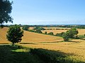
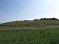
English: Long Man is a civil parish in the Wealden District of East Sussex, England which includes the villages of Wilmington, Milton Street and Folkington. The parish is named after the Long Man of Wilmington, a chalk figure, which is located within the parish.
Italiano: Long Man è una parrocchia civile nel distretto del Weald nell'East Sussex,Inghilterra.Essa
Sottocategorie
Questa categoria contiene le 5 sottocategorie indicate di seguito, su un totale di 5.
F
L
- Long Man of Wilmington (71 F)
M
- Milton Street, East Sussex (49 F)
W
- Wootton Manor, East Sussex (2 F)
File nella categoria "Long Man"
Questa categoria contiene 200 file, indicati di seguito, su un totale di 670.
(pagina precedente) (pagina successiva)-
 "The Wilmington Yew" - in Wilmington churchyard - geograph.org.uk - 6633857.jpg 3 796 × 2 135; 3,23 MB
-
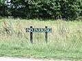 'No Parking' sign, Wilmington Green, East Sussex - geograph.org.uk - 2520255.jpg 1 600 × 1 200; 872 KB
-
 A line of gorse buses on the South Downs - geograph.org.uk - 1819866.jpg 640 × 430; 132 KB
-
 A wet field entrance - geograph.org.uk - 2596394.jpg 640 × 480; 104 KB
-
 A winter view - geograph.org.uk - 6379531.jpg 4 900 × 3 205; 2,24 MB
-
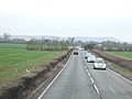
 A22 near Folkington Wood - geograph.org.uk - 2040387.jpg 1 600 × 1 061; 460 KB
-
 A22, northbound - geograph.org.uk - 4773034.jpg 640 × 426; 61 KB
-
 A22, northbound - geograph.org.uk - 4773035.jpg 640 × 426; 79 KB
-
 A22, southbound - geograph.org.uk - 4764190.jpg 640 × 426; 84 KB
-
 A22, southbound - geograph.org.uk - 4764192.jpg 640 × 426; 66 KB
-

-
 A27 heading west - geograph.org.uk - 2840837.jpg 640 × 480; 46 KB
-
 A27 Lewes Road crosses the Cuckmere River - geograph.org.uk - 3008055.jpg 3 648 × 2 497; 1,01 MB
-
 A27 Lewes Road junction with Folkington Road - geograph.org.uk - 3008041.jpg 3 648 × 2 450; 1,7 MB
-
 A27 Lewes Road junction with Milton Street lane - geograph.org.uk - 3008053.jpg 3 600 × 2 235; 1,04 MB
-
 A27 Lewes Road junction with Thornwell Road - geograph.org.uk - 3008049.jpg 3 648 × 2 562; 1,48 MB
-
 A27 Sherman Bridge - geograph.org.uk - 2556344.jpg 640 × 427; 82 KB
-
 Above the Long Man of Wilmington - geograph.org.uk - 2988910.jpg 4 000 × 3 000; 4,49 MB
-
 Across the Field to Wilmington - geograph.org.uk - 936798.jpg 479 × 640; 85 KB
-
 Adesfield - geograph.org.uk - 2455727.jpg 640 × 480; 109 KB
-
 An enclosed area of gorse, South Downs - geograph.org.uk - 1819903.jpg 640 × 430; 121 KB
-
 Approaching the Long Man of Wilmington - geograph.org.uk - 6446408.jpg 3 336 × 2 126; 2,24 MB
-
 Approaching Wilmington Hill - geograph.org.uk - 6446368.jpg 1 600 × 1 040; 394 KB
-
 Arable land at Wilmington - geograph.org.uk - 6416852.jpg 1 024 × 683; 161 KB
-
 Arlington 40b Bridleway - geograph.org.uk - 6288862.jpg 640 × 480; 108 KB
-
 Arlington Reservoir and The Weald - geograph.org.uk - 3574757.jpg 1 184 × 788; 179 KB
-
 Barley's Laine - geograph.org.uk - 2479708.jpg 640 × 476; 108 KB
-
 Barley's Land - geograph.org.uk - 2456922.jpg 640 × 480; 98 KB
-
 Barn Field - geograph.org.uk - 2634240.jpg 640 × 480; 79 KB
-
 Barn Laine - geograph.org.uk - 2441125.jpg 640 × 480; 57 KB
-
 Barn, Manor Farm - geograph.org.uk - 2146122.jpg 640 × 430; 214 KB
-
 Barn, Milton Court Farm - geograph.org.uk - 2133611.jpg 640 × 430; 160 KB
-
 Barns near Milton Gate - geograph.org.uk - 935897.jpg 640 × 479; 114 KB
-
 Bayley's Lane - geograph.org.uk - 2456932.jpg 480 × 640; 95 KB
-
 Bayley's Lane - geograph.org.uk - 2479712.jpg 480 × 640; 49 KB
-
 Bayley's Lane, Arlington - geograph.org.uk - 1033285.jpg 640 × 489; 94 KB
-
 Bend in The South Downs Way - geograph.org.uk - 1819884.jpg 640 × 430; 116 KB
-
 Beside the Long Man - geograph.org.uk - 2964950.jpg 4 320 × 3 240; 5,39 MB
-
 Blossom by the East Coastway Line - geograph.org.uk - 2421087.jpg 640 × 430; 48 KB
-
 Books in a decommissioned phone box - geograph.org.uk - 6633868.jpg 4 032 × 3 024; 2,43 MB
-
 Boot Field - geograph.org.uk - 2441904.jpg 640 × 480; 92 KB
-
 Bowl barrow on Windover Hill - geograph.org.uk - 4609681.jpg 1 306 × 979; 459 KB
-
 Bridleway bank with Horseshoe Vetch - geograph.org.uk - 1882880.jpg 640 × 428; 169 KB
-
-
 Bridleway east of Wilmington - geograph.org.uk - 2141710.jpg 640 × 430; 208 KB
-
 Bridleway in the woods - geograph.org.uk - 2145837.jpg 640 × 430; 216 KB
-
 Bridleway junction near Wilmington - geograph.org.uk - 2141738.jpg 640 × 430; 171 KB
-
 Bridleway junction on the South Downs - geograph.org.uk - 1818921.jpg 640 × 430; 121 KB
-
 Bridleway Junction, Wilmington Hill - geograph.org.uk - 2457615.jpg 640 × 480; 42 KB
-
 Bridleway near Burlough Castle - geograph.org.uk - 936159.jpg 479 × 640; 150 KB
-
 Bridleway near Wilmington - geograph.org.uk - 5362193.jpg 3 672 × 4 896; 6,49 MB
-
 Bridleway off Wilmington Street - geograph.org.uk - 2141690.jpg 640 × 430; 197 KB
-
 Bridleway on Holt Brow - geograph.org.uk - 4609694.jpg 1 469 × 1 102; 314 KB
-
 Bridleway to Folkington - geograph.org.uk - 1133551.jpg 480 × 640; 170 KB
-
 Bridleway to Folkington - geograph.org.uk - 2141721.jpg 640 × 430; 203 KB
-
 Bridleway to Folkington - geograph.org.uk - 2141747.jpg 640 × 430; 192 KB
-
 Bridleway to Folkington - geograph.org.uk - 2141775.jpg 640 × 430; 205 KB
-

-
 Bridleway to Wilmington - geograph.org.uk - 1133508.jpg 480 × 640; 97 KB
-
 Bridleway towards Abbot's Wood - geograph.org.uk - 5438208.jpg 640 × 480; 205 KB
-
 Bridleway up the scarp slope - geograph.org.uk - 2141814.jpg 640 × 430; 152 KB
-
 Bridleway, Abbot's Wood - geograph.org.uk - 5438014.jpg 640 × 480; 175 KB
-
 Bridleway, Wilmington - geograph.org.uk - 5362220.jpg 4 896 × 3 672; 5,76 MB
-
 Bridleway, Windover Hill - geograph.org.uk - 936707.jpg 479 × 640; 91 KB
-
 Bridleways meet, Widover Hill - geograph.org.uk - 1818762.jpg 640 × 430; 127 KB
-
 Bug housing development - geograph.org.uk - 3035544.jpg 4 000 × 3 000; 3,55 MB
-
 Burlough Castle - geograph.org.uk - 2441180.jpg 640 × 480; 72 KB
-
 Burlough Castle - geograph.org.uk - 936148.jpg 443 × 640; 105 KB
-
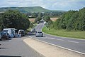
 Bus stop on the A27 - geograph.org.uk - 3035559.jpg 4 000 × 3 000; 3,27 MB
-
 Bushes on the South Downs scarp slope - geograph.org.uk - 2141796.jpg 640 × 430; 166 KB
-
 Bushes, Windover Hill - geograph.org.uk - 1818812.jpg 640 × 430; 133 KB
-
 Buttercup meadow near Milton Court Farm - geograph.org.uk - 2133497.jpg 640 × 430; 157 KB
-
 By-way near Wilmington - geograph.org.uk - 2876110.jpg 770 × 1 024; 219 KB
-
 Byway to Milton Gate - geograph.org.uk - 3035602.jpg 4 000 × 3 000; 3,49 MB
-
 Car Park on the downs, The Street - geograph.org.uk - 1818675.jpg 640 × 430; 68 KB
-
 Car Park, The Street - geograph.org.uk - 2634111.jpg 640 × 480; 98 KB
-
 Castle Field - geograph.org.uk - 2441182.jpg 640 × 480; 123 KB
-
 Chalk Hill Figure - geograph.org.uk - 3819592.jpg 4 156 × 1 789; 1,52 MB
-
 Chalky field near Wilmington - geograph.org.uk - 2141732.jpg 640 × 430; 133 KB
-
 Church and nearby buildings - Wilmington - geograph.org.uk - 6612896.jpg 4 032 × 2 268; 2,87 MB
-
 Church of St Peter ad Vincula, Folkington - geograph.org.uk - 6620816.jpg 4 032 × 2 268; 2,85 MB
-
 Church of St Peter ad Vincula, Folkington - geograph.org.uk - 6630109.jpg 2 917 × 1 641; 1,44 MB
-
 Clay Vale from The South Downs - geograph.org.uk - 2145824.jpg 640 × 430; 140 KB
-
 Cleared Area, Wilmington Wood - geograph.org.uk - 6288810.jpg 640 × 480; 83 KB
-
 Climbing the scarp slope - geograph.org.uk - 2145833.jpg 640 × 430; 162 KB
-
 Communication mast by Natewood Farm - geograph.org.uk - 3567743.jpg 3 264 × 2 448; 3,23 MB
-
 Concrete lined and oval shaped dew pond near the Long Man - geograph.org.uk - 6419123.jpg 5 472 × 3 648; 4,81 MB
-
 Couch Laine (1) - geograph.org.uk - 2457650.jpg 640 × 480; 54 KB
-
 Couch Laine (2) - geograph.org.uk - 2457655.jpg 640 × 480; 110 KB
-
 Countryside near the Cuckmere River - geograph.org.uk - 2118733.jpg 640 × 430; 111 KB
-
 Countryside near Wilmington - geograph.org.uk - 2118726.jpg 640 × 430; 107 KB
-
 Covered reservoir on Windover Hill - geograph.org.uk - 3033947.jpg 4 000 × 3 000; 3,6 MB
-
 Cow Field (1) - geograph.org.uk - 2455772.jpg 640 × 480; 106 KB
-
 Cow Field (2) - geograph.org.uk - 2455866.jpg 640 × 480; 87 KB
-
 Crab Hide - geograph.org.uk - 2456989.jpg 640 × 480; 60 KB
-
 Crossways Hotel, Wilmington - geograph.org.uk - 3536489.jpg 1 024 × 766; 315 KB
-
 Cuckmere River north of Alfriston (2) - geograph.org.uk - 2439391.jpg 1 600 × 1 200; 573 KB
-
 Cuckmere Valley - geograph.org.uk - 4980739.jpg 2 399 × 1 599; 941 KB
-
 Cyclist on The South Downs Way - geograph.org.uk - 1819916.jpg 640 × 430; 94 KB
-
 Dappled sunlight on Gillett's Lane - geograph.org.uk - 3034170.jpg 4 000 × 3 000; 3,73 MB
-
 Deep Dean from the South Downs Way - geograph.org.uk - 4606059.jpg 4 000 × 3 000; 4,04 MB
-
 Descending Wilmington Hill - geograph.org.uk - 1135407.jpg 640 × 480; 60 KB
-
 Descending Windover Hill, South Downs Way - geograph.org.uk - 5094792.jpg 4 896 × 3 672; 5,51 MB
-

-
 Dew Pond - geograph.org.uk - 45358.jpg 640 × 480; 146 KB
-
 Dew pond on the north side of Windover Hill - geograph.org.uk - 6634109.jpg 3 851 × 1 719; 1,41 MB
-
 Dew pond or urinal^ - geograph.org.uk - 3034104.jpg 4 000 × 3 000; 3,46 MB
-
 Distant view of The Long Man of Wilmington - geograph.org.uk - 2431675.jpg 1 280 × 960; 619 KB
-
 Dog walkers on The Street - and view towards the Long Man - geograph.org.uk - 6620778.jpg 4 032 × 2 268; 2,28 MB
-
 Domans (1) - geograph.org.uk - 2634318.jpg 640 × 480; 82 KB
-
 Domans (2) - geograph.org.uk - 2634442.jpg 640 × 480; 80 KB
-
 Downland on north side of South Downs Way - geograph.org.uk - 2343804.jpg 1 500 × 843; 1,02 MB
-
 Draw Field - geograph.org.uk - 2634448.jpg 640 × 480; 101 KB
-
 Drawfield Cottage - geograph.org.uk - 2455687.jpg 480 × 640; 89 KB
-
 Drawfield Cottage - geograph.org.uk - 2629995.jpg 640 × 480; 48 KB
-
 Dry valley below Windover Hill (2) - geograph.org.uk - 1818889.jpg 640 × 430; 157 KB
-
 Dry valley below Windover Hill - geograph.org.uk - 1818726.jpg 640 × 430; 127 KB
-
 Dry valley below Windover Hill - geograph.org.uk - 1818885.jpg 640 × 430; 120 KB
-
 Duck on the lake in Abbot's Wood - geograph.org.uk - 6516722.jpg 3 002 × 1 689; 1,82 MB
-
 Early oilseed rape north of the A27 - geograph.org.uk - 2118715.jpg 640 × 430; 117 KB
-
 Earthwork on Windover Hill - geograph.org.uk - 4044736.jpg 4 422 × 2 000; 1,68 MB
-
 East Coastway Line - geograph.org.uk - 2441539.jpg 480 × 640; 94 KB
-
 East Coastway Line - geograph.org.uk - 2455891.jpg 640 × 480; 92 KB
-
 East Coastway Line - geograph.org.uk - 2455995.jpg 640 × 480; 98 KB
-
 East of Windover Hill - geograph.org.uk - 4609688.jpg 1 306 × 979; 376 KB
-
 Eight Acres - geograph.org.uk - 2457576.jpg 640 × 480; 91 KB
-
 Embankment along the River Cuckmere - geograph.org.uk - 2133509.jpg 640 × 430; 145 KB
-
 End of the Road - geograph.org.uk - 2479658.jpg 640 × 480; 113 KB
-
 Enjoying the view north - geograph.org.uk - 4044726.jpg 1 888 × 2 000; 1,02 MB
-
 Entering Woodside on the A22 - geograph.org.uk - 4764188.jpg 640 × 426; 62 KB
-
 Eroded bridleway - geograph.org.uk - 2141768.jpg 640 × 430; 198 KB
-
 Eroded bridleway to Folkington - geograph.org.uk - 2141770.jpg 640 × 430; 200 KB
-
 Eroded bridleway to Folkington - geograph.org.uk - 2141773.jpg 640 × 430; 192 KB
-
 Eroded chalk bridleway - geograph.org.uk - 2141801.jpg 640 × 430; 144 KB
-
 Evening Sunshine on the Long Man - geograph.org.uk - 2440562.jpg 2 560 × 1 920; 2,42 MB
-
 Ewe Dean from the South Downs Way - geograph.org.uk - 4605343.jpg 4 000 × 3 000; 4,36 MB
-
 Farm near Wilmington - geograph.org.uk - 3074374.jpg 1 600 × 1 200; 451 KB
-
 Farm track of bridleway Long Man 3B - geograph.org.uk - 3035516.jpg 4 000 × 3 000; 3,32 MB
-
 Farm Track to Home Farm - geograph.org.uk - 2441934.jpg 640 × 480; 59 KB
-
 Farmland by the East Coastway Line - geograph.org.uk - 2421083.jpg 640 × 430; 32 KB
-
 Farmland by the East Coastway Line - geograph.org.uk - 4742140.jpg 640 × 426; 39 KB
-
 Farmland near Monken Pyn - geograph.org.uk - 4742236.jpg 640 × 426; 47 KB
-
 Farmland near New Barn Farm - geograph.org.uk - 2421095.jpg 640 × 430; 34 KB
-
 Farmland near Wilmington - geograph.org.uk - 2620772.jpg 640 × 480; 65 KB
-
 Farmland near Wilmington - geograph.org.uk - 3074836.jpg 1 600 × 1 200; 405 KB
-
 Farmland south of Wilmington - geograph.org.uk - 6267167.jpg 1 024 × 758; 167 KB
-
 Fence, Wilmington Hill - geograph.org.uk - 1135406.jpg 640 × 480; 82 KB
-

-
 Fenced off eroded bridleway - geograph.org.uk - 2141789.jpg 640 × 430; 145 KB
-
 Field by The Street - geograph.org.uk - 2556336.jpg 640 × 480; 76 KB
-
 Field entrance off Thornwell Road - geograph.org.uk - 3035598.jpg 4 000 × 3 000; 2,88 MB
-
 Field near Underwood Farm - geograph.org.uk - 2479717.jpg 640 × 480; 85 KB
-
 Field next to the A27 - geograph.org.uk - 936099.jpg 640 × 479; 110 KB
-
 Fields around Wilmington - geograph.org.uk - 3074826.jpg 1 600 × 1 200; 413 KB
-

-
 Fields near Castlebank - geograph.org.uk - 936175.jpg 479 × 640; 92 KB
-
 Fields near Folkington - geograph.org.uk - 1133672.jpg 640 × 480; 75 KB
-
 Fields near Lewes Road - geograph.org.uk - 1133515.jpg 640 × 480; 58 KB
-
 Fields near Warren Farm - geograph.org.uk - 3925204.jpg 1 024 × 662; 114 KB
-
 Firle Beacon from Wilmington Priory - geograph.org.uk - 1853000.jpg 1 075 × 619; 154 KB
-
 Five Acres - geograph.org.uk - 2457034.jpg 640 × 480; 74 KB
-
 Flint Barn, Milton Court Farm - geograph.org.uk - 2133607.jpg 640 × 415; 111 KB
-
 Folkington Bottom - geograph.org.uk - 2146109.jpg 640 × 430; 157 KB
-
 Folkington Bottom - geograph.org.uk - 6446021.jpg 4 032 × 2 609; 3,89 MB
-
 Folkington Church - geograph.org.uk - 6446010.jpg 1 600 × 1 057; 489 KB
-
 Folkington Hill - geograph.org.uk - 6446375.jpg 3 581 × 2 465; 2,46 MB
-
 Folkington Lane - geograph.org.uk - 1133619.jpg 480 × 640; 82 KB
-
 Folkington Reservoir - geograph.org.uk - 4822115.jpg 3 385 × 2 206; 3,4 MB
-
 Folkington Road - geograph.org.uk - 2596487.jpg 640 × 428; 121 KB
-
 Folkington Road - geograph.org.uk - 3069631.jpg 2 256 × 1 496; 909 KB
-
 Folkington Road - geograph.org.uk - 3069670.jpg 2 256 × 1 496; 921 KB
-
 Folkington Road, west of Polegate - geograph.org.uk - 2439381.jpg 1 600 × 1 200; 684 KB
-
 Folkington, View towards the reservoir from Folkington Road - geograph.org.uk - 4822106.jpg 3 678 × 2 456; 5,62 MB
-
 Footpath at Wilmington - geograph.org.uk - 5362212.jpg 4 896 × 3 672; 5,5 MB
-
 Footpath Long Man 24a to Milton Street - geograph.org.uk - 3032272.jpg 4 000 × 3 000; 3,5 MB
-
 Footpath Long Man 8 to the A27 at Wilmington - geograph.org.uk - 3035552.jpg 4 000 × 3 000; 3,47 MB
-
 Footpath near Milton Street - geograph.org.uk - 6134903.jpg 5 120 × 3 840; 4,39 MB
-
 Footpath off the Wealdway - geograph.org.uk - 2146149.jpg 640 × 430; 167 KB
-
 Footpath on Wilmington Street - geograph.org.uk - 3007816.jpg 1 500 × 1 000; 338 KB
-
 Footpath Sign near Lullington Road - geograph.org.uk - 6135618.jpg 3 648 × 2 736; 2,83 MB
-
 Footpath sign off the Wealdway - geograph.org.uk - 1834225.jpg 640 × 480; 81 KB
-
 Footpath Sign on Milton Street - geograph.org.uk - 6135622.jpg 5 120 × 3 840; 5,43 MB
-
 Footpath signposted to Wilmington - geograph.org.uk - 2141030.jpg 640 × 430; 145 KB
-
 Footpath through a thistly field - geograph.org.uk - 2596450.jpg 640 × 480; 105 KB
-
 Footpath through oilseed rape - geograph.org.uk - 2141098.jpg 640 × 430; 150 KB
-
 Footpath through the wheat - geograph.org.uk - 2133686.jpg 640 × 430; 133 KB
-
 Footpath to Alfriston - geograph.org.uk - 6135615.jpg 5 120 × 3 840; 4,99 MB
-
 Footpath to Folkington - geograph.org.uk - 1133666.jpg 640 × 480; 72 KB
-
 Footpath to Long Man - geograph.org.uk - 2440545.jpg 2 560 × 1 920; 2,43 MB
-
 Footpath to Milton Court Farm - geograph.org.uk - 2133500.jpg 640 × 430; 152 KB
-
 Footpath to Milton Court Farm - geograph.org.uk - 2133521.jpg 640 × 430; 144 KB
-
 Footpath to Milton Street - geograph.org.uk - 2133673.jpg 640 × 430; 132 KB
-
 Footpath to Milton Street - geograph.org.uk - 2133692.jpg 640 × 430; 135 KB
-
 Footpath to Milton Street - geograph.org.uk - 2629989.jpg 640 × 480; 38 KB
-
 Footpath to the Long Man - geograph.org.uk - 3007784.jpg 1 500 × 1 000; 293 KB
-
 Footpath to Wilmington - geograph.org.uk - 2141062.jpg 640 × 430; 137 KB
-
 Footpath to Wilmington - geograph.org.uk - 2141091.jpg 640 × 430; 152 KB
-
 Footpath to Wilmington - geograph.org.uk - 2141115.jpg 640 × 430; 149 KB
-
 Footpath to Wilmington - geograph.org.uk - 2141624.jpg 640 × 430; 164 KB
-
 Footpath toward Milton Street - geograph.org.uk - 6134900.jpg 5 120 × 3 840; 6,01 MB


_-_geograph.org.uk_-_2457650.jpg)
_-_geograph.org.uk_-_2457655.jpg)


_-_geograph.org.uk_-_2455772.jpg)
_-_geograph.org.uk_-_2455866.jpg)


_-_geograph.org.uk_-_2439391.jpg)


,_South_Downs_Way_-_geograph.org.uk_-_936613.jpg)


_-_geograph.org.uk_-_2634318.jpg)
_-_geograph.org.uk_-_2634442.jpg)


_-_geograph.org.uk_-_1818889.jpg)


