Category:Longton, Lancashire
Vai alla navigazione
Vai alla ricerca
English: Longton is a small rural community in the west of the borough of South Ribble, Lancashire about 5 km south west of Preston. Longton is a village of ancient origin. The Parish Church, St. Andrew's was completed in 1887, but there is record of a chapel on the same site as long ago as 1150. A document refers to "Earward Priest of Longton" of that date.
village and civil parish in Lancashire, UK  | |||||
| Carica un file multimediale | |||||
| Istanza di | |||||
|---|---|---|---|---|---|
| Luogo | South Ribble, Lancashire, Nord Ovest dell'Inghilterra, Inghilterra | ||||
 | |||||
Sottocategorie
Questa categoria contiene le 3 sottocategorie indicate di seguito, su un totale di 3.
File nella categoria "Longton, Lancashire"
Questa categoria contiene 200 file, indicati di seguito, su un totale di 238.
(pagina precedente) (pagina successiva)-
 A footbridge out of the wood and into the park - geograph.org.uk - 3652817.jpg 4 456 × 3 056; 7,72 MB
-
 A lane near Thornton Barn - geograph.org.uk - 3651355.jpg 4 592 × 2 951; 7,77 MB
-
 A new housing development on Long Moss Lane - geograph.org.uk - 3651433.jpg 4 458 × 2 397; 6,82 MB
-
 A path through the park - geograph.org.uk - 3652882.jpg 4 592 × 3 056; 7,62 MB
-
 A rural car park - geograph.org.uk - 5187245.jpg 4 608 × 3 456; 4,56 MB
-
 A tributary of the River Douglas at Hall Green - geograph.org.uk - 5739116.jpg 1 024 × 768; 217 KB
-
 A white house on Pope Lane - geograph.org.uk - 3652677.jpg 4 592 × 3 056; 7,3 MB
-
 A59 approaching New Longton - geograph.org.uk - 2973541.jpg 800 × 546; 52 KB
-
 A59 Longton by-pass - geograph.org.uk - 4968794.jpg 640 × 480; 55 KB
-
 A59 near Balshaw Farm - geograph.org.uk - 2973534.jpg 800 × 554; 73 KB
-
 A59 nears Gill Lane roundabout - geograph.org.uk - 4968801.jpg 640 × 481; 53 KB
-
 All Quiet - geograph.org.uk - 3275109.jpg 2 000 × 1 333; 2,35 MB
-
 All Saints' Church, New Longton - geograph.org.uk - 4574626.jpg 640 × 480; 434 KB
-
 Approaching the junction with Hall Poole Lane - geograph.org.uk - 3787093.jpg 4 592 × 3 056; 7,62 MB
-
 Back Lane becomes a track here - geograph.org.uk - 3981322.jpg 3 807 × 2 495; 3,99 MB
-
 Back Lane, Longton - geograph.org.uk - 2173863.jpg 640 × 480; 138 KB
-
 Back Lane, Longton - geograph.org.uk - 5740419.jpg 1 024 × 768; 357 KB
-
 Back Lane, Longton - geograph.org.uk - 5740425.jpg 1 024 × 770; 333 KB
-
 Back Lane, Longton - geograph.org.uk - 5740441.jpg 1 024 × 768; 371 KB
-
 Bench on Marsh Lane, Longton - geograph.org.uk - 5740351.jpg 1 024 × 768; 242 KB
-
 Bench on the Ribble Way - geograph.org.uk - 5739210.jpg 1 024 × 768; 198 KB
-
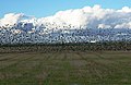 Birds of a feather - geograph.org.uk - 613048.jpg 640 × 416; 162 KB
-
 Booths Supermarket - geograph.org.uk - 3652912.jpg 4 106 × 2 732; 6,11 MB
-
 Booths Supermarket, Longton - geograph.org.uk - 2173795.jpg 640 × 480; 163 KB
-
 Bridge abutments on Hall Carr Lane - geograph.org.uk - 4381524.jpg 1 024 × 768; 129 KB
-
 Brownhill Lane - geograph.org.uk - 4575025.jpg 640 × 480; 489 KB
-
 Brownhill Lane, Longton - geograph.org.uk - 5955921.jpg 640 × 480; 47 KB
-
 Brownhill Lane, New Longton - geograph.org.uk - 4575275.jpg 640 × 480; 444 KB
-
 Bungalows on Old Pope Lane - geograph.org.uk - 5955036.jpg 640 × 480; 65 KB
-

-

-
 Chapel Park Road - geograph.org.uk - 4574986.jpg 640 × 480; 416 KB
-

-
 Dismantled Railway Bridge on Hall Lane, Longton - geograph.org.uk - 5739029.jpg 1 024 × 770; 212 KB
-
 Drain off Hall Carr Lane - geograph.org.uk - 4256463.jpg 640 × 480; 62 KB
-
 Drumacre Lane at Thornton Barn Farm - geograph.org.uk - 4575293.jpg 640 × 480; 461 KB
-
 Drumacre Lane East - geograph.org.uk - 4575303.jpg 640 × 480; 515 KB
-
 Drumacre Lane East - geograph.org.uk - 4575308.jpg 640 × 480; 443 KB
-
 Drumacre Lane East - geograph.org.uk - 5955924.jpg 640 × 480; 97 KB
-
 Drumacre Lane West - geograph.org.uk - 6154091.jpg 800 × 600; 912 KB
-

-
 Elizabeth II postbox on Pope Lane, White Stake - geograph.org.uk - 5958041.jpg 1 452 × 2 745; 847 KB
-
 Ellerslie Farm - geograph.org.uk - 4256454.jpg 640 × 480; 80 KB
-
 End of the road, this is Grange Lane - geograph.org.uk - 2173870.jpg 590 × 442; 127 KB
-
 Entrance to Longton Brickcroft Nature Reserve - geograph.org.uk - 4381532.jpg 1 024 × 768; 293 KB
-
 Entrance to Longton Brickroft (N) - geograph.org.uk - 6154101.jpg 800 × 600; 867 KB
-
 Entrance to Longton Brickroft (S) - geograph.org.uk - 6154098.jpg 800 × 601; 1 008 KB
-
 Entrance to Odd House Farm on Hall Carr Lane - geograph.org.uk - 4381517.jpg 1 024 × 768; 289 KB
-
 Evening at Logton Brickcroft - geograph.org.uk - 6154085.jpg 800 × 601; 742 KB
-
 Farm Trailer on Longton Moss - geograph.org.uk - 6087910.jpg 1 186 × 884; 491 KB
-
 Farmers Arms - geograph.org.uk - 166323.jpg 640 × 480; 81 KB
-
 Field access on Marsh Lane, Longton - geograph.org.uk - 5740385.jpg 1 024 × 768; 442 KB
-
 Field Boundaries on Little Hoole Moss - geograph.org.uk - 6087931.jpg 1 600 × 1 200; 566 KB
-
 Field Boundary North of Hall Lane, Longton - geograph.org.uk - 5739056.jpg 1 024 × 768; 232 KB
-

-
 Field entrance off Grange Lane - geograph.org.uk - 4257181.jpg 640 × 480; 70 KB
-
 Field Entrance Track - geograph.org.uk - 3302800.jpg 2 557 × 1 719; 2,76 MB
-
 Field North of back Lane, Longton - geograph.org.uk - 5740451.jpg 1 024 × 768; 320 KB
-
 Field towards Wholesome Farm - geograph.org.uk - 5955928.jpg 640 × 480; 80 KB
-
 Footbridge over Tarra Carr Gutter - geograph.org.uk - 5739127.jpg 1 024 × 768; 179 KB
-
 Footpath And Drainage - geograph.org.uk - 3302789.jpg 2 560 × 1 920; 2,83 MB
-
 Footpath from Back Lane to Grange Lane, Longton - geograph.org.uk - 5740421.jpg 1 024 × 768; 363 KB
-
 Footpath from Hall Carr Lane to the Ribble Way - geograph.org.uk - 5739105.jpg 1 024 × 768; 248 KB
-
 Franklands - geograph.org.uk - 3981329.jpg 4 442 × 2 684; 5,53 MB
-
 Function room, Dolphin Inn - geograph.org.uk - 4256480.jpg 640 × 480; 55 KB
-
 Gill Lane, Walmer Bridge - geograph.org.uk - 2176218.jpg 640 × 480; 78 KB
-
 Grange Lane - geograph.org.uk - 4257182.jpg 640 × 480; 62 KB
-
 Grange Lane, Longton - geograph.org.uk - 2173871.jpg 640 × 480; 129 KB
-
 Grange Lane, Longton - geograph.org.uk - 5740411.jpg 1 024 × 770; 306 KB
-
 Grangefield, Longton - geograph.org.uk - 4257216.jpg 640 × 480; 52 KB
-
 Grazing and pylons - geograph.org.uk - 4256459.jpg 640 × 452; 44 KB
-
 Grazing north of Hugh Barn Lane - geograph.org.uk - 5955058.jpg 640 × 480; 55 KB
-
 Grazing off Drumacre Lane East - geograph.org.uk - 5955922.jpg 640 × 480; 53 KB
-
 Grazing west of Hall Carr Lane - geograph.org.uk - 4256464.jpg 640 × 480; 67 KB
-
 H. B. Panelcraft Ltd - geograph.org.uk - 5740470.jpg 1 024 × 770; 175 KB
-
 Hall Carr Lane - geograph.org.uk - 3787070.jpg 4 538 × 3 011; 8 MB
-
 Hall Carr Lane - geograph.org.uk - 4256455.jpg 640 × 480; 55 KB
-
 Hall Carr Lane - geograph.org.uk - 4256462.jpg 640 × 480; 68 KB
-
 Hall Carr Lane - geograph.org.uk - 4256466.jpg 640 × 480; 71 KB
-
 Hall Carr Lane - geograph.org.uk - 4966783.jpg 640 × 480; 71 KB
-
 Hall Carr Lane, Hall Green - geograph.org.uk - 5739087.jpg 1 024 × 768; 212 KB
-
 Hall Carr Lane, Longton - geograph.org.uk - 2175165.jpg 640 × 480; 88 KB
-
 Hall Carr Lane, Longton - geograph.org.uk - 2175166.jpg 640 × 480; 99 KB
-
 Hall Carr Lane, Longton - geograph.org.uk - 2175175.jpg 590 × 442; 87 KB
-
 Hall Lane, Longton - geograph.org.uk - 5739042.jpg 1 024 × 769; 343 KB
-
 Hillsborough Nurseries - geograph.org.uk - 158074.jpg 640 × 480; 88 KB
-
 Horse and rider on the lane to Harrison's Farm - geograph.org.uk - 3651280.jpg 3 706 × 2 508; 7,72 MB
-
 House at the Junction - geograph.org.uk - 4575289.jpg 640 × 480; 432 KB
-
 House on Gill Lane - geograph.org.uk - 5955927.jpg 640 × 489; 62 KB
-
 House on Marsh Lane, Longton - geograph.org.uk - 4257183.jpg 640 × 480; 61 KB
-
 Houses on Chapel Lane, New Longton - geograph.org.uk - 5955063.jpg 640 × 408; 50 KB
-
 Houses on Marsh Lane, Longton - geograph.org.uk - 4256479.jpg 640 × 480; 70 KB
-
 Hugh Barn Lane - geograph.org.uk - 5955061.jpg 640 × 480; 46 KB
-
 Hugh Barn Lane, New Longton - geograph.org.uk - 5955054.jpg 640 × 486; 69 KB
-
 Jelly Ear Fungi on Hall Lane, Longton - geograph.org.uk - 5739077.jpg 1 024 × 768; 329 KB
-
 Junction of Land Lane with Gill Lane - geograph.org.uk - 2176224.jpg 608 × 456; 117 KB
-

-

-
 Land Lane, New Longton - geograph.org.uk - 2176220.jpg 640 × 480; 91 KB
-
 Liverpool Road - geograph.org.uk - 4257229.jpg 640 × 480; 81 KB
-
 Liverpool Road at Hutton boundary - geograph.org.uk - 4968711.jpg 640 × 480; 62 KB
-

-
 Liverpool Road, Longton - geograph.org.uk - 2173854.jpg 640 × 480; 176 KB
-
 Liverpool Road, Longton - geograph.org.uk - 4257221.jpg 640 × 480; 92 KB
-
 Liverpool Road, Longton - geograph.org.uk - 4968707.jpg 640 × 480; 93 KB
-
 Long Moss Lane - geograph.org.uk - 4575447.jpg 640 × 480; 408 KB
-
 Longton Brickcroft Visitor's Centre - geograph.org.uk - 2422957.jpg 1 024 × 739; 335 KB
-
 Longton Brickcroft, Flooded Claypit - geograph.org.uk - 6154081.jpg 800 × 600; 927 KB
-

-

-
 Longton Brook - geograph.org.uk - 3652943.jpg 4 592 × 3 056; 7,1 MB
-
 Longton Brook - geograph.org.uk - 3788386.jpg 1 600 × 1 065; 636 KB
-
 Longton Brook goes through the floodbank - geograph.org.uk - 5187291.jpg 4 608 × 3 456; 4,41 MB
-
 Longton Brook near Pilots Cottage - geograph.org.uk - 4381191.jpg 1 024 × 768; 143 KB
-

-
 Longton Marsh with Sheep grazing - geograph.org.uk - 5187266.jpg 4 608 × 3 456; 3,87 MB
-
 Longton Methodist Church - geograph.org.uk - 4257195.jpg 640 × 480; 79 KB
-
 Longton Post Office - geograph.org.uk - 4257224.jpg 640 × 480; 59 KB
-
 Longton village centre - geograph.org.uk - 2428079.jpg 1 024 × 683; 215 KB
-
 Longton, Bus Stop on Liverpool Road - geograph.org.uk - 6153981.jpg 800 × 600; 731 KB
-
 Longton, Church Row Chambers - geograph.org.uk - 6154007.jpg 800 × 533; 608 KB
-
 Longton, St. Andrew - geograph.org.uk - 158056.jpg 640 × 480; 87 KB
-
 Longton, The Ram's Head - geograph.org.uk - 6153983.jpg 800 × 533; 559 KB
-
 Manor Court - Longton - geograph.org.uk - 3981449.jpg 4 596 × 2 625; 5,77 MB
-
 Marsh Lane looking east - geograph.org.uk - 4968695.jpg 640 × 480; 91 KB
-
 Marsh Lane Substation, Longton - geograph.org.uk - 5740418.jpg 1 024 × 768; 382 KB
-
 Marsh Lane, Longton - geograph.org.uk - 2173861.jpg 640 × 480; 134 KB
-
 Marsh Lane, Longton - geograph.org.uk - 4256476.jpg 640 × 480; 66 KB
-
 Marsh Lane, Longton - geograph.org.uk - 4257191.jpg 640 × 480; 69 KB
-
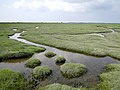 Marshland east of the River Douglas - geograph.org.uk - 2016673.jpg 1 600 × 1 200; 1,47 MB
-
 Methodist Church Hall, New Longton - geograph.org.uk - 4574976.jpg 640 × 481; 386 KB
-
 Midge Hall Lane - geograph.org.uk - 5955929.jpg 640 × 480; 44 KB
-
 Midge Hall Lane - geograph.org.uk - 6164405.jpg 1 573 × 1 132; 759 KB
-
 Modern Housing on Long Moss Lane - geograph.org.uk - 4575445.jpg 640 × 480; 409 KB
-

-
 New Longton Children's Playground - geograph.org.uk - 4574926.jpg 640 × 480; 512 KB
-
 New Longton Cricket Club - Ground - geograph.org.uk - 3214054.jpg 1 600 × 1 200; 227 KB
-
 New Longton Cricket Club - Pavilion - geograph.org.uk - 3214064.jpg 1 600 × 1 200; 287 KB
-
 New Longton Methodist Church - geograph.org.uk - 4574982.jpg 640 × 480; 420 KB
-
 New Longton Village Hall - geograph.org.uk - 4574931.jpg 640 × 481; 420 KB
-
 New Longton, All Saints' Church - geograph.org.uk - 4574630.jpg 640 × 480; 460 KB
-
 New Longton, Brownhill Lane - geograph.org.uk - 4575281.jpg 640 × 480; 419 KB
-
 New Longton, Village Pharmacy - geograph.org.uk - 4574648.jpg 640 × 481; 452 KB
-
 Old tractor on Marsh Lane, Longton - geograph.org.uk - 5740357.jpg 1 024 × 772; 203 KB
-
 St Oswald's Catholic Church, Longton - geograph.org.uk - 872655.jpg 640 × 480; 61 KB
-
 Path between hall Lane and Marsh Farm, Longton - geograph.org.uk - 5739081.jpg 1 024 × 768; 459 KB
-
 Path in Longton Brickcroft LNR - geograph.org.uk - 6154070.jpg 800 × 600; 1 006 KB
-

-
 Path North of Heath House Farm - geograph.org.uk - 6087916.jpg 1 600 × 1 200; 469 KB
-
 Pendle Hill from River Douglas - geograph.org.uk - 128839.jpg 640 × 482; 66 KB
-
 Pond next to path near Hall Lane,Longton - geograph.org.uk - 4381530.jpg 1 024 × 768; 171 KB
-
 Pope Lane towards White Stake - geograph.org.uk - 5955038.jpg 640 × 480; 33 KB
-
 Power lines, Longton - geograph.org.uk - 4257180.jpg 640 × 480; 48 KB
-
 Red Lion - Longton - geograph.org.uk - 3981445.jpg 4 160 × 2 699; 4,28 MB
-
 Remains of a barn - geograph.org.uk - 4256481.jpg 640 × 480; 41 KB
-
 Remains of farm structure on Marsh Lane, Longton - geograph.org.uk - 5740382.jpg 1 024 × 768; 254 KB
-
 Ribble Way - geograph.org.uk - 2173885.jpg 640 × 480; 91 KB
-
 Ribble Way - geograph.org.uk - 2173887.jpg 640 × 480; 103 KB
-
 Ribble Way on the flood bank - geograph.org.uk - 5187254.jpg 4 608 × 3 456; 4,65 MB
-
 Road to Odd House Farm - geograph.org.uk - 2175170.jpg 640 × 480; 206 KB
-
 Saltmarsh boundary fence - geograph.org.uk - 5740333.jpg 1 024 × 769; 132 KB
-
 Saltmarsh on the Ribble Way at Longton - geograph.org.uk - 5739183.jpg 1 024 × 768; 199 KB
-
 Saunders' Lane, Hutton - geograph.org.uk - 2173784.jpg 640 × 480; 159 KB
-
 Seven Sands, Longton - geograph.org.uk - 2175162.jpg 594 × 446; 99 KB
-
 Seven Sands, Longton - geograph.org.uk - 2175163.jpg 640 × 480; 119 KB
-
 Sewage Works on Hall Lane, Longton - geograph.org.uk - 5739048.jpg 1 024 × 768; 158 KB
-
 Shops off Liverpool Road, Longton - geograph.org.uk - 4257213.jpg 640 × 480; 65 KB
-
 Shops on Liverpool Road, Longton - geograph.org.uk - 4257223.jpg 640 × 480; 63 KB
-

-
 Sign for the Black Bull, Longton - geograph.org.uk - 4257219.jpg 440 × 640; 49 KB
-
 Sign for the Dolphin Inn - geograph.org.uk - 4256475.jpg 579 × 640; 51 KB
-
 Sign for the Farmers Arms - geograph.org.uk - 5955044.jpg 261 × 640; 36 KB
-
 Sign for the Ram's Head, Longton - geograph.org.uk - 4257226.jpg 531 × 640; 51 KB
-
 Sign for the Red Lion, Longton - geograph.org.uk - 4257211.jpg 561 × 640; 58 KB
-

-
 Spar, Liverpool Road, Longton - geograph.org.uk - 2173852.jpg 640 × 480; 130 KB
-
 Stile on the Ribble Way - geograph.org.uk - 5739197.jpg 1 024 × 768; 239 KB
-
 Tarra Carr Gutter - geograph.org.uk - 5739161.jpg 1 024 × 768; 195 KB
-
 Tarradale, Longton - geograph.org.uk - 4257217.jpg 640 × 480; 55 KB
-
 The A59 - geograph.org.uk - 3653993.jpg 4 385 × 2 179; 5,46 MB
-
 The Black Bull ^ The Vine Leaf - geograph.org.uk - 3275102.jpg 2 000 × 1 333; 1,59 MB
-
 The Black Bull, Longton - geograph.org.uk - 4257218.jpg 640 × 480; 53 KB
-
 The dam at Tarra Carr Gutter - geograph.org.uk - 5739141.jpg 1 024 × 768; 214 KB
-
 The dam at Tarra Carr Gutter - geograph.org.uk - 5739150.jpg 1 024 × 768; 275 KB
-
 The Dolphin Inn - geograph.org.uk - 153622.jpg 640 × 480; 84 KB
-
 The Dolphin Inn - geograph.org.uk - 2173876.jpg 602 × 450; 108 KB
-
 The Dolphin Inn - geograph.org.uk - 3302775.jpg 2 529 × 1 770; 2,09 MB
-
 The Dolphin Inn - geograph.org.uk - 4256472.jpg 640 × 480; 65 KB
-
 The Dolphin Inn - geograph.org.uk - 5740348.jpg 1 024 × 768; 212 KB
-
 The Dolphin Inn, Marsh Lane - geograph.org.uk - 4968688.jpg 640 × 480; 61 KB
-

-

-
 The end of Marsh Lane from the seaside - geograph.org.uk - 2173884.jpg 640 × 480; 116 KB
-
 The Farmer's Arms Carvery, Wham Lane - geograph.org.uk - 4574606.jpg 640 × 481; 436 KB
-
 The Farmer's Arms, Whitestake - geograph.org.uk - 4574605.jpg 640 × 481; 449 KB
-
 The Farmers Arms - geograph.org.uk - 5955041.jpg 640 × 480; 50 KB
-
 The footpath is the other side - geograph.org.uk - 5187213.jpg 4 608 × 3 456; 4,28 MB
-
 The Golden Ball, Longton - geograph.org.uk - 4257208.jpg 640 × 480; 53 KB
-
 The Golden Ball, Longton - geograph.org.uk - 5740444.jpg 1 024 × 769; 198 KB
-
 The Longton bypass,part of the A59 - geograph.org.uk - 3076900.jpg 1 600 × 1 198; 305 KB


_-_geograph.org.uk_-_6154101.jpg)
_-_geograph.org.uk_-_6154098.jpg)


_crossing_Chapel_Park_Road,_New_Longton_-_geograph.org.uk_-_4575023.jpg)


