Category:Lostwithiel
Zur Navigation springen
Zur Suche springen
Kleinstadt im Vereinigten Königreich  | |||||
| Medium hochladen | |||||
| Ist ein(e) | |||||
|---|---|---|---|---|---|
| Ort | Cornwall, Südwestengland, England | ||||
| Einwohnerzahl |
| ||||
| offizielle Website | |||||
 | |||||
Unterkategorien
Es werden 14 von insgesamt 14 Unterkategorien in dieser Kategorie angezeigt:
In Klammern die Anzahl der enthaltenen Kategorien (K), Seiten (S), Dateien (D)
B
- Brunel Quays (7 D)
C
- Countryside around Lostwithiel (79 D)
- Crewel Cross (2 D)
H
- Hillhead, Cornwall (1 D)
L
- Limekiln, Quay Street (3 D)
- Lostwithiel Bridge (19 D)
- Lostwithiel Stannary Palace (22 D)
- Lostwithiel War Memorial (2 D)
M
- Andy Mackay (4 D)
R
S
Medien in der Kategorie „Lostwithiel“
Folgende 200 Dateien sind in dieser Kategorie, von 242 insgesamt.
(vorherige Seite) (nächste Seite)-
 6024 climbs to Treverran Tunnel - geograph.org.uk - 749248.jpg 577 × 640; 145 KB
-
 A pile of boats - geograph.org.uk - 5041002.jpg 640 × 343; 71 KB
-
 Access road, Restormel Water Treatment Works - geograph.org.uk - 5999974.jpg 1.600 × 1.200; 1,06 MB
-
 Alley linking North Street and Fore Street, Lostwithiel - geograph.org.uk - 5182018.jpg 1.600 × 1.064; 357 KB
-
 Ancient Lostwithiel bridge - geograph.org.uk - 2936024.jpg 640 × 480; 98 KB
-
 Angler's Platform by the River Fowey - geograph.org.uk - 464605.jpg 640 × 427; 156 KB
-
 Arable field near Maudlin - geograph.org.uk - 5291462.jpg 3.056 × 1.820; 1,29 MB
-
 Archway, Quay Street - geograph.org.uk - 5707456.jpg 640 × 480; 84 KB
-
 B3268 - geograph.org.uk - 5039461.jpg 640 × 426; 65 KB
-
 Bales by the B3268 - geograph.org.uk - 5291368.jpg 3.072 × 1.601; 872 KB
-
 Barns near Woodlands Farm - geograph.org.uk - 5293496.jpg 3.070 × 1.912; 1,25 MB
-
 Bodmin Hill - geograph.org.uk - 5077948.jpg 1.920 × 1.231; 887 KB
-
 Bridge over railway, Restormel - geograph.org.uk - 5691836.jpg 1.333 × 1.000; 1,24 MB
-
 Bridge over the Railway Line - geograph.org.uk - 3913144.jpg 768 × 1.024; 363 KB
-
 Brunel Quays - geograph.org.uk - 5631418.jpg 640 × 426; 90 KB
-
 Brunel Quays - geograph.org.uk - 5871407.jpg 1.024 × 681; 168 KB
-
 Brunel Quays - geograph.org.uk - 5871410.jpg 1.024 × 681; 174 KB
-
 Building site, Lostwithiel - geograph.org.uk - 5041003.jpg 640 × 394; 88 KB
-
 Buildings, Penlyne - geograph.org.uk - 5014564.jpg 1.920 × 1.229; 847 KB
-
 By the A390 - geograph.org.uk - 5015282.jpg 3.008 × 1.918; 1,05 MB
-
 By the River Fowey - geograph.org.uk - 5039521.jpg 640 × 426; 84 KB
-
 Car Park near Station Lodge - geograph.org.uk - 461815.jpg 640 × 427; 135 KB
-
 Castle Hill - geograph.org.uk - 4155498.jpg 4.000 × 3.000; 3,82 MB
-
 Castle, Cornwall - geograph.org.uk - 2523878.jpg 2.816 × 1.880; 2,51 MB
-
 Cattle grazing - geograph.org.uk - 5631419.jpg 640 × 426; 67 KB
-
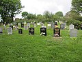
 Central section Castle Hill Cemetery - geograph.org.uk - 4155476.jpg 4.000 × 3.000; 4,42 MB
-
 Children's play area - geograph.org.uk - 4009505.jpg 4.000 × 3.000; 3,88 MB
-
 Church Lane and St Bartholomew's church, Lostwithiel - geograph.org.uk - 5332646.jpg 1.064 × 1.600; 194 KB
-
 Clay for Export - geograph.org.uk - 1060441.jpg 640 × 475; 77 KB
-
 Construction work at Restormel Farm - geograph.org.uk - 6000034.jpg 1.600 × 1.200; 1,05 MB
-
 Converted chapel near Sweetshouse - geograph.org.uk - 2279162.jpg 640 × 480; 77 KB
-

-
 Coombe Farm - geograph.org.uk - 5291358.jpg 3.049 × 1.802; 1,82 MB
-
 Cornish pasture - geograph.org.uk - 5631420.jpg 640 × 426; 57 KB
-
 Cornish Pasture - geograph.org.uk - 5871417.jpg 1.024 × 681; 84 KB
-
 Cott Road - geograph.org.uk - 5014645.jpg 1.883 × 2.307; 1,25 MB
-
 Cott Road - geograph.org.uk - 5014655.jpg 1.920 × 1.280; 806 KB
-
 Cottages at Slip Wood - geograph.org.uk - 4162777.jpg 4.000 × 3.000; 3,69 MB
-
 Cottages, Restormel Farm - geograph.org.uk - 6000040.jpg 1.600 × 1.200; 1,1 MB
-
 Countryside at Maudlin - geograph.org.uk - 5291458.jpg 3.056 × 1.911; 1,4 MB
-
 Courtyard, Restormel Castle - geograph.org.uk - 6206368.jpg 1.024 × 768; 309 KB
-

-
-
 Downend Garage, Lostwithiel - geograph.org.uk - 4888838.jpg 1.920 × 1.003; 523 KB
-
 Duchy Nurseries car park - geograph.org.uk - 748395.jpg 640 × 480; 114 KB
-
 Duchy of Cornwall Nurseries - geograph.org.uk - 1238840.jpg 640 × 480; 259 KB
-
 Duchy Of Cornwall Nurseries - geograph.org.uk - 430977.jpg 640 × 480; 131 KB
-
 Duchy Palace, Lostwithiel - geograph.org.uk - 5707405.jpg 640 × 480; 66 KB
-
 Duke Street, Lostwithiel (geograph 4103458).jpg 1.600 × 961; 325 KB
-
 Earl of Chatham. Lostwithiel - geograph.org.uk - 3416390.jpg 640 × 480; 67 KB
-
 Emma Chamberlain playing two short sets at Lostfest 14th May 2017.jpg 4.000 × 3.000; 4,77 MB
-
 Farmland by the B3268 - geograph.org.uk - 5291412.jpg 2.363 × 1.059; 594 KB
-
 Field below Leadenhill Wood - geograph.org.uk - 5999986.jpg 1.600 × 1.200; 852 KB
-
 Field entrance near Bodardle - geograph.org.uk - 5293813.jpg 3.027 × 1.441; 852 KB
-
 Field near Bodardle - geograph.org.uk - 5293795.jpg 2.849 × 1.852; 1,51 MB
-
 Flooded track near Pill Farm - geograph.org.uk - 5499378.jpg 480 × 640; 272 KB
-
 Footpath into Trapp Wood from Cott Road - geograph.org.uk - 5692020.jpg 1.000 × 1.333; 1,28 MB
-
 Fore Street - geograph.org.uk - 5119946.jpg 1.024 × 683; 212 KB
-
 Fore Street, Lostwithiel - geograph.org.uk - 5182023.jpg 1.600 × 1.064; 347 KB
-
 Former quarry in Ford Plantation, Lanhydrock estate - geograph.org.uk - 5999961.jpg 1.200 × 1.600; 1,08 MB
-
 Fowey Valley - geograph.org.uk - 5631369.jpg 640 × 426; 75 KB
-
 Fowey Valley - geograph.org.uk - 5631372.jpg 640 × 426; 76 KB
-
 Fowey Valley - geograph.org.uk - 5871378.jpg 1.024 × 681; 156 KB
-
 From the Tunnel top - geograph.org.uk - 2195662.jpg 640 × 418; 103 KB
-
 Gnarled old oak tree, Restormel - geograph.org.uk - 5691833.jpg 1.000 × 1.333; 1,29 MB
-
 Greatwood Plantation - geograph.org.uk - 5655187.jpg 640 × 426; 40 KB
-
 Greatwood Plantation - geograph.org.uk - 6028197.jpg 1.024 × 681; 90 KB
-
 Grenville Rd - geograph.org.uk - 5841445.jpg 1.024 × 681; 119 KB
-
 Grenville Rd - geograph.org.uk - 6028184.jpg 1.024 × 681; 155 KB
-
 Harvesting by the B3268 - geograph.org.uk - 5291407.jpg 1.767 × 820; 314 KB
-
 Hillside behind the sub station - geograph.org.uk - 151698.jpg 640 × 427; 82 KB
-
 Impressive sky over the Fowey valley - geograph.org.uk - 1127902.jpg 640 × 480; 132 KB
-
 In the Fowey Valley - geograph.org.uk - 5631374.jpg 640 × 426; 80 KB
-
 In the Fowey Valley - geograph.org.uk - 5871332.jpg 1.024 × 681; 205 KB
-
 Industrial Estate - geograph.org.uk - 5156279.jpg 640 × 426; 54 KB
-
 Industrial estate - geograph.org.uk - 5631413.jpg 640 × 425; 49 KB
-
 Industrial Estate, Lostwithiel - geograph.org.uk - 5871321.jpg 1.024 × 681; 136 KB
-
 Industry, Lostwithiel - geograph.org.uk - 5039452.jpg 640 × 426; 58 KB
-
 Interior of Restormel Castle - geograph.org.uk - 5988305.jpg 1.600 × 1.200; 838 KB
-
 Inverness to Kyle Lostwithiel50046191183 (16927592675).jpg 3.181 × 1.886; 4,33 MB
-
 Junction near Sweetshouse - geograph.org.uk - 5293379.jpg 2.245 × 1.235; 681 KB
-
 Junction near Sweetshouse - geograph.org.uk - 5293503.jpg 2.167 × 1.377; 644 KB
-
 Junction of paths in Ford Plantation, Lanhydrock estate - geograph.org.uk - 5999935.jpg 1.200 × 1.600; 1,11 MB
-
 Junction on Cott Road - geograph.org.uk - 3913166.jpg 768 × 1.024; 490 KB
-
 Junction, Hillhead - geograph.org.uk - 5293785.jpg 3.072 × 1.977; 1,28 MB
-
 Lane from Woodlands Farm - geograph.org.uk - 5291542.jpg 2.018 × 2.730; 1,15 MB
-
 Lane near Coombe Farm - geograph.org.uk - 5291359.jpg 2.048 × 3.072; 1,43 MB
-
 Lane to Coombe Farm - geograph.org.uk - 5291473.jpg 2.048 × 3.072; 1,47 MB
-
 Lane to Woodlands Farm - geograph.org.uk - 5291510.jpg 3.072 × 2.048; 1,46 MB
-
 Lane to Woodlands Farm - geograph.org.uk - 5293360.jpg 1.096 × 1.350; 345 KB
-
 Lanhydrock corridor.jpg 2.592 × 3.888; 3,4 MB
-
 Looking up the Fowey valley from Restormel Castle - geograph.org.uk - 5333158.jpg 1.600 × 1.064; 334 KB
-
 Looking up the Fowey valley, north of Restormel - geograph.org.uk - 5333156.jpg 1.600 × 1.064; 321 KB
-
 Lostwithiel (2021-09-04) 49.jpg 3.712 × 5.568; 17,42 MB
-
 Lostwithiel (2021-09-05) 85.jpg 3.444 × 5.166; 17,44 MB
-
 Lostwithiel (2021-09-05) 91.jpg 5.568 × 3.712; 17,08 MB
-
 Lostwithiel (2021-09-05) 92.jpg 5.568 × 3.712; 17,34 MB
-
 Lostwithiel (2021-09-05) 93.jpg 5.568 × 3.712; 18,44 MB
-
 Lostwithiel (2021-09-05) 94.jpg 3.712 × 5.568; 17,55 MB
-
 Lostwithiel and Fowey bridge on Shirehall Moor.jpg 1.024 × 768; 439 KB
-
 Lostwithiel Bowls Club green - geograph.org.uk - 2722433.jpg 2.048 × 1.536; 450 KB
-
 Lostwithiel Bridge - geograph.org.uk - 5119889.jpg 1.024 × 683; 265 KB
-

-
 Lostwithiel Crossing - geograph.org.uk - 5655171.jpg 640 × 426; 63 KB
-
 Lostwithiel Crossing signalbox - geograph.org.uk - 5655168.jpg 640 × 426; 70 KB
-
 Lostwithiel Crossing Signalbox - geograph.org.uk - 6028183.jpg 1.024 × 681; 141 KB
-
 Lostwithiel Diamond Jubilee Sculpture.JPG 1.024 × 768; 251 KB
-
 Lostwithiel Golf Course - geograph.org.uk - 5871337.jpg 1.024 × 681; 144 KB
-
 Lostwithiel Industrial Estate - geograph.org.uk - 5871318.jpg 1.024 × 681; 144 KB
-
 Lostwithiel mediaeval bridge, View westwards - geograph.org.uk - 5692029.jpg 1.000 × 1.333; 1,13 MB
-
 Lostwithiel station - geograph.org.uk - 6267457.jpg 640 × 480; 77 KB
-
 Lostwithiel Viaduct - GWR 802013 Paddington train.JPG 1.366 × 910; 629 KB
-

-
 Lostwithiel, Duchy of Cornwall Nursery Car Park - geograph.org.uk - 5925214.jpg 7.159 × 4.772; 6 MB
-
 Lostwithiel, former Methodist Free Church - geograph.org.uk - 5333023.jpg 1.600 × 1.064; 259 KB
-
 Lostwithiel, gate to King George's Field - geograph.org.uk - 5333041.jpg 1.600 × 1.064; 571 KB
-
 Lostwithiel, gatepost to King George's Field - geograph.org.uk - 5333043.jpg 1.064 × 1.600; 352 KB
-
 Lostwithiel, gatepost to King George's Field - geograph.org.uk - 5333045.jpg 1.064 × 1.600; 298 KB
-
 Lostwithiel, Golden Dynasty Chinese Takeaway - geograph.org.uk - 5928301.jpg 7.415 × 4.942; 7,64 MB
-
 Lostwithiel, Medieval arch into South Street - geograph.org.uk - 4669639.jpg 1.200 × 811; 974 KB
-
 Lostwithiel, Picnic Tables near Respryn Bridge - geograph.org.uk - 4669667.jpg 1.200 × 777; 1,03 MB
-
 Lostwithiel, Railway Bridge over the River Fowey - geograph.org.uk - 4669671.jpg 1.200 × 795; 1,1 MB
-
 Lostwithiel, Respryn Bridge - geograph.org.uk - 4669647.jpg 1.200 × 782; 952 KB
-
 Lostwithiel, Restormel Royal Mine - geograph.org.uk - 2381191.jpg 640 × 427; 522 KB
-
 Lostwithiel, The old bridge - geograph.org.uk - 5692033.jpg 1.333 × 1.000; 1,2 MB
-
 Lostwithiel, The River Fowey - geograph.org.uk - 4993774.jpg 3.678 × 2.455; 5,38 MB
-
 Lostwithiel.jpg 2.735 × 1.164; 905 KB
-

-

-
 Maudlin entrance sign - geograph.org.uk - 2425426.jpg 640 × 446; 73 KB
-
 Milltown Ford - geograph.org.uk - 4677685.jpg 6.000 × 4.000; 6,48 MB
-
 Milltown Wood - geograph.org.uk - 5871421.jpg 1.024 × 681; 236 KB
-
 Miss F M Hext 1819-1896.jpg 550 × 837; 152 KB
-
 Monmouth Lane, Lostwithiel - geograph.org.uk - 6007461.jpg 1.024 × 768; 179 KB
-

-
 No Golf Course in them days - geograph.org.uk - 3277802.jpg 640 × 426; 73 KB
-
 North St - geograph.org.uk - 5871313.jpg 1.024 × 681; 189 KB
-
 North St, B3268 - geograph.org.uk - 5631415.jpg 640 × 426; 103 KB
-
 Northeastern corner of Castle Hill Cemetery - geograph.org.uk - 4155472.jpg 4.000 × 3.000; 4,36 MB
-
 Old barns and renovated building, Restormel Farm - geograph.org.uk - 6000038.jpg 1.600 × 1.200; 1,05 MB
-

-
 Paddington to Penzance Express - geograph.org.uk - 455853.jpg 640 × 428; 118 KB
-

-
 Path in Ford Plantation, Lanhydrock estate - geograph.org.uk - 5999930.jpg 1.200 × 1.600; 1,14 MB
-
 Penntiow Golf Cottages - geograph.org.uk - 5014768.jpg 3.012 × 1.864; 1.020 KB
-

-
 Play area at Pendour Park - geograph.org.uk - 748402.jpg 640 × 480; 76 KB
-
 Pond by mainline - geograph.org.uk - 6028201.jpg 1.024 × 681; 206 KB
-
 Private road to Pelyn - geograph.org.uk - 1671733.jpg 640 × 480; 262 KB
-
 Pylon line crossing the Fowey valley - geograph.org.uk - 5333153.jpg 1.600 × 1.064; 246 KB
-
 Restormel Bridge on the A390 - geograph.org.uk - 2279600.jpg 640 × 480; 79 KB
-
 Restormel Castle - geograph.org.uk - 6206358.jpg 1.024 × 768; 197 KB
-
 Restormel Castle, Ivy growing on the north east battlement - geograph.org.uk - 5925212.jpg 6.771 × 4.514; 6,44 MB
-
 Restormel Cottage, Cott Road (geograph 4158723).jpg 4.000 × 3.000; 3,55 MB
-
 Restormel Manor - geograph.org.uk - 5871344.jpg 1.024 × 681; 192 KB
-
 Restormel Manor, Farm and Castle - geograph.org.uk - 5691813.jpg 1.430 × 1.000; 1,17 MB
-
 Restormel Water Treatment Works - geograph.org.uk - 5999967.jpg 1.600 × 1.200; 812 KB
-
 Restricted road near Woodlands Farm - geograph.org.uk - 5077895.jpg 2.841 × 1.428; 843 KB
-
 River Fowey - geograph.org.uk - 5039498.jpg 640 × 426; 86 KB
-
 River Fowey - geograph.org.uk - 5039499.jpg 640 × 426; 91 KB
-
 River Fowey - geograph.org.uk - 5156276.jpg 640 × 426; 69 KB
-
 River Fowey - geograph.org.uk - 5631375.jpg 640 × 426; 108 KB
-
 River Fowey - geograph.org.uk - 5655163.jpg 640 × 426; 71 KB
-
 River Fowey - geograph.org.uk - 5841446.jpg 1.024 × 681; 192 KB
-
 River Fowey - geograph.org.uk - 5841447.jpg 1.024 × 681; 200 KB
-
 River Fowey - geograph.org.uk - 5871356.jpg 1.024 × 681; 258 KB
-
 River Fowey - geograph.org.uk - 5871362.jpg 1.024 × 681; 205 KB
-
 River Fowey - geograph.org.uk - 5871366.jpg 1.024 × 681; 182 KB
-
 River Fowey - geograph.org.uk - 5871369.jpg 1.024 × 681; 188 KB
-
 River Fowey - geograph.org.uk - 5871373.jpg 1.024 × 681; 199 KB
-
 River Fowey at Lostwithiel - geograph.org.uk - 2726170.jpg 3.008 × 2.000; 2,89 MB
-
 River Fowey at Lostwithiel - geograph.org.uk - 5707446.jpg 640 × 480; 104 KB
-
 River Fowey, Restormel - geograph.org.uk - 5691826.jpg 1.431 × 1.000; 1,38 MB
-
 River Lerryn at high tide - geograph.org.uk - 434583.jpg 640 × 427; 102 KB
-
 Robert Howe plaque.jpg 2.240 × 4.608; 3,12 MB
-
 Robin at Restormel - geograph.org.uk - 5691855.jpg 1.333 × 1.000; 834 KB
-

-
 Rosehill - geograph.org.uk - 5871412.jpg 1.024 × 681; 160 KB
-
 Sculpture by the River Fowey - geograph.org.uk - 2279588.jpg 640 × 480; 101 KB
-
 Sheep grazing - geograph.org.uk - 5841439.jpg 1.024 × 681; 108 KB
-
 Sheep near Coombe Farm - geograph.org.uk - 5291504.jpg 3.069 × 1.967; 1,41 MB
-
 Shirehall Moor 66107.jpg 1.024 × 768; 392 KB
-
 Slip Wood - geograph.org.uk - 5655189.jpg 640 × 426; 93 KB
-
 Small pond - geograph.org.uk - 5039437.jpg 640 × 426; 104 KB
-
 Small waterfall, Terras Hill Wood near Restormel - geograph.org.uk - 5691797.jpg 1.000 × 1.333; 1,36 MB
-
 Southeastern corner Castle Hill Cemetery - geograph.org.uk - 4155479.jpg 4.000 × 3.000; 4,16 MB
-
 Stream on the edge of Higginsmoor Wood - geograph.org.uk - 4233979.jpg 480 × 640; 135 KB
-
 Stream through Higginsmoor Wood - geograph.org.uk - 5333150.jpg 1.064 × 1.600; 760 KB
-
 Sunrise over Coulson Park - geograph.org.uk - 1274934.jpg 640 × 428; 75 KB
-
 Swan on the River Fowey - geograph.org.uk - 109214.jpg 640 × 447; 111 KB
-
 Swimming in the river - geograph.org.uk - 889901.jpg 640 × 480; 122 KB
-
 The edge of Polscoe Wood - geograph.org.uk - 6028193.jpg 1.024 × 681; 161 KB
-
 The lower Fowey valley - geograph.org.uk - 5655143.jpg 640 × 426; 90 KB
-
 The Manor - geograph.org.uk - 3913131.jpg 1.024 × 768; 339 KB
-
 The River Fowey at Lostwithiel - geograph.org.uk - 2279576.jpg 640 × 480; 99 KB
-
 The river Fowey at Lostwithiel - geograph.org.uk - 3857856.jpg 5.902 × 3.935; 5,56 MB
-
 The Saints' Way near No Man's Land - geograph.org.uk - 5373397.jpg 4.608 × 3.456; 4 MB
-
 The Saints' Way near Pelyn Wood - geograph.org.uk - 5373403.jpg 4.608 × 3.456; 5 MB
-
 Tollhouse by Grenville Road, Lostwithiel - geograph.org.uk - 6077226.jpg 640 × 638; 204 KB
-
 Towards the Fowey valley - geograph.org.uk - 5293603.jpg 2.531 × 1.047; 661 KB


.jpg)


.jpg)


.jpg)


_49.jpg)
_85.jpg)
_91.jpg)
_92.jpg)
_93.jpg)
_94.jpg)


.jpg)


