Category:Lound, Nottinghamshire
Aller à la navigation
Aller à la recherche
English: Lound is a village in Nottinghamshire four miles north of Retford, it has a population of 493. The village is of Danish origin dating from the 8th century with a street running along the spine of the village. The oldest houses are tofts which are endways on to the street with strips of land running back from the road. Nearby villages are Sutton cum Lound and Mattersey.
village britannique | |||||
| Téléverser des médias | |||||
| Nature de l’élément | |||||
|---|---|---|---|---|---|
| Lieu | Bassetlaw, Nottinghamshire, Midlands de l'Est, Angleterre | ||||
 | |||||
Sous-catégories
Cette catégorie comprend 2 sous-catégories, dont les 2 ci-dessous.
B
L
Média dans la catégorie « Lound, Nottinghamshire »
Cette catégorie comprend 136 fichiers, dont les 136 ci-dessous.
-
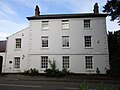 Alpha House, Lound.jpg 1 024 × 768 ; 123 kio
-
 Belt change position sand and gravel conveyor. - geograph.org.uk - 526959.jpg 640 × 506 ; 141 kio
-
 Birds on the Fence - geograph.org.uk - 4784370.jpg 3 751 × 4 970 ; 4,98 Mio
-
 Blaco Hill Farm - geograph.org.uk - 2452404.jpg 640 × 427 ; 81 kio
-
 Bridge over the Idle - geograph.org.uk - 3708759.jpg 640 × 480 ; 207 kio
-
 Byway towards wildfowl reserve and Sutton Grange - geograph.org.uk - 1962327.jpg 1 024 × 768 ; 456 kio
-
 Chain Bridge Lane - geograph.org.uk - 1573084.jpg 640 × 427 ; 80 kio
-
 Chain Bridge Road - geograph.org.uk - 2351733.jpg 1 280 × 955 ; 215 kio
-
 Chainbridge Scrape - geograph.org.uk - 5807155.jpg 800 × 588 ; 109 kio
-
 Chapel - geograph.org.uk - 1573101.jpg 640 × 415 ; 69 kio
-
 Charcon Plant - geograph.org.uk - 3708800.jpg 640 × 480 ; 234 kio
-
 Crossroads at Lound - geograph.org.uk - 1573072.jpg 640 × 401 ; 77 kio
-
 Danes Hill Road heading west - geograph.org.uk - 2688029.jpg 800 × 600 ; 124 kio
-
 Dung heap - geograph.org.uk - 1574231.jpg 640 × 427 ; 72 kio
-
 Entrance on the Idle Valley Nature Reserve - geograph.org.uk - 4029076.jpg 1 024 × 768 ; 160 kio
-
 Entrance to Daneshill Landfill Site - geograph.org.uk - 5083645.jpg 1 024 × 768 ; 214 kio
-
 Farmland near Loundfield Farm - geograph.org.uk - 2688020.jpg 800 × 600 ; 132 kio
-
 Farmland north off Lound - geograph.org.uk - 2688021.jpg 800 × 600 ; 120 kio
-
 Farmland off Mattersey Road - geograph.org.uk - 2688024.jpg 800 × 600 ; 103 kio
-
 Farmland south off Lound - geograph.org.uk - 2688035.jpg 800 × 600 ; 75 kio
-
 Flooded pits by Neat Holme Road - geograph.org.uk - 3708850.jpg 640 × 480 ; 215 kio
-
 Follow the poles - geograph.org.uk - 1574265.jpg 640 × 414 ; 57 kio
-
 Footbridge over the River Idle - geograph.org.uk - 2452946.jpg 640 × 427 ; 118 kio
-
 Footpath and the edge of Ellis Plantation - geograph.org.uk - 5083630.jpg 1 024 × 768 ; 291 kio
-
 Footpath off Retford Road - geograph.org.uk - 2688015.jpg 1 600 × 1 200 ; 406 kio
-
 Footpath to Ranskill - geograph.org.uk - 5083597.jpg 1 024 × 768 ; 238 kio
-
 Footpath to Ranskill - geograph.org.uk - 5083606.jpg 1 024 × 768 ; 230 kio
-
 Footpath to Wild Goose Farm - geograph.org.uk - 5084405.jpg 1 024 × 768 ; 208 kio
-
 Footpath to Wild Goose Farm - geograph.org.uk - 5085042.jpg 1 024 × 768 ; 196 kio
-
 Footpath to Wildgoose Farm - geograph.org.uk - 2452409.jpg 640 × 427 ; 116 kio
-
 Gate and Antcliff Plantation - geograph.org.uk - 5084615.jpg 1 024 × 768 ; 197 kio
-
 Gate leading to Neat Holme Road - geograph.org.uk - 4029127.jpg 1 024 × 768 ; 306 kio
-
 Gate off Chainbridge Lane - geograph.org.uk - 5938662.jpg 5 376 × 3 024 ; 4,64 Mio
-
 Grass field off Chainbridge Lane - geograph.org.uk - 5083655.jpg 1 024 × 768 ; 144 kio
-
 Gravel Quarry - geograph.org.uk - 179415.jpg 640 × 480 ; 109 kio
-
 Harvest over, sowing yet to begin - geograph.org.uk - 5085168.jpg 1 024 × 768 ; 209 kio
-
 Harvested short rotation coppice - geograph.org.uk - 3708859.jpg 640 × 480 ; 194 kio
-
 Hedgerow and the edge of Antcliff Plantation - geograph.org.uk - 5085192.jpg 1 024 × 768 ; 238 kio
-
 Idle Valley - geograph.org.uk - 179395.jpg 640 × 480 ; 116 kio
-
 Idle Valley Nature Reserve - geograph.org.uk - 2452494.jpg 640 × 427 ; 87 kio
-
 Idle Valley Nature Reserve - geograph.org.uk - 2452514.jpg 640 × 427 ; 113 kio
-
 Idle Valley Nature Reserve - geograph.org.uk - 2452816.jpg 640 × 427 ; 96 kio
-
 Idle Valley Nature Reserve - geograph.org.uk - 2452824.jpg 640 × 427 ; 81 kio
-
 Idle Valley Nature Reserve - geograph.org.uk - 2452831.jpg 640 × 427 ; 88 kio
-
 Idle Valley Nature Reserve - geograph.org.uk - 2452950.jpg 640 × 427 ; 126 kio
-
 Idle Valley Nature Reserve - geograph.org.uk - 5204148.jpg 1 024 × 768 ; 135 kio
-
 Idle Valley Nature Reserve, aerial 2013 - geograph.org.uk - 3641072.jpg 640 × 427 ; 51 kio
-
 Lake north of Chain Bridge Lane - geograph.org.uk - 1963348.jpg 1 024 × 667 ; 473 kio
-
 Ling Hurst Lake - geograph.org.uk - 3708839.jpg 640 × 480 ; 274 kio
-
 Ling Hurst Lakes - geograph.org.uk - 2452472.jpg 640 × 427 ; 96 kio
-
 Little Top Lane - geograph.org.uk - 2351700.jpg 1 280 × 959 ; 416 kio
-
 Lound - geograph.org.uk - 1573114.jpg 640 × 448 ; 92 kio
-
 Lound farmland - geograph.org.uk - 2452432.jpg 640 × 427 ; 103 kio
-
 Lound Hall - geograph.org.uk - 2351726.jpg 1 280 × 959 ; 344 kio
-
 Lound Hall - geograph.org.uk - 5084418.jpg 1 024 × 768 ; 199 kio
-
 Nature reserve view - geograph.org.uk - 4028436.jpg 1 024 × 768 ; 342 kio
-
 Near Ellis Plantation - geograph.org.uk - 5085172.jpg 1 024 × 768 ; 169 kio
-
 Neatholme Lane - geograph.org.uk - 2452476.jpg 640 × 427 ; 105 kio
-
 Neatholme Lane - geograph.org.uk - 5083648.jpg 1 024 × 768 ; 168 kio
-
 Parish boundary - geograph.org.uk - 2452414.jpg 640 × 427 ; 84 kio
-
 Part of the Idle Valley Nature Reserve - geograph.org.uk - 5205545.jpg 1 024 × 768 ; 152 kio
-
 Part of the Idle Valley Nature Reserve - geograph.org.uk - 5205549.jpg 1 024 × 768 ; 179 kio
-
 Path near Wild Goose Farm - geograph.org.uk - 4029135.jpg 1 024 × 768 ; 167 kio
-
 Pinfold Close bus stop, Lound - geograph.org.uk - 2351717.jpg 1 280 × 959 ; 196 kio
-
 Pond by Sutton Grange Farm - geograph.org.uk - 5938666.jpg 5 376 × 3 024 ; 4,02 Mio
-
 Primitive Methodist Chapel, Lound - geograph.org.uk - 2351699.jpg 1 280 × 959 ; 328 kio
-
 Retford Road heading south - geograph.org.uk - 2688017.jpg 1 024 × 768 ; 114 kio
-
 River Idle - geograph.org.uk - 2452956.jpg 640 × 427 ; 103 kio
-
 River Idle - geograph.org.uk - 5938663.jpg 5 376 × 3 024 ; 4,28 Mio
-
 River Idle from Chainbridge Lane Bridge - geograph.org.uk - 3616652.jpg 3 648 × 2 736 ; 2,08 Mio
-
 Security hut Daneshill Landfill Site - geograph.org.uk - 4784369.jpg 3 725 × 3 847 ; 3,57 Mio
-
 Sheep pasture and trees surrounding ponds - geograph.org.uk - 5085161.jpg 1 024 × 702 ; 124 kio
-
 Sheepish sheep - geograph.org.uk - 5084353.jpg 1 024 × 768 ; 291 kio
-
 Straw stacked across the fields - geograph.org.uk - 1574270.jpg 640 × 424 ; 72 kio
-
 The Gadwall Trail - geograph.org.uk - 4028444.jpg 1 024 × 768 ; 186 kio
-
 The grounds of Sutton Grange - geograph.org.uk - 5807152.jpg 800 × 600 ; 146 kio
-
 The reason for everything around here. - geograph.org.uk - 526390.jpg 640 × 480 ; 134 kio
-
 The River Idle - geograph.org.uk - 5205551.jpg 1 024 × 768 ; 242 kio
-
 The River Idle - geograph.org.uk - 5807159.jpg 800 × 600 ; 152 kio
-
 This way to the wildfowl lakes - geograph.org.uk - 1572868.jpg 640 × 437 ; 58 kio
-
 Town Street - geograph.org.uk - 2452479.jpg 640 × 427 ; 106 kio
-
 Town Street towards Lound - geograph.org.uk - 2688037.jpg 800 × 600 ; 56 kio
-
 Town Street, Lound - geograph.org.uk - 2351694.jpg 1 280 × 959 ; 286 kio
-
 Town Street, Lound - geograph.org.uk - 2351722.jpg 1 280 × 959 ; 209 kio
-
 Town Street, Lound - geograph.org.uk - 2351731.jpg 1 280 × 959 ; 207 kio
-
 Town Street, Lound - geograph.org.uk - 2688042.jpg 640 × 480 ; 45 kio
-
 Town Street, Lound - geograph.org.uk - 5084581.jpg 1 024 × 789 ; 113 kio
-
 Track (footpath) towards disused quarry - geograph.org.uk - 2688019.jpg 800 × 600 ; 88 kio
-
 Track into a plantation - geograph.org.uk - 5083641.jpg 1 024 × 768 ; 210 kio
-
 Track north of Chain Bridge Lane - geograph.org.uk - 1962336.jpg 1 024 × 768 ; 516 kio
-
 Track running north off Chain Bridge Lane - geograph.org.uk - 2688047.jpg 800 × 600 ; 184 kio
-
 Track to Loundfield Farm - geograph.org.uk - 2688025.jpg 640 × 480 ; 36 kio
-
 Track to Mattersey Hill - geograph.org.uk - 5085055.jpg 1 024 × 768 ; 172 kio
-
 Trees by Lound sewage works - geograph.org.uk - 3708828.jpg 640 × 480 ; 242 kio
-
 View from the viewing platform - east - geograph.org.uk - 4029089.jpg 1 024 × 768 ; 168 kio
-
 View from the viewing platform - north - geograph.org.uk - 4029085.jpg 1 024 × 768 ; 173 kio
-
 View from the viewing platform - north-east - geograph.org.uk - 4029096.jpg 1 024 × 768 ; 181 kio
-
 View over wetlands north of Chainbridge Lane - geograph.org.uk - 3616659.jpg 3 646 × 2 604 ; 1,88 Mio
-
 View towards Antcliff Plantation - geograph.org.uk - 5085050.jpg 1 024 × 768 ; 185 kio
-
 View towards lake in gravel working area - geograph.org.uk - 1962351.jpg 1 024 × 479 ; 284 kio
-
 View towards Lound - geograph.org.uk - 5085179.jpg 1 024 × 768 ; 221 kio
-
 View towards Mattersey Hill - geograph.org.uk - 5084364.jpg 1 024 × 768 ; 217 kio
-
 Village Hall, Lound - geograph.org.uk - 2351730.jpg 1 280 × 959 ; 262 kio
-
 Wild Goose Farm - geograph.org.uk - 4028388.jpg 1 024 × 768 ; 112 kio
-
 Wild Goose Farm - geograph.org.uk - 4029138.jpg 1 024 × 768 ; 169 kio
-
 Yet more flooded sand and gravel quarries. - geograph.org.uk - 526384.jpg 640 × 480 ; 113 kio
-
 Another straight lane. - geograph.org.uk - 526987.jpg 640 × 480 ; 160 kio
-
 Avenue of trees entering Lound. - geograph.org.uk - 526952.jpg 640 × 405 ; 104 kio
-
 Blackberries already^ - geograph.org.uk - 526395.jpg 640 × 480 ; 141 kio
-

-
 Chain Bridge Lane - geograph.org.uk - 179416.jpg 640 × 480 ; 111 kio
-
 Chain bridge lane. - geograph.org.uk - 526958.jpg 640 × 480 ; 109 kio
-
 Conveyor bridge over River Idle. - geograph.org.uk - 526961.jpg 640 × 480 ; 128 kio
-
 Damaged oak tree. - geograph.org.uk - 526994.jpg 640 × 480 ; 102 kio
-
 Farmland on flood plain. - geograph.org.uk - 526969.jpg 640 × 361 ; 96 kio
-
 Field hedge. - geograph.org.uk - 514724.jpg 640 × 380 ; 77 kio
-
 Flood embankment along River Idle. - geograph.org.uk - 526371.jpg 640 × 480 ; 93 kio
-
 Footpath sign going east. - geograph.org.uk - 514706.jpg 640 × 480 ; 170 kio
-
 Gate in front of flooded gravel quarry. - geograph.org.uk - 526957.jpg 640 × 480 ; 109 kio
-
 Gate into precast concrete yard. - geograph.org.uk - 526956.jpg 640 × 480 ; 74 kio
-
 Gate on River Idle embankment. - geograph.org.uk - 526965.jpg 640 × 480 ; 109 kio
-
 Gate with horse access on side. - geograph.org.uk - 527000.jpg 640 × 480 ; 85 kio
-
 Heading south down Retford Road. - geograph.org.uk - 514711.jpg 640 × 440 ; 97 kio
-
 Is this the footpath^ - geograph.org.uk - 526989.jpg 640 × 480 ; 115 kio
-

-
 Lound Hall residential home. - geograph.org.uk - 527007.jpg 640 × 480 ; 145 kio
-
 Lound Village Hall. - geograph.org.uk - 526953.jpg 640 × 338 ; 115 kio
-
 Neatholme Lane - geograph.org.uk - 179417.jpg 640 × 480 ; 103 kio
-
 No fishing^ - geograph.org.uk - 526991.jpg 426 × 640 ; 111 kio
-
 Pump from quarry into River Idle. - geograph.org.uk - 526967.jpg 640 × 602 ; 255 kio
-
 Sand and gravel quarry. - geograph.org.uk - 526368.jpg 640 × 480 ; 84 kio
-
 Stables. - geograph.org.uk - 526997.jpg 640 × 480 ; 83 kio
-
 Start of Neatholme Lane. - geograph.org.uk - 527001.jpg 640 × 480 ; 170 kio
-
 Tarmac Topcon precast concrete factory. - geograph.org.uk - 526955.jpg 640 × 480 ; 86 kio
-
 The bridge at the end of Chain Bridge Lane. - geograph.org.uk - 526962.jpg 640 × 480 ; 95 kio
-
 Track to Loundfield - geograph.org.uk - 179413.jpg 640 × 480 ; 103 kio


_towards_disused_quarry_-_geograph.org.uk_-_2688019.jpg)


