Category:Lugar Water
Zur Navigation springen
Zur Suche springen
See Lugar Water
linker Nebenfluss des River Ayr in Schottland  | |||||
| Medium hochladen | |||||
| Ist ein(e) | |||||
|---|---|---|---|---|---|
| Ort | East Ayrshire, Schottland | ||||
| Mündet in |
| ||||
| Nebenfluss |
| ||||
 | |||||
Unterkategorien
Es werden 7 von insgesamt 7 Unterkategorien in dieser Kategorie angezeigt:
In Klammern die Anzahl der enthaltenen Kategorien (K), Seiten (S), Dateien (D)
A
- Auchinleck House bridge (2 D)
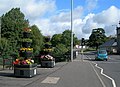
- Avenue Bridge, Dumfries House (27 D)
B
- Bank Viaduct (4 D)
L
- Leifnorris Castle (7 D)
S
- Slatehole (7 D)
T
W
- Woodroad viaduct (4 D)
Medien in der Kategorie „Lugar Water“
Folgende 46 Dateien sind in dieser Kategorie, von 46 insgesamt.
-
 Auchinleck Castle, gorge and River Lugar.jpg 4.608 × 3.456; 6,04 MB
-
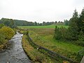
 Bridge over the Lugar water - geograph.org.uk - 985587.jpg 640 × 480; 69 KB
-
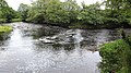
 By The Lugar Water - geograph.org.uk - 937324.jpg 640 × 465; 82 KB
-
 Confluence of the Lugar and Ayr rivers, Barskimming, Ayrshire.jpg 4.896 × 2.752; 3,94 MB
-
 Dumfries House Humeston Wood avenue, East Ayrshire.jpg 1.920 × 1.080; 1,37 MB
-
 Fim de Tarde Mágico.jpg 2.560 × 1.920; 1,43 MB
-
 FOTO DE ATARDECER.jpg 853 × 1.280; 133 KB
-
 Futa 016 (1024x768).jpg 1.024 × 683; 148 KB
-
 Kemp's Castle base looking north, Ochiltree, East Ayrshire, Scotland.jpg 4.608 × 3.456; 3,54 MB
-
 Lugar Water and bridge, Dumfries House, East Ayrshire.jpg 4.896 × 2.752; 5,12 MB
-
 Lugar Water and Chinese Bridge, Dumfries House, East Ayrshire.jpg 4.896 × 2.752; 4,64 MB
-
 Lugar Water near Wallace's Cave - geograph.org.uk - 914080.jpg 428 × 640; 110 KB
-
 Ochiltree Castle, East Ayrshire, Scotland - the motte summit and view of the Lugar.jpg 4.608 × 3.456; 3,6 MB
-
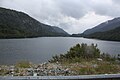
 Ochiltree Dam - geograph.org.uk - 434693.jpg 640 × 480; 81 KB
-
 Ochiltree in the Snow - geograph.org.uk - 58640.jpg 640 × 424; 71 KB
-
 Old Auchinleck Castle, Lugar Gorge, East Ayrshire.jpg 3.962 × 1.838; 2,57 MB
-
 Old Barskimming Bridge, Lugar Water, Mauchline, East Ayrshire.jpg 4.896 × 2.752; 5,63 MB
-
-
 Peden's Cave, access steps, Ochiltree, East Ayrshire.jpg 4.608 × 3.456; 5,07 MB
-
 Peden's Cave, Auchinbay, River Lugar, Ochiltree, East Ayrshire - view from cave.jpg 4.608 × 3.456; 3,61 MB
-
 Peden's Cave, view of the Lugar Gorge, Ochiltree, East Ayrshire, Scotland.jpg 2.106 × 1.100; 1,05 MB
-
 River confluence - geograph.org.uk - 1496366.jpg 640 × 480; 135 KB
-
 River Lugar, Mote Hill wood, Cumnock, East Ayrshire - view east.jpg 1.920 × 1.080; 1,04 MB
-
 River Lugar, Mote Hill, Cumnock, East Ayrshire - view north.jpg 1.920 × 1.080; 1,15 MB
-
 River Lugar, Mote Hill, Cumnock, East Ayrshire.jpg 1.496 × 939; 566 KB
-
 River Lugar, new Lugar Bridge and weir, Ochiltree, East Ayrshire.jpg 3.456 × 4.608; 5,58 MB
-
 River Lugar, view upstream, Ochiltree, East Ayrshire.jpg 3.456 × 4.608; 6,17 MB
-
 Slatehole Ford, River Lugar, East Ayrshire, Scotland.jpg 4.608 × 3.456; 3,55 MB
-
 The Chinese Bridge, Dumfries House, Lugar Water, Ayrshire, Scotland.jpg 1.920 × 1.080; 1,19 MB
-
 The Lugar Water below the weir, Ochiltree, East Ayrshire.jpg 3.433 × 3.587; 3,06 MB
-
 The new Lugar Water bridge and weir, Ochiltree, East Ayrshire.jpg 3.456 × 3.603; 3,74 MB
-
 The old Lugar Water bridge, Ochiltree, East Ayrshire.jpg 3.438 × 2.642; 2,08 MB
-
 The old Slatehole Bridge ruins, River Lugar, East Ayrshire, Scotland.jpg 4.608 × 3.454; 4,87 MB
-
 The old Slatehole Ford and exit, River Lugar, East Ayrshire, Scotland.jpg 4.608 × 3.456; 3,52 MB
-
 The old Slatehole Ford view downstream, River Lugar, East Ayrshire, Scotland.jpg 4.608 × 3.456; 3,56 MB
-
 The old Slatehole Ford view upstream, River Lugar, East Ayrshire, Scotland.jpg 4.608 × 3.456; 3,45 MB
-
 The old Slatehole Pool, River Lugar, East Ayrshire, Scotland.jpg 4.608 × 3.456; 5,08 MB
-
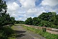
 The path next to the Lugar Water - geograph.org.uk - 753086.jpg 640 × 480; 59 KB
-
 The River Lugar and the Taringzean Holm, South Ayrshire.JPG 2.288 × 1.712; 1,23 MB
-
 The River Lugar with Taringzean Castle to the right.JPG 2.288 × 1.712; 1,19 MB
-
 The Slatehole Ford, River Lugar, East Ayrshire, Scotland.jpg 4.608 × 3.456; 3,5 MB
-
 Vista para o Rio São João.jpg 2.560 × 1.920; 3,47 MB
-
 Wallace's Cave access view, Lugar Gorge, Auchinleck, East Ayrshire.jpg 3.456 × 4.608; 3,5 MB
-
 Wallace's Cave and location, Lugar Gorge, Auchinleck, East Ayrshire.jpg 4.608 × 3.456; 3,51 MB
-
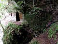 Wallace's Cave entrance, Lugar Gorge, Auchinleck, East Ayrshire.jpg 4.608 × 3.456; 4,72 MB
-
 Wallace's Cave path access path, Lugar Gorge, Auchinleck, East Ayrshire.jpg 3.387 × 3.965; 5,69 MB


.jpg)


