Category:Lullington, Derbyshire
Aller à la navigation
Aller à la recherche
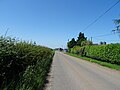
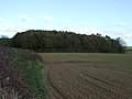
English: Lullington is a village and parish in south Derbyshire. It has an All Saints Church, a village hall, and a pub - The Colvile Arms (Charles Robert Colvile was living at Lullington Hall in the 1850s). In 1850, it had a school that was designed to take fifty children.
localité britannique du comté anglais de Derbyshire  | |||||
| Téléverser des médias | |||||
| Nature de l’élément | |||||
|---|---|---|---|---|---|
| Lieu | South Derbyshire, Derbyshire, Midlands de l'Est, Angleterre | ||||
 | |||||
Sous-catégories
Cette catégorie comprend seulement la sous-catégorie ci-dessous.
Média dans la catégorie « Lullington, Derbyshire »
Cette catégorie comprend 65 fichiers, dont les 65 ci-dessous.
-
 Barns At Westbrook Farm - geograph.org.uk - 1393937.jpg 640 × 480 ; 116 kio
-
 Dag Lane Lullington - geograph.org.uk - 392256.jpg 640 × 481 ; 74 kio
-
 Decaying Tree Trunk near Westbrook Farm - geograph.org.uk - 2666021.jpg 3 296 × 2 472 ; 1,05 Mio
-
 Derbyshire UK parish map highlighting Lullington.svg 888 × 1 308 ; 2,35 Mio
-
 Entrance to Bald Hill's Farm, Lullington - geograph.org.uk - 2505849.jpg 640 × 428 ; 102 kio
-
 Entrance to Lady Leys Farm - geograph.org.uk - 2505794.jpg 640 × 428 ; 60 kio
-
 Entrance to Lullington - geograph.org.uk - 3822662.jpg 640 × 480 ; 65 kio
-
 Ewe looking at me^ - geograph.org.uk - 337335.jpg 640 × 480 ; 105 kio
-
 Farmer rolling his field - geograph.org.uk - 392251.jpg 640 × 481 ; 86 kio
-
 Farmland south of Lullington - geograph.org.uk - 3198112.jpg 640 × 480 ; 74 kio
-
 Farmland west of Lullington - geograph.org.uk - 3198149.jpg 640 × 480 ; 78 kio
-
 Farmland, Lady Leys - geograph.org.uk - 3198142.jpg 640 × 480 ; 90 kio
-
 Farmland, Westbrook Farm - geograph.org.uk - 3198136.jpg 640 × 480 ; 87 kio
-
 Field of gold to Haunton - geograph.org.uk - 392707.jpg 640 × 481 ; 108 kio
-
 Fields in view - geograph.org.uk - 392626.jpg 640 × 481 ; 92 kio
-
 Fields to the North of Lullington - geograph.org.uk - 2117164.jpg 3 296 × 2 472 ; 1,11 Mio
-
 Fox Covert at Lullington - geograph.org.uk - 392671.jpg 640 × 481 ; 90 kio
-
 Gateway Near Coton-In-The-Elms - geograph.org.uk - 1393950.jpg 640 × 480 ; 91 kio
-
 Gateway to Westbrook on crossroads - geograph.org.uk - 2505910.jpg 640 × 428 ; 107 kio
-
 Good grazing - geograph.org.uk - 5566676.jpg 2 000 × 1 333 ; 1,84 Mio
-
 Grazing near Woodfields Farm - geograph.org.uk - 6200603.jpg 800 × 600 ; 114 kio
-
 Grazing, Lullington Park - geograph.org.uk - 3198131.jpg 640 × 480 ; 125 kio
-
 Haystack and Coppice - geograph.org.uk - 4648587.jpg 4 000 × 3 000 ; 3,03 Mio
-
 Heading north towards Coton in the Elms - geograph.org.uk - 3198151.jpg 640 × 480 ; 87 kio
-
 Home Farm, on road leaving Lullington - geograph.org.uk - 2505873.jpg 640 × 428 ; 78 kio
-
 Its O'hay here - geograph.org.uk - 392614.jpg 640 × 481 ; 91 kio
-
 Lady Leys - geograph.org.uk - 3822672.jpg 640 × 480 ; 45 kio
-
 Lady Leys - geograph.org.uk - 392635.jpg 640 × 481 ; 78 kio
-
 Lady Leys Farm.jpg 640 × 467 ; 48 kio
-
 Lane Junction near Lullington - geograph.org.uk - 2117180.jpg 3 296 × 2 472 ; 1,04 Mio
-
 Lane to the West of Lullington - geograph.org.uk - 4648577.jpg 4 000 × 3 000 ; 2,23 Mio
-
 Last leg to Lullington - geograph.org.uk - 392412.jpg 640 × 481 ; 90 kio
-
 Distant view of Lullington Church - geograph.org.uk - 594435.jpg 480 × 640 ; 76 kio
-
 Lullington Park and the Cricket Club entrance - geograph.org.uk - 392651.jpg 640 × 481 ; 127 kio
-
 Lullington Park Cricket pavilion - geograph.org.uk - 392643.jpg 640 × 481 ; 63 kio
-
 Lullington Village Hall (geograph 6868308).jpg 1 024 × 768 ; 201 kio
-
 Lullington Village Scene - geograph.org.uk - 2117349.jpg 3 296 × 2 472 ; 1,08 Mio
-
 Lullington, Derbyshire ... where the post office was. (6312839253).jpg 3 888 × 3 225 ; 7,54 Mio
-
 Lullington6.JPG 1 280 × 960 ; 909 kio
-
 LullingtonVillageHall7.JPG 1 280 × 960 ; 753 kio
-
 LullingtonVillageHall9.JPG 1 280 × 960 ; 904 kio
-
 Minor road near Woodfields Farm - geograph.org.uk - 6200605.jpg 800 × 600 ; 110 kio
-
 Minor road towards Coton in the Elms - geograph.org.uk - 3198139.jpg 640 × 480 ; 113 kio
-
 Minor road towards Coton in the Elms - geograph.org.uk - 3198144.jpg 640 × 480 ; 64 kio
-
 Minor road towards Edingale - geograph.org.uk - 3198134.jpg 640 × 480 ; 112 kio
-
 Minor road towards Lullington - geograph.org.uk - 3198121.jpg 640 × 480 ; 42 kio
-
 River Mease near Clifton Campville 402455 3c6eb2ed.jpg 481 × 640 ; 141 kio
-
 Road junction - geograph.org.uk - 3822673.jpg 640 × 486 ; 62 kio
-
 Small woodland south of Lullington - geograph.org.uk - 3198117.jpg 640 × 480 ; 68 kio
-
 Start or footpath to Coton in the Elms - geograph.org.uk - 392264.jpg 640 × 481 ; 73 kio
-
 Street scene, Lullington - geograph.org.uk - 3198125.jpg 640 × 480 ; 76 kio
-
 The Colvile Arms - geograph.org.uk - 3822697.jpg 640 × 480 ; 54 kio
-
 The Colville Arms, Lullington - geograph.org.uk - 2505816.jpg 640 × 428 ; 59 kio
-
 The Limes, Lullington - geograph.org.uk - 2505804.jpg 640 × 428 ; 76 kio
-

-
 Towards Seal Brook - geograph.org.uk - 392227.jpg 640 × 481 ; 80 kio
-
 Towards West Brook - geograph.org.uk - 392663.jpg 640 × 481 ; 78 kio
-
 Track Near Westbrook Farm - geograph.org.uk - 1393941.jpg 640 × 480 ; 112 kio
-
 Village Hall, Lullington - geograph.org.uk - 184293.jpg 640 × 480 ; 101 kio
-
 Weekend cricket match at Lullington - geograph.org.uk - 902342.jpg 640 × 480 ; 69 kio
-
 Contented Cows - geograph.org.uk - 392619.jpg 640 × 481 ; 132 kio
-
 Cottage at Westbrook Farm - geograph.org.uk - 392689.jpg 640 × 481 ; 70 kio
-
 Eastward field boundary - geograph.org.uk - 403116.jpg 640 × 481 ; 136 kio
-
 Feeding Time at Woodfields farm - geograph.org.uk - 392233.jpg 640 × 481 ; 99 kio
-
 Westbrook Farm - The main House - geograph.org.uk - 392684.jpg 640 × 481 ; 120 kio


.jpg)

.jpg)


