Category:Lund, East Riding of Yorkshire
Aller à la navigation
Aller à la recherche
English: Lund is a village and civil parish in the East Riding of Yorkshire, England. It is situated approximately 7 miles (11 km) north west of Beverley town centre and 7 miles (11 km) south west of Driffield town centre. It lies to the east of the B1248 road.
village britannique  | |||||
| Téléverser des médias | |||||
| Nature de l’élément | |||||
|---|---|---|---|---|---|
| Lieu | East Riding of Yorkshire, Yorkshire de l'Est, Yorkshire-et-Humber, Angleterre | ||||
| Réputé identique à | Lund (page en doublon, paroisse civile) | ||||
 | |||||
Sous-catégories
Cette catégorie comprend seulement la sous-catégorie ci-dessous.
A
- All Saints Church, Lund (6 F)
Média dans la catégorie « Lund, East Riding of Yorkshire »
Cette catégorie comprend 177 fichiers, dont les 177 ci-dessous.
-
 A footpath off Goodmanham Road - geograph.org.uk - 2389529.jpg 800 × 600 ; 370 kio
-
 A minor road towards Middleton on the Wolds - geograph.org.uk - 2460441.jpg 800 × 600 ; 196 kio
-
 A minor road towards Middleton-on-the-Wolds - geograph.org.uk - 2389524.jpg 800 × 600 ; 246 kio
-
 A road junction to the east of Lund - geograph.org.uk - 2300305.jpg 800 × 600 ; 231 kio
-
 A straight kilometre over Lund Wold - geograph.org.uk - 6323475.jpg 1 024 × 768 ; 192 kio
-
 After the harvest, Lund - geograph.org.uk - 1444856.jpg 475 × 640 ; 185 kio
-
 All Saint's Church, Lund - geograph.org.uk - 5461811.jpg 776 × 1 200 ; 492 kio
-
 All Saint's Church, Lund - geograph.org.uk - 5461815.jpg 1 200 × 799 ; 278 kio
-
 All Saint's Church, Lund - geograph.org.uk - 5461817.jpg 1 200 × 799 ; 293 kio
-
 All Saints Church Lund - geograph.org.uk - 2317999.jpg 3 264 × 2 448 ; 2,72 Mio
-
 All Saints', Lund - tower - geograph.org.uk - 3183076.jpg 768 × 1 024 ; 141 kio
-
 Autumn colours in Prickett's Hollow - geograph.org.uk - 6323498.jpg 1 024 × 768 ; 480 kio
-
 B1248 at Lund - geograph.org.uk - 6323512.jpg 1 024 × 768 ; 150 kio
-
 B1248 near Lund - geograph.org.uk - 5251033.jpg 640 × 480 ; 64 kio
-
 B1248 towards Bainton - geograph.org.uk - 1496359.jpg 640 × 480 ; 52 kio
-
 Barley on Lund Moor - geograph.org.uk - 1444867.jpg 476 × 640 ; 203 kio
-
 Beverley Road - geograph.org.uk - 5251044.jpg 640 × 480 ; 80 kio
-
 Broken fingerpost on National Cycle Route 1 - geograph.org.uk - 5250135.jpg 640 × 480 ; 85 kio
-
 Bryan Mills Beck - geograph.org.uk - 6349431.jpg 1 024 × 768 ; 332 kio
-
 Caravan site - geograph.org.uk - 12790.jpg 640 × 427 ; 116 kio
-
 Cherry Garth, Lund (2) - geograph.org.uk - 3181360.jpg 1 024 × 768 ; 174 kio
-
 Cherry Garth, Lund - geograph.org.uk - 3181344.jpg 1 024 × 768 ; 197 kio
-
 Cherry Garth, Lund - geograph.org.uk - 5251024.jpg 640 × 480 ; 79 kio
-
 Church Hall, Lund - geograph.org.uk - 3180914.jpg 1 024 × 768 ; 148 kio
-
 Clematis Farm, Lund - geograph.org.uk - 5250142.jpg 640 × 480 ; 60 kio
-
 Close up, Elizabeth II postbox on Lockington Road, Lund - geograph.org.uk - 5250156.jpg 1 336 × 2 570 ; 867 kio
-
 Corporation Farm - geograph.org.uk - 1519079.jpg 640 × 480 ; 65 kio
-
 Cottages in North Road, Lund - geograph.org.uk - 3180940.jpg 1 024 × 768 ; 171 kio
-
 Cottages on Cherry Garth, Lund - geograph.org.uk - 3181112.jpg 1 024 × 768 ; 163 kio
-
 Country Lane over Lund Moor - geograph.org.uk - 2318035.jpg 3 264 × 2 448 ; 2,42 Mio
-
 Country road near Lund - geograph.org.uk - 67584.jpg 640 × 480 ; 93 kio
-
 Cross and village green, Lund - geograph.org.uk - 5250149.jpg 640 × 480 ; 54 kio
-
 Cross Lund.jpg 640 × 480 ; 81 kio
-
 Cross on The Green, Lund - geograph.org.uk - 5251019.jpg 640 × 480 ; 69 kio
-
 Dropping into Prickett's Hollow - geograph.org.uk - 4321134.jpg 1 024 × 768 ; 215 kio
-
 East of Lund - geograph.org.uk - 111024.jpg 640 × 480 ; 122 kio
-
 East towards Middleton-on-the-Wolds - geograph.org.uk - 2389497.jpg 800 × 600 ; 288 kio
-

-

-
 Entering Lund - geograph.org.uk - 5250141.jpg 640 × 480 ; 76 kio
-
 Enthorpe House - geograph.org.uk - 11163.jpg 640 × 483 ; 50 kio
-
 Entrance to Vicarage Farm - geograph.org.uk - 6323471.jpg 1 024 × 689 ; 124 kio
-
 Farmland east of Lund - geograph.org.uk - 5250139.jpg 640 × 480 ; 49 kio
-
 Farmland northwest of Lund - geograph.org.uk - 3234652.jpg 640 × 442 ; 165 kio
-
 Farmland, Middleton Wold - geograph.org.uk - 1543067.jpg 640 × 480 ; 100 kio
-
 Field into Hugill Dale - geograph.org.uk - 4465165.jpg 1 024 × 766 ; 323 kio
-
 Field path towards Beverley Road - geograph.org.uk - 6323505.jpg 1 024 × 768 ; 307 kio
-
 Field west of Lund - geograph.org.uk - 5251035.jpg 640 × 480 ; 57 kio
-
 Footpath East of Lund - geograph.org.uk - 1519103.jpg 640 × 480 ; 96 kio
-
 Footpath East of Lund - geograph.org.uk - 1519113.jpg 640 × 480 ; 92 kio
-
 Footpath near Middleton on the Wolds - geograph.org.uk - 1176411.jpg 507 × 640 ; 218 kio
-
 Footpath to Bulmer's Triangle - geograph.org.uk - 1519074.jpg 640 × 480 ; 100 kio
-
 Footpath to Lund over Lund Moor - geograph.org.uk - 3959027.jpg 4 000 × 3 000 ; 2,55 Mio
-
 Footpath to Mount Pleasant from Beverley Road - geograph.org.uk - 4187173.jpg 4 608 × 3 456 ; 6,15 Mio
-
 Former church hall, Lund - geograph.org.uk - 5251021.jpg 640 × 480 ; 64 kio
-
 Former smithy. Lund - geograph.org.uk - 3180889.jpg 1 024 × 768 ; 250 kio
-
 Former viaduct at Warren Dale - geograph.org.uk - 9540.jpg 640 × 480 ; 162 kio
-
 Former Wesleyan Methodist Chapel - geograph.org.uk - 5461825.jpg 1 200 × 799 ; 441 kio
-
 Glebe Farm - geograph.org.uk - 3186961.jpg 1 024 × 768 ; 184 kio
-
 Godmanham Road - geograph.org.uk - 6323490.jpg 1 024 × 768 ; 156 kio
-
 Goodmanham Road - geograph.org.uk - 1519049.jpg 640 × 480 ; 57 kio
-
 Goodmanham Road toward Middleton on the Wolds - geograph.org.uk - 4465156.jpg 1 024 × 754 ; 277 kio
-
 House on West End, Lund - geograph.org.uk - 5251031.jpg 640 × 480 ; 60 kio
-
 Hugill Dale and Lund Wold - geograph.org.uk - 3979847.jpg 4 000 × 3 000 ; 2,11 Mio
-
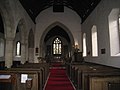 Interior, All Saints' church, Lund - geograph.org.uk - 3180990.jpg 1 024 × 768 ; 117 kio
-
 Ivy House, Lund - geograph.org.uk - 3181009.jpg 1 024 × 768 ; 178 kio
-
 K6 Telephone Kiosk, Lund - geograph.org.uk - 3181090.jpg 1 024 × 768 ; 213 kio
-
 Kipling Coates Racecourse - geograph.org.uk - 2157149.jpg 4 000 × 3 000 ; 3,99 Mio
-
 Kiplingcotes Derby - geograph.org.uk - 4939739.jpg 4 000 × 3 000 ; 2,77 Mio
-
 Lairhill Farm - geograph.org.uk - 1519056.jpg 640 × 480 ; 63 kio
-
 Lane going south past Lund Moor Plantations - geograph.org.uk - 3959034.jpg 4 000 × 3 000 ; 2,76 Mio
-
 Lane to Lairhill Farm - geograph.org.uk - 2305230.jpg 1 024 × 768 ; 239 kio
-
 Lark Cottage, Lund - geograph.org.uk - 3181101.jpg 1 024 × 768 ; 150 kio
-
 Levitt Lanes on Eastgate, Lund - geograph.org.uk - 2644188.jpg 800 × 600 ; 393 kio
-
 Lockington Road - geograph.org.uk - 1519106.jpg 640 × 480 ; 59 kio
-
 Lockington Road - geograph.org.uk - 2318014.jpg 3 264 × 2 448 ; 2,37 Mio
-
 Lockington Road - geograph.org.uk - 5250138.jpg 640 × 480 ; 48 kio
-
 Lockington Road towards Lund - geograph.org.uk - 5250140.jpg 640 × 480 ; 81 kio
-
 Lockington Road, Lund, East Yorkshire - geograph.org.uk - 2300312.jpg 800 × 600 ; 336 kio
-
 Lockington Road, Lund. - geograph.org.uk - 526948.jpg 640 × 480 ; 105 kio
-
 Looking back over the Kiplingcotes Racecourse - geograph.org.uk - 2305079.jpg 1 024 × 768 ; 161 kio
-
 Looking towards Money Hill - geograph.org.uk - 5712093.jpg 1 600 × 1 065 ; 811 kio
-
 Lund Farm - geograph.org.uk - 3180919.jpg 1 024 × 768 ; 296 kio
-

-

-
 Lund Wold - geograph.org.uk - 1519067.jpg 640 × 480 ; 44 kio
-
 Lund Wold - geograph.org.uk - 3181498.jpg 1 024 × 768 ; 209 kio
-
 Lund Wold toward Holme Wold House Farm - geograph.org.uk - 3979816.jpg 4 000 × 3 000 ; 2,65 Mio
-
 Lund, East Riding of Yorkshire UK parish locator map.svg 1 425 × 1 107 ; 1,68 Mio
-
 Manure heaps at field edge - geograph.org.uk - 3979777.jpg 4 000 × 3 000 ; 2,09 Mio
-
 Middleton Wold - geograph.org.uk - 1519053.jpg 640 × 480 ; 67 kio
-
 Middleton Wold - geograph.org.uk - 208949.jpg 640 × 480 ; 118 kio
-
 Middleton Wold - geograph.org.uk - 2333510.jpg 640 × 480 ; 66 kio
-
 Milestone in Lund - geograph.org.uk - 673161.jpg 640 × 480 ; 122 kio
-
 Minor road on Lund Wold - geograph.org.uk - 3979838.jpg 4 000 × 3 000 ; 2,3 Mio
-
 Minor road to Lund - geograph.org.uk - 2115064.jpg 800 × 600 ; 294 kio
-
 Minor road toward the B1248 at Lund - geograph.org.uk - 3979762.jpg 4 000 × 3 000 ; 2,29 Mio
-
 Minor Road Towards Holme-on-the-Wolds - geograph.org.uk - 1519061.jpg 640 × 480 ; 66 kio
-
 Minor Road Towards Lund - geograph.org.uk - 1496316.jpg 640 × 480 ; 58 kio
-
 Minor Road Towards Lund - geograph.org.uk - 1519065.jpg 640 × 480 ; 60 kio
-
 Minor Road Towards Lund - geograph.org.uk - 1519082.jpg 640 × 480 ; 94 kio
-
 Minor Road Towards Lund - geograph.org.uk - 1519172.jpg 640 × 480 ; 68 kio
-
 Minor Road Towards Middleton - geograph.org.uk - 1543107.jpg 640 × 480 ; 74 kio
-
 Minor Road Towards Middleton - geograph.org.uk - 1543123.jpg 640 × 480 ; 50 kio
-
 Minor road towards Middleton-on-the-Wolds - geograph.org.uk - 5251037.jpg 640 × 480 ; 46 kio
-
 Narrow path to Kilnwick - geograph.org.uk - 3186969.jpg 768 × 1 024 ; 232 kio
-
 North Road and the garden wall to Lund House - geograph.org.uk - 3183090.jpg 1 024 × 768 ; 248 kio
-
 North Road, Lund - geograph.org.uk - 1496353.jpg 640 × 480 ; 94 kio
-
 North Road, Lund - geograph.org.uk - 3183067.jpg 1 024 × 779 ; 129 kio
-
 NW of Lund - geograph.org.uk - 110548.jpg 640 × 480 ; 190 kio
-
 Obstructed highway, Lund - geograph.org.uk - 3181358.jpg 1 024 × 768 ; 317 kio
-
 Old gateway, Lund - geograph.org.uk - 5250145.jpg 506 × 640 ; 95 kio
-
 On Lund Wold - geograph.org.uk - 3181489.jpg 1 024 × 768 ; 225 kio
-
 Ploughed field north of Lockington Road - geograph.org.uk - 5250137.jpg 640 × 480 ; 68 kio
-
 Pond at Lund - geograph.org.uk - 6323467.jpg 1 024 × 768 ; 263 kio
-
 Pond, Lund - geograph.org.uk - 3181108.jpg 1 024 × 768 ; 210 kio
-
 Pond, West End, Lund - geograph.org.uk - 5251028.jpg 640 × 480 ; 97 kio
-
 Prickett's Hollow, near Middleton - geograph.org.uk - 1176450.jpg 640 × 426 ; 189 kio
-
 Road in Warren Dale - geograph.org.uk - 6323485.jpg 1 024 × 768 ; 326 kio
-
 Road junction on National Cycle Route 1 - geograph.org.uk - 5250134.jpg 640 × 480 ; 60 kio
-
 Road leading to Lund - geograph.org.uk - 5712098.jpg 1 600 × 1 101 ; 548 kio
-
 Road leading to Lund - geograph.org.uk - 5712105.jpg 1 600 × 1 065 ; 573 kio
-
 Road sign near Wood Flats - geograph.org.uk - 5712091.jpg 1 600 × 1 065 ; 765 kio
-
 Road to Lairhill Farm - geograph.org.uk - 2333507.jpg 640 × 480 ; 63 kio
-
 Sign for the Wellington Inn, Lund - geograph.org.uk - 5250148.jpg 487 × 640 ; 62 kio
-
 Snowy field - geograph.org.uk - 4321137.jpg 1 024 × 768 ; 189 kio
-
 South Avenue, Lund - geograph.org.uk - 2644192.jpg 800 × 600 ; 274 kio
-
 Spraying crop on Lund Wold - geograph.org.uk - 3979795.jpg 4 000 × 3 000 ; 3 Mio
-
 SW of Lund - geograph.org.uk - 110544.jpg 640 × 480 ; 201 kio
-
 Telephone box, Lund - geograph.org.uk - 5250146.jpg 640 × 480 ; 69 kio
-
 The B1248 at Lund - geograph.org.uk - 2460431.jpg 800 × 600 ; 235 kio
-
 The boundary between the parishes of Middleton and Lund - geograph.org.uk - 2310352.jpg 1 024 × 768 ; 180 kio
-
 The Church Gate, Lund - geograph.org.uk - 673162.jpg 480 × 640 ; 92 kio
-
 The churchyard, Lund - geograph.org.uk - 3180975.jpg 1 024 × 768 ; 169 kio
-
 The Green, Lund (2) - geograph.org.uk - 3181097.jpg 1 024 × 768 ; 164 kio
-
 The Green, Lund - geograph.org.uk - 1444843.jpg 495 × 640 ; 201 kio
-
 The Green, Lund - geograph.org.uk - 3180925.jpg 1 024 × 768 ; 210 kio
-
 The Green, Lund - geograph.org.uk - 3180935.jpg 1 024 × 768 ; 205 kio
-
 The Kipling Cotes Race Course - geograph.org.uk - 2310360.jpg 1 024 × 768 ; 173 kio
-
 The manure heap has been spread - geograph.org.uk - 4187188.jpg 4 608 × 3 456 ; 3,42 Mio
-
 The road to Warren House Farm - geograph.org.uk - 2389515.jpg 800 × 600 ; 322 kio
-
 The Village Green Lund - geograph.org.uk - 673160.jpg 640 × 480 ; 75 kio
-
 The Village Green Signpost, Lund - geograph.org.uk - 673159.jpg 480 × 640 ; 94 kio
-
 The Village Green, Lund. - geograph.org.uk - 527031.jpg 640 × 480 ; 63 kio
-
 The Village Hall, Lund - geograph.org.uk - 3180906.jpg 1 024 × 768 ; 152 kio
-
 The Wellington Inn at Lund - geograph.org.uk - 83195.jpg 640 × 480 ; 100 kio
-
 The Wellington Inn, Lund - geograph.org.uk - 1519094.jpg 640 × 480 ; 104 kio
-
 The Wellington Inn, Lund, 2016 - geograph.org.uk - 5250147.jpg 640 × 480 ; 76 kio
-
 To Corporation Farm, Lund - geograph.org.uk - 3234638.jpg 640 × 507 ; 189 kio
-
 To Lund - geograph.org.uk - 3234642.jpg 640 × 427 ; 143 kio
-
 Tomb recess, All Saints' church, Lund - geograph.org.uk - 3180982.jpg 1 024 × 768 ; 101 kio
-
 Toward the B1248 junction - geograph.org.uk - 4187185.jpg 4 608 × 3 456 ; 3,7 Mio
-
 Towards Middleton-on-the-Wolds - geograph.org.uk - 3234655.jpg 640 × 427 ; 140 kio
-
 Track from Mount Pleasant Farm - geograph.org.uk - 4321098.jpg 1 024 × 768 ; 187 kio
-
 Track into Ashslack Wood - geograph.org.uk - 2310329.jpg 1 024 × 768 ; 311 kio
-
 Track to Mount Pleasant - geograph.org.uk - 1496328.jpg 640 × 480 ; 75 kio
-
 Track to Vicarage Farm - geograph.org.uk - 1519076.jpg 640 × 480 ; 59 kio
-
 Track to Warren House Farm - geograph.org.uk - 1543131.jpg 640 × 480 ; 112 kio
-
 Vicarage Farm, Lund - geograph.org.uk - 5712102.jpg 1 600 × 1 065 ; 525 kio
-
 View towards Enthorpe Wood - geograph.org.uk - 2310309.jpg 1 024 × 768 ; 157 kio
-
 View towards Lund Wold Farm - geograph.org.uk - 4321128.jpg 1 024 × 768 ; 251 kio
-
 View towards South Dalton - geograph.org.uk - 3181511.jpg 1 024 × 768 ; 165 kio
-
 View towards Vicarage Farm - geograph.org.uk - 4321109.jpg 1 024 × 768 ; 187 kio
-
 Village Pond Lund.jpg 640 × 426 ; 200 kio
-
 Warren House Farm - geograph.org.uk - 2305228.jpg 1 024 × 768 ; 251 kio
-
 Wellington Inn at Lund - geograph.org.uk - 6323455.jpg 1 024 × 768 ; 190 kio
-
 West End, Lund - geograph.org.uk - 6323463.jpg 1 024 × 702 ; 212 kio
-
 West End, Lund, East Yorkshire - geograph.org.uk - 2300322.jpg 800 × 600 ; 335 kio
-
 West of Lund minor road over wolds - geograph.org.uk - 3979769.jpg 4 000 × 3 000 ; 2,15 Mio
-
 Windmill Whin - geograph.org.uk - 2317991.jpg 3 264 × 2 448 ; 1,8 Mio
-
 Winter wheat on Lund Wold - geograph.org.uk - 8569.jpg 640 × 480 ; 90 kio
-
 Wolds crossroads - geograph.org.uk - 6323479.jpg 1 024 × 768 ; 213 kio
-
 Wolds Farmland - geograph.org.uk - 1519118.jpg 640 × 480 ; 75 kio
-
 Wolds Farmland - geograph.org.uk - 1519176.jpg 640 × 480 ; 54 kio
-
 Wolds Farmland - geograph.org.uk - 1543138.jpg 640 × 480 ; 76 kio
-
 Woodland beside Beverley Road - geograph.org.uk - 5251042.jpg 640 × 480 ; 110 kio
-
 Young crop field north west of Lund - geograph.org.uk - 5251038.jpg 640 × 480 ; 58 kio


_-_geograph.org.uk_-_3181360.jpg)


_-_geograph.org.uk_-_3181097.jpg)


