Category:Lutton, Lincolnshire
Aller à la navigation
Aller à la recherche
localité britannique du comté anglais de Lincolnshire  | |||||
| Téléverser des médias | |||||
| Nature de l’élément | |||||
|---|---|---|---|---|---|
| Lieu | South Holland, Lincolnshire, Midlands de l'Est, Angleterre | ||||
 | |||||
Sous-catégories
Cette catégorie comprend 4 sous-catégories, dont les 4 ci-dessous.
Média dans la catégorie « Lutton, Lincolnshire »
Cette catégorie comprend 99 fichiers, dont les 99 ci-dessous.
-
 A remote house and trees on North Drove - geograph.org.uk - 2723894.jpg 4 320 × 3 240 ; 5,19 Mio
-
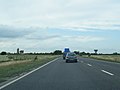 A17 east of Gedney Fen - geograph.org.uk - 3641922.jpg 640 × 481 ; 39 kio
-
 A17 towards Holbeach - geograph.org.uk - 4719857.jpg 640 × 480 ; 52 kio
-
 Baa baa black sheep - geograph.org.uk - 2670149.jpg 4 320 × 3 240 ; 5,72 Mio
-
 Bend in Lutton Bank - geograph.org.uk - 3567296.jpg 2 612 × 1 807 ; 1,99 Mio
-
 Bridleway along private road - geograph.org.uk - 6223118.jpg 1 600 × 1 067 ; 413 kio
-
 Bridleway and field - geograph.org.uk - 6223125.jpg 1 600 × 1 067 ; 262 kio
-
 Bushes on the bend, South Drove, Lutton Marsh - geograph.org.uk - 2670126.jpg 4 320 × 3 240 ; 5,33 Mio
-
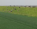
 Cattle relaxing in the early morning sun - geograph.org.uk - 3594132.jpg 3 519 × 2 358 ; 2,41 Mio
-
 Chapel in Autumn - geograph.org.uk - 602615.jpg 640 × 481 ; 123 kio
-
 Chapel near Lutton - geograph.org.uk - 73923.jpg 640 × 428 ; 78 kio
-
 Charter's Lane - geograph.org.uk - 4719840.jpg 640 × 480 ; 49 kio
-
 Cows on the sea bank - geograph.org.uk - 3564208.jpg 3 138 × 2 067 ; 3 Mio
-
 Cows on the sea bank - geograph.org.uk - 3594094.jpg 4 000 × 2 776 ; 3,29 Mio
-
 Crop boundary off North Drove - geograph.org.uk - 6223108.jpg 1 600 × 1 067 ; 431 kio
-
 Crop field off Charter's Lane - geograph.org.uk - 4719838.jpg 640 × 480 ; 92 kio
-
 Dead end lane to Lodge Farm - geograph.org.uk - 2669651.jpg 4 320 × 3 240 ; 5,49 Mio
-
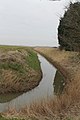
 Deep dike on Lutton Marsh - geograph.org.uk - 2669688.jpg 4 320 × 3 240 ; 5,57 Mio
-
 Drain and farmland behind the sea bank - geograph.org.uk - 3564115.jpg 2 448 × 3 264 ; 3,46 Mio
-
 Drain and field off Lutton Garnsgate - geograph.org.uk - 4719849.jpg 640 × 480 ; 55 kio
-
 End of the public road - geograph.org.uk - 6223114.jpg 1 600 × 1 067 ; 381 kio
-
 Entrance to the Peele Community College - geograph.org.uk - 3567167.jpg 2 928 × 2 003 ; 2,35 Mio
-
 Farm buildings on Lutton Garnsgate - geograph.org.uk - 4719845.jpg 640 × 480 ; 69 kio
-
 Farm buildings, Garnsgate Villa - geograph.org.uk - 4719843.jpg 640 × 480 ; 57 kio
-
 Farmland and pylon along Lutton Bank - geograph.org.uk - 3567345.jpg 2 735 × 2 258 ; 2,48 Mio
-
 Farmland near Lodge Farm, Lutton Marsh - geograph.org.uk - 2964338.jpg 4 320 × 3 240 ; 5,64 Mio
-
 Farmland near Sutton Corner north of Lutton - geograph.org.uk - 2723749.jpg 4 320 × 3 240 ; 5,99 Mio
-
 Farmland north of Lutton - geograph.org.uk - 3567325.jpg 2 683 × 2 317 ; 2,72 Mio
-
 Field off Lutton Garnsgate - geograph.org.uk - 4719850.jpg 640 × 480 ; 40 kio
-
 Field on Lutton Marsh - geograph.org.uk - 6223124.jpg 1 600 × 1 067 ; 415 kio
-
 Flat farmland in Lutton - geograph.org.uk - 3567231.jpg 2 315 × 2 040 ; 2,13 Mio
-
 Flat farmland near Lutton - geograph.org.uk - 3567233.jpg 2 285 × 1 884 ; 1,94 Mio
-
 Flat farmland on Lutton Marsh - geograph.org.uk - 3567351.jpg 3 264 × 2 448 ; 3,09 Mio
-
 Flat farmland viewed from the sea bank - geograph.org.uk - 3594071.jpg 3 081 × 2 444 ; 2,39 Mio
-
 Flat farmland west of the sea bank - geograph.org.uk - 3564239.jpg 3 065 × 2 218 ; 2,76 Mio
-
 Fleet River and Docking's Holt Lane - geograph.org.uk - 2723440.jpg 4 320 × 3 240 ; 6,03 Mio
-
 Footpath on the sea bank near Guy's Head - geograph.org.uk - 2964849.jpg 4 320 × 3 240 ; 5,63 Mio
-
 Friendly cows on the sea bank - geograph.org.uk - 3564211.jpg 3 264 × 2 448 ; 3,44 Mio
-
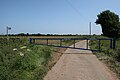
 Gate and stile to the sea bank - geograph.org.uk - 3564053.jpg 3 131 × 2 269 ; 3,37 Mio
-
 Gate post and seat on the sea bank - geograph.org.uk - 3564326.jpg 3 264 × 2 448 ; 3,21 Mio
-
 Gedney Drain - geograph.org.uk - 3361188.jpg 1 504 × 2 256 ; 2,05 Mio
-
 Grassy spur on the salt marsh near Crabs' Hole - geograph.org.uk - 2964468.jpg 4 320 × 3 240 ; 5,8 Mio
-
 Greenhouses Near Sutton Corner - geograph.org.uk - 602707.jpg 640 × 495 ; 93 kio
-

-

-
 Hawthorn bushes on the sea bank - geograph.org.uk - 2964834.jpg 4 320 × 3 240 ; 5,65 Mio
-
 Heading north along Lutton Bank - geograph.org.uk - 3567338.jpg 2 792 × 1 805 ; 1,93 Mio
-
 Hedge on Lutton Marsh - geograph.org.uk - 6223121.jpg 1 600 × 1 067 ; 490 kio
-
 Herd of cows on the sea bank - geograph.org.uk - 3564118.jpg 2 491 × 1 983 ; 2,45 Mio
-
 Houses along Lutton Bank - geograph.org.uk - 3567329.jpg 3 264 × 2 448 ; 3,9 Mio
-
 Houses along Lutton Gowts - geograph.org.uk - 3567184.jpg 3 081 × 2 013 ; 2,88 Mio
-
 Lutton Bank - geograph.org.uk - 5679612.jpg 640 × 428 ; 105 kio
-
 Lutton Bank - geograph.org.uk - 5679616.jpg 640 × 428 ; 100 kio
-
 Lutton Garnsgate - geograph.org.uk - 4719847.jpg 640 × 480 ; 47 kio
-
 Lutton Garnsgate - geograph.org.uk - 4719852.jpg 640 × 480 ; 49 kio
-
 Lutton Garnsgate - geograph.org.uk - 619795.jpg 640 × 427 ; 139 kio
-
 Lutton Gowts - geograph.org.uk - 5679607.jpg 640 × 428 ; 126 kio
-
 Lutton Gowts Mill.jpg 640 × 426 ; 127 kio
-
 Lutton House (geograph 6235922).jpg 1 024 × 768 ; 154 kio
-
 Lutton Marsh and distant trees - geograph.org.uk - 2723952.jpg 4 320 × 3 240 ; 5,84 Mio
-
 Lutton St. Nicholas church - geograph.org.uk - 5798584.jpg 3 456 × 2 592 ; 3,92 Mio
-
 Lutton St. Nicholas church and War Memorial - geograph.org.uk - 5798586.jpg 3 456 × 2 592 ; 3,84 Mio
-
 Lutton village sign along Lutton Bank - geograph.org.uk - 3567358.jpg 3 055 × 2 292 ; 3 Mio
-
 Main Shaft of Windmill.png 729 × 369 ; 723 kio
-
 Meat and one veg - geograph.org.uk - 2671247.jpg 4 320 × 3 240 ; 5,36 Mio
-
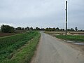
 Minor road, Lutton Marsh - geograph.org.uk - 6223110.jpg 1 600 × 1 067 ; 415 kio
-
 Monmouth Lane - geograph.org.uk - 3402079.jpg 2 256 × 1 504 ; 2,16 Mio
-
 Nene outflow, aerial 2017 - geograph.org.uk - 5468372.jpg 640 × 427 ; 37 kio
-
 North Drove near Lutton, Lincolnshire - geograph.org.uk - 2723866.jpg 4 320 × 3 240 ; 5,31 Mio
-

-
 Old gate post on the sea bank - geograph.org.uk - 3564313.jpg 3 264 × 2 448 ; 3,14 Mio
-
 Old gate posts atop the sea bank - geograph.org.uk - 3564277.jpg 3 264 × 2 448 ; 3,31 Mio
-
 Onion field near Lutton - geograph.org.uk - 6235924.jpg 1 024 × 768 ; 200 kio
-
 Polytunnel in Lutton Gowts - geograph.org.uk - 3567194.jpg 2 197 × 1 651 ; 1,51 Mio
-
 Poplar Lane leading to Smith's Farm - geograph.org.uk - 3567384.jpg 2 411 × 1 876 ; 1,93 Mio
-
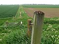
 Post and barbed wire near the sea bank - geograph.org.uk - 3564100.jpg 3 257 × 2 340 ; 3,28 Mio
-
 Prepared field, Lutton - geograph.org.uk - 6235916.jpg 1 024 × 768 ; 176 kio
-
 Root vegetable crop, Lutton Marsh - geograph.org.uk - 6223113.jpg 1 600 × 1 067 ; 552 kio
-
 Salt marsh along the Wash coast - geograph.org.uk - 3564126.jpg 3 264 × 2 448 ; 3,12 Mio
-
 Salt marsh at Crabs' Hole north of Sutton Bridge - geograph.org.uk - 2964867.jpg 4 320 × 3 240 ; 6,04 Mio
-
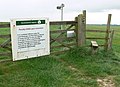
 Sign post on the sea bank - geograph.org.uk - 3564233.jpg 2 433 × 2 751 ; 2,09 Mio
-
 South Drove - geograph.org.uk - 3402083.jpg 2 256 × 1 504 ; 1,74 Mio
-
 South Drove in Lutton - geograph.org.uk - 3567205.jpg 2 902 × 1 963 ; 2,24 Mio
-
 South Drove near Sutton Marsh - geograph.org.uk - 3404073.jpg 2 256 × 1 504 ; 1,79 Mio
-
 South Drove on Lutton Marsh - geograph.org.uk - 2670117.jpg 4 320 × 3 240 ; 5,43 Mio
-
 Stormy skies over Lutton Marsh, Lincolnshire - geograph.org.uk - 2724035.jpg 4 320 × 3 240 ; 5,31 Mio
-
 Stubble field beside the A17 - geograph.org.uk - 4719855.jpg 640 × 480 ; 41 kio
-
 Sunset over White House Farm - geograph.org.uk - 3697463.jpg 1 600 × 1 294 ; 201 kio
-
 Tall trees on Blaze Gate, Long Sutton - geograph.org.uk - 2723448.jpg 4 320 × 3 240 ; 5,3 Mio
-
 The Wash near Guy's Head, Sutton Bridge - geograph.org.uk - 2964812.jpg 4 320 × 3 240 ; 5,74 Mio
-
 Tidal creek near Crabs' Hole - geograph.org.uk - 3564298.jpg 3 264 × 2 448 ; 3,37 Mio
-
 Track And Drain - geograph.org.uk - 657547.jpg 640 × 480 ; 58 kio
-
 Track leading to Marsh Road - geograph.org.uk - 3564104.jpg 2 788 × 1 971 ; 2,6 Mio
-
 Track leading to Marsh Road - geograph.org.uk - 3594084.jpg 3 097 × 2 160 ; 2,2 Mio
-
 Track on an old sea bank near Gedney Drove End - geograph.org.uk - 2669629.jpg 4 320 × 3 240 ; 5,69 Mio
-
 Tree lined dike on Lutton Marsh - geograph.org.uk - 2670122.jpg 4 320 × 3 240 ; 5,79 Mio
-
 Village sign along Lutton Gowts - geograph.org.uk - 3567172.jpg 2 586 × 2 078 ; 2,36 Mio
-
 Wintertime near Monmouth House, Lutton Gowts - geograph.org.uk - 2799845.jpg 4 320 × 3 240 ; 5,8 Mio
-
 Dear Love Gate, near Sutton Corner - geograph.org.uk - 602683.jpg 640 × 480 ; 104 kio


.jpg)


